From I-10, take Exit 103 and drive north on North 339th Avenue for 3.4 kilometres to a T-intersection with West Indian School Road. Turn left and drive west for 3.2 kilometres to the intersection with North 355th Avenue. Turn right and drive north for 27.0 kilometres to the intersection with Vulture Mine Road. Turn right and drive north for 20.0 kilometres before turning right again into a large pullout where RVs might be camped. This pullout can also be reached from the north. From the junction with Highway 93 in the town of Wickenburg, drive west on Highway 60 for 4.5 kilometres and turn left onto Vulture Mine Road. Drive south for 11.0 kilometres and turn left into the same large pullout. Follow a gravel road past the pullout for another 700 metres to the first trailhead (toilet and shelter). Vehicles with high clearance can drive to a second trailhead (no facilities) about 2.4 kilometres further.
From the first trailhead, we followed the continuation of the dirt road
and dropped into Syndicate Wash before climbing out on a footpath heading east to
the second trailhead. The myriad of trails, roads and washes
crisscrossing throughout this area can be a bit confusing, but
thankfully, the proper route is signed and easy to follow. Beyond
the second trailhead, the trail climbs up the western slopes of Vulture
Peak on well-designed switchbacks and ends at a high col just south of
the summit. We finished the ascent with a moderate scramble up a
narrow gully that runs from the col right to the top.
After taking a lengthy break at the summit, we carefully descended the
narrow gully without mishap. The remainder of our descent was quick
and easy, and we also took a couple of short cuts, possibly
inadvertently, on the hike back to the first trailhead.
Upon returning to our car, we promptly packed our gear and headed north.
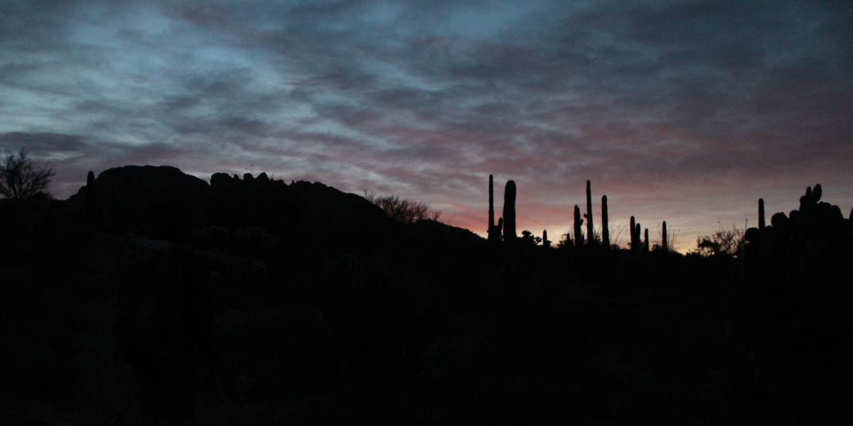
Dawn arrives at Vulture Peak (silhouette at far left).
Photo courtesy of Zosia
Zgolak
Photo courtesy of Zosia Zgolak
Photo courtesy of Zosia
Zgolak
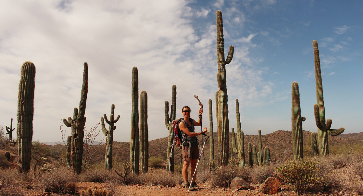
Zosia blends in nicely among the saguaro cacti. After lunch, we hiked Thumb Butte
Loop, a popular hiking path which climbs over the southwest shoulder of a
prominent outcrop of rock overlooking the town of Prescott.
Unfortunately, access to the summit of Thumb Butte is prohibited between
February and July every year in order to prevent disturbances to the
courtship and breeding of peregrine falcons. Disappointingly, we had
to settle on reaching a lower viewpoint which has some interpretive
displays about the surrounding landscape. Upon returning to the recreation area, we continued our drive to
Sedona and ultimately stopped just on the outskirts of the town to camp
for the night. Photo courtesy of Zosia
Zgolak
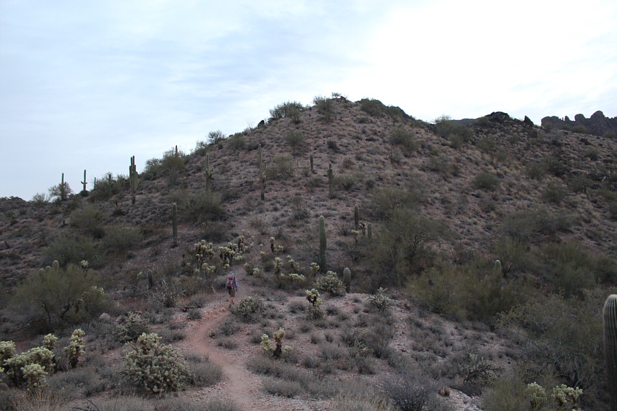
Zosia follows a good trail leading to
the second trailhead.
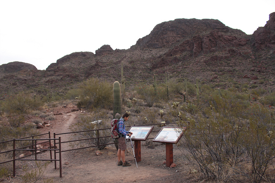
Zosia reads an interpretive display at
the second trailhead. Vulture Peak is just ahead.

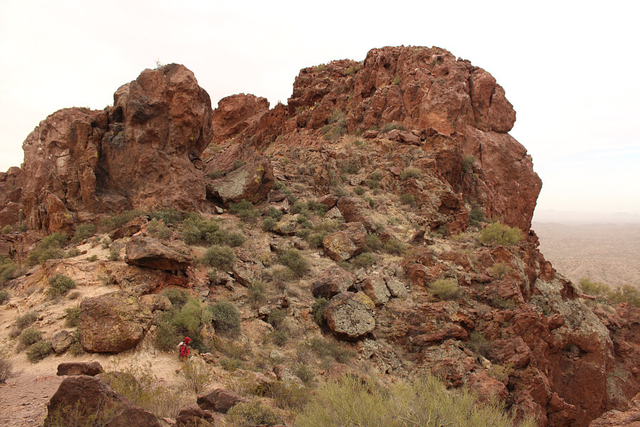
The trail climbs up alongside these
red cliffs.

Sonny passes a couple of saguaro cacti
just before reaching a high col.

At a high col, Zosia heads for the
narrow gully at left.
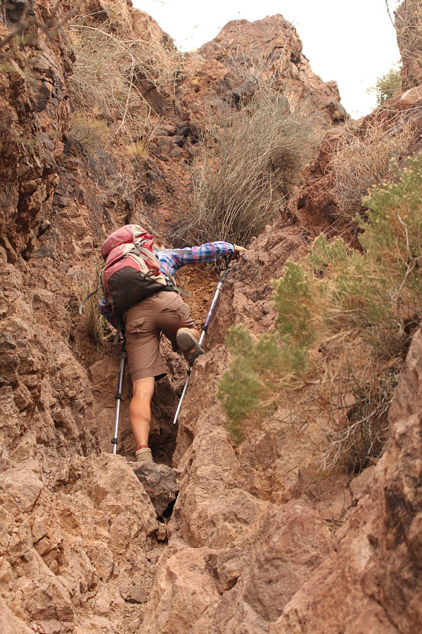
Zosia scrambles up the narrow gully to
access the summit.
Zosia tags a lower point along the
summit ridge.
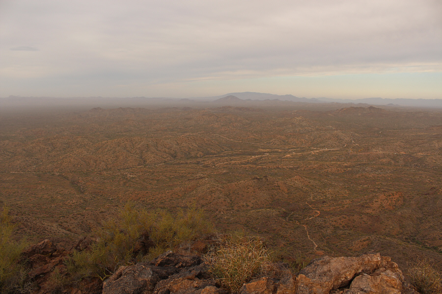
The view to the west includes Black
Butte and Harquahala Mountain on the central horizon. The
approach trail for Vulture Peak is also visible at bottom right.
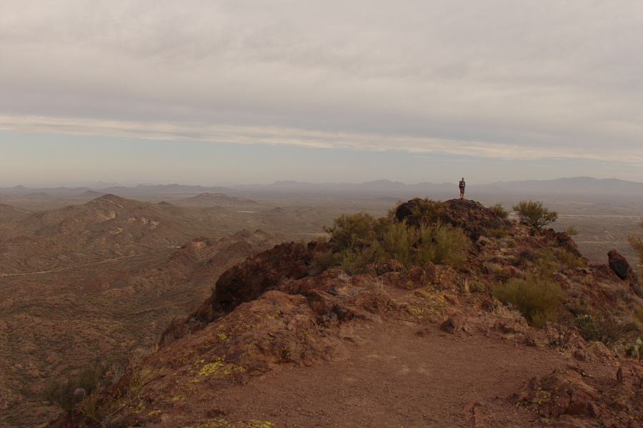
Sonny and Zosia stand on the summit of
Vulture Peak (1104 metres).

The summit register is in an ammo box
along with other curious items.
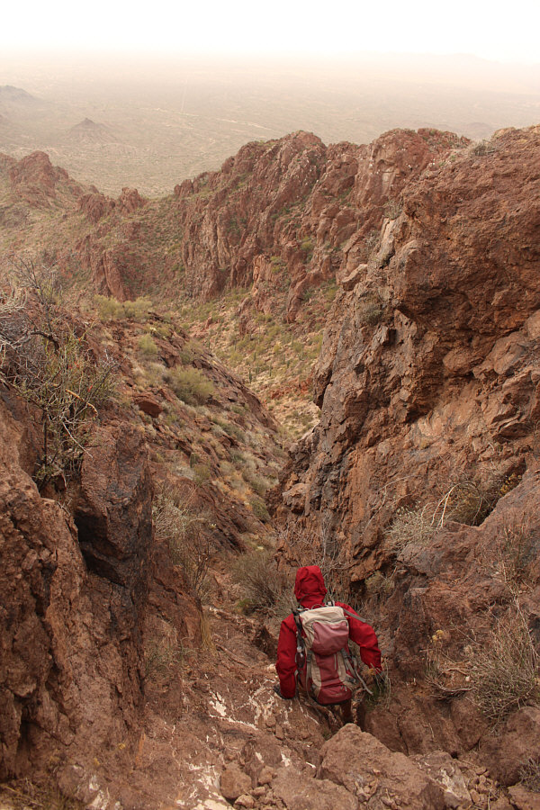
Zosia carefully descends the narrow
gully on the return trip.

Sonny slithers down an awkward section
in the narrow gully.
Back at the high col, Zosia regains
and descends the approach trail.
Later in the day, we arrived in Prescott and stopped for lunch
at Thumb Butte Recreation Area ($5 USD day use charge but free on
Wednesdays). The recreation area is accessed by heading west on
Gurley Street for 5.6 kilometres from the intersection with Montezuma
Street. Gurley Street eventually turns into Thumb Butte Drive, and
the recreation area is on the right.
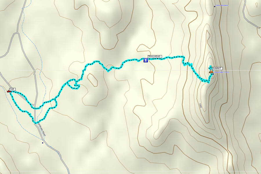
Total Distance:
6.9 kilometres
Round-Trip Time: 3 hours 48 minutes
Net Elevation Gain: 344 metres
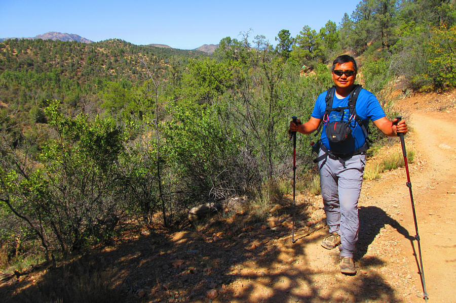
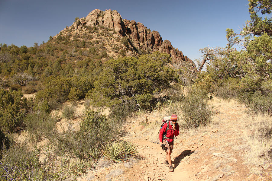
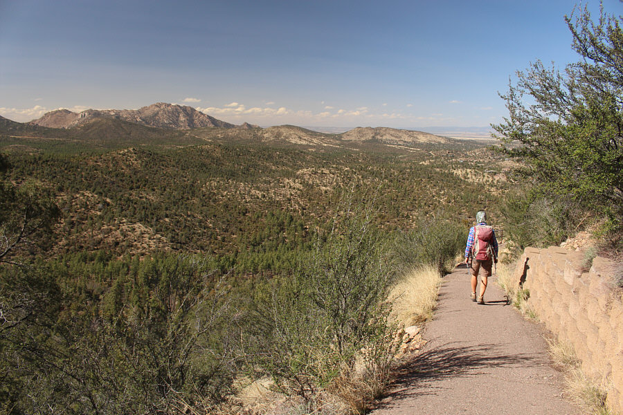
Sonny hikes along the western section
of Thumb Butte Loop.
The top of Thumb Butte appears behind Zosia.
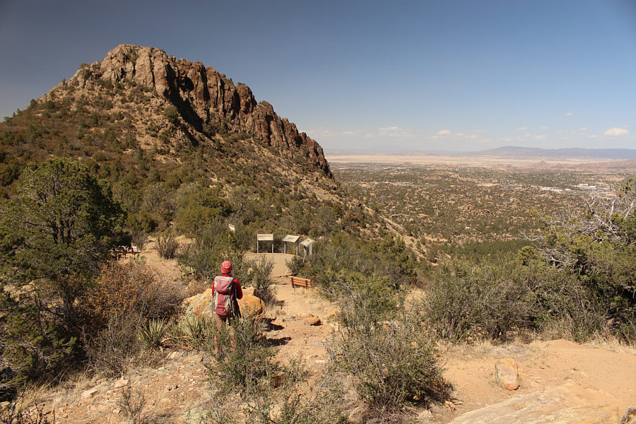
The viewpoint grants a nice perspective of Thumb Butte and the town of
Prescott.
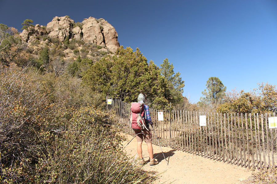
A fence blocks access to the summit of Thumb Butte.
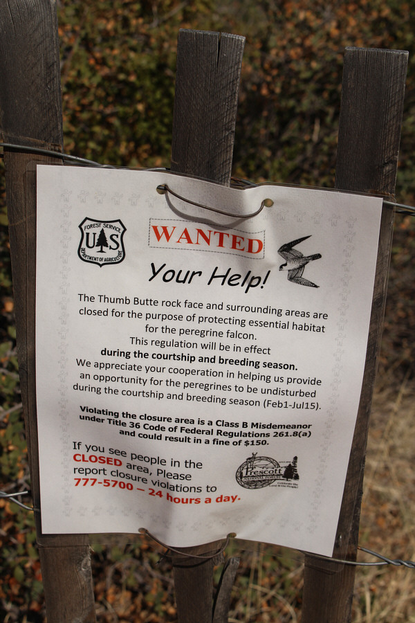
A sign explains the seasonal closure of Thumb Butte's summit.
Zosia heads down a paved section of
the loop.
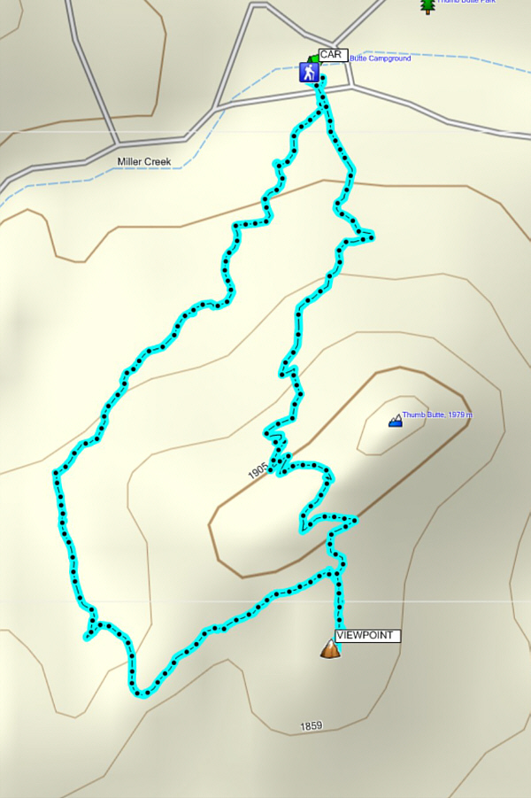
Total Distance:
3.7 kilometres
Round-Trip Time: 1 hour 53 minutes
Net Elevation Gain to Viewpoint: 178 metres