BOU AVENUE
Mount Williamson
With our original climbing plan scuttled for reasons related to recent wildfires, Wendy Kadar (plus her dog, Ruthie), Michael Schoemaker, Marta Wojnarowska, Zosia Zgolak and I backpacked to Eva Lake in British Columbia's Mount Revelstoke National Park on the Labour Day long weekend with intentions of climbing Mount Williamson, a prominent peak in the heart of the park's backcountry.  Based on information from a friend's attempt and also from an online trip report by Ben Wilkey, we decided to bring full climbing gear as a backup in case the route via the west ridge turned out to be too technical to scramble.

After spending the previous night at Wendy's condo apartment in Revelstoke, we drove up Meadows in the Sky Parkway on the morning of 1 September 2018 and arrived at a locked gate about half an hour before the official opening time of 8:00 AM.  We were the second group in line, and several other vehicles soon formed a queue behind us.  When the gate finally opened, the party in front of us booked two of the four available tent sites at Eva Lake campground for the weekend.  We subsequently booked the remaining two sites for just a single night since we did not have plans to climb anything else in the park.  Once we received our backcountry camping permits, we drove to the lower parking lot at the end of Meadows in the Sky Parkway.  Unfortunately, we arrived too early to take advantage of Parks Canada's free shuttle bus which runs between the lower parking lot and the Eva Lake trailhead at the upper parking lot (not open to public vehicles).  Instead, we simply humped our packs and walked the one-kilometre-long Upper Summit trail to the upper parking lot.  One of us would have had to walk with Ruthie anyway since the shuttle bus does not allow dogs on board.  It took us about 20 minutes to walk to the upper parking lot.

It took us about two hours to hike the well-maintained trail to Eva Lake.  There are some ups and downs along the way, but the grade is never too difficult.  Arriving at the lake, we set up camp and took a short break before starting our ascent of Mount Williamson.
We're only 1 km from the summit? I guess it's gonna be a short day! 
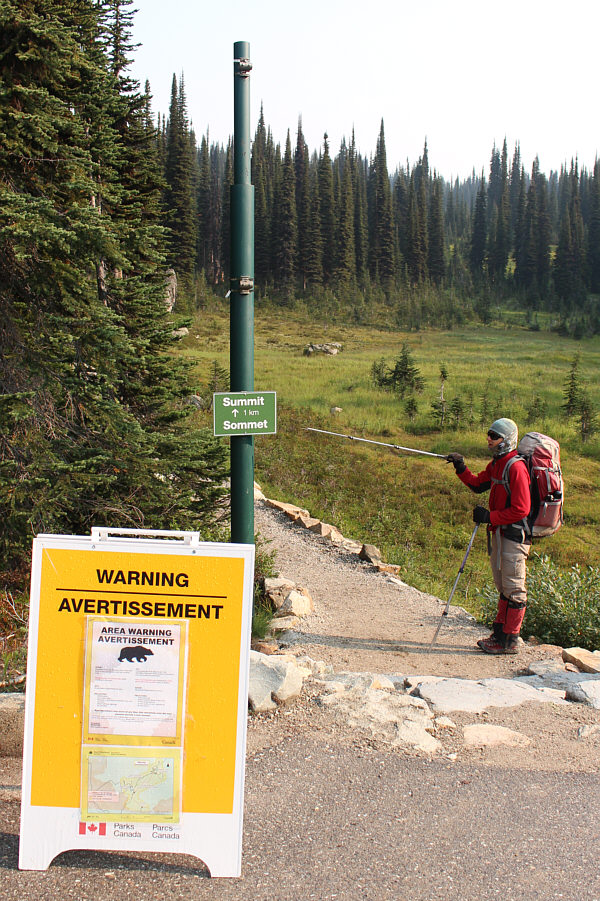
Zosia begins hiking along the Upper Summit trail which starts near the main parking lot.
Dogs must be kept on a leash at all times! 
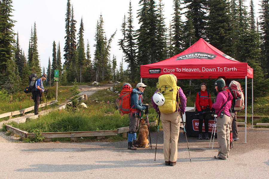
Michael waits patiently at the trailhead to Eva Lake while a park staff member (with radio on her hip) gives the rest of the group some information about a local grizzly bear known as "49".
Keep an eye out for huckleberries...and bear "49"! 
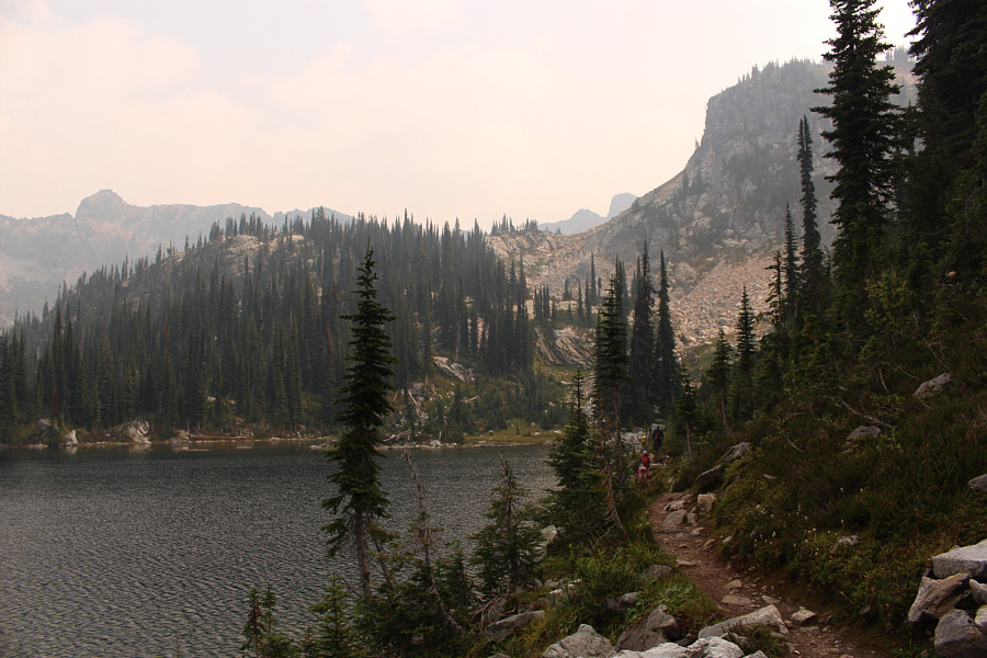
The group hikes the well-maintained trail to Eva Lake.
Makes for a nice cooking shelter if the weather sucks. Sonny arrives at Eva Lake campground.  Built in 1928, the cabin was restored in 2013 and is open for use as a day hikers' shelter (no overnight stays permitted).

Photo courtesy of Zosia Zgolak

From the campground, we circled around the south shore of Eva Lake before heading east up a grassy slope leading to a hidden tarn below a rocky ramp.  The ramp is the terminus of a scree-covered bench which runs along the north side of Mount Williamson's extended west ridge.  We climbed up the ramp and hiked through a few tedious boulder fields before arriving at a high col just west of the main peaks of Mount Williamson.  This col can also be easily reached via the trail to Jade Pass.  We took a short break at the col before continuing eastward up the ridge.
Yep, that's the top of Mount Williamson just peeking above the ridge! The group hikes along the south shore of Eva Lake aiming for the rocky slope just right of centre.
Most people that hike to Eva Lake probably don't even know about this tarn. 
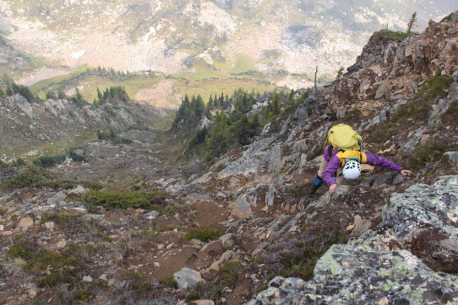
The group scrambles up a rocky ramp just beyond an unnamed tarn to the east of Eva Lake.
The tarn would make for a great secret bivy site... 
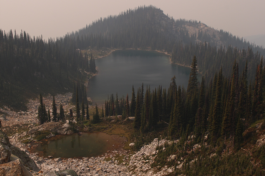
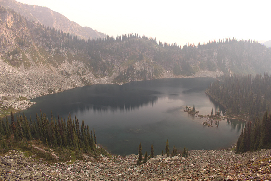
From the top of the ramp is this aerial view of the unnamed tarn and Eva Lake.
Hmm...that false summit on the right sure doesn't look very inviting... 
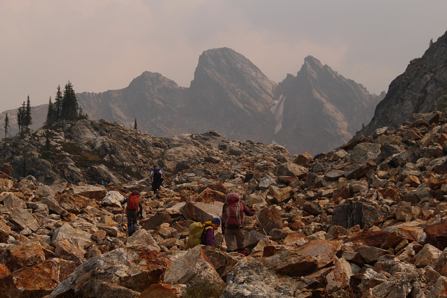
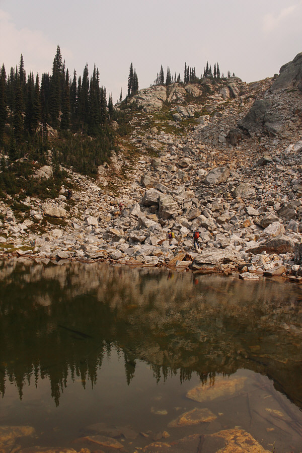
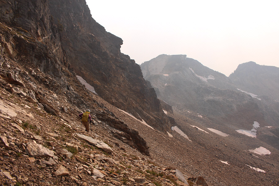
The group makes its way through a tedious boulder field with Mount Williamson looming in the background.
A good warm-up for what's to come... 
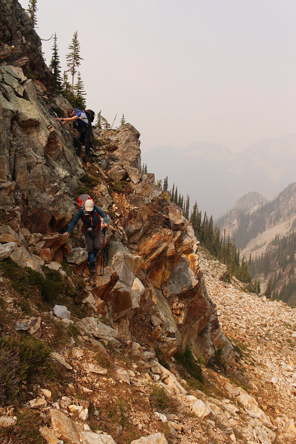
Wendy and Michael traverse a mildly exposed ledge to avoid some unnecessary elevation loss.
That false summit is not looking any easier as we get closer! 
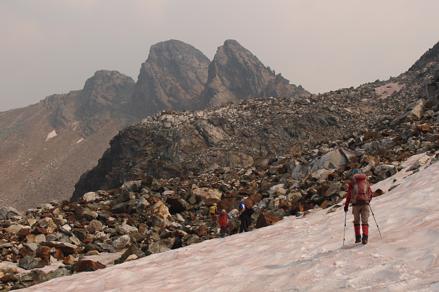
The group makes use of lingering snow patches to alleviate the tedium of hiking through the boulder fields.
If this aspect terrifies you, go no further! Wendy and Michael get their first good look at the west ridge of Mount Williamson.
A chilly wind was blowing here...just when we didn't need it! 
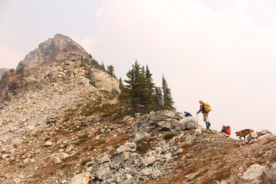
The group stops for a break on a high col west of Mount Williamson.
As we climbed higher, we encountered a series of gendarmes which were progressively more difficult to surmount or bypass.  One particular gendarme proved to be very problematic, and at this point, Wendy (plus Ruthie), Michael and Zosia opted to turn around and head back to camp.  They would eventually hike back to Eva Lake along the crest of the extended west ridge.  In the meantime, Marta and I managed to muddle our way up the troublesome gendarme.  Right at the start, I had to take off my awkwardly huge backpack and hand it up to Marta above me, but once we cleared this first obstacle, we enjoyed some nice hands-on scrambling before reaching the top of a false summit.
Marta and I are now on our own... Sonny and Marta can be seen scrambling beyond the first problematic gendarme (upper right) along the west ridge.

Photo courtesy of Zosia Zgolak

Enjoyable hands-on scrambling here!

Marta scrambles up the west ridge.  Visible behind her is the bench route leading to Eva Lake.


This is where things get...interesting... 
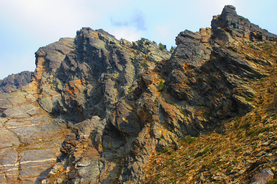
Marta reaches the top of the false summit along Mount Williamson's west ridge.
Descending the east side of the false summit is not for the faint of heart.  The drop-off is steep and seemingly impossible to down-climb without a rope.  However, closer inspection showed an abundance of good holds, and I convinced Marta that we could make it down without having to set up a rappel.  As I slithered down the drop-off, I double-checked every handhold and foothold, and sure enough, a few were alarmingly loose.  The exposure is unforgiving here, but frankly, I was too focused on the placement of my hands and feet to really notice.  Fortunately, we both got down safely without any mishaps.  In retrospect, the down-climb reminded me a lot of a similar crux on Fisher Peak in Alberta's Kananaskis Country.

Once we cleared the false summit, we easily circumvented another gendarme before tackling the steep slabs of the main summit block.  In general, we had no serious problems climbing up these slabs, but more than a few sections gave me pause as I wondered how difficult it would be to descend the same way.

Arriving at the summit, I gave out a loud and enthusiastic yell to let our comrades know that Marta and I had reached the top.
No margin for error here--double-check all your holds! Marta carefully descends the exposed east side of the false summit.  This is the crux of the ascent.
An easy section just before the final summit push! 
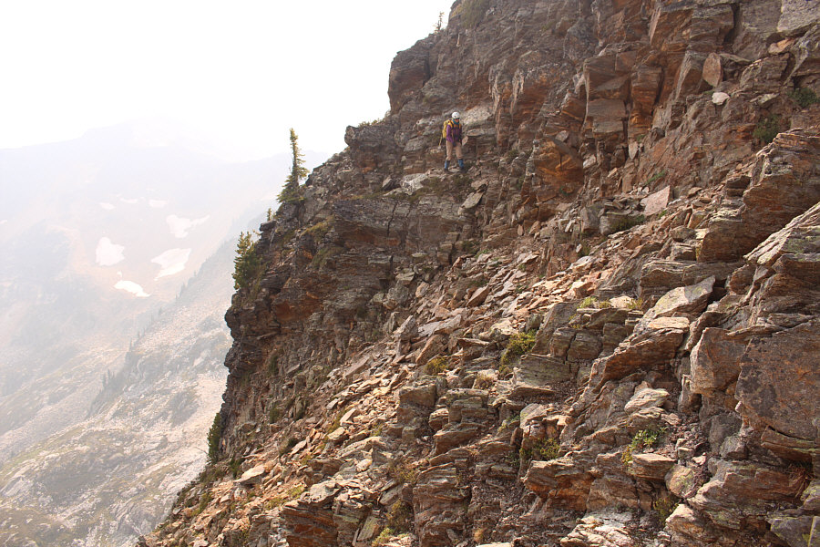
After descending from the top of the false summit, Marta traverses some steep terrain just before the main summit block.
Steep and exposed enough for ya? Marta scrambles up the main summit block.
Ben Wilkey refers to the peak at left as "Mount Harry". 
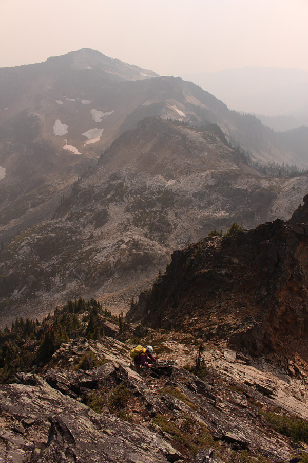
Marta takes the last few steps before the summit.  At lower right is Upper Jade Lake.
A beautiful peak, I must say! 
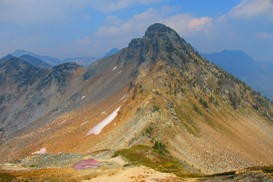
Here is the view of Mount Williamson from the other side of the high col (bottom centre).  Marta and Sonny are barely visible on the summit.

Photo courtesy of Zosia Zgolak

Tough little summit, but we nailed it!

Marta and Sonny stand on the summit of Mount Williamson (2370 metres).


The ridge makes for a very nice consolation prize if difficult scrambling is not your thing! The undulating west ridge of Mount Williamson extends beyond the false summit at left.  From the high col, the ridge can be followed all the way back to Eva Lake.
All these peaks are probably seldom climbed... 
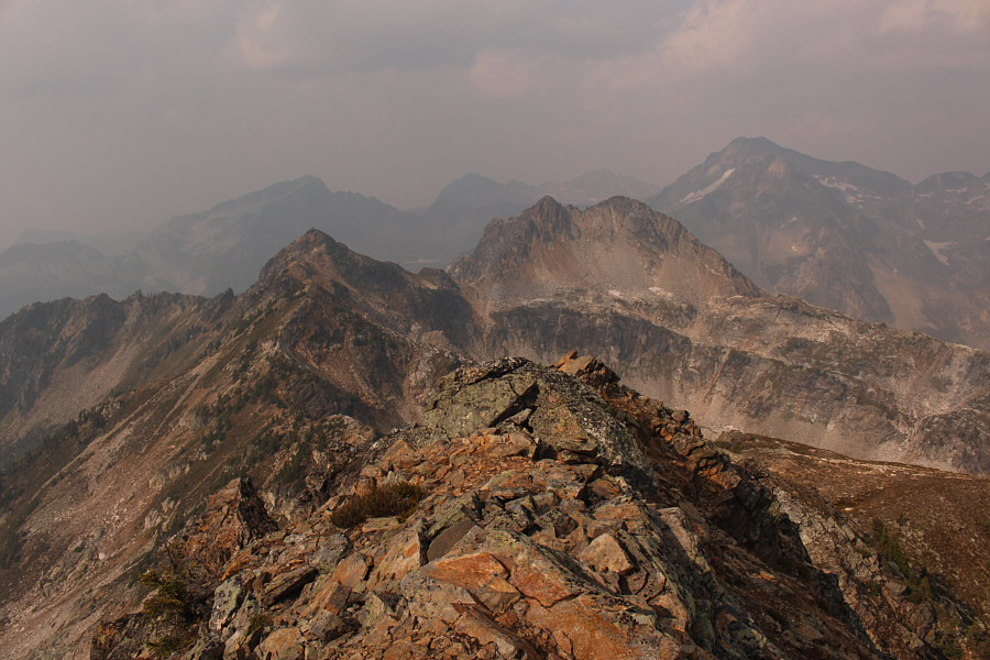
Named summits that are visible to the north include Mount Dickey (left horizon), Mount St. Cyr (right of centre in hazy distance), and Mount Coursier (right).
While I had every intention of returning the same way, Marta suggested that we should try and traverse the peak just as Wilkey had done in his trip report.  I was admittedly skeptical at first, and a sizeable drop-off at the north end of the summit ridge seemed to confirm my misgivings about attempting the traverse.  Of course, we could have simply set up a rappel, but once again, the rope stayed in my pack as we spotted a feasible way to bypass the drop-off.  The east side of the summit block is very steep, but we found enough ledges and holds to work our way down and across the face to the base of the aforementioned drop-off.  The rocks here are dangerously loose, and we again had to be cautious about the placement of our hands and feet.

After bypassing the drop-off, we noticed that the gully just north of the main summit block looked like a steep but uncomplicated route down to the scree-filled basin below.  We opted to drop down here but quickly realized how incredibly loose the rocks are in this gully.  By descending one at a time, we managed to clear the gully safely without raining rocks down on each other.

In the basin below the gully, we traversed across scree slopes to regain the high col on the west ridge.  Instead of returning along the bench route we had come up earlier in the day, Marta and I worked our way over to nearby Jade Pass and picked up the good trail which leads back to a junction with Eva Lake trail.  Our return hike to Eva Lake campground was easy and uneventful, and we even managed to get back in time to enjoy dinner with the rest of our friends.

After spending a surprisingly warm night at Eva Lake, Wendy, Michael, Marta, Zosia and I got up early on the morning of 2 September 2018 and ate a leisurely breakfast before packing up our camp and hiking out.

A very big thank you goes out to Wendy for hosting all of us in her condo apartment.
It would only make sense to use this alternate route if camping at Upper Jade Lake. Marta descends very steep terrain on the east side of the main summit block.  Below her is possibly a Class 3 route from Upper Jade Lake (not visible here).
I think we're gonna make it! Marta drops down the last few metres near the bottom of the main summit block's northeast side.
Very, very loose rocks here. Wear a helmet and go down one at a time... If dry, the steep gully just north of the main summit block is a viable descent route.
Most of the difficult stuff is behind us now! After reaching the bottom of the gully, Marta traverses across scree slopes below the west face of Mount Williamson.
The traverse was not as painful as I had anticipated! Marta carefully crosses a snow slope on her way back to the western col (left of centre).

I even see a possible route that could bypass all that mess on the west ridge...

The complexities of Mount Williamson's west ridge are more apparent in this view from Jade Pass.


Too bad there's no camping allowed here. This is Miller Lake as seen from the Jade Pass trail.

It was worth camping here overnight to get this shot.

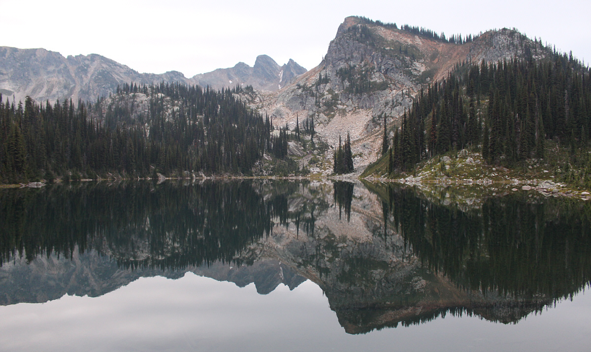
Mount Williamson (centre) and the terminus of its west ridge (right) are reflected in Eva Lake early the following morning.


There are some sick people in this photo...literally! 
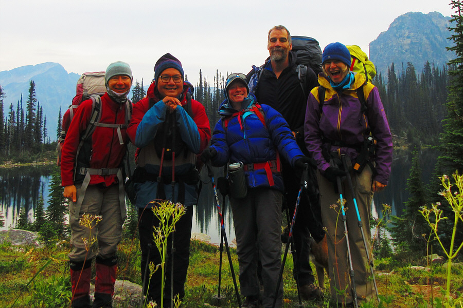
Zosia, Sonny, Wendy, Michael and Marta pose for a group photo before departing Eva Lake campground.

Photo courtesy of Zosia Zgolak

Probably can be climbed in a day, but camping at Eva Lake makes for a more leisurely trip without worries about the evening access gate closure. Total Distance:  21.1 kilometres
Round-Trip Time:  25 hours 4 minutes
Net Elevation Gain from Camp:  420 metres

GPX Data