BOU AVENUE
Blackman Peak

After spending a second night camping at Fourth of July trailhead in the White Cloud Mountains of central Idaho, Zosia Zgolak and I enjoyed an easy ascent of Blackman Peak on 2 July 2019.  The mountain has apparently been renamed "Blackmon Peak" in honour of a freed slave and mining pioneer named George Blackmon, but the name "Blackman Peak" still persists on most topographical maps.  In any case, we could see the peak from the trailhead and surmised that its west ridge would be a fairly short and easy ascent.

The Fourth of July Creek Road is accessed from Highway 75 about 24 kilometres south of Stanley or 74 kilometres north of Ketchum.  Drive east along the well-maintained 2WD gravel road for 16 kilometres to its terminus at Fourth of July trailhead.

From the trailhead, we briefly followed the continuation of the road which initially heads eastward before turning south to go to Phyllis Lake.  We left the road here and headed north where we soon came upon an old mine site.  After a brief exploration of the mine remnants, we continued to climb up the partially open slopes above aiming for a col between Blackman Peak and an unnamed high point to the west.  Despite some deadfall from a previous forest fire, travel was generally pretty easy, and higher up, we even picked up a trail which apparently heads over the col.  Before we actually reached the col, we left the trail to climb up the west ridge of Blackman Peak.  The ridge presents no difficulties, and we reached the summit about 1.5 hours after starting from the trailhead.

For such an easy ascent, we were amply rewarded with scenic views in all directions, and we hung around at the top for about 40 minutes before commencing our descent.  Although it is entirely feasible to drop down the east ridge and subsequently return via Fourth of July Lake, we had already been there the day before, and instead, we simply went back the way we came more or less.  We had no trouble descending the easy terrain and made it back to the trailhead in about 45 minutes.
It's hard to resist climbing such an easy peak within sight! Blackman Peak is visible from Fourth of July trailhead.
Talk about going off the rails! 
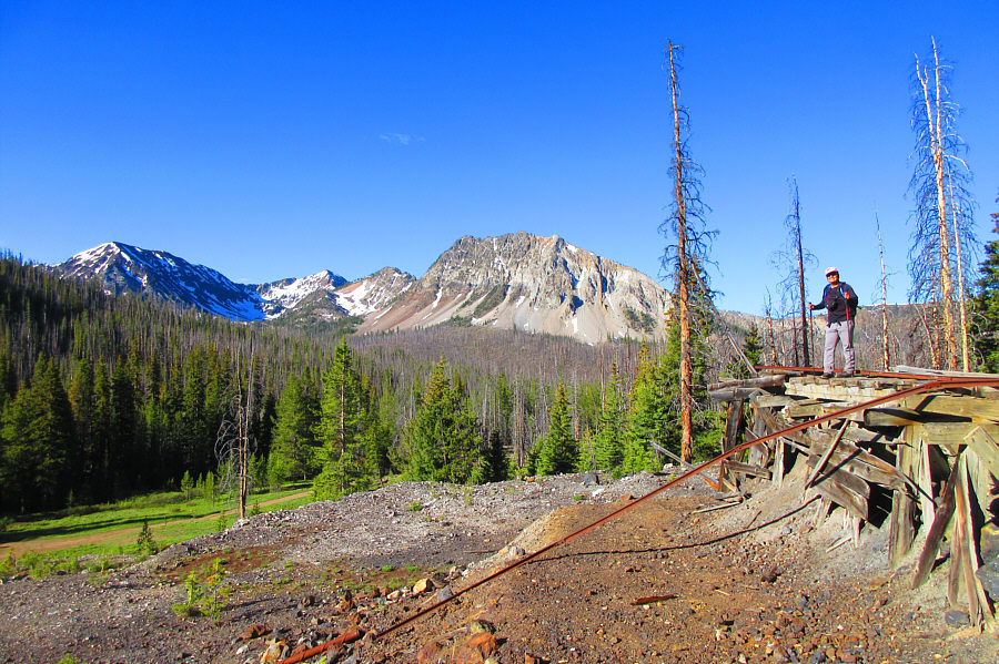
Sonny stands on the remnants of a short railway at an old mine site not far from the trailhead.

Photo courtesy of Zosia Zgolak

What shall we find in the Mines of Moria? Zosia curiously peers into a water-filled adit at the mine site.
There are a few marshy spots but no serious obstacles. 
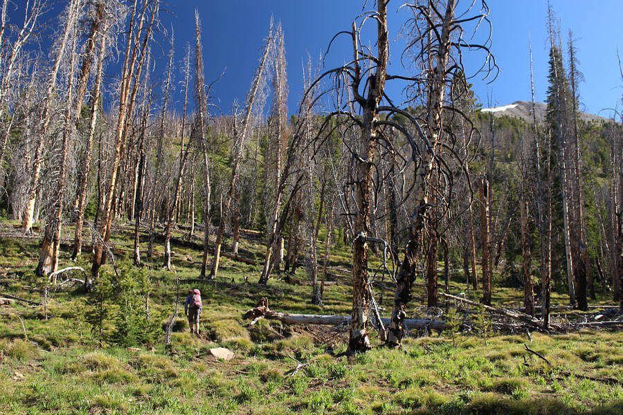
Zosia hikes up generally open slopes to gain the west ridge of Blackman Peak.
Just keep climbing! The west ridge presents no difficulties for Zosia.
There's even a trail to follow! Zosia passes the last tree on the west ridge.

Still some good ski touring to be had here!

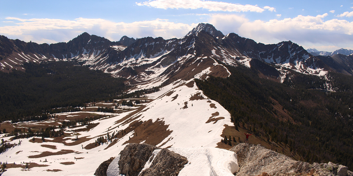
In this view from Blackman Peak's summit, Zosia descends a short distance along the east ridge for a better view of Ants Basin at left.  Castle Peak stands high above all other peaks in the area.


This cornice might even last until next winter! Here is Zosia's view from the east ridge of Sonny on Blackman Peak's summit.

Photo courtesy of Zosia Zgolak

Wazzup biatch! Sonny and Zosia stand together on the summit of Blackman Peak (3138 metres).
Patterson Peak looks like a straightforward scramble from here. 
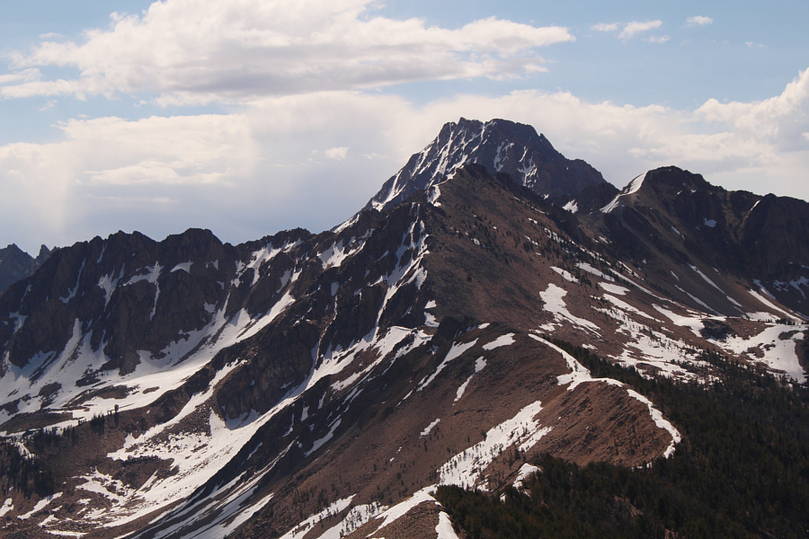
Here is a closer look at Castle Peak which is partly obscured in front by Patterson Peak.
Looks like another easy scramble... 
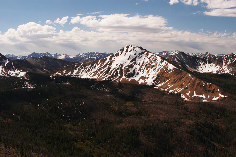
To the south is unofficially-named Fourth of July Peak.  Fourth of July Lake is barely visible at far left.
We might even be back down before lunch time! This is looking back down the west ridge with Fourth of July trailhead visible in the valley just left of centre.
Lotsa wilderness to explore here! 
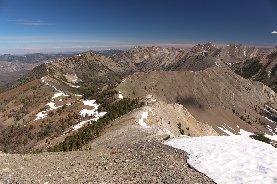
To the north are Strawberry Basin (left) and Watson Peak (centre on horizon).
There are tons of lakes to the east of these unnamed peaks. Unnamed peaks sit to the east across Ants Basin.
Nothing too tough here! 
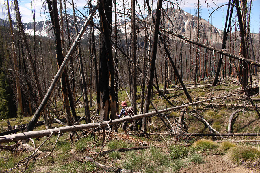
Zosia maneuvers past some deadfall on her way back to the trailhead.

I'll be back again someday...

Here is a last look at Blackman Peak from the trailhead.
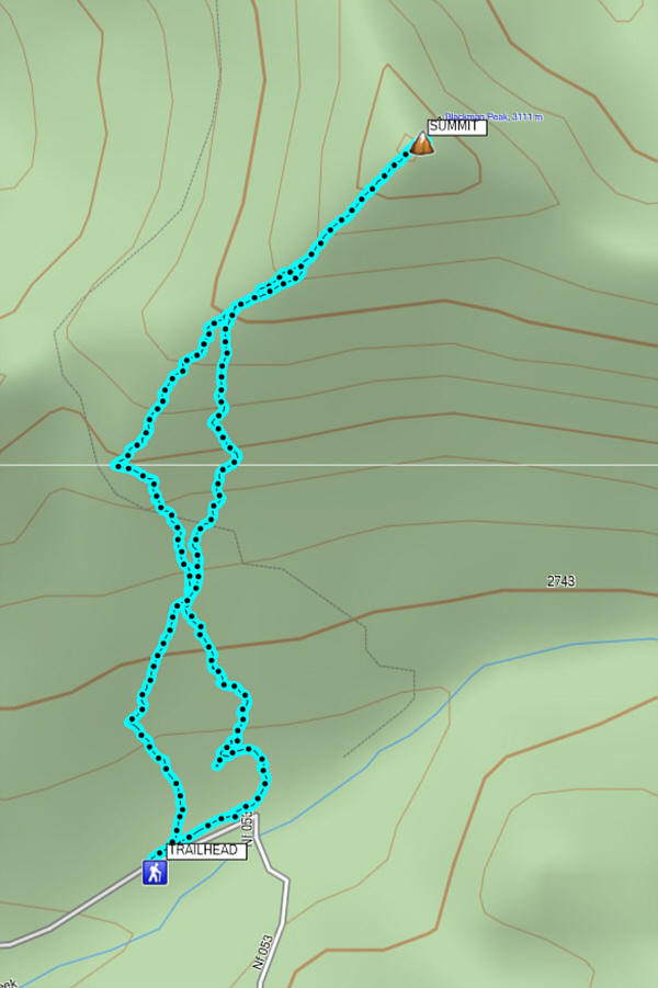
 

A very nice and easy half-day hike from the trailhead. Total Distance:  3.7 kilometres
Round-Trip Time:  2 hours 59 minutes
Net Elevation Gain:  475 metres

GPX Data