BOU AVENUE
Calf Robe Mountain

Wrapping up our three-week road trip to the United States, Zosia Zgolak and I climbed Calf Robe Mountain in Montana's Glacier National Park on 20 July 2019.  J. Gordon Edwards describes two similar ascent routes in his guidebook, A Climber's Guide to Glacier National Park, and both routes begin at the Firebrand Pass trailhead which is located on the west side of US Highway 2 (10 kilometres south of East Glacier or 8.4 kilometres northeast of Marias Pass).  The trailhead is not signed on the highway and is easy to miss.

From the gravel parking area, we crossed the train tracks to an obvious trail which passes through a fence with some signage.  The trail is pretty flat for the first kilometre, but then it starts to climb a bit to reach a junction with the Continental Divide Trail (CDT) about 2.3 kilometres from the trailhead.  Turning right (north), we followed the CDT for about 1.5 kilometres to a second junction where we took the left fork which is Ole Creek Trail.  One of the routes described by Edwards leaves this trail at some point and climbs the northeast ridge of Calf Robe Mountain.  Because we were not in any mood for bushwhacking or off-trail route-finding, we stuck to the easier but longer route which follows Ole Creek Trail around the end of the northeast ridge and up to Firebrand Pass.

It is about 4.2 kilometres from the second junction to Firebrand Pass, but the trail is well-maintained and not too steep which makes for very pleasant hiking.  The only issue we had was a lingering snow patch covering the trail just before the pass.  While a trail had already been broken through, the snow patch was steep enough to be a little unnerving to cross without an ice axe.  I took a chance and made it across without a slip while Zosia played it safe and circumvented the entire snow patch.

From Firebird Pass, the route we chose leaves the trail and climbs over 300 metres up the west slope of Calf Robe Mountain.  This slope is steeper and a bit more rugged than we were expecting, but we put our noses to the grindstone anyway and scrambled up loose rubble and some cliff bands which turned out to be easier than they looked from below.  The upper half of the west slope is nothing but easy scree, and we were soon standing on the spacious summit less than an hour after leaving Firebrand Pass.

For our return, we briefly considered taking the shorter route down the northeast ridge, but given how easy it was to hike to Firebrand pass, we opted to simply return the same way.  The loose scree on the west slope worked wonderfully for our descent, and by staying further to skier's left, we managed to bypass most of the cliff bands that we had ascended earlier.  Near the pass, we both skirted around the aforementioned snow patch to regain Ole Creek Trail, and the rest of our hike back to the trailhead was pleasant and trouble-free.

Calf Robe Mountain was the last hike of a long summer road trip for Zosia and me.  Over the 22.5 days we were on the road, we drove 6835 kilometres, visited 7 US states, tagged 23 summits, and slept in Zosia's tent for 2 nights and the back of my car for 20 nights (ie. not a single night in a hotel).  As a bonus, I even lost about 10 pounds (which unfortunately I have probably regained by now)!
Trains frequently run through here. Sonny cautiously crosses train tracks to get to the trailhead.  Calf Robe Mountain is visible in the background.

Photo courtesy of Zosia Zgolak

Zosia thinks they're stinky flowers! Bear grass is in full bloom in the park.
Actually, quite a few trails in Glacier National Park could use some weed-whacking! It appears that somebody came through this section of trail with a weed-whacker.
We could probably go off-trail here and take a short cut to the summit, but why spoil such a nice hike? 
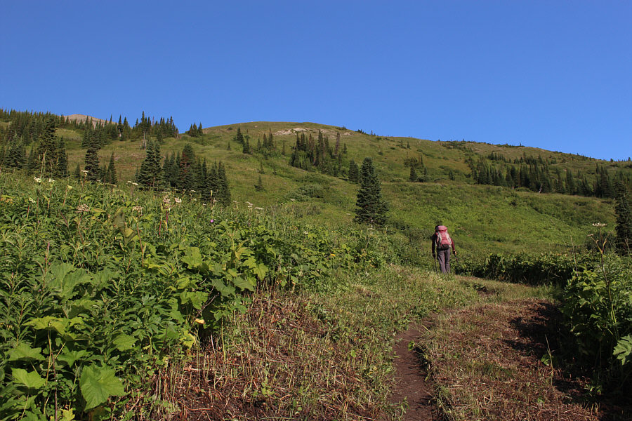
The trail heads right to go around the northeast outlier of Calf Robe Mountain.
Good ski run still! Zosia crosses a lingering snow patch covering the trail.
No more short cuts from here! 
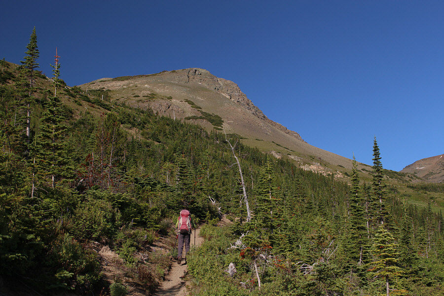
Zosia passes the rugged end of Calf Robe Mountain's northeast ridge.

Firebrand Pass is, in itself, a great hiking destination!

This is the first glimpse of Calf Robe Mountain's north face.  The trail can be seen heading up to Firebrand Pass.


Steep enough to be a little unnerving! Sonny crosses another lingering snow patch just before reaching Firebrand Pass.

Photo courtesy of Zosia Zgolak

How about we call it "Hungry Wolf Mountain"?

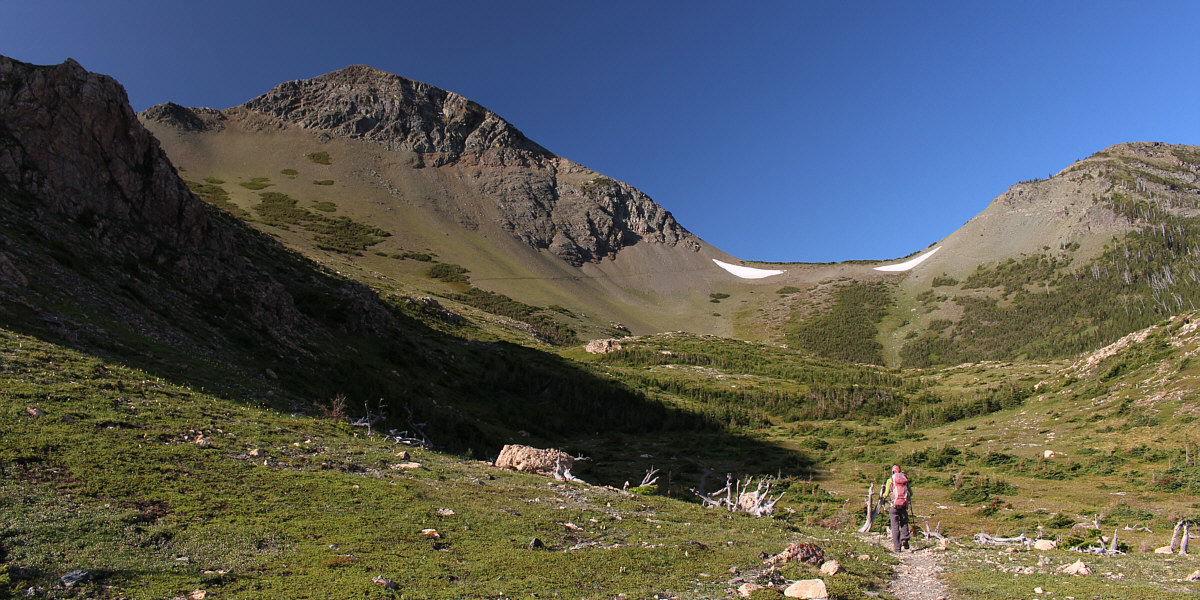
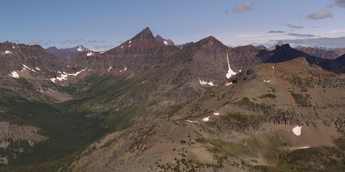
The view to the southwest from Firebrand Pass includes Sheep Mountain (left) and Brave Dog Mountain (centre).  Strangely enough, the big peak at right is unnamed.


Not the cake walk I was expecting! 
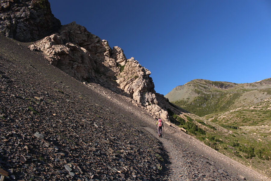
The west slope of Calf Robe Mountain is surprisingly steep and rugged.
Better than a scree slog, I suppose! 
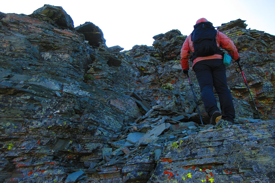
Sonny scrambles up some easy cliff bands.

Photo courtesy of Zosia Zgolak

And like any good scrambler, she's wearing her helmet! 
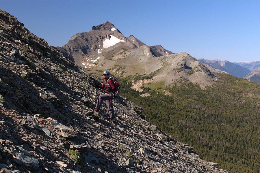
Zosia climbs steadily up the west slope of Calf Robe Mountain.  Summit Mountain and Little Dog Mountain are visible behind her.
Great for surfing on the way down! The upper part of the west slope is nothing but loose scree.

Thumbs up for this scramble!

Sonny and Zosia stand on the summit of Calf Robe Mountain (2417 metres).


There are some intriguing mountains further south at far right... Lubec Lake is at centre in this view to the east.  Lubec Ridge is at left on the other side of the highway but is difficult to discern.

Mount Rockwell is high on my to-do list.

Notable peaks to the northwest include Eaglehead Mountain (left through gap), Grizzly Mountain (left of centre), Mount Rockwell (behind and to the right of Grizzly Mountain) and Flinsch Peak (behind shadowy ridge at right).  Red Crow Mountain is in the right foreground.


I have fond memories of all those ascents! Rising Wolf Mountain (left horizon), Mount Henry (right of centre) and Bison Mountain (far right) are all visible to the north.
No short cuts today--keep it simple, stupid! Sonny descends from Firebrand Pass (right).

Photo courtesy of Zosia Zgolak

No regrets about taking the long way home! 
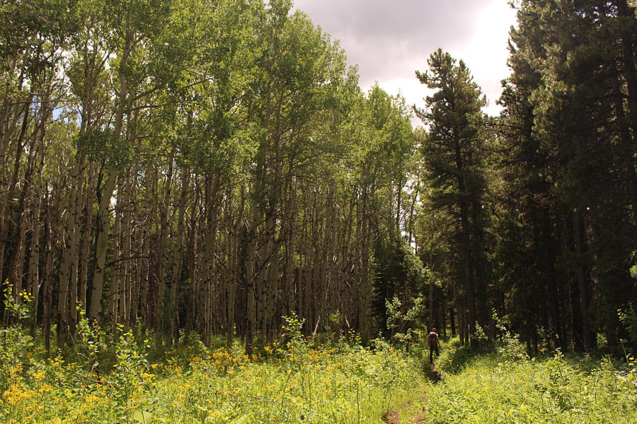
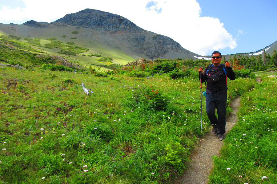
Zosia enjoys a pleasant hike through the forest back to the trailhead.
Do not eat this! 
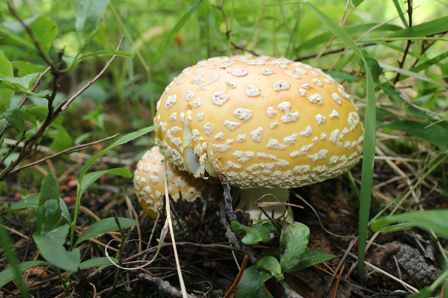
Lots of mushrooms can be found beside the trail in the forest.
A fantastic final peak on our 3-week road trip! Total Distance:  17.8 kilometres
Round-Trip Time:  6 hours 2 minutes
Net Elevation Gain:  906 metres

GPX Data