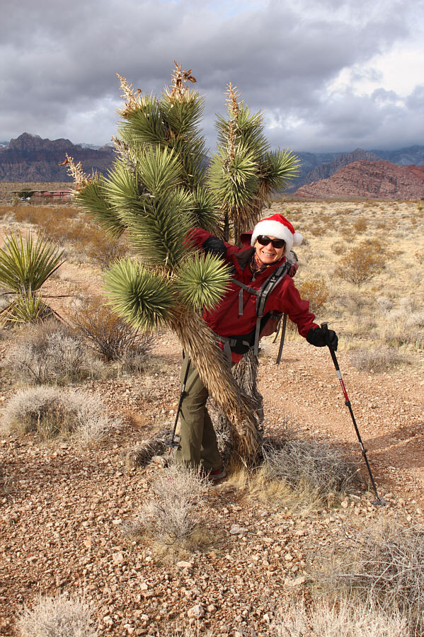
On 25 December 2019, Zosia Zgolak and I made
plans for a leisurely ascent of Turtlehead Peak in Red Rock Canyon
National Conservation Area (NCA) just west of Las Vegas, Nevada.
Since a well-marked official trail runs all the way to the summit, we
figured that this would be a relatively easy outing and that we would
even be comfortably back in the city in time for an early dinner
engagement. What we did not anticipate though were the revised
hours for Christmas Day--the NCA was only open from 12:00 PM to 5:00 PM!
We did not learn of this until we drove up to the closed gate at the
entrance to the NCA's one-way Scenic Drive early that morning.
At a loss for what to do, we puttered around for a bit at the nearby Red
Rock Overlook parking lot before I found an interesting
objective--Firehouse Hill--in my phone's map application. Firehouse
Hill is an unofficially-named little bump located in the shadow of the
northeast cliffs of Blue Diamond Hill. The name probably derives
from the nearby Red Rock Fire Station. Since it looked like a short
outing, Zosia and I decided to pay a visit with hopes of getting back
early enough to then enter Red Rock Canyon NCA and climb Turtlehead
Mountain.
Turn south onto Moenkopi Road (access road for Red Rock Canyon
Campground) from Highway 159 (Charleston Boulevard) about 4 kilometres
west of the junction with Desert Foothills Drive or 3.9 kilometres east
of the entry point for Red Rock Canyon NCA's Scenic Drive. Numerous
trails start from various points along Moenkopi Road, but the most direct
one to Firehouse Hill begins near a small pullout about 1.4 kilometres
south of Highway 159. When parking, be sure not to block the gate
for the nearby restricted access dirt road.
From the pullout, Zosia and I crossed the road and briefly followed a
beaten path along a fence before passing through a gate to the start of
an obvious double-track. This double-track appears to head toward
the fire station at first, but it then veers off toward the hill and
eventually narrows to a hiking trail which rises efficiently all the way
to the top. As easy as the ascent was, I really enjoyed the quiet
solitude on Firehouse Hill despite its close proximity to the campground
and busy highway. After a brief stop on top of the hill, we easily
retraced our steps back along the trail and double-track.
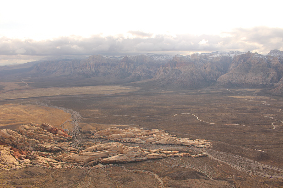
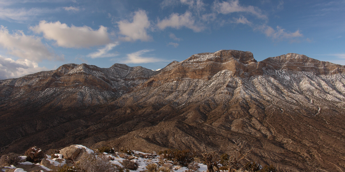
Calico Hills and Turtlehead Mountain are readily
visible to the northwest.
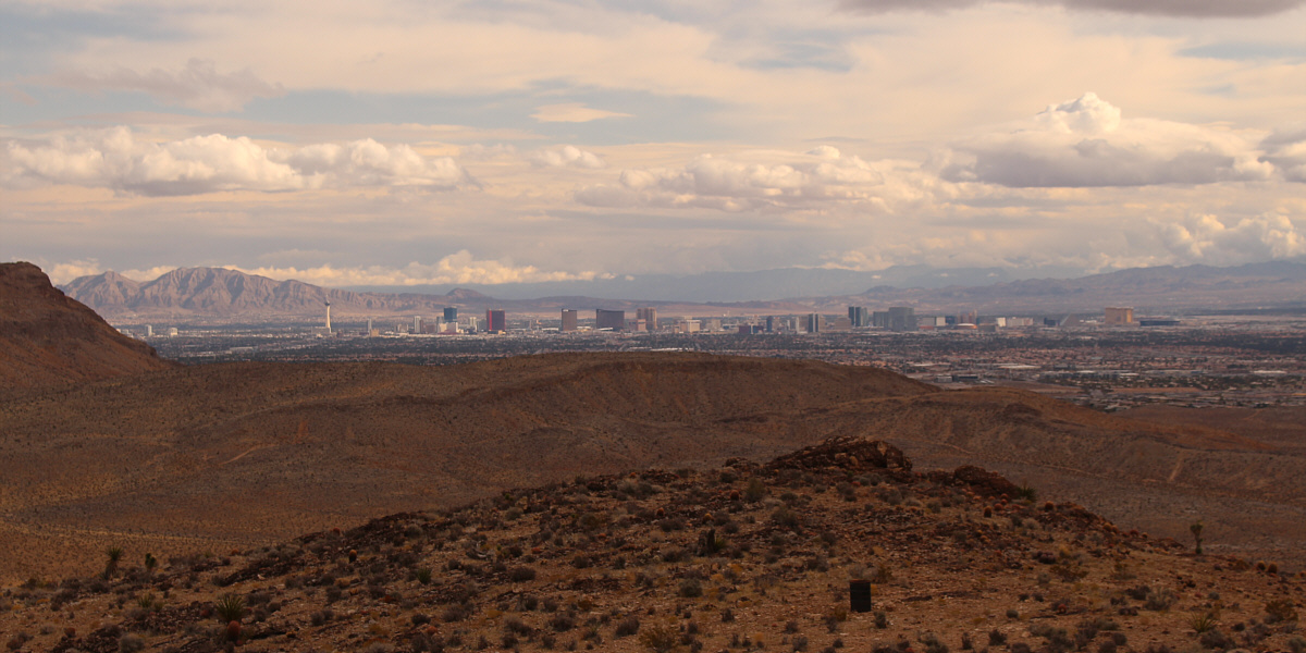
The hotels of the Las Vegas Strip stand out to the
east. Also visible at far left is
Frenchman Mountain.
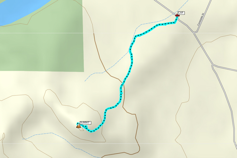 |
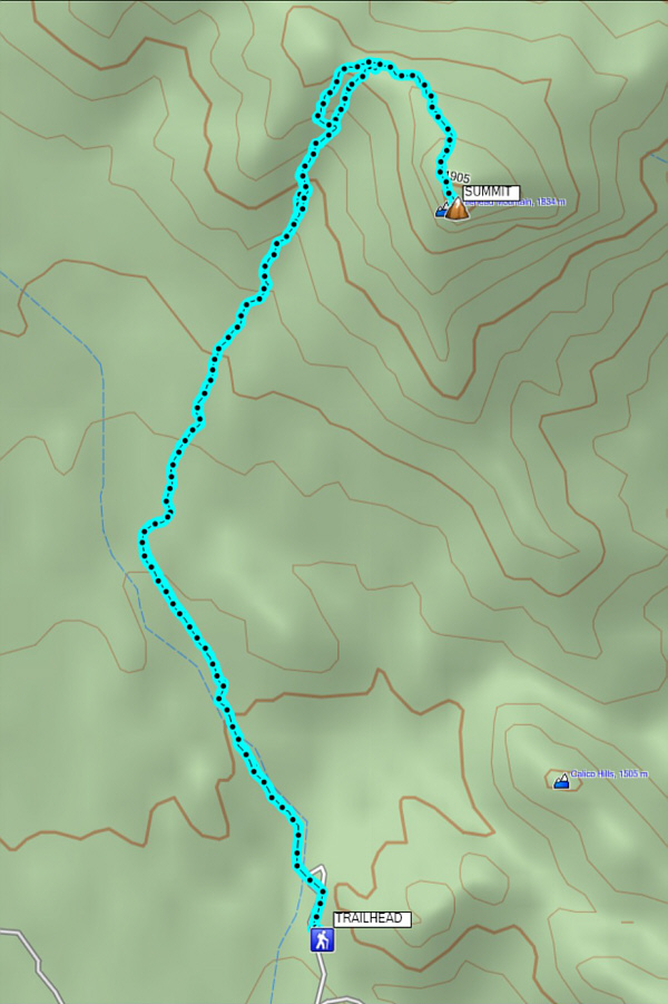
Total
Distance: 3.5 kilometres
Round-Trip Time: 1 hour 25 minutes
Net Elevation Gain: 160 metres
GPX Data |
Upon returning to our car, Zosia and I still had lots of time
before the opening of the Scenic Drive gate, and we drove to Calico Basin
Parking Lot to eat lunch. The parking lot was teeming with people
when we arrived, but we had no problems finding a parking spot. In
retrospect, I should have maybe clued in to the fact that, given the
hordes of people here, there might be a major rush to get through the
Scenic Drive gate when it opened. Sure enough, when we left Calico
Basin Parking Lot at around noon, there was already a line-up of cars
just trying to turn onto Highway 159, and the traffic jam just got worse
as we approached the Scenic Drive turnoff. The lengthy wait to get
onto Scenic Drive reminded me of a similar gridlock we experienced a
couple of years ago trying to drive into San Francisco from Oakland via
the Bay Bridge during morning rush hour. Fortunately, the wait this
time was not nearly as long, and we eventually made it to the Sandstone
Quarry trailhead (4.6 kilometres north of the turnoff from Highway 159)
just before 1:00 PM.
Not surprisingly, the trailhead parking lot was almost full when we
arrived as this is also the same place where hordes of tourists gather to
explore the very popular Calico Hills. I was fortunate to find a
parking spot, but as soon as we were parked, Zosia and I wasted little
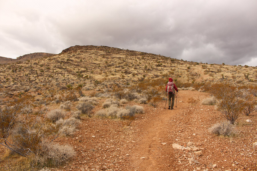
time in marching up the signed trail to Turtlehead Mountain. Due to
the delay in starting our ascent, we maintained a brisk and steady pace
which made this trip feel more like an athletic workout than a scenic
hike.
The trail is generally straightforward to follow except in the drainage
west of the summit block. Here, the trail braids a few times which
can cause confusion, but it is hard to go wrong with most route choices
since the terrain is so open and easy to navigate. At the top of
the drainage, the trail levels out a bit at a saddle before zigzagging up
the final slope to the summit. Zosia and I were a little surprised
to encounter a fair bit of snow and ice on this slope, and we had to be
extra vigilant with our footing to avoid any slips. Because of
foreshortening, this last slope is also longer than it appears.
Nevertheless, our pace seldom flagged, and we finally stepped foot on the
summit about 90 minutes after leaving the trailhead.Although it would
have been nice to linger on the summit, Zosia and I stopped for only ten
minutes before turning around and heading back down the way we came.
Other than taking a slightly different descent route in the
aforementioned drainage, we pretty much retraced our steps all the way
back to the trailhead without any problems.
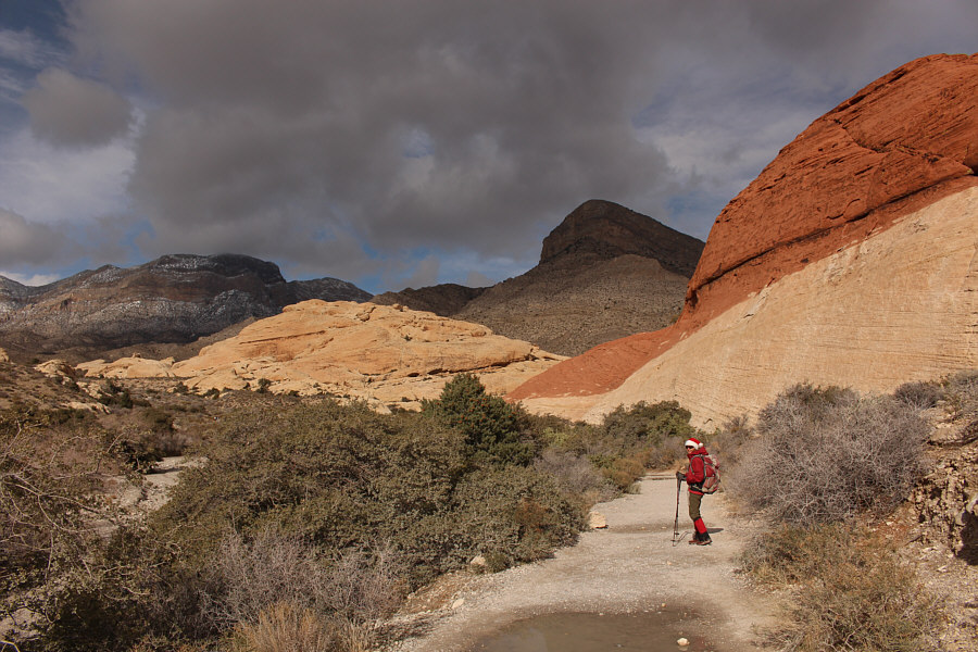 |
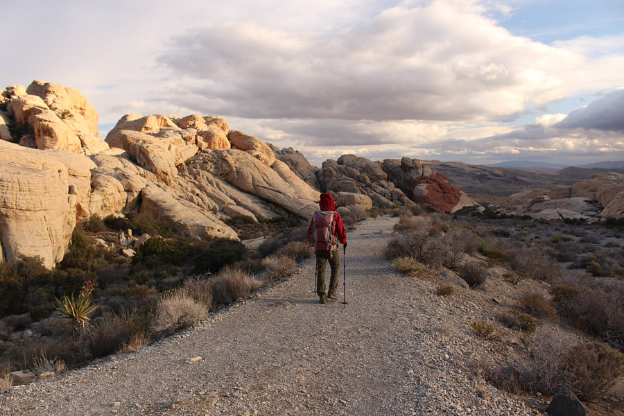
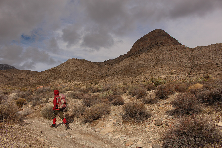
Zosia begins hiking the trail to Turtlehead Mountain which is visible in
the background. |
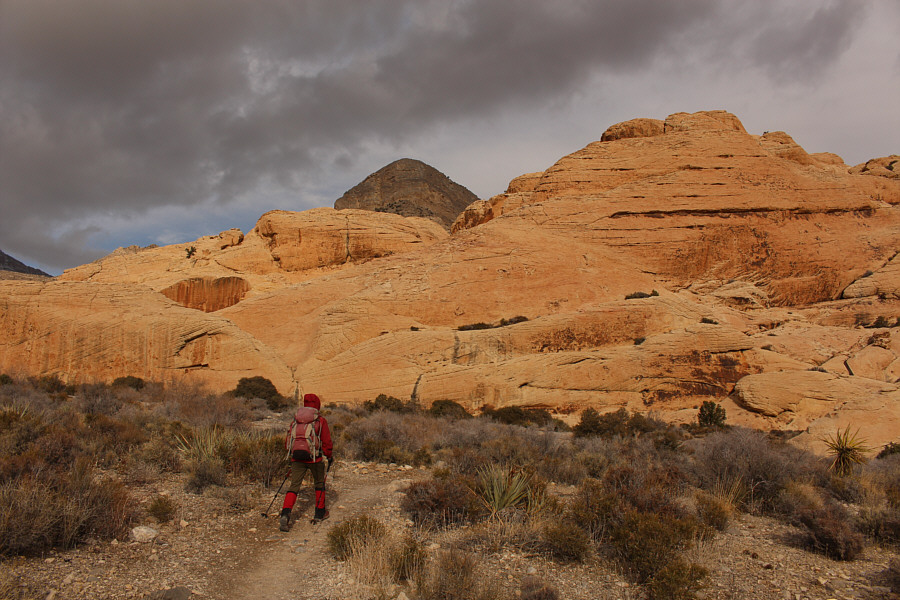 |
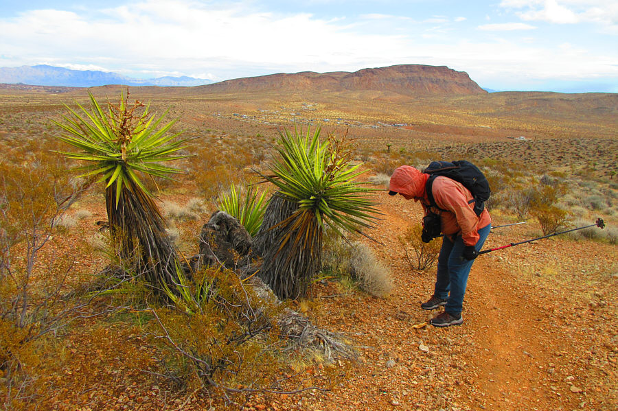
Although the rocks of Calico Hills look tempting to explore, Zosia sticks
to the trail and remains focused on Turtlehead Mountain in the
background. |
 |
The trail eventually runs up the drainage to the left of Turtlehead
Mountain. |
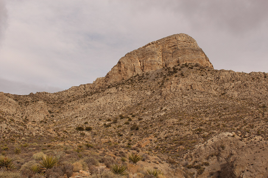 |
Turtlehead Mountain looks more inviting in the afternoon sunshine. |
 |
The trail braids a bit going up the drainage and can be a bit confusing
to follow, but painted markers help point the way. |
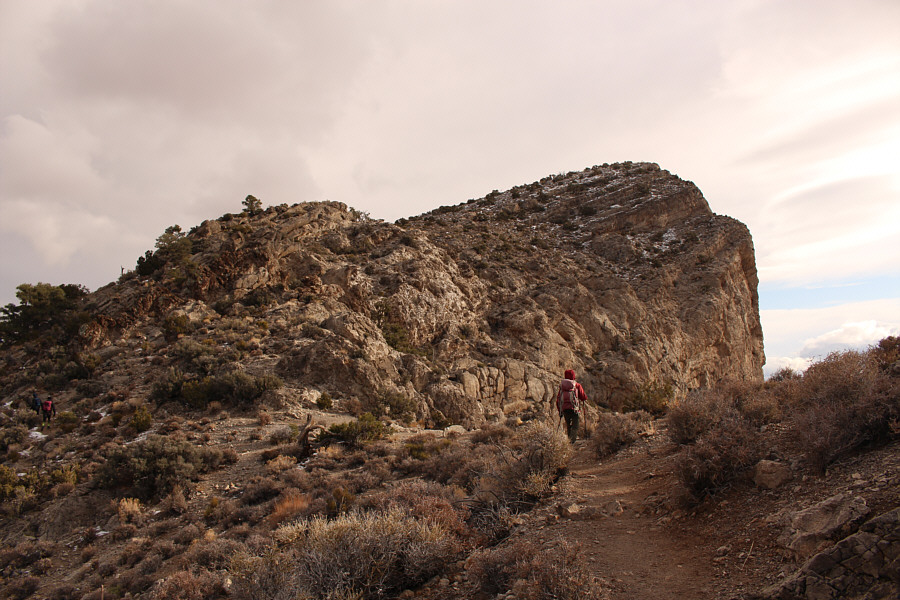 |
Zosia reaches a high saddle to the north of Turtlehead Mountain's summit. |
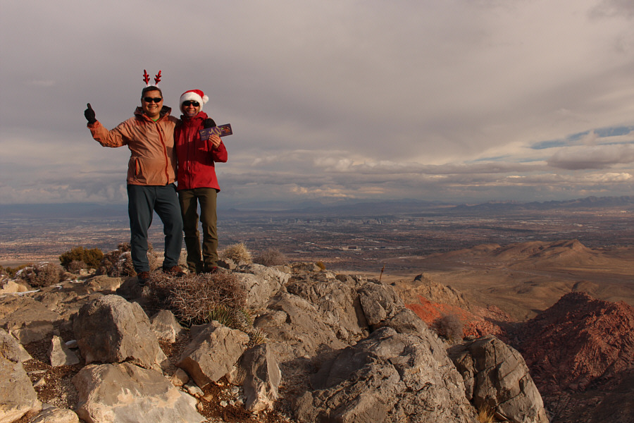 |
Sonny and Zosia stand on the summit of Turtlehead Mountain (1922 metres). |
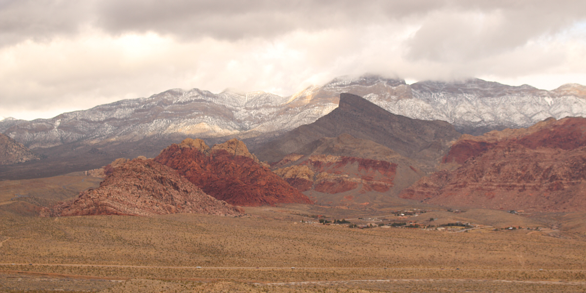
El Padre Mountain (right of centre) and La Madre
Mountain (far right) dominate the view to the northwest.
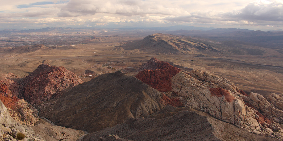
Colourful Calico Hills draw most of the attention to
the south. Blue Diamond Hill is the big land feature in the
distance, and visible at the edge of its shadow to the left is Firehouse
Hill.
Finishing our hike
early, we drove out of Red Rock Canyon NCA and had
plenty of time to return to our hotel in Las Vegas for a shower before
meeting our local friend, Shin Goto, for dinner. We rendezvoused
with Shin at a Japanese restaurant called Izakaya Go, and he regaled us
with thoughtful presents, excellent food, and entertaining stories from
his past. It was a perfect way to cap off a most enjoyable
Christmas Day. Arigatō, Shin!
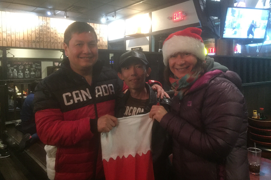 |
At the Japanese restaurant, Sonny, Shin and Zosia pose with a giant
Christmas stocking. |