BOU AVENUE
Smith Rock State Park
Making the most of an extended Easter long weekend, Zosia Zgolak and I drove to central Oregon and visited Smith Rock State Park near the town of Terrebonne on 19 April 2019.  Up until the long weekend, neither Zosia nor I had even heard of this small park, but it is apparently very popular with rock climbers, hikers, trail runners and mountain bikers.  Our source of inspiration for visiting the park came from Barbara I. Bond's guidebook, 75 Scrambles in Oregon, but we ultimately took advantage of the park's excellent trail system to tag a couple of high points in the vicinity.

The park was already very busy when we arrived around midday, and we were lucky to find a parking spot ($5 USD day use fee required).  From the parking area, we started along the main access trail which drops down a steep embankment to a bridge over Crooked River.  On the north bank, we turned eastward and followed Wolf Tree Trail which winds around a bend in the river before connecting with another trail known as Burma Road near the outlet tunnel of an irrigation canal.  Burma Road actually leaves the state park and enters BLM land where it makes a single switchback before gently sweeping upward across the west face of a high point known as Peak 4230.  Just before reaching a 4-way intersection, we left the road to take an obvious beaten path which runs up the northwest ridge of Peak 4230.  This path is brutally steep, but otherwise, we encountered no technical difficulties in reaching the top of Peak 4230.
Reminds me of southern Utah. 
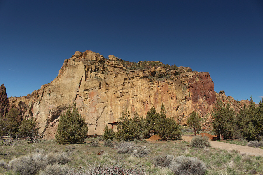
Misery Ridge is instantly visible from the parking lot at Smith Rock State Park.
Is it time for lunch yet? 
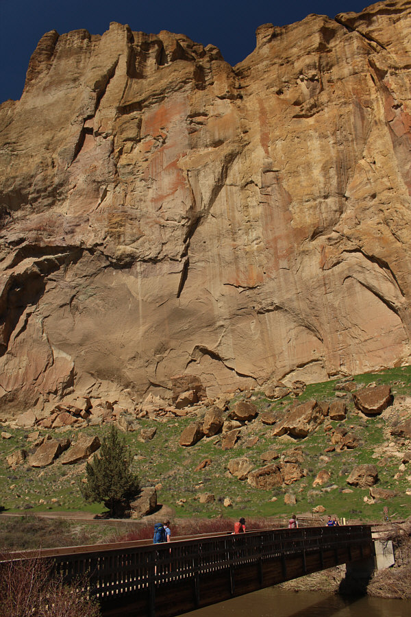
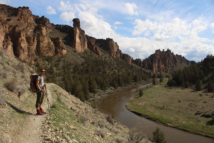
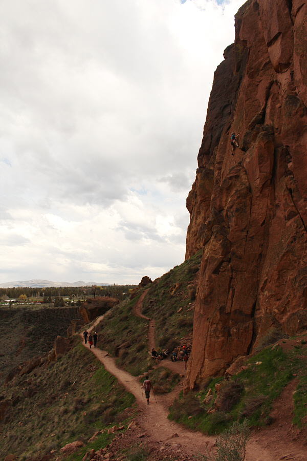
Beyond the bridge over Crooked River is the rock climbing area known as Picnic Lunch Wall.
It was tempting to go for a dip in the river! 
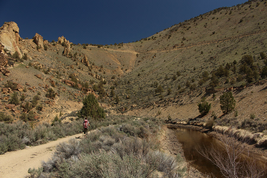
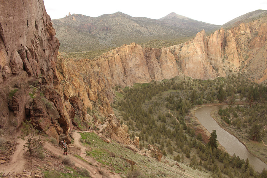
Zosia hikes along the north bank of Crooked River.
Guess where we're headed? 
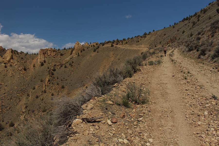
Zosia walks along an irrigation canal near the juncture of Wolf Tree Trail and Burma Road.  At upper right is Peak 4230.

It's not a big park, but you get a lot of bang for your buck!

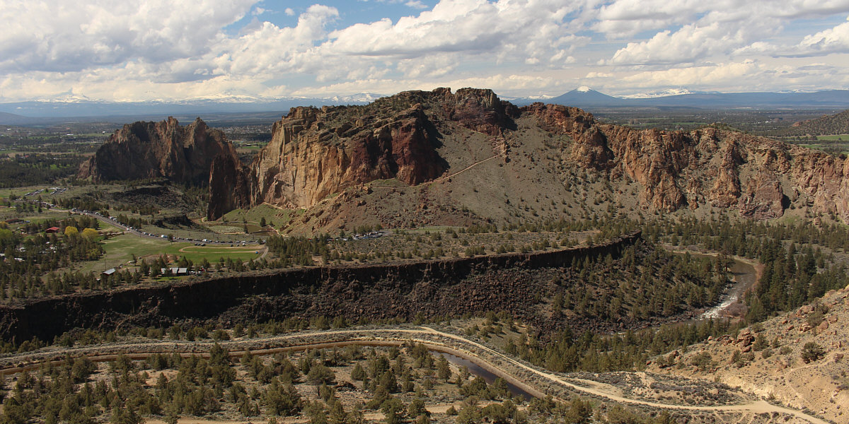
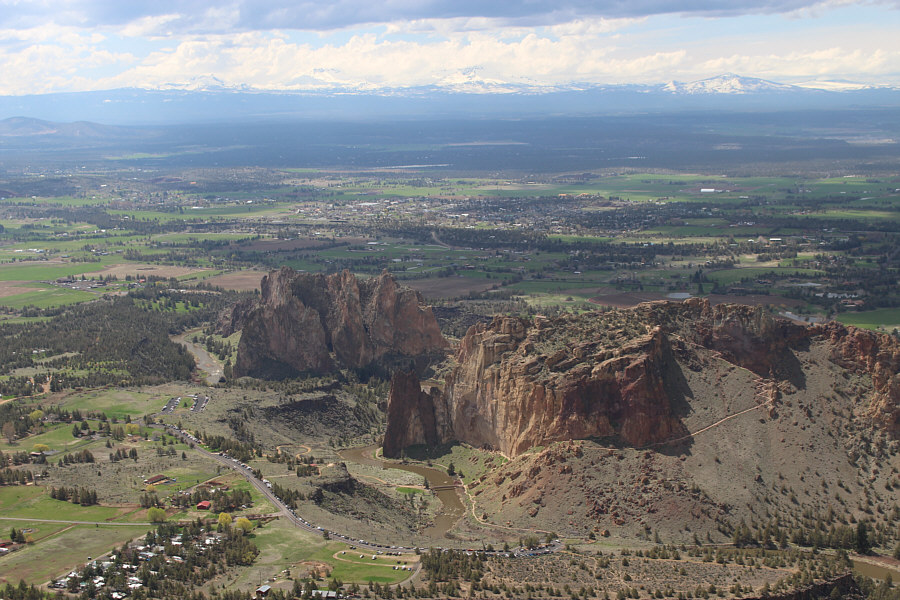
Most of Smith Rock State Park is visible in this view from partway up Burma Road.  Smith Rock is at left, and at centre is Misery Ridge.


I could've driven up here! Zosia hikes up gently rising Burma Road.
The path is steeper than it looks! 
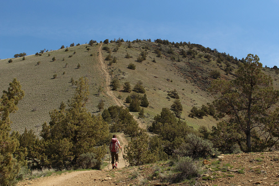
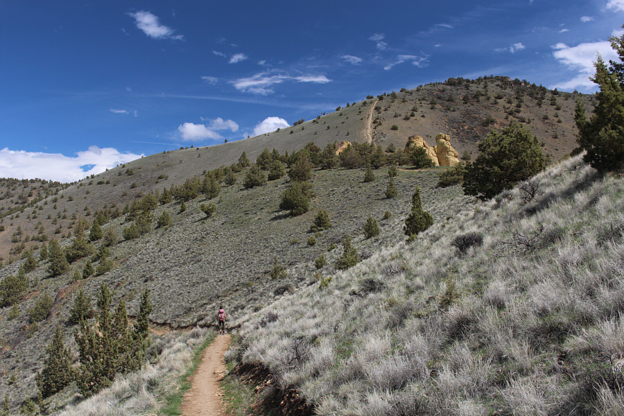
Zosia takes to a beaten path going up the northwest ridge of Peak 4230.
I'm pretty sure there was some grunting too! Sonny grinds his way up the beaten path.

Photo courtesy of Zosia Zgolak

It figures that, on a mostly sunny day, we would get rain on the summit!

Zosia and Sonny stand on the high point of Peak 4230 (1292 metres).

While Misery Ridge was teeming with people, we enjoyed solitude on top of Peak 4230. Here is the view of Smith Rock (left) and Misery Ridge (right) from the top of Peak 4230.
After taking a short break, we retraced our steps back down the northwest ridge and continued westward along what is known as Summit Trail.  Leaving BLM land, we descended several annoyingly long switchbacks (the trail is designed for mountain bikers) before traversing the northern rim of the park.  The trail briefly crosses private land before turning southward and re-entering the park along the banks of Crooked River.  At a T-intersection, we turned eastward and began climbing what is known as Misery Ridge Trail.  This trail passes another junction below a striking rock pinnacle known as Monkey Face before rising in a series of switchbacks to the crest of Misery Ridge.  As we climbed the switchbacks, we were awed by the efforts of a climbing team tackling the fearsome Monkey Face.
I wish I had a mountain bike! 
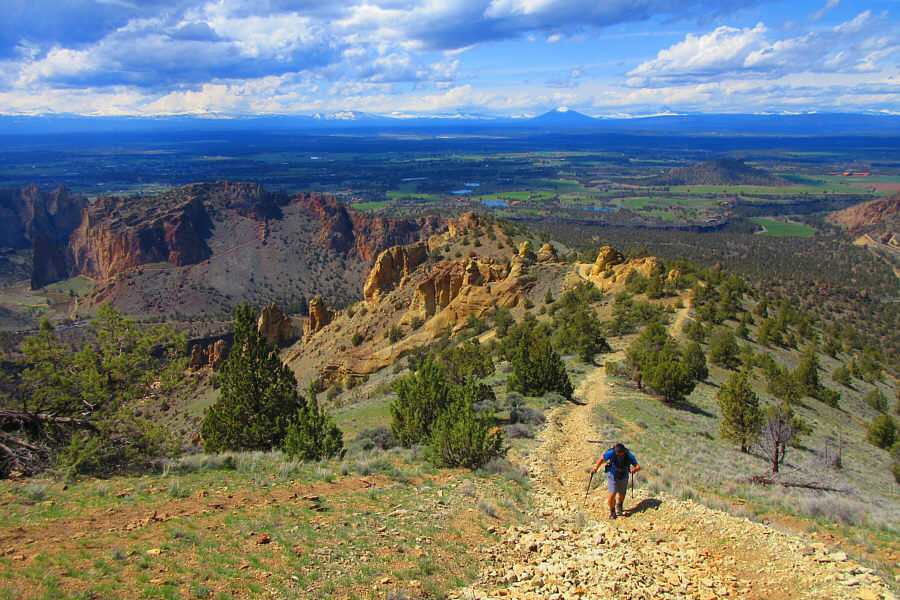
Zosia descends one of the long switchbacks along Summit Trail.  Peak 4230 is visible in the distance.
My token flower photo! 
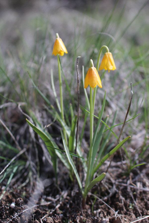
Blooming yellow fritillaries (yellowbells) are a sure sign that spring has arrived.
Yo, Adrian! 
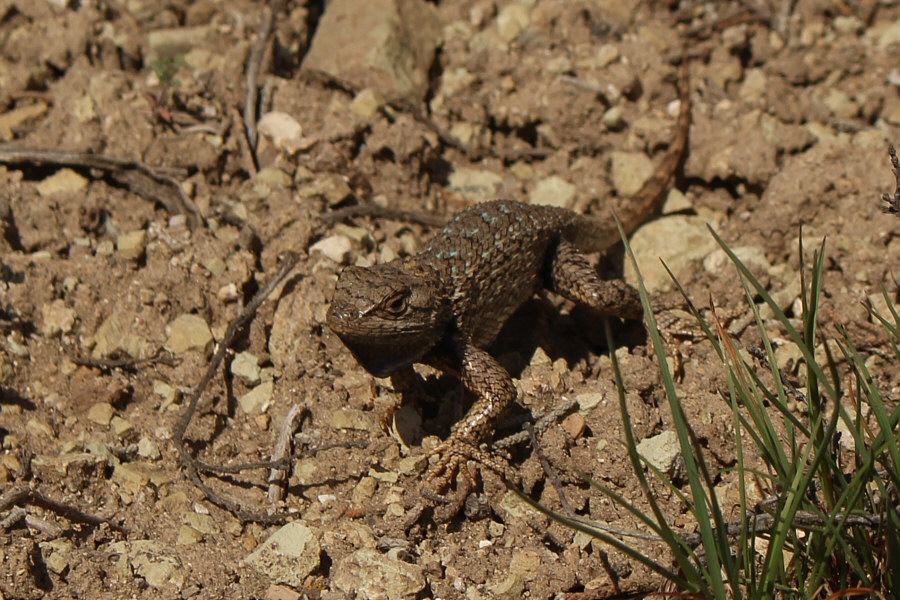
A startled western fence lizard starts doing push-ups possibly as a defensive display of strength.
Astonishingly scenic here! 
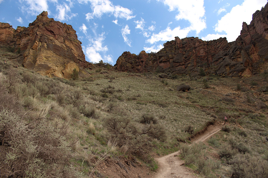
Zosia hikes along the western side of the park with Smith Rock visible at distant right.
Insert your own phallic joke here. 
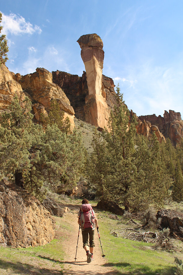
Zosia approaches the pinnacle known as Monkey Face.
People climb up this? Yeesh! 
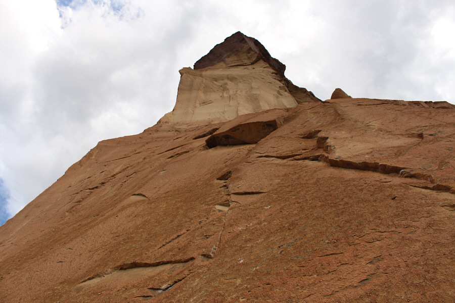
This is looking up the western side of Monkey Face.  Climbing bolts can be seen embedded in the rock.
The climb is not nearly as bad as that from the eastern side. Zosia climbs up the switchbacks on the western side of Misery Ridge.
Flintstones' house? 
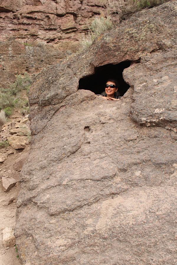
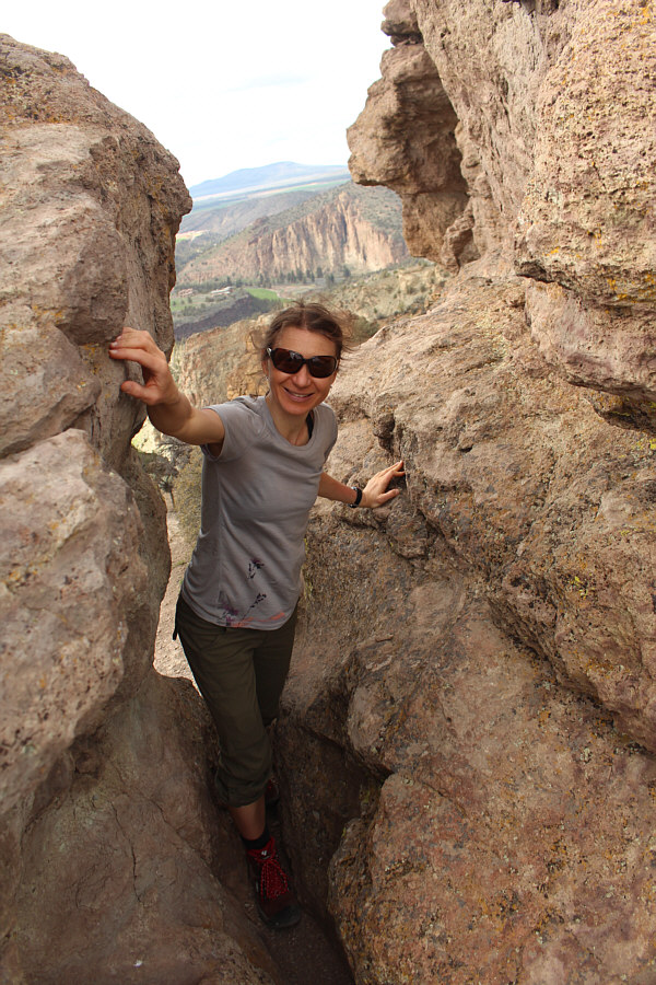
On her way up Misery Ridge, Zosia finds a small cave with a window.
Could be a giant fist as well! Monkey Face lives up to its name in this view from near the crest of Misery Ridge.
The highest point of Misery Ridge is a short distance off the official trail, and we easily tagged it after a short Class 3 scramble with some mild exposure.  Upon returning to the trail, we descended the east side of Misery Ridge passing some other rock climbing areas (Red Wall and Picnic Lunch Wall) before ending up back at the bridge over Crooked River.  We endured one last annoying uphill walk to return to the parking area.
It feels weird scrambling after a long winter of skiing... Sonny scrambles up some rocks near the high point of Misery Ridge.

Photo courtesy of Zosia Zgolak

Cutest scrambler ever! 
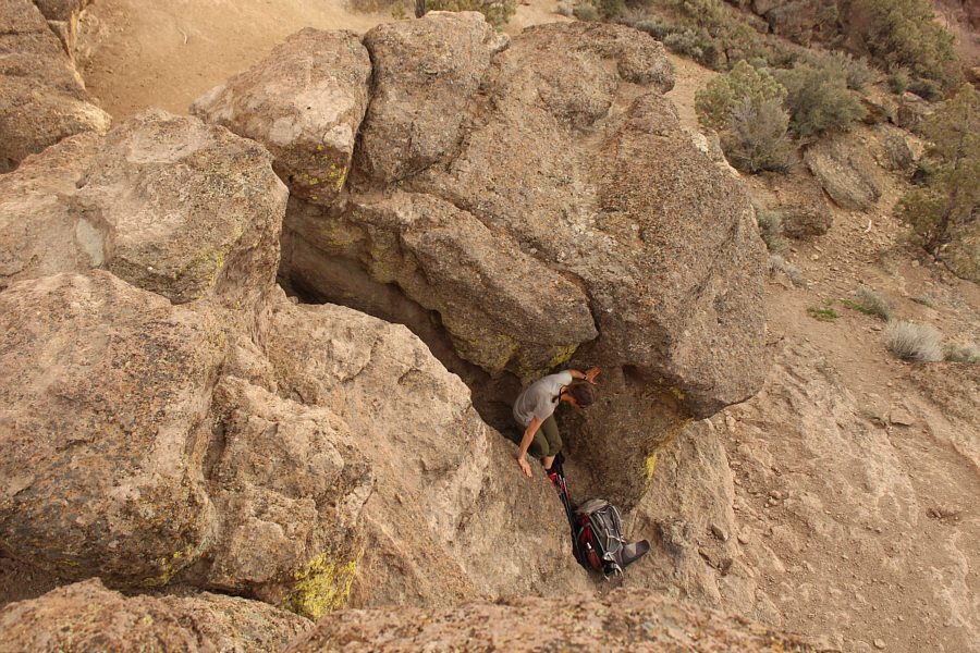
Zosia squeezes through a gap while scrambling to the top of Misery Ridge.
2nd summit of the day! 
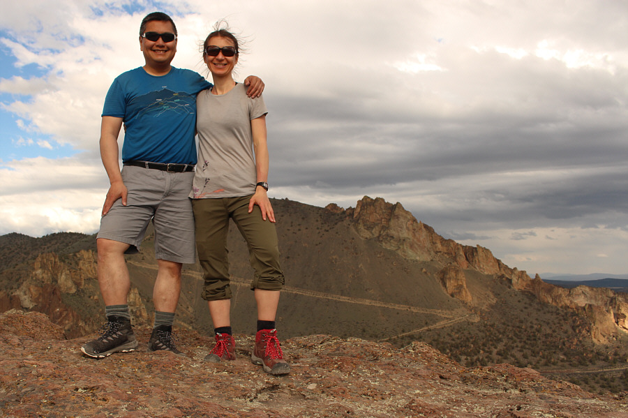
Sonny and Zosia stand on the high point of Misery Ridge (1030 metres).
Time to head down! 
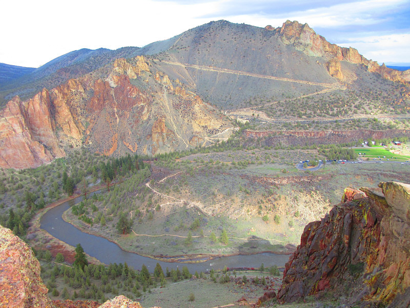
Peak 4230 stands out to the east in this view from the high point of Misery Ridge.

Photo courtesy of Zosia Zgolak

I guess I need to get down too! Below the high point of Misery Ridge, Zosia carefully descends to her backpack.
One of these days, that pinnacle is gonna collapse... 
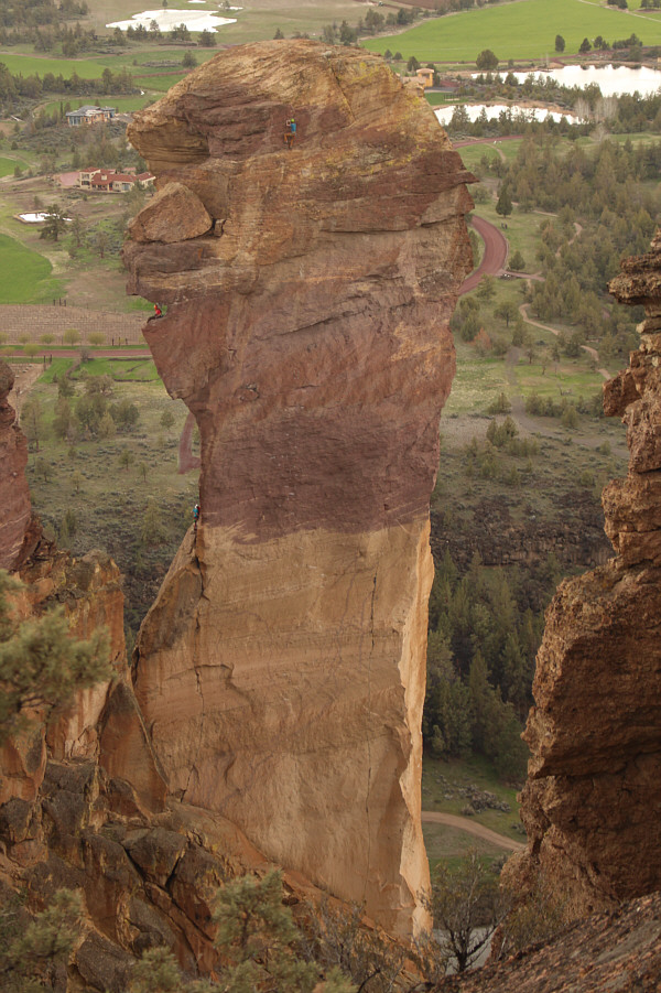
A team of climbers scales Monkey Face.
Let's leave this Misery behind! Zosia descends the steep trail on the eastern side of Misery Ridge.
Impressive! On her way back to the trailhead, Zosia passes under a climbing area known as Red Wall.
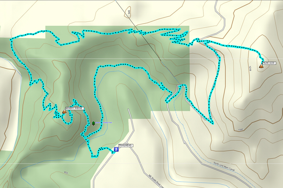
A real gem of a park! Total Distance:  12.3 kilometres
Round-Trip Time:  5 hours 48 minutes
Cumulative Elevation Gain:  796 metres

GPX Data