Gimli Peak is perhaps the most accessible of
the stunning array of spectacular mountains at the south end of British
Columbia's Valhalla Provincial Park. While the peak's south ridge
is a classic technical route which attracts climbers from all over the
world, the east ridge (climbers' descent route) is a Class 3 scramble
well within the capability of mere mortals like myself. Having said
that, the east ridge is still a serious endeavour, and there have been
some fatalities on this route in recent years (in
2017 and
2019). With a favourable weather forecast on 5 August 2020,
Zosia Zgolak and I ventured into the park to scramble up this stunningly
beautiful peak.
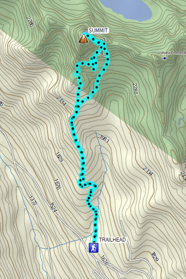
At the south end of the village of Slocan, go west on Gravel Pit Road
which becomes Little Slocan Road just past the bridge over Slocan River.
From the bridge, ignore all side roads and drive for 12.0 kilometres
along Little Slocan Road (good 2WD gravel) before turning right onto
Bannock Burn Forest Service Road (FSR). Following occasional signs
for Valhalla Provincial Park, drive for another 13.0 kilometres to the
signed trailhead parking area with green throne toilet. We counted
96 water bars along Bannock Burn FSR; a high-clearance vehicle is
strongly recommended.
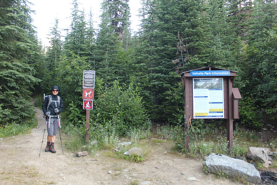
After camping at the trailhead the previous night, Zosia and I got off to
a good start in the morning along the well-maintained trail to Gimli
Ridge. The trail is fairly flat for the first 600 metres but begins
to climb in earnest after crossing a bridge to the west side of a creek.
Near tree line, we ran into the first of numerous mountain goats that
frequent the area. Much like their counterparts in the United
States, these goats have become habituated to humans and crave the salt
that is left behind when people urinate in the open. As such,
official BC Parks policy is to discourage people from approaching or
interacting with the goats and from urinating in the open if possible.
There is both a green throne toilet and a fancy outhouse located on Gimli
Ridge. We also ran into a group of student rangers who were on
their way out after spending the previous day fixing signage in the area
and monitoring the goats.
Upon reaching the crest of Gimli Ridge and the end of the official trail,
Zosia and I worked our way eastward along the base of the cliffs guarding
Gimli Peak. Surprisingly, there are hardly any obvious game trails
or beaten paths here, and it was quite tedious to traverse to the start
of the rubble slope leading to the east ridge. We actually stayed a
bit too high along the traverse and got cliffed out at one point which
necessitated a rather annoying detour with loss of elevation. In
retrospect, we should have left the official trail much earlier and
climbed grassy slopes further to climber's right which would have saved
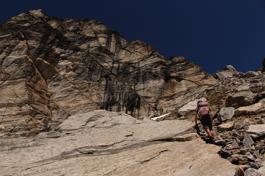
us some grief. Once we reached the start of the rubble slope, we
began seeing some cairns leading us up increasingly steep and loose
terrain. We eventually ended up in a gully which seemingly
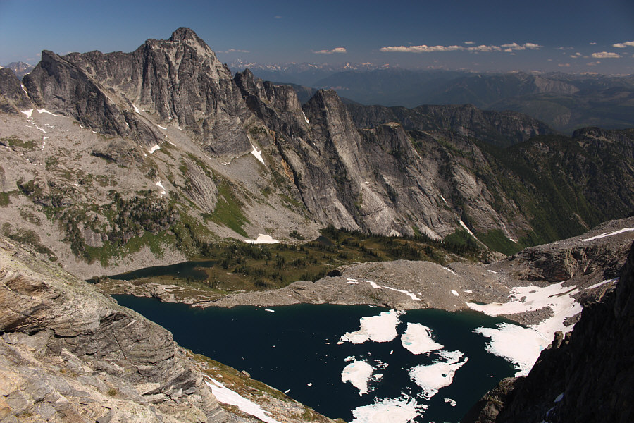
dead-ends on the crest of the east ridge with a jaw-dropping view of the
Mulvey Lakes on the other side. From here, the route traverses to
climber's left before continuing upward into more steep terrain.
Zosia was already out of her comfort zone at this point and agreed to
stay put while I continued up alone.
The final section going up the summit block looks a bit daunting at
first, but besides some mild exposure, the proper route never exceeds
Class 3 difficulty. Plenty of cairns help guide the way, and I
found the ascent of the summit block to be far more enjoyable than the
rubble slope Zosia and I had ascended earlier. Upon gaining the
flat and spacious summit ridge, I turned left for a short and easy walk
to the large summit cairn.
On such a beautiful day, it would have been nice to linger for a lot
longer on the summit, but knowing that Zosia was waiting for me below, I
promptly began descending once I completed my usual summit chores.
Following the cairns, I carefully retraced my steps down the summit block
and had no issues getting back to the gully where I had left Zosia.
After reuniting, we continued down the rubble slope together but chose a
slightly different line than the one we came up. We generally tried
to stick to larger boulders and avoid loose sections of dirt, but either
way, the descent was slow and tedious. Only when we reached the
grassy meadows below did we finally breathe a sigh of relief knowing that
the worst was behind us. We took a short break in the shade of some
big rocks further down in the meadows before heading cross-country back
to the official trail. Upon regaining the trail, we were once again
greeted by one of the resident goats, but adhering to BC Parks policy, we
ignored the goat and refrained from urinating in the area. The
remaining hike back to the trailhead was uneventful, and we subsequently
managed to make it down Bannock Burn FSR in one piece despite driving
over 96 water bars for the second time in as many days.
 |
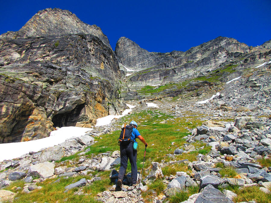
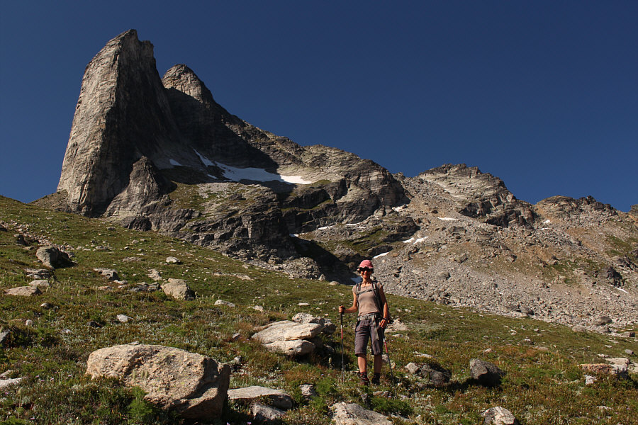
Zosia is ready to start hiking from
the trailhead. |
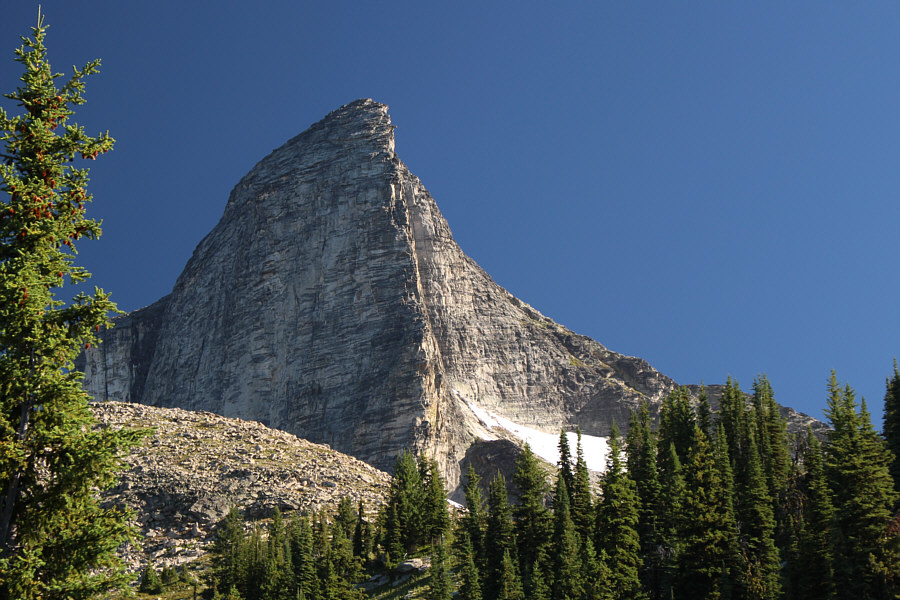 |
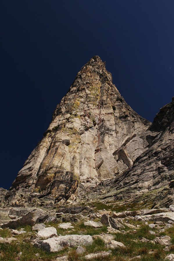
Gimli Peak's southwest face and south ridge are awesome to behold. |
 |
The many goats in this area have become habituated to the presence of
humans and show no fear. |
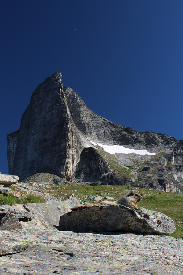 |
A hoary marmot relaxes on a rock below Gimli Peak. |
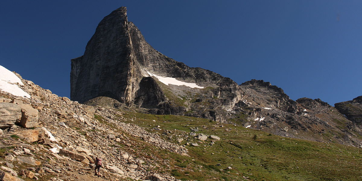
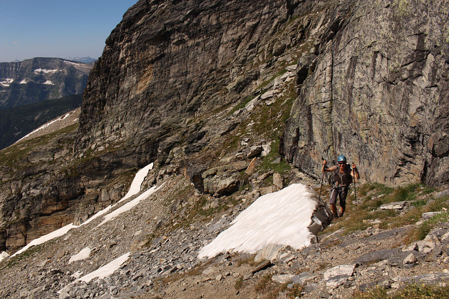
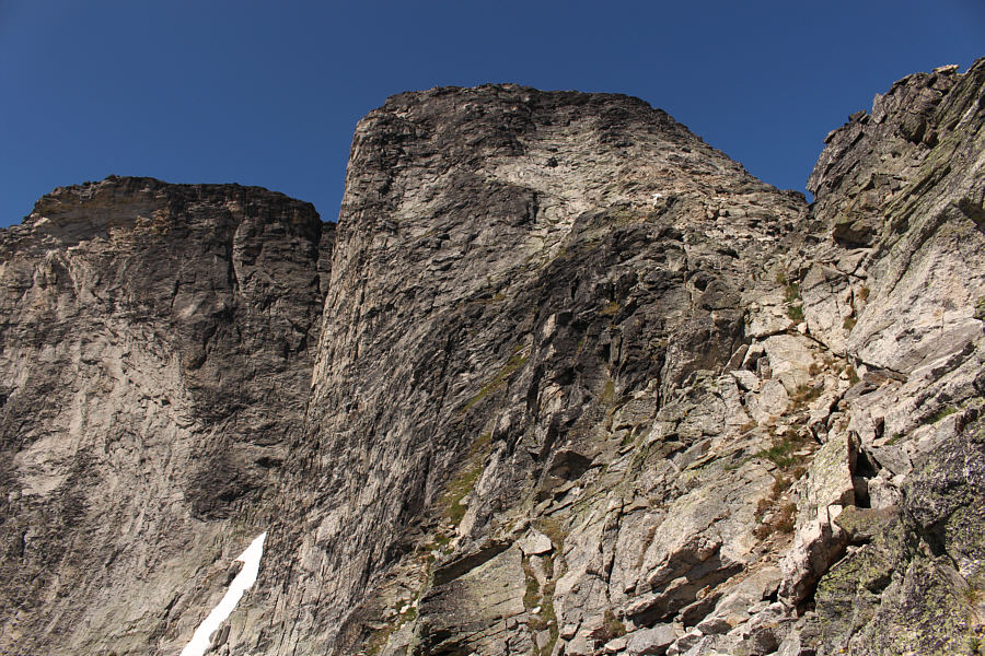
To scramble up the east ridge of Gimli Peak, it would
be better to leave the trail well before this spot in order to climb the
rubble slope at right.
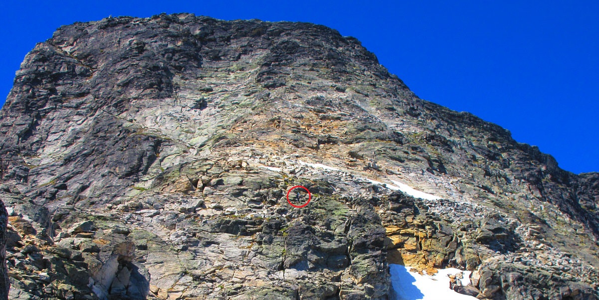
Sonny (circled) methodically works his way up the
summit block of Gimli Peak.
Photo courtesy of Zosia Zgolak
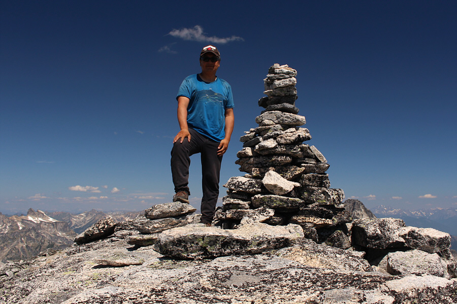 |
Sonny reaches the summit of Gimli Peak (2800 metres). |
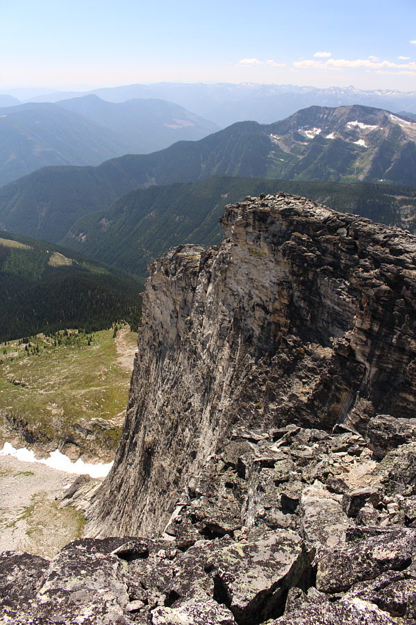 |
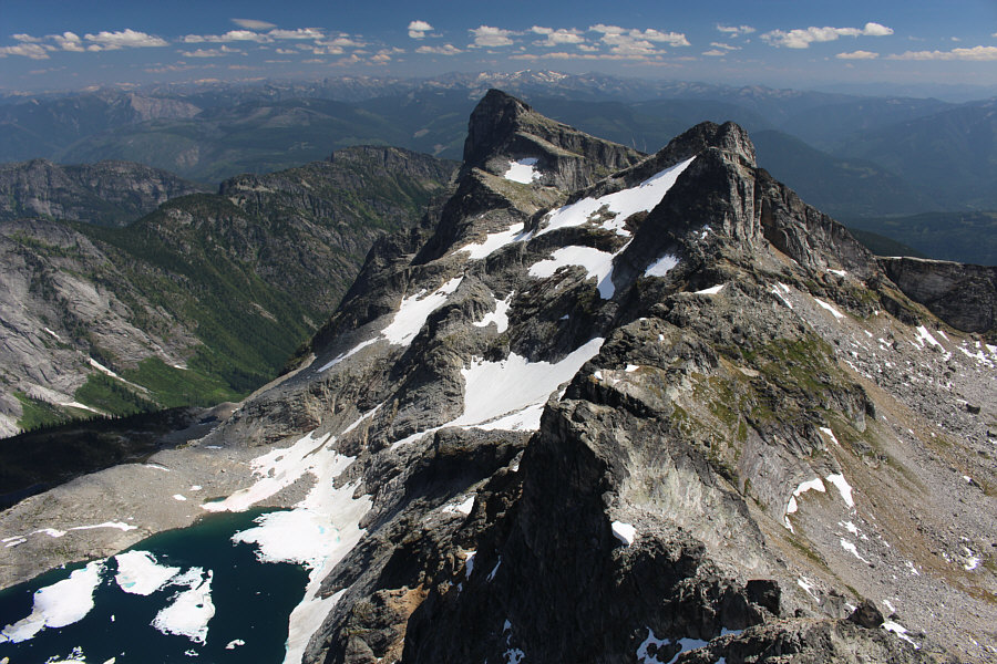
This is looking down at the south ridge from the summit. |
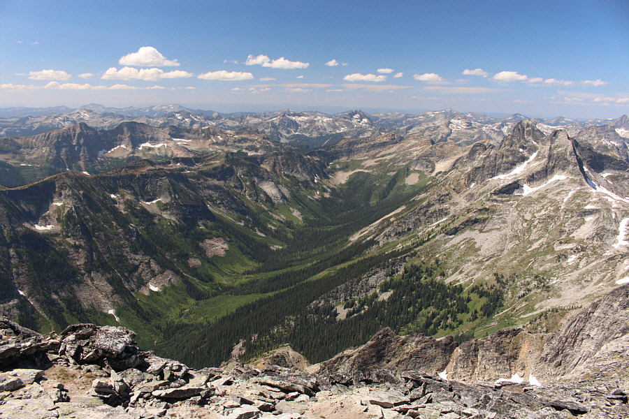 |
A host of unfamiliar peaks stretch out beyond the green valley to the
west. |
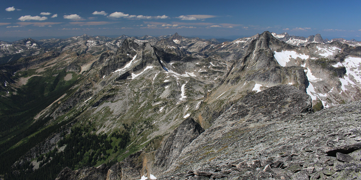
Notable peaks to the northwest include Mount Prestley
(left), Woden Peak (centre horizon), Midgard Peak (right), and Devils
Dome (far right horizon).