BOU AVENUE
Old Glory Mountain

Among the mostly rounded summits of the Rossland Range in the southern Monashee Mountains of British Columbia, Old Glory Mountain stands head and shoulders above the rest and is readily visible from many vantage points throughout the area.  A good trail runs all the way to top which is capped by a decommissioned fire lookout building.  Old Glory Mountain is also a popular ski mountaineering objective in winter, but unwilling to wait for the next snowfall, Zosia Zgolak and I settled for just walking up on 8 August 2020.

Starting from the information kiosk at the trailhead (large pullout on the west side of Highway 3B 18 kilometres south of the junction with Highway 3 or 9.9 kilometres north of the junction with Highway 22), Zosia and I followed the trail briefly to a signed junction.  We turned right to take Plewman Trail which is the shortest and most direct route to Old Glory Mountain.  The Old Glory Trail is an alternate route which climbs more gently but is significantly longer.  Some parties incorporate both trails to make a loop.  The Plewman Trail runs parallel to the highway for about a half kilometre before crossing a creek and climbing steadily up the drainage south of Mount Plewman.  The trail is long and can feel a bit monotonous at times, but stopping a few times to pick ripe huckleberries helped alleviate some of the drudgery.

The trail eventually breaks out of the trees and makes a couple of sweeping switchbacks before intersecting the Seven Summits Trail on the crest of Unnecessary Ridge.  We got our first good look at Old Glory Mountain here and took a short break before briefly following the Seven Summits Trail southward to the turnoff for our objective.  Taking the turnoff, we descended about 90 metres to a low point before climbing up to the crest of Old Glory Mountain's south ridge.  Surprisingly, the trail does not follow the south ridge although there are indications that many people go off-trail here and do just that.  Instead, the trail meanders up the broad meadows of the southwest face and climbs in a more leisurely fashion up to the summit.  I imagine that the trail was designed to accommodate mountain bikers, but I also could not help thinking about how nice it would be to ski here in winter.

The top of Old Glory Mountain was a busy place on this Saturday, but we still managed to enjoy a bit of solitude while eating lunch beside the lookout building.  The lookout building still has a working Osborne Fire Finder, and we had some fun using it to identify distant peaks on the horizon.  There is no functional outhouse on the summit, but lower down along the trail, there is a sign that reads "WC" with an arrow pointing to a small grove of trees and some rocks on the open slope.  Our return hike to Unnecessary Ridge and back along Plewman Trail felt long, but we had no issues getting back to the trailhead.
They need to install an outhouse here! 
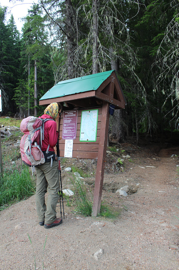
Zosia peruses the information kiosk at the trailhead.
Guess what happened to these berries right after this photo was taken... 
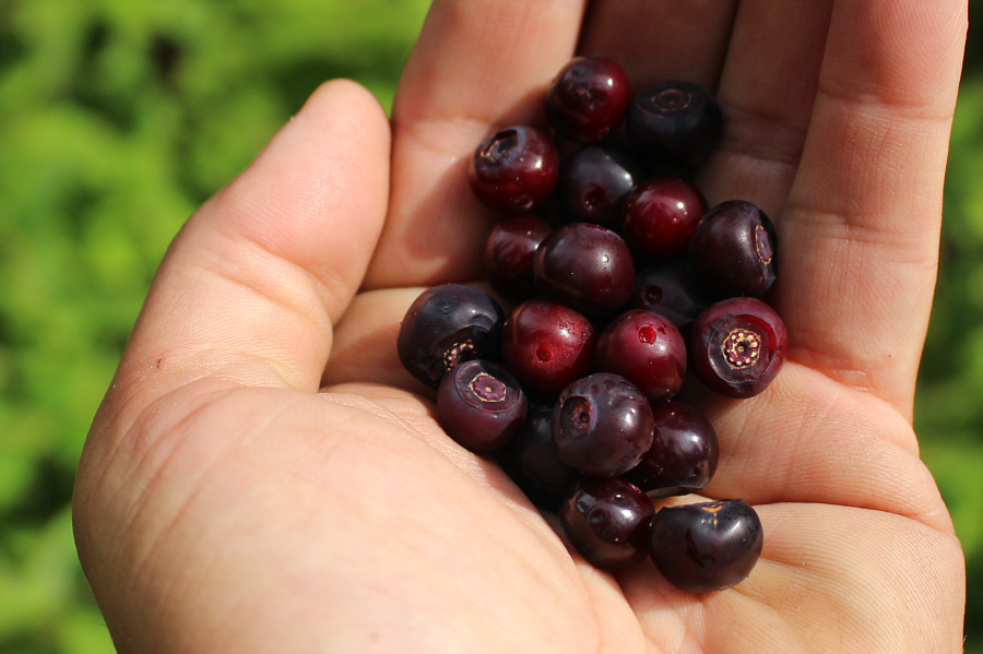
Huckleberries can be found along the trail to Old Glory Mountain.
At least I blend in with the flora! Sonny grinds his way up yet another long forested trail.

Photo courtesy of Zosia Zgolak

Do you hear voices? The trees begin to thin out near the ridge crest.
Hot enough for ya? 
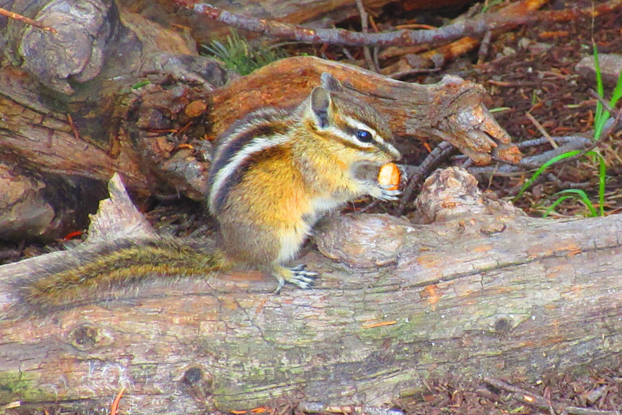
A chipmunk finds one of Sonny's BBQ-flavoured Cheerios that was inadvertently dropped.

Photo courtesy of Zosia Zgolak

Finally, we see our objective!

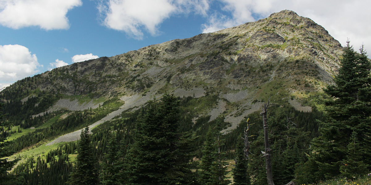
Here is a view of Old Glory Mountain from Unnecessary Ridge.


The trail never feels steep here; mountain bikers probably climb this! After descending about 90 metres from Unnecessary Ridge, Zosia regains all the lost elevation while ascending to the south ridge of Old Glory Mountain.
I'd like to come back and ski this! 
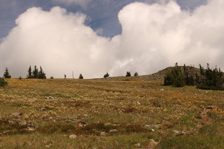
Instead of going straight up the south ridge, the trail ascends more gradually up the meadow-like southwest slopes.
Apparently, it's not safe to take shelter inside the building during a thunderstorm. Zosia reaches the lookout building atop Old Glory Mountain (2370 metres).
The place needs a bit of work, but it's not bad as far as lookout buildings go. 
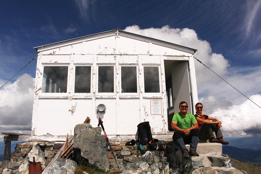
Sonny and Zosia relax on the lookout building's front porch.
Some of these look like good ski ascents... 
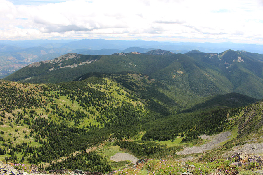
The view to the southeast includes Mount Kirkup (left), Grey Mountain (centre), Granite Mountain (right of centre), Mount Roberts (right), and Record Mountain (far right).
Ready? Aim. Fire torpedo! 
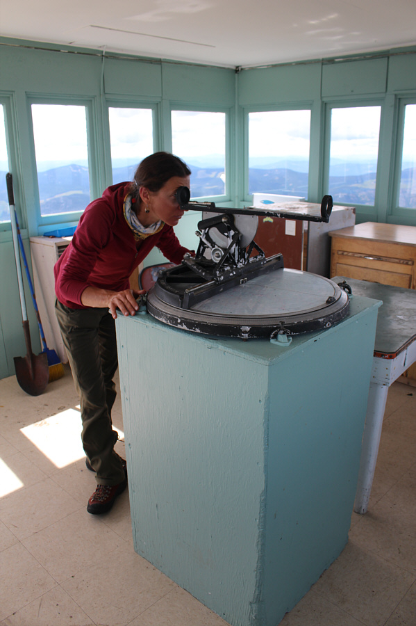
Zosia tries out the Osborne Fire Finder inside the lookout building.
Looks like a real fixer-upper! 
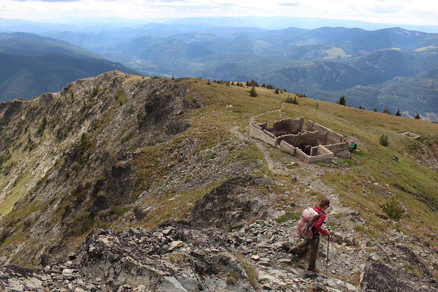
Zosia begins descending the trail which goes past some ruins.
I imagine that this would be a more exciting trip in winter... Total Distance:  16.4 kilometres
Round-Trip Time:  8 hours 11 minutes
Cumulative Elevation Gain:  1064 metres

GPX Data