BOU AVENUE
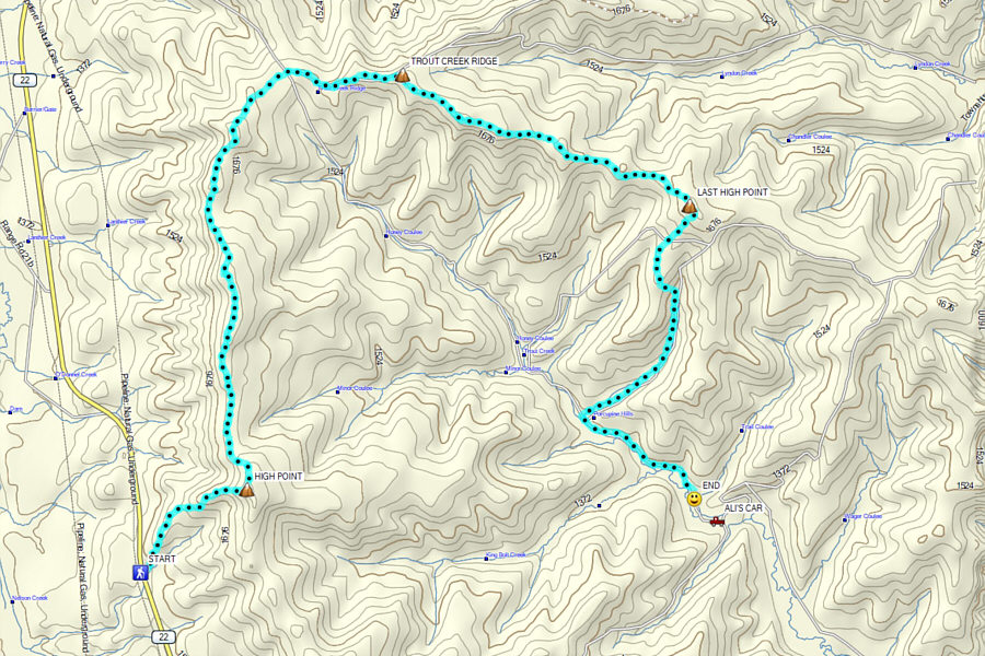
Porcupine Hills Northern Traverse
On 30 May 2020, Zosia Zgolak and I were back
for our third visit in four weeks to the Porcupine Hills of southwest
Alberta. Building on our previous separate hikes to
Trout Creek
Ridge and
Porcupine Hills North, I conceived of a hiking route which continues
north from Porcupine Hills North to the high point of Trout Creek Ridge
and finishes along another ridge flanking the east side of Trout Creek.
Of course, this traverse necessitates setting up a car shuttle, but our friends, Asieh Ghodratabadi and Ali Shariat, agreed to join us for this adventure
and provide the requisite second vehicle.
For the western starting point of the traverse, park in a turnoff
along Highway 22 located 21.0 kilometres south of the junction with
Highway 533 or 6.0 kilometres north of the junction with Highway 520. Be sure
not to block the nearby locked gate. As of this writing, there are
two convenient porta-potties situated here. For the eastern end
point of the traverse, turn east from Highway 22 onto Highway 520 and
drive 3.3 kilometres to a 4-way intersection with Skyline Road.
Turn left and drive north for 8.8 kilometres to a crossroads and staging
area. Park a second vehicle here. The trailhead for Porcupine Hills Ridge
Trail is located 3.5 kilometres north of the 4-way intersection and can
be used as an alternate starting point for the traverse. The road
beyond this trailhead to the staging area may be rutted in places but
should generally be passable for 2WD vehicles in dry conditions.
Since Zosia and I had already previously hiked to Porcupine Hills North
via Porcupine Hills Ridge Trail, we opted to take the shorter approach
from Highway 22. Crossing to the east side of the highway, we
squeezed through a barbed wire fence before climbing up a northeast
trending ridge which ultimately leads to Porcupine Hills North.
Smatterings of trail and an overgrown exploration road on this ridge
helped ease our ascent, but the forest is open enough to allow easy
route-finding regardless. The final pull to the top is steep but
not technically difficult despite the presence of bluffs guarding the
ridge. The weather was very pleasant on top of Porcupine Hills
North on this day, and we took a short break here before resuming our
hike.
Utilizing a mix of ATV and foot trails, we followed the undulating crest
of the main ridge northward. The next high point is guarded by an
unexpectedly impressive cliff band, but just when I thought that we would
have to make a big detour around this obstacle, we found an easy scramble
route right on the ridge crest. Descending beyond this high point,
we wound up straying from the ridge crest and entering a huge clear
cut. At first glance, it seemed to make sense to make a beeline
across the clear cut to reach a prominent bump at the west end of Trout
Creek Ridge. However, we soon found that walking through the clear
cut is more tedious than it looks because the enticing grasses hide a lot
of ankle-twisting debris. We made better and more enjoyable
progress by sticking to the untouched forest at the edge of the clear cut
on the ridge crest. We soon reached the top of the prominent bump
at the west end of Trout Creek Ridge, and this was a good place to stop
for lunch.When lunch was finished,
we continued eastward along Trout Creek Ridge and eventually picked up
the 4x4 road that Zosia and I had previously hiked on our first visit
here. We followed this road for about 1.4 kilometres before leaving
it to gain the crest of another ridge branching away to the southeast
(the road carries on along the rest of Trout Creek Ridge to the
northeast). Once again, a mix of ATV and foot trails helped
facilitate easy route-finding and travel along this branching ridge which
flanks the east side of Trout Creek valley. We eventually abandoned
the trail to ascend our last high point of the day before descending into
the valley.
The descent into Trout Creek valley was
not without some route-finding challenges as I tried to reconcile the
out-of-date roads on my GPS map with some of the dirt tracks we came
across. Once again, we resorted to walking through some clear cuts,
and as expected, the footing was not the most pleasant. We
eventually stumbled onto a reclaimed road running alongside a flowing
side creek, and we were able to follow this road until it merged with a
well-used ATV track. This ATV track, in turn, intersects a 4x4 road
near the valley bottom, and although we intuitively turned right to
follow the road downhill toward Trout Creek, we should have instead turned left
to go uphill albeit only briefly. This left branch of the 4x4 road
eventually descends to Trout Creek further downstream and continues to
the staging area without any problems. By taking the right branch
immediately down to the creek, we were soon facing possible multiple
fords which would have slowed us considerably. Fortunately, we
managed to find a rough bypass trail on the north bank of Trout Creek,
and we subsequently gained the aforementioned left branch of the 4x4
road.
For some strange reason, Ali took off at
this point to retrieve his car at the staging area and return along the
4x4 road to pick the rest of us up. While I was grateful that he
saved the rest of us an extra 400 metres of walking, I am not sure if it
was really worth the risk of driving his car through Trout Creek (a
nearby footbridge makes the crossing easy for walkers). In
any case, Ali is a braver driver than me, and he drove back across Trout
Creek for a second time without any mishaps. From the staging area,
Ali drove us all back to our starting point along Highway 22 to conclude
our adventure.
Be sure to check out
Ali's interactive record
of this traverse.
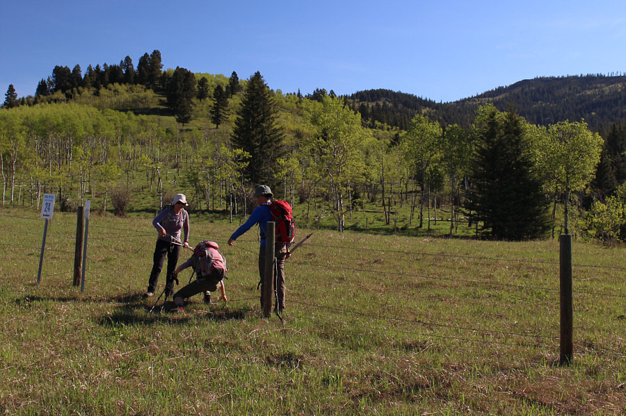 |
Asieh and Ali assist Zosia in getting
through a barbed wire fence at the start. The ridge behind them
leads directly to Porcupine Hills North which is visible at upper
right. |
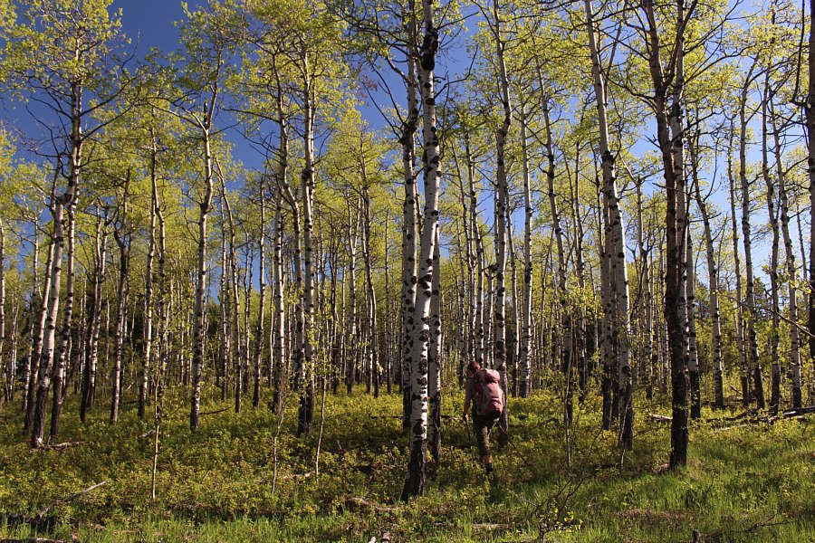 |
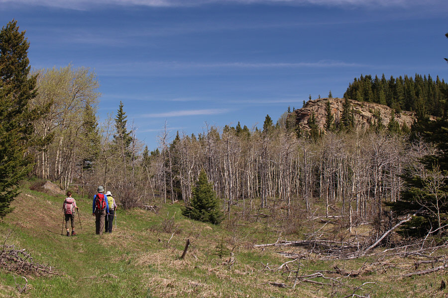
Aspen trees cover the ridge leading to Porcupine Hills North. |
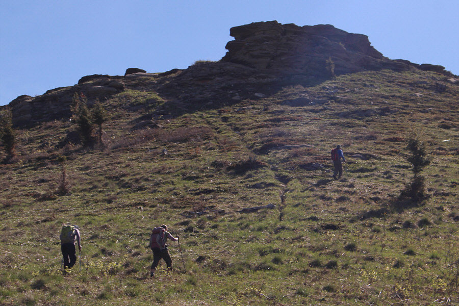 |
The group grinds up the steep slope below the bluffs on Porcupine Hills
North. |
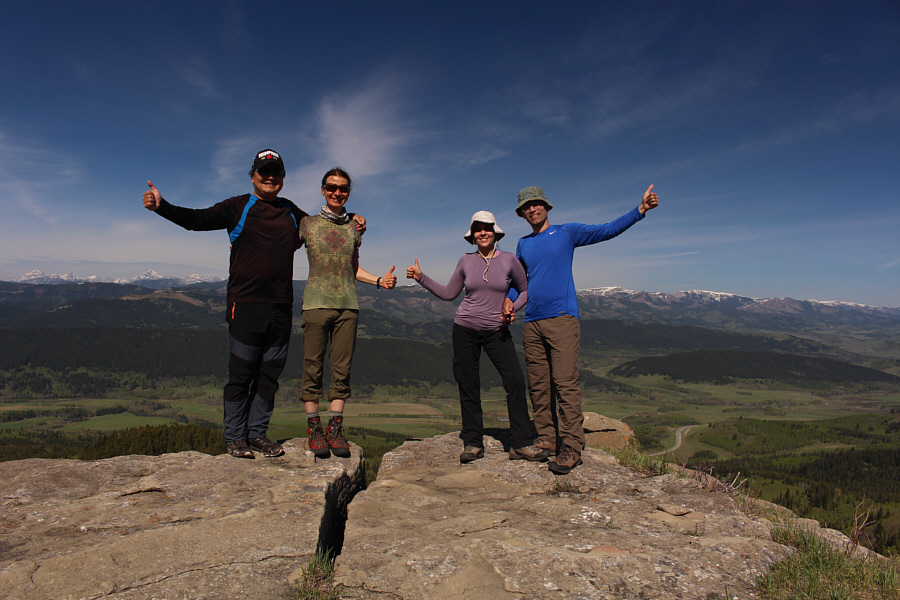 |
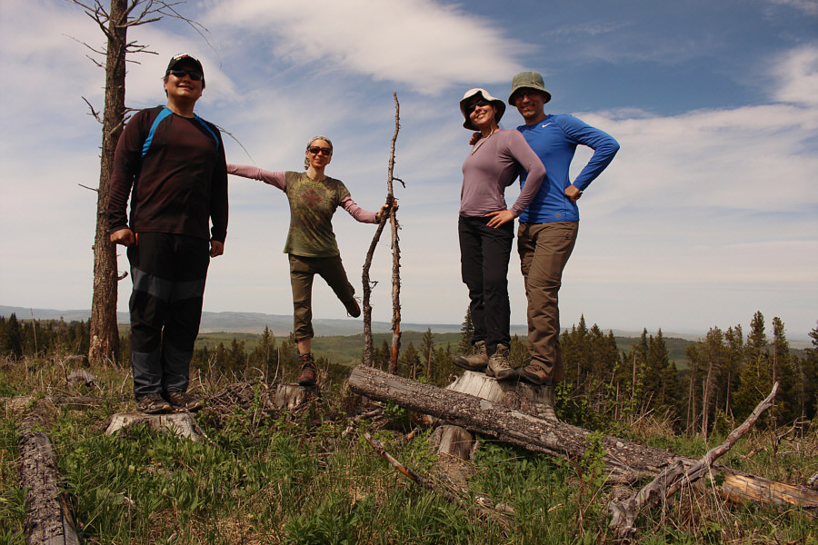
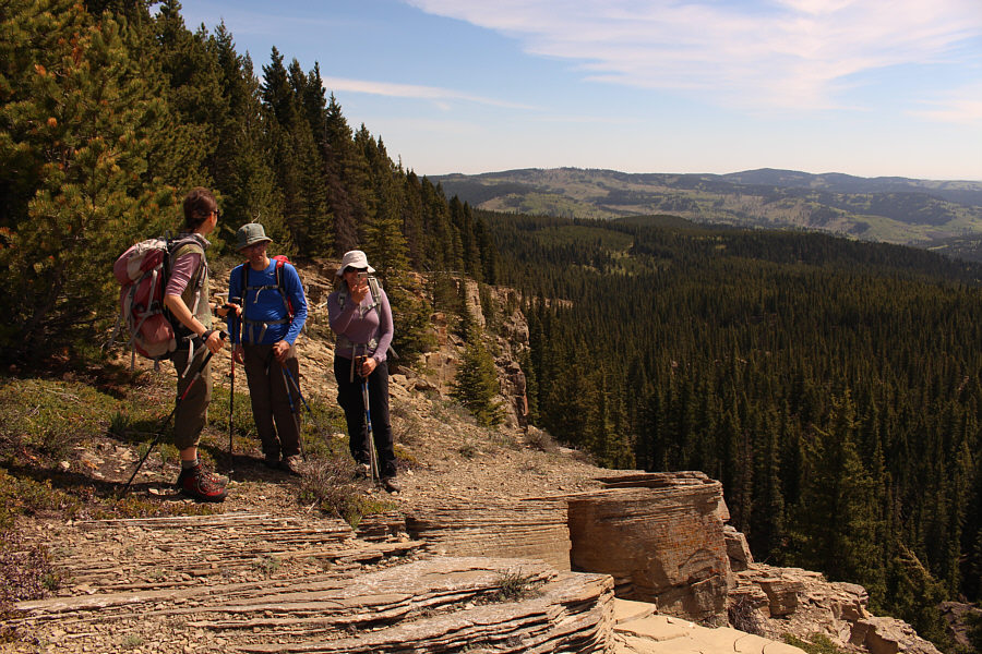
Sonny, Zosia, Asieh and Ali reach the top of Porcupine Hills North (1798
metres), the highest point of the day. |
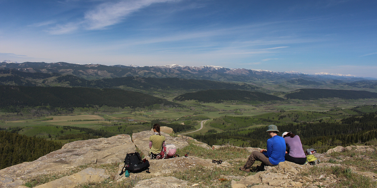
Here is the view looking west
from Porcupine Hills North.
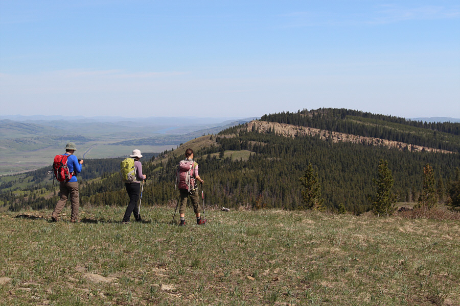 |
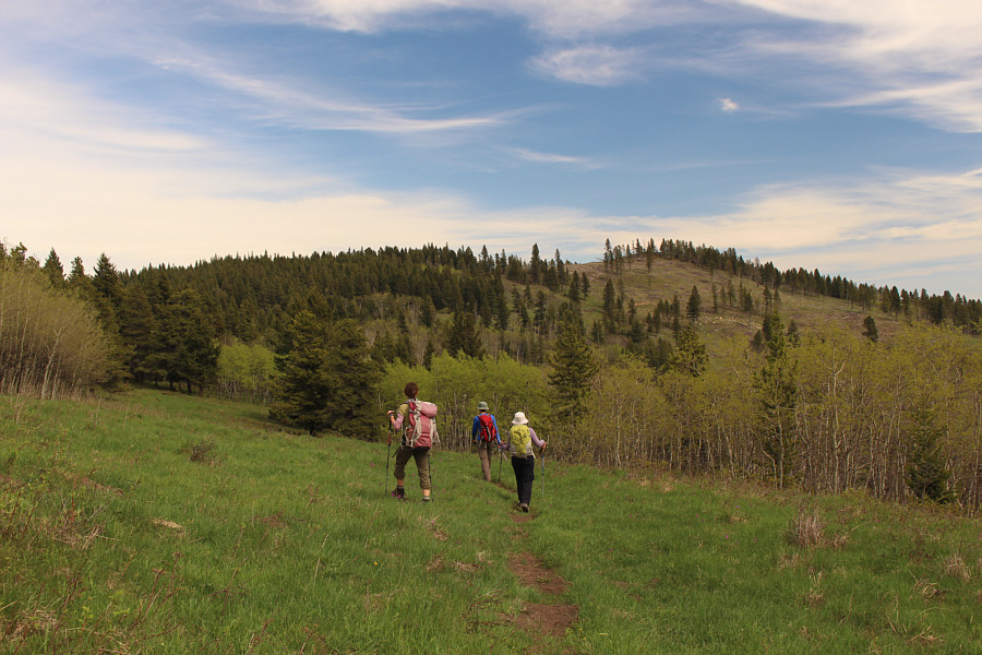
Leaving the top of Porcupine Hills North, the group turns its attention
to the next
high point. |
 |
More bluffs guard the southern approach to the next high point. |
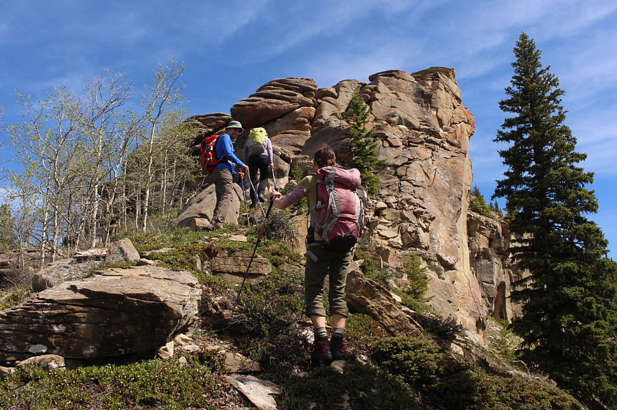 |
The best place to surmount the bluffs is right on the ridge crest. |
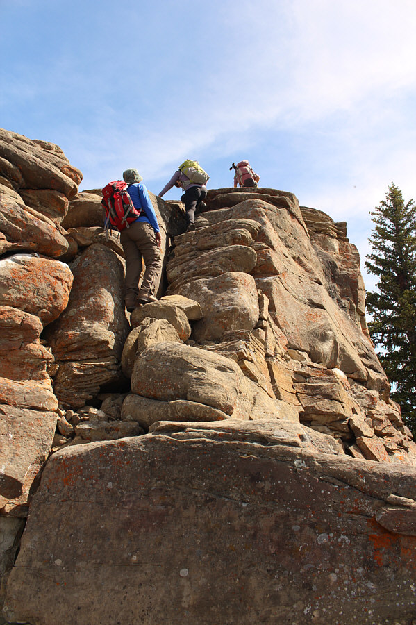 |
The group enjoys some unexpected scrambling. |
 |
The impressive bluffs stretch away to the east for quite a distance. |
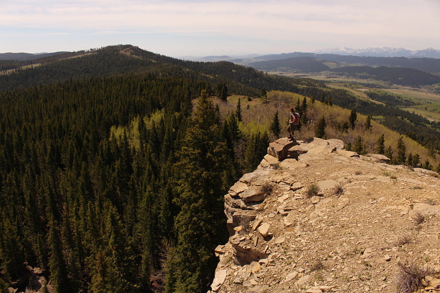 |
This is looking back at Porcupine Hills North (left) from the top of the
bluffs. |
 |
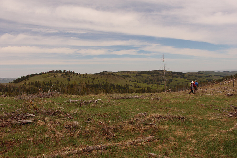
Zosia follows Ali and Asieh through a
clear cut as they head for the prominent bump (right) at the west end
of Trout Creek Ridge. |
 |
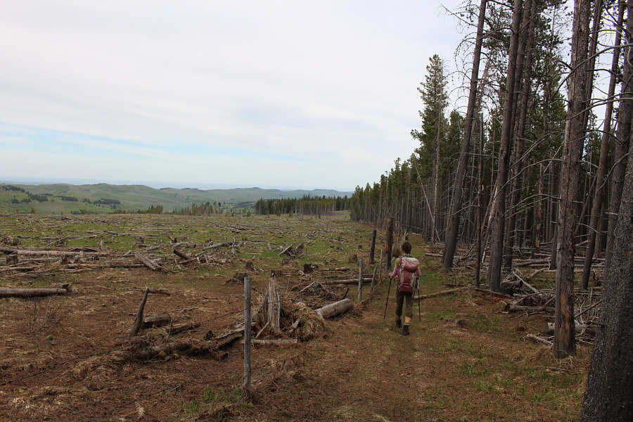
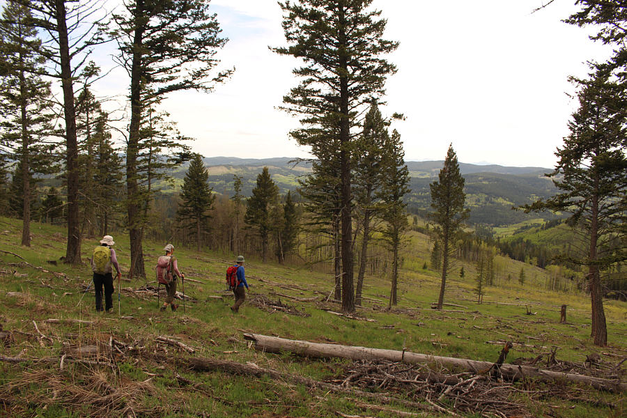
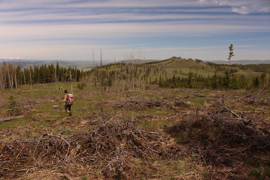
The group hikes along the edge of
another
clear cut as they make their way toward the high point of Trout Creek
Ridge (right of centre). |
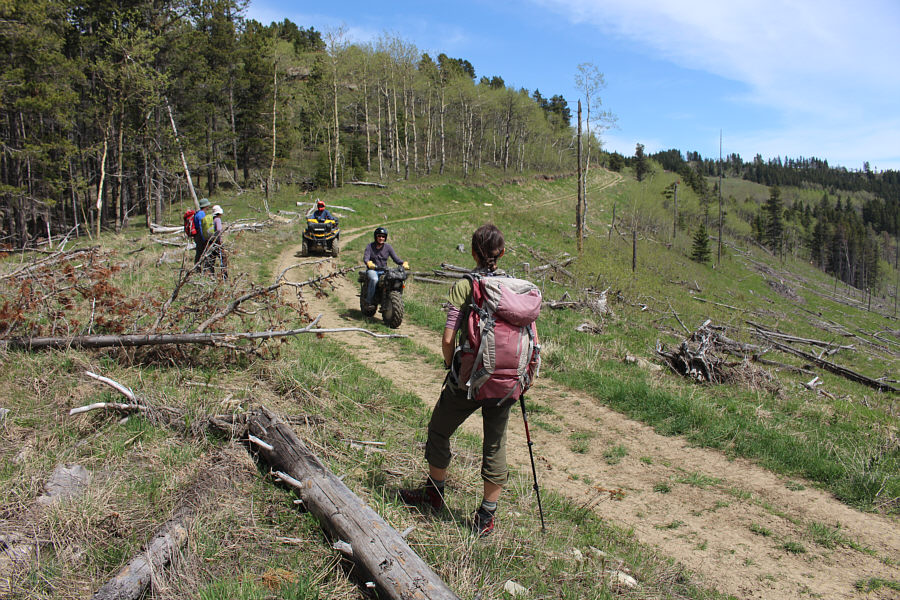 |
The group allows an ATV and a dirt
bike to pass through on the road along Trout Creek Ridge. |
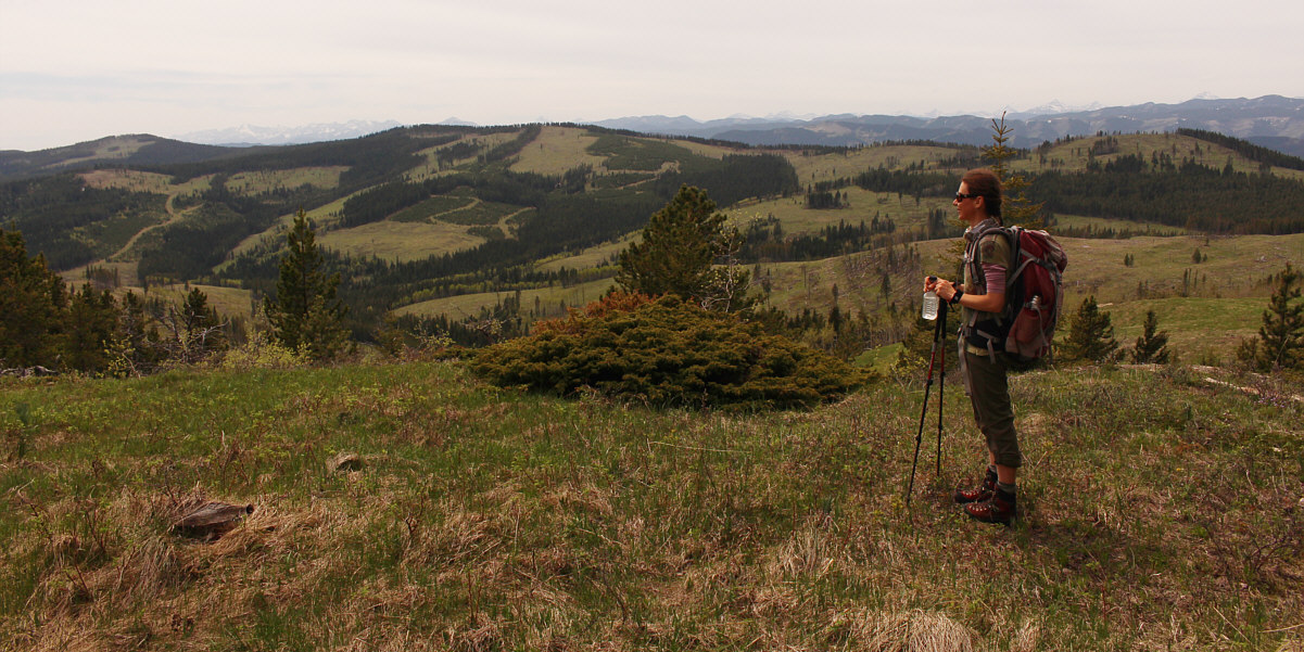
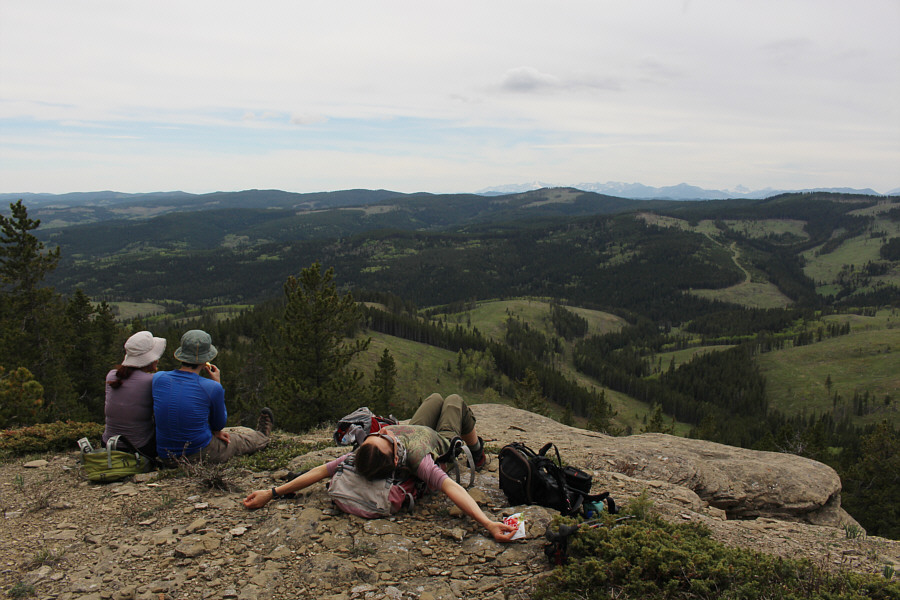
Near the high point of Trout Creek Ridge (1753 metres),
Zosia stops for a drink of water and surveys the route she has walked
thus far from Porcupine Hills North (far left).