BOU AVENUE
Saddle Mountain

From the village of Nakusp, British Columbia, Saddle Mountain stands out to the southwest across Upper Arrow Lake like a great horn which beckons to be climbed.  Fortunately, the summit of Saddle Mountain is the site of a decommissioned fire lookout building and can be easily accessed via a good gravel road and trail.  Several trip reports are available online, and the route is also described in Kathy & Craig Copeland's guidebook, Where Locals Hike in the West Kootenay.  Due to recent changes to the area, there is now a second trailhead higher up the mountain which saves some distance and elevation gain.

From the northern terminal of Arrow Park Ferry, drive north along Arrow Park Road for about 170 metres and turn right onto Saddle Mountain Road.  Drive for 9.5 kilometres before turning left onto another gravel road climbing up the slope to the west.  Drive for 7.9 kilometres to the lower trailhead parking area with toilet.  The signed trailhead is about 70 metres further up the road.  Continue driving up the road for another 2.5 kilometres to reach the upper trailhead which also has a toilet but is unsigned.  The start of the trail here is marked with flagging tape.  Contrary to what a hand-written note at the lower trailhead says, the road to the upper trailhead is in remarkably good shape and should be feasible even for 2WD low-clearance vehicles.

From the upper trailhead, Zosia and I followed a flagged trail into the forest where it drops a bit and crosses a small rock slide before intersecting the main trail coming up from the lower trailhead.  Other than some occasional deadfall, the main trail is generally well-maintained and easy to follow.  We passed an old dilapidated cabin at around the two-kilometre mark, and shortly after, we began zigzagging up some flower-filled avalanche paths with occasional glimpses of the gleaming white lookout building atop the summit.  Near the last trees, we had to take a steep but easy short cut to circumvent a lingering snow patch covering the trail.  The trail disappears momentarily in a talus slope just below the sheer east face of the summit block, and although there are cairns to help point the way, the footing here requires some care and attention.  Past the talus slope, we picked up the trail again which led us to a saddle, so to speak, between the summit block and a rocky knob to the south.  Although the ascent of the summit block from the saddle looks a bit daunting at first, no scrambling is necessary as the trail pleasantly winds its way to the top.

The summit area is spacious and is capped by the white lookout building and even an outhouse.  The lookout building looked brand new and was very clean with nice sleeping platforms and excellent interpretive displays inside.  Obviously, the building had been recently refurbished, and it is encouraging to know that there is a growing movement to restore many of these historic lookout buildings.

After enjoying a relaxing lunch on the summit, Zosia and I descended back to the saddle and went to investigate the rocky knob to the south which, according to one of the interpretive signs inside the lookout building, is known as South Saddle.  Unlike the summit block, getting up South Saddle requires some easy scrambling, but this was not a problem for us.  There is a collapsed man-made structure atop South Saddle that we were unable to identify, but otherwise, the views from there are comparable to the ones from the summit.  We took a short break here before scrambling back down to the saddle and descending the main trail.  Other than being careful not to miss the turnoff to the upper trailhead, we had no issues on our return hike.
We should've camped here the night before! 
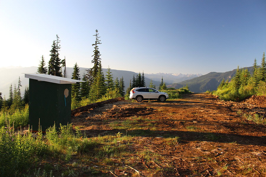
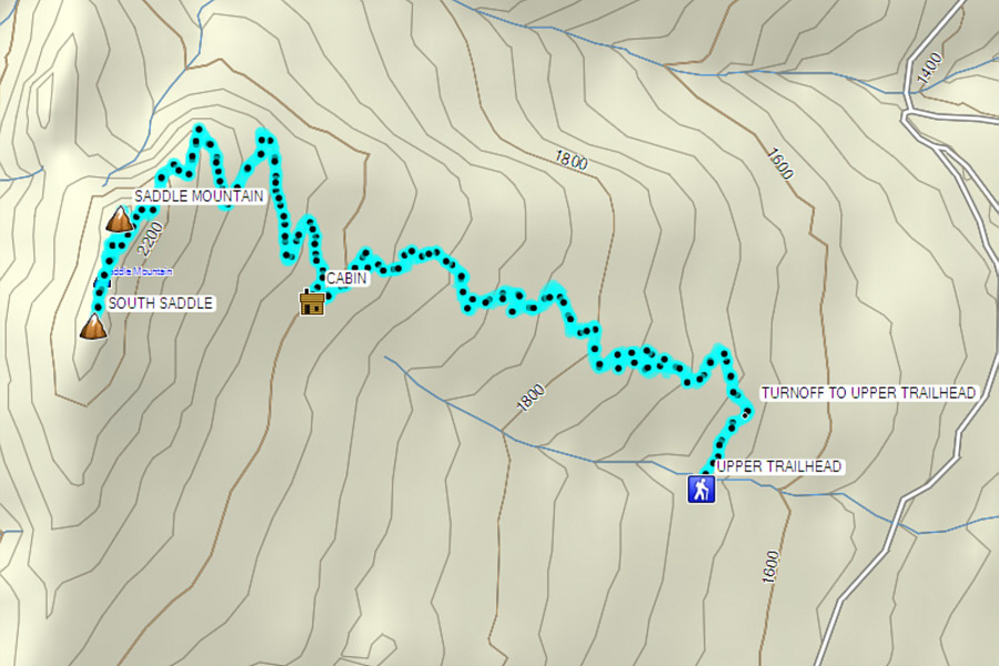
The upper trailhead has an outhouse and ample space for parking.
Cheap rent! Zosia inspects some of the detritus near a collapsed old cabin along the trail.
Get your fill of wildflowers! 
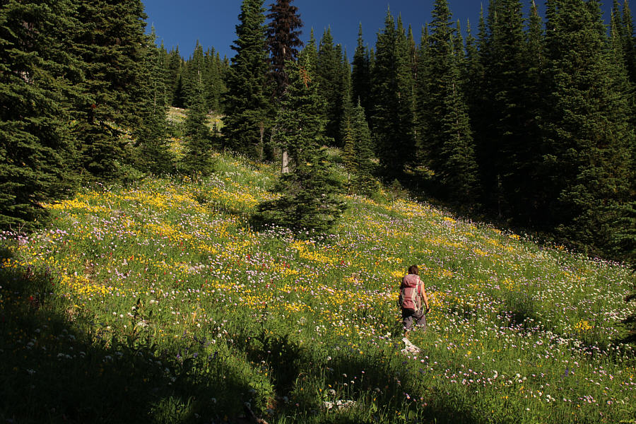
The trail crisscrosses several flower-filled avalanche slopes such as this one.
Actually, the lookout building can even be seen from the trailhead. 
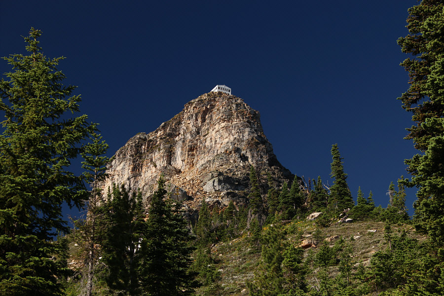
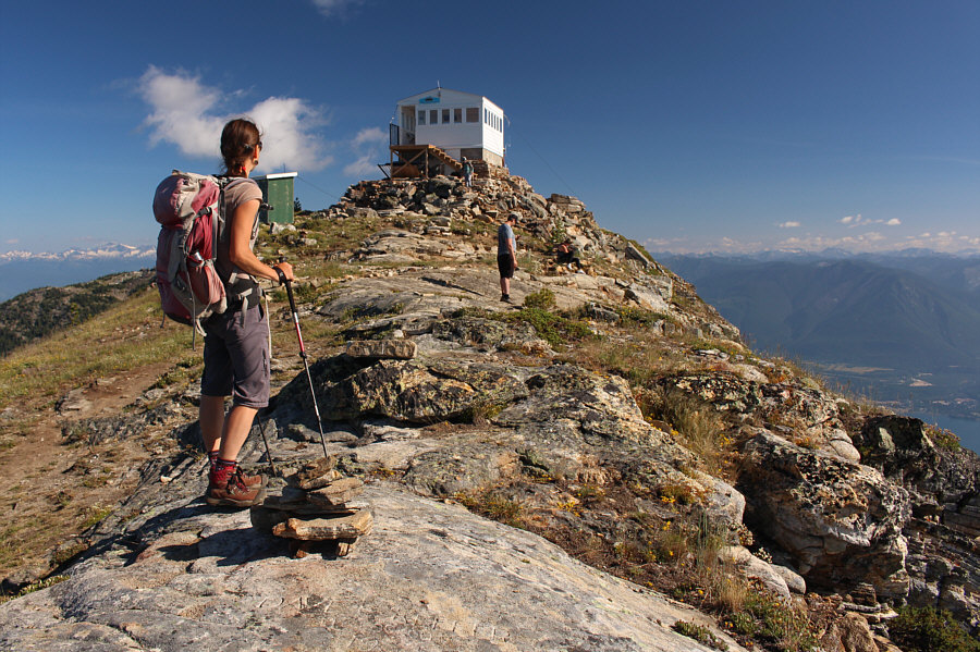
The lookout building can be seen atop Saddle Mountain.
Don't worry; no scree bashing is required here! Zosia picks her way through a rocky section where the trail momentarily disappears.  Cairns help guide the way.
It's tempting to consider South Saddle as a separate summit... 
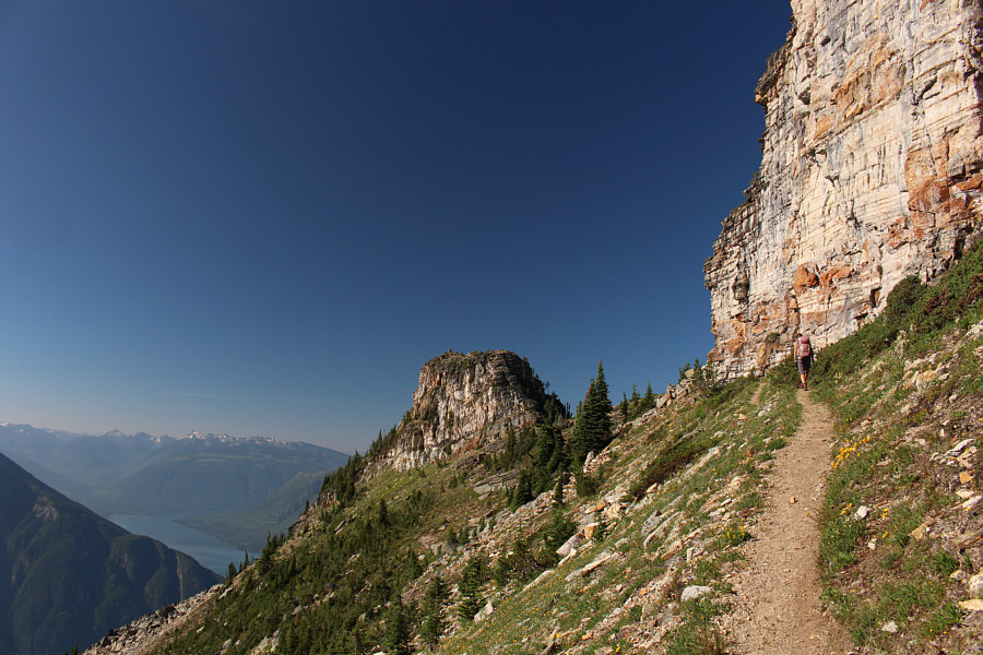
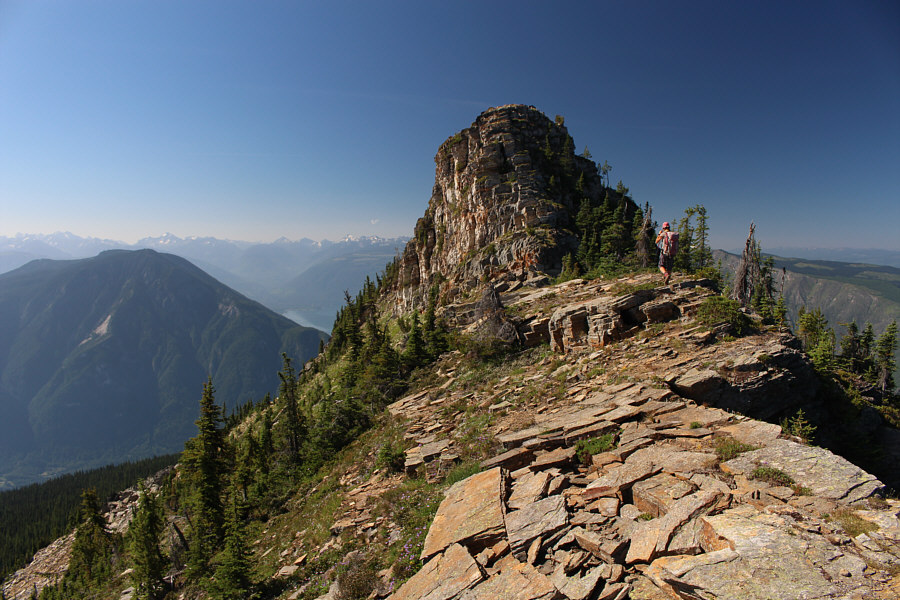
Regaining the trail, Zosia hikes below the sheer east face of Saddle Mountain.  The rocky knob at centre is known as South Saddle according to an interpretive display inside the lookout building.
Easier than it looks; no scrambling required! 
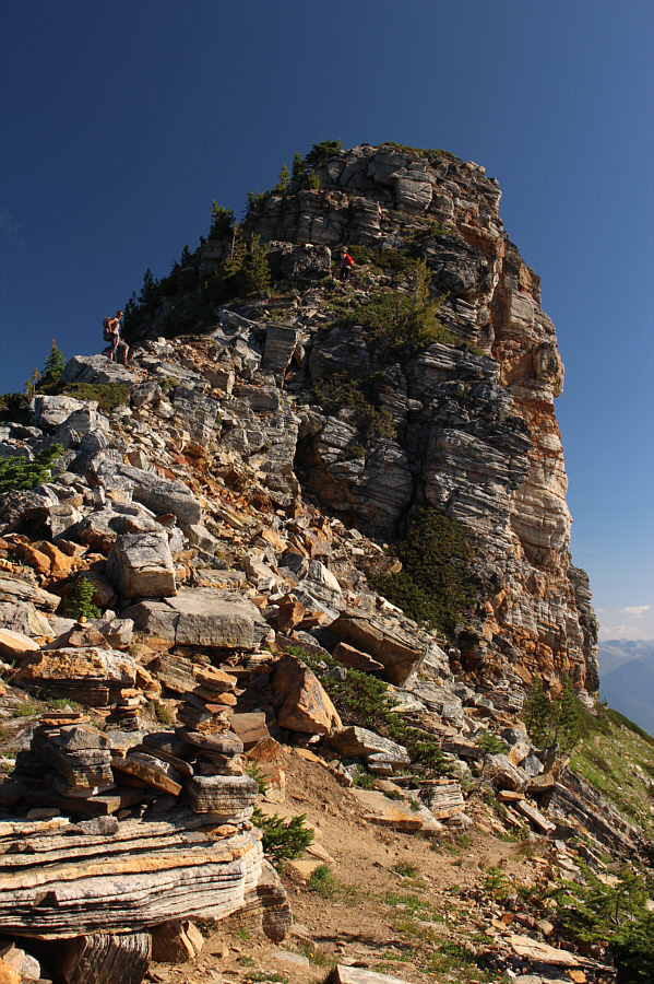
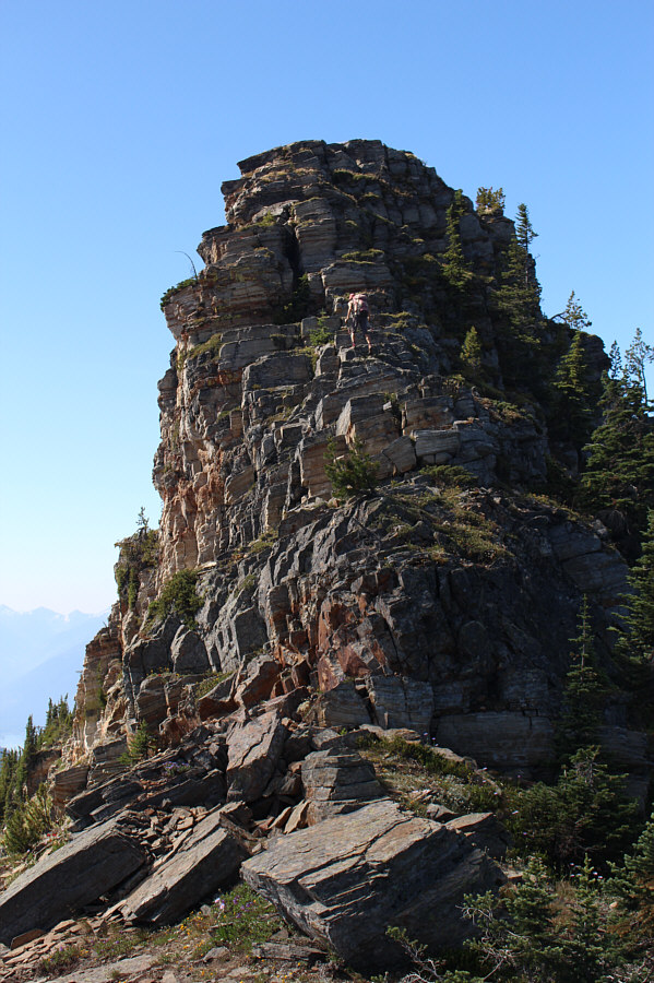
Zosia follows another hiker up the south side of Saddle Mountain's summit block.
Another awesome camping spot! Zosia arrives at the top of Saddle Mountain.  Note the outhouse behind her.
We'll come back for this one in the future! 
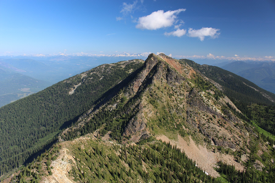
To the north is Upper Saddle Mountain which is a separately named summit that is marginally higher.
So much better than the summit of Kuskanax Mountain which is visible behind us! 
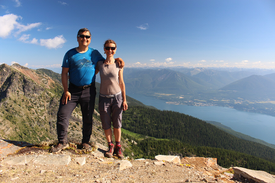
Sonny and Zosia stand on the north side of the lookout building atop Saddle Mountain (2294 metres).
Just too enticing a knob to pass up! After leaving the summit of Saddle Mountain, Zosia heads toward South Saddle.
No problemo! Ascending South Saddle requires some easy scrambling.

I'm not sure what the flattened structure in the foreground was for.

The view to the south of South Saddle includes Scalping Knife Mountain (left), Columbia River (centre), and Mount Ingersoll (right).  The strip of water to the right is incongruously known as Mosquito Creek.


It's a miracle that the outhouse doesn't get blown off the mountain when it's windy! 
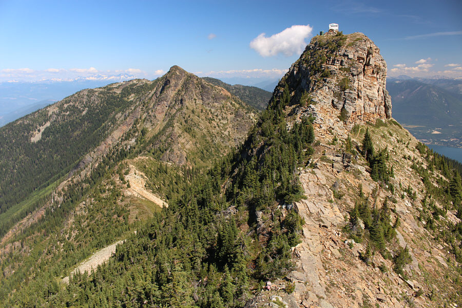
From the top of South Saddle, here is a look back north to Upper Saddle Mountain (left) and Saddle Mountain (right).

Now I feel like going for a swim in the lake!

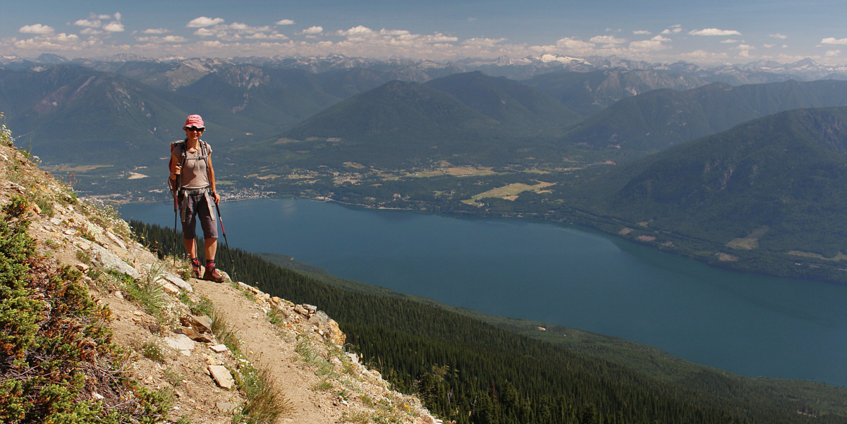
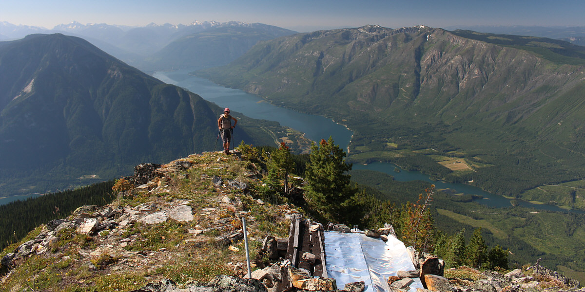
Here is one last look at Upper Arrow Lake as Zosia heads back down the trail.


Relatively easy access and a rewarding summit make this hike a real winner. Total Distance:  8.8 kilometres
Round-Trip Time:  6 hours 8 minutes
Net Elevation Gain:  654 metres

GPX Data