BOU AVENUE
Soowa Mountain
On 21 June 2020, Zosia Zgolak and I ascended Soowa Mountain in the Flathead region of southeast British Columbia.  As usual with obscure peaks like this one, we were fortunate that a route description was available from the late Rick Collier.  According to Collier, Soowa is a "Kootenuha word for mountain lion or cougar".

From Highway 3, turn east onto Morrissey Road about 8.8 kilometres south of the turnoff to Fernie Ski Resort or 17 kilometres east and north of the junction with Highway 93.  Cross both the bridge over Elk River and the train tracks before turning right at a T-intersection.  Stay on Morrissey Road and keep right at a split about 3 kilometres south of the T-intersection (there is a cutoff road 560 metres further along the left fork if you miss this split).  From the split, drive 9.1 kilometres along Lodgepole Road to a junction with Wigwam Forest Service Road (FSR).  Turn right and drive for 19 kilometres to a Y-junction.  Take the left fork (right fork is the continuation of Wigwam FSR and leads to Ram-Wigwam Creek Recreation Site) and drive along Cabin FSR for about 5.2 kilometres to the start of a nearly-hidden trail heading northwest into the forest.  Park on the side of the road where feasible.  This trail does not lead all the way up Soowa Mountain, but it is probably the best starting point for the ascent.

While driving along Cabin FSR from the east, I spotted a good trail climbing up through a clear cut towards where I imagined Collier's ascent route would go.  As a result, Zosia and I started our hike about 350 metres to the northeast of where we should have been only to find out that my good trail quickly petered out halfway across the clear cut.  Rather than retreating for a restart, we bashed our way through the thick undergrowth until we reached the drainage we were supposed to be following up the mountain.  It was a rather inauspicious start for us, but the misery would continue for the next several hours as we grinded our way up the mostly forested and bushy northeast aspect of Soowa Mountain.  This route is sure to be a classic one for masochists.  The climb is unrelentingly steep, and although the bushwhacking is not all bad, it just feels never-ending.

At around the 1900-metre level, the trees begin to thin out, and we endured a final thrash through some fire-damaged alders before pushing up a very steep bowl to gain the rocky northeast ridge of Soowa Mountain.  In contrast to the tedium that came before, ascending the northeast ridge proved to be the highlight of the trip as we enjoyed some easy to moderate scrambling up a series of rock steps.  The angle eventually eases, and the route becomes an easy ridge walk the rest of the way to the top.  We paused partway up this final section and huddled under a tree to wait out a bit of rain, but otherwise, we had no further problems reaching the summit.  Perhaps not surprisingly, Zosia and I were the first ascensionists to record our names in the summit register since it was placed by Collier in 2010 (a pair of firefighters also signed the register in 2017, but they admitted that they had been dropped off by helicopter). 

Resigned to the fact that the mostly overcast skies were not going to clear up anytime soon, Zosia and I reluctantly left the summit after a 30-minute break, and we essentially retraced our steps back along the northeast ridge and down the steep slopes we came up.  While our ascent had taken about five hours, our descent took less than half that time.  Besides the fact that descending is generally less strenuous than ascending, our route-finding was much more efficient on our way down, and we avoided most of the more problematic stretches of bushwhacking that we had encountered going up.  Ultimately, we stumbled upon the trail mentioned in the driving directions and emerged from the forest onto Cabin FSR about 350 metres southwest of where we originally started.  We easily walked the short distance back to my car to conclude this trip.

The lowly elevation of Soowa Mountain and the arduous nature of Collier's ascent route are unlikely to attract even the most die-hard peak-baggers, and it would not be surprising if this summit sees no visitors for another ten years or more.  Having said that, I think there might be a much more pleasant ascent route via the longer but less bushy south ridge starting from near Ram-Wigwam Creek Recreation Site, but that is an exploratory trip to be undertaken by someone else in the future.
Not the best place to start the hike! Sonny gears up on the side of Cabin Forest Service Road.

Photo courtesy of Zosia Zgolak

Classic "sucker's trail"! Zosia starts up an obvious trail, but it would peter out fairly soon.  A much better trailhead can be found about 350 metres further to the southwest along the road.
Ugh. 
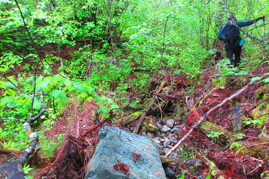
The bulk of the ascent entails bushwhacking through terrain such as this.

Photo courtesy of Zosia Zgolak

Insert lots of grunting (and possibly grumbling) here! 
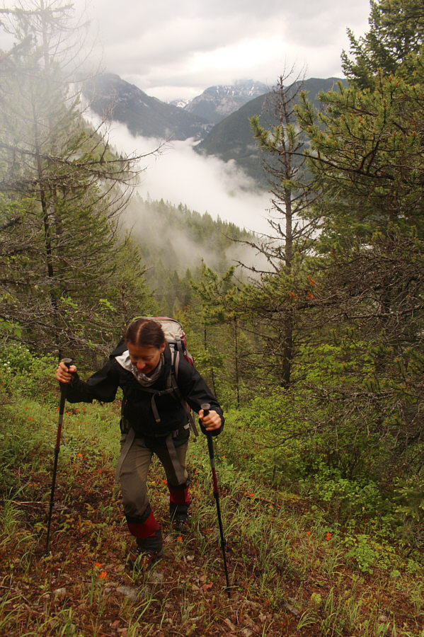
Mist rolls through the valley below as Zosia climbs a steep and partially open slope.
Oh deer! A couple of fawns are surprised to see intruders on their home turf.

Photo courtesy of Zosia Zgolak

The nastiness just never ends!! Zosia thrashes through some burnt alder trees situated on increasingly steep terrain.
Lotsa fun hands-on scrambling here! 
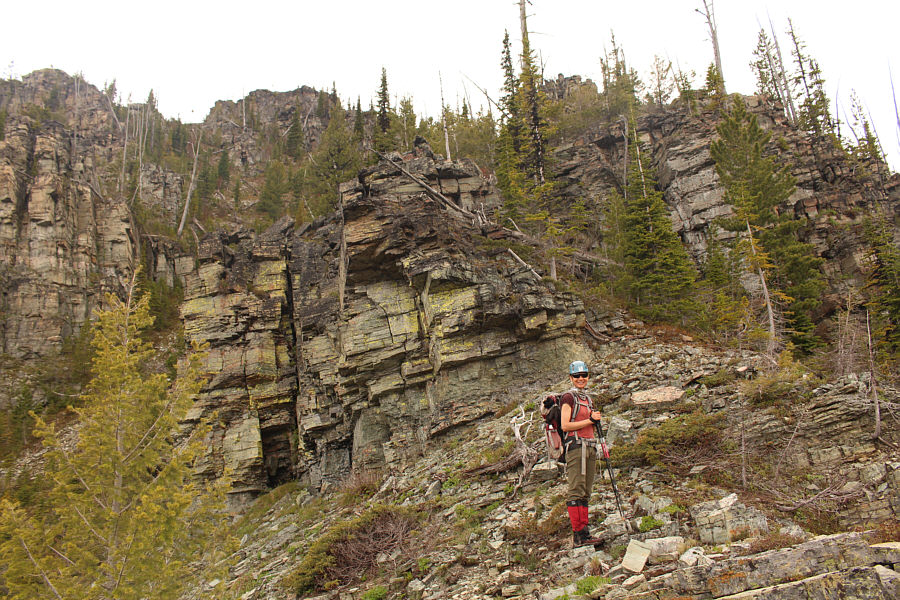
On the upper mountain, bushy slopes give way to stacks of rocks.
We've got this...unless it rains really hard! The summit comes into view as the steepness of the terrain eases.
Rain, rain, go away! Come again some other day! After waiting out some light rain, Sonny resumes ascending the summit ridge.

Photo courtesy of Zosia Zgolak

Was it worth it? Hmmmm... Zosia and Sonny reach the summit of Soowa Mountain (2179 metres).
"Sowa" means "owl" in Polish! The summit register placed by Rick Collier is soaking wet.  The only other entry was written in 2017 by a couple of firefighters who were "heli-dumped" here (they even admitted that they "cheated").

Photo courtesy of Zosia Zgolak

I'm not too eager at the moment to return and try it though! The south ridge of Soowa Mountain--as seen here--might be a longer but less difficult ascent route.
I'm thankful that we could see anything at all from the top on this rainy day! 
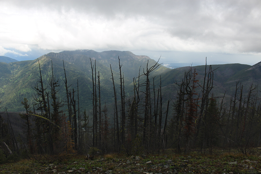
A small section of Lake Koocanusa can be seen at right just beyond the unnamed ridges to the west.
Must be hard finding fresh human blood on Soowa Mountain! 
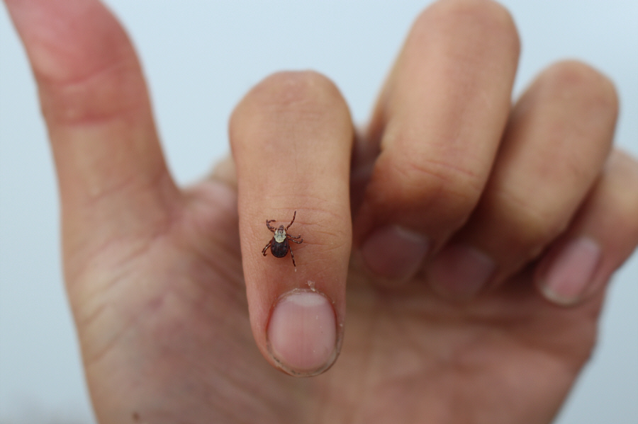
Zosia found this female wood tick crawling on her jacket as she was preparing to leave the summit.  Contrary to popular belief, wood ticks are generally harmless and do not transmit Lyme disease to humans.
Those damn Chinese! Clouds shroud the top of Mount Broadwood to the northwest.  However, China Wall, a mostly impregnable cliff band encircling the mountain's mid-section, is still visible.
I reckon you lichen it too! Colourful wolf lichen break up the monotony of a mostly gray and rainy day.
Back to the thrash! Zosia pauses for a quick break partway down a bushy drainage.
Reminds me of a Christmas tree for some reason. Merry Christmas! 
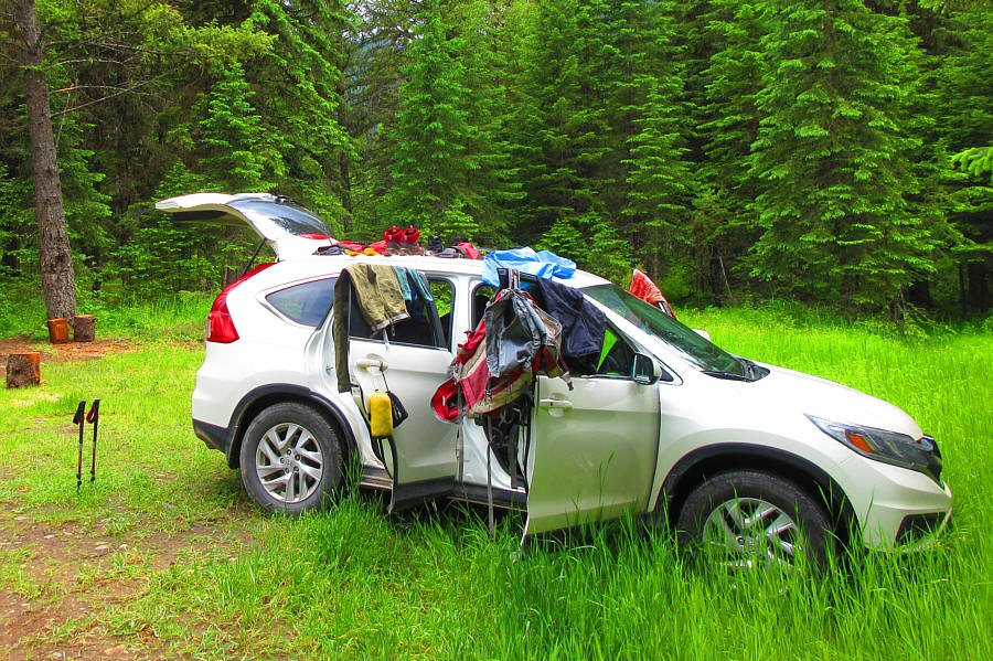
At Ram-Wigwam Creek Recreation Site, Sonny's car is turned into a makeshift drying rack.

Photo courtesy of Zosia Zgolak
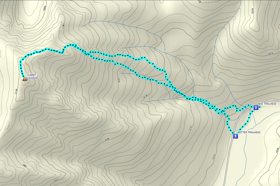
There's a reason why the summit register is so empty! Total Distance:  7.9 kilometres
Round-Trip Time:  8 hours
Net Elevation Gain:  991 metres

GPX Data