BOU AVENUE
Sphinx Mountain

After shelving plans for another objective due to access concerns, Zosia Zgolak and I ascended Sphinx Mountain near Gray Creek Pass, British Columbia on 13 August 2020.  An easy ascent route is described in Kathy & Craig Copeland's guidebook, Where Locals Hike in the West Kootenay, but their access description is out-of-date.  West Kootenay Hiking also has an excellent trip report, but admittedly, I did not plan well enough for this hike and had neglected to print a copy of the report.  Without any cellular reception, we had to rely on my phone's offline mapping application to just find the original access road, and even then, we had no indication of the exact location of the actual trailhead.

From Highway 3A, turn east onto Oliver Road about 7.0 kilometres south of Crawford Bay.  Drive for 350 metres and keep right to cross a bridge over Gray Creek before intersecting Anderson Road on the other side (Anderson Road can also be accessed from Highway 3A about 600 metres south of the Oliver Road junction if coming from Creston).  Go straight passing a sign advising the use of winter tires or chains.  Drive for 900 metres to the junction with Gray Creek Road and keep left.  Ignoring all minor side roads, drive 15.6 kilometres to reach Oliver Lake Recreation Site.  Continue driving for 5.1 kilometres over Gray Creek Pass to a junction with a mining road which, unbeknownst to us at the time, is the starting point described in the West Kootenay Hiking trip report.  We drove an additional 3.3 kilometres and parked in a small pullout near the junction with the east end of the Old Gray Creek Road which is decommissioned and only suitable for ATVs or monster trucks.  Note that the junction with the west end of the Old Gray Creek Road is located about 10 kilometres west of Oliver Lake Recreation Site, but unfortunately, I do not have any information regarding the drivability of this part of the road.  Starting the hike from the west junction would entail a much longer approach (4.6 kilometres) to the trailhead and significantly more elevation gain (730 metres) than from the east junction (2.7 kilometres and 330 metres elevation gain).

From the junction, Zosia and I hiked up the Old Gray Creek Road, and right away, several massive water bars convinced us that it was the right decision to leave our car behind.  Although the road is technically easy, it is still a strenuous climb going over a pass of sorts before dropping moderately down the other side.  At this point, we were still unsure about the location of the trailhead, and I even contemplated abandoning the road to bushwhack up a steep avalanche gully.  There was also one section of road that was completely inundated, and we had to thrash through some low bushes to circumvent the water.  Fortunately, our patience to stay on the road paid off when we finally located the signed trailhead.  The ruins of a nearby cabin mentioned in the Copelands' guidebook is no longer there as far as we could tell.

Leaving the road, Zosia and I crossed a bridge over a creek and took a short break before resuming our climb up the trail.  Other than a few minor detours around deadfall, we had no problems following the trail up through the forest and into some flower-filled meadows.  The trail peters out shortly before an obvious drainage leading up to a high col, but off-trail travel here was still easy.  Upon reaching the high col, we turned right and climbed up the broad but startlingly steep west aspect of Sphinx Mountain.  Some route-finding is required initially to minimize bushwhacking, but the vegetation soon gives way to open slopes with a mix of grass and rubble.  Foreshortening makes these open slopes look shorter than they really are, but we eventually reached the summit after a steady uphill grind.

While Zosia and I took an extended break on the summit, we noticed black smoke to the west and later learned that a fire had broken out at a tree nursery across Kootenay Lake.  Fortunately, the smoke did little to diminish the grand views we were enjoying, and by the time we were ready to leave the summit, much of it had already dissipated.  For our descent, we essentially retraced our steps by dropping to the high col and hiking down the drainage to regain the trail.  The remainder of the hike back to the trailhead and out the Old Gray Creek Road was uneventful.
We weren't sure how far we had to walk up the road at this point! Zosia hikes up the old Gray Creek Forest Service Road.
We hit the jackpot! 
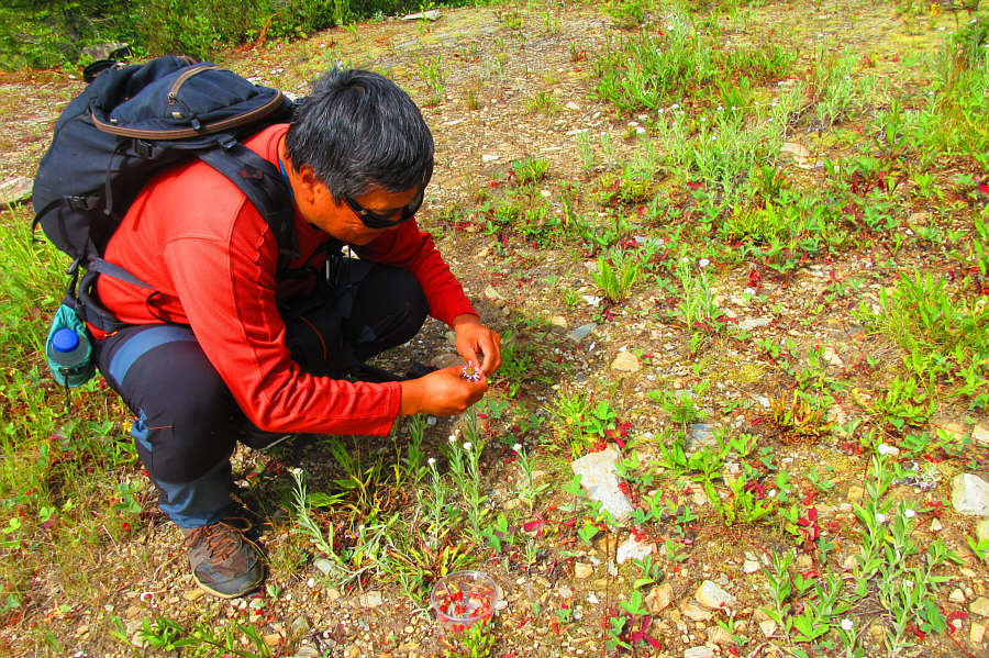
Sonny stoops to pick wild strawberries.

Photo courtesy of Zosia Zgolak

As delicious as they look! Here is a close-up of some wild strawberries.

Photo courtesy of Zosia Zgolak

Whew! We were almost ready to bushwhack at this point! A makeshift sign marks the actual trailhead for Sphinx Mountain.
Lotsa larches here! 
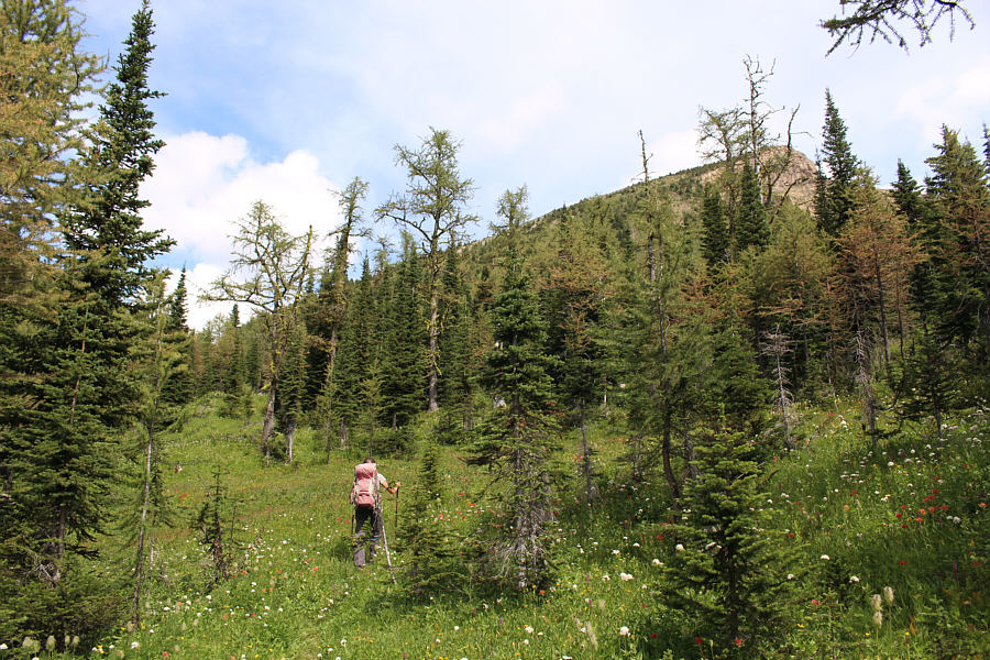
The upper slopes of Sphinx Mountain are visible behind the trees as Zosia hikes through a meadow.
No problem. We know where we're supposed to go now! The trail disappears just before a high col.
Easy hiking here! 
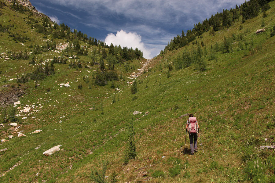
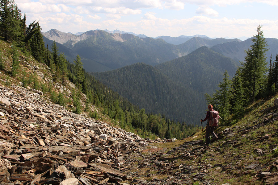
Zosia hikes up the drainage just below the high col.
Turn right, right here. Sonny arrives at the high col with views of Mount Hooker (left) and Old Tom Mountain (centre).

Photo courtesy of Zosia Zgolak

As usual. Zosia waits for Sonny on the summit of Sphinx Mountain (2608 metres).
Is that a sphinx pout? 
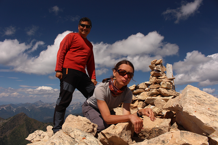
Sonny does not know what to think of Zosia's sphinx pose on the summit.

We would later learn that the wildfire started in a tree nursery.

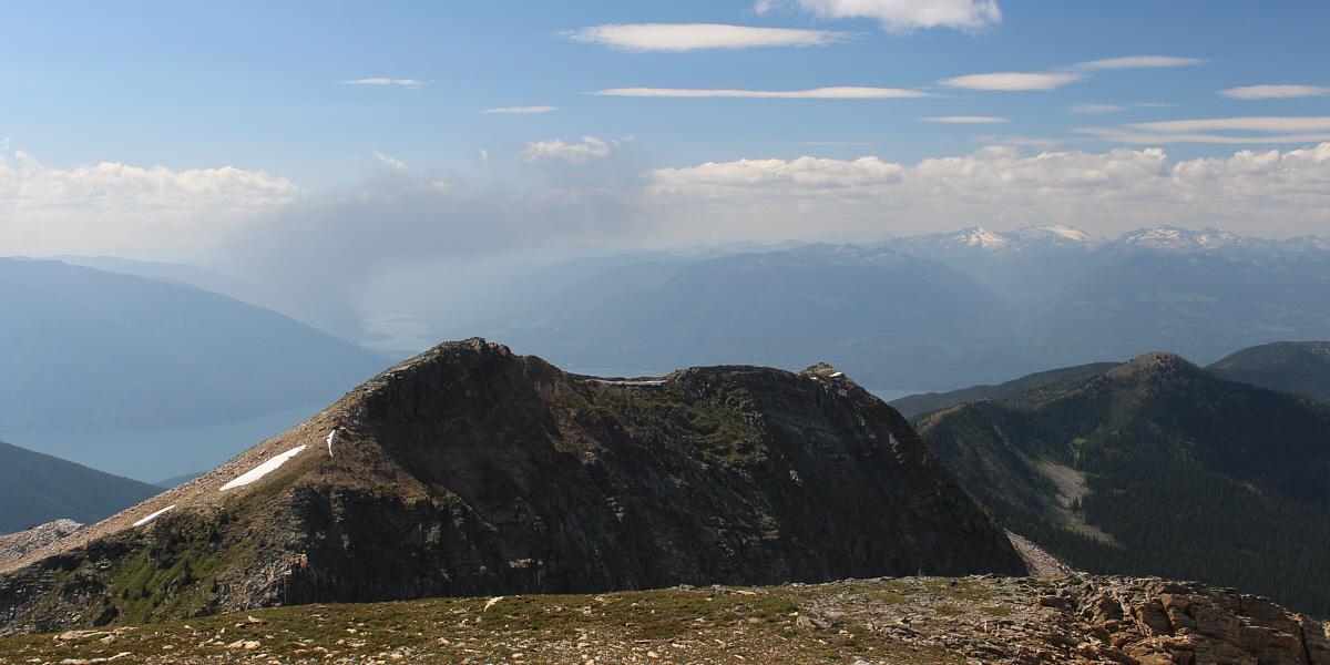
Smoke from an industrial fire can be seen beyond the western outlier of Sphinx Mountain.  Also visible on the right horizon are the glaciated peaks of Kokanee Glacier Provincial Park.


Mount Loki is unbelievably high on my to-do list! On the northern horizon, Mount Loki stands head and shoulders above all the surrounding peaks.
But not today! 
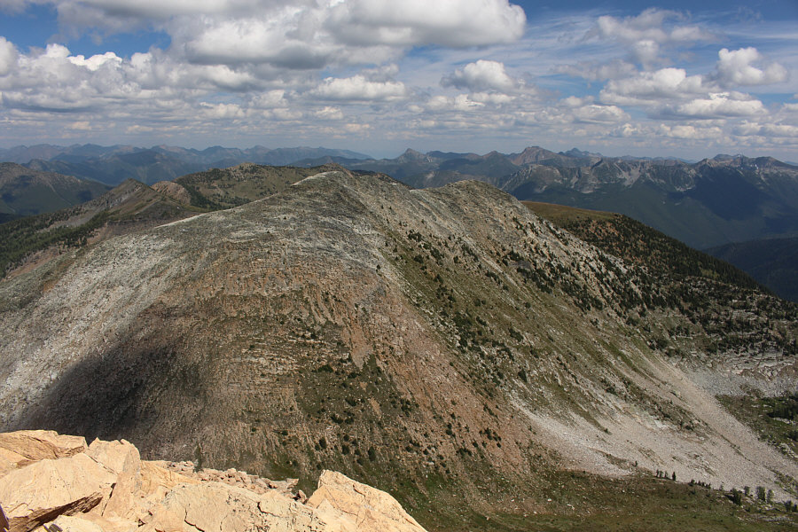
Unnamed ridges to the east invite further exploration.
Very intriguing... 
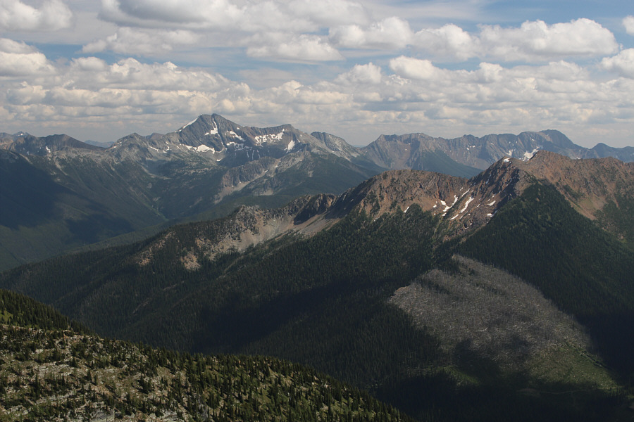
Snowcrest Mountain stands out to the southeast.
Forget the smoke; watch your step on the steep and loose rubble! Some smoke is still present to the west as Zosia descends back to the high col.
Back on easy street here; put it on cruise control! Zosia continues descending down the drainage below the high col.
Splish, splash! 
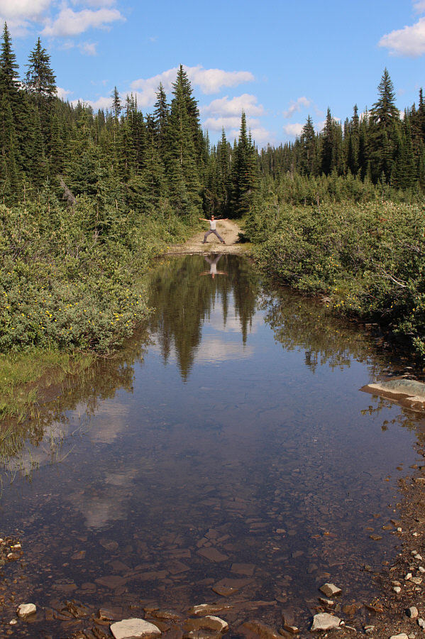
One last obstacle is getting around this inundated section of the old road.
A fairly easy trip once you find the trailhead. Total Distance:  11.8 kilometres
Round-Trip Time:  7 hours 23 minutes
Net Elevation Gain:  1009 metres

GPX Data