BOU AVENUE
Stinky Narrows Loop
Arriving in Blairmore, Alberta on the
morning of 22 December 2020 after a night of heavy snowfall, Zosia Zgolak
and I were a bit confounded about what to do for the day.
Originally, we had plans to ski to the ghost town of Lille, but deep snow
made the access road impassable. The prospect of breaking trail
through deep snow for many kilometres also killed our motivation to
pursue this plan. Subsequently perusing a map application on my
phone, we discovered a short trail known as Stinky Narrows Loop to the
east of town and felt that it would make for a more reasonable ski tour
given the inclement weather. The trail derives its name from a
nearby sulphur spring which we also hoped to visit at some point.
The trailhead for Stinky Narrows Loop is coincidentally the same as that
for Turtle Mountain
(in the southeast corner of Blairmore, turn south from 15 Avenue onto a
dirt road opposite the 135 Street cul-de-sac and follow the road to a
pullout about 300 metres further), but because the town was still digging
itself out from the previous night's winter storm, we elected to park
somewhere on the plowed main drag (20 Avenue) and start skiing from
there.
From where we parked, Zosia and I crossed to
the south side of the train tracks which run through Blairmore and skied
along the town's snow-covered streets until we reached the Turtle
Mountain trailhead. Instead of climbing up Turtle Mountain, we
followed the continuation of the road--actually, a pipeline
right-of-way--up to a low bench overlooking Highway 3. We skied
down the other side of the low bench and continued to follow the pipeline
right-of-way to where it drops down a steep embankment to Crowsnest
River. Instead of dropping down, we left the right-of-way here and
followed a cut line for a short distance to where it, too, begins to drop
steeply to the river. At this point, the trail veers away from the
cut line and enters forest for a short distance before emerging in a
glade below some impressive cliffs on the east side of Turtle Mountain's
north ridge. We re-entered forest at the far end of the glade, but
the trail narrows considerably here and becomes much more challenging to
ski. In hindsight, we should have turned around at the glade and
descended to the river via the pipeline right-of-way. Instead, we
got suckered into following the trail as it snakes its way through much
denser forest and on a precariously steep slope. There is a hairpin
turn--the south end of the loop--about 700 metres beyond the glade, and
it took us over forty minutes to ski this section while going generally
downhill. The skiing here was unpleasant to say the least, but it
only got worse as we turned northward to contour along the river bank.
Much to our chagrin, the trail undulates constantly, and from time to
time, it seemingly disappears in thick bush. In the end, it was
easier to just pick up our skis and walk most of this section along the
river.
Just as Zosia and I were beginning to tire
of this whole miserable endeavour, we surprisingly stumbled upon an
unnamed pond with a most singular blue hue. The pond is tucked
between the north end of Turtle Mountain and Highway 3, but it is not
visible to passing motorists because of an intervening railway bridge.
The pond is also fed by the aforementioned sulphur spring which accounts
for the intriguing colour and the distinct "rotten egg" smell in the
vicinity. After investigating the spring, we discovered a geocache
nearby and happily signed the log book before moving on. Continuing
northward, we carefully crossed both the railway tracks and Highway 3 to
intersect an interpretive pathway running alongside Crowsnest River.
Turning westward, we skied along the pathway into Blairmore and
ultimately back to our starting point without further trouble.
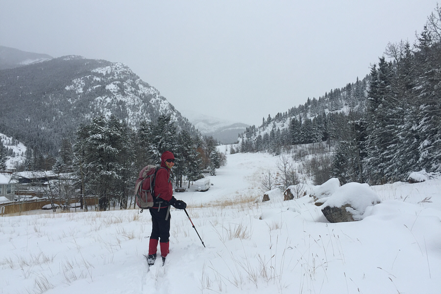 |
After skiing through the town of Blairmore, Zosia approaches the
trailhead for Turtle Mountain. |
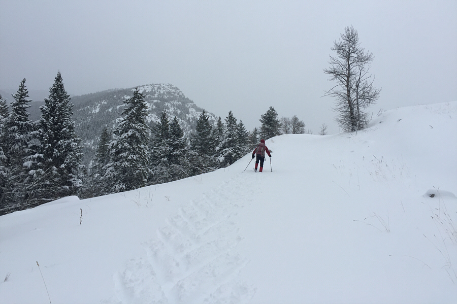 |
From the Turtle Mountain trailhead, it is a short but steep climb up to a
low bench. |
 |
Zosia prepares to drop down the other side of the low bench along a
pipeline right-of-way. |
 |
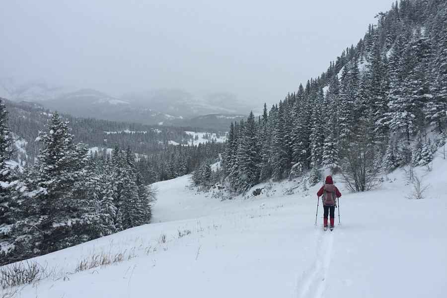
The route finally levels out for awhile and provides enjoyable ski
touring. |
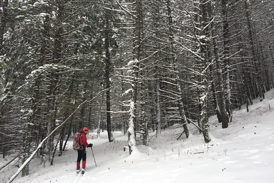 |
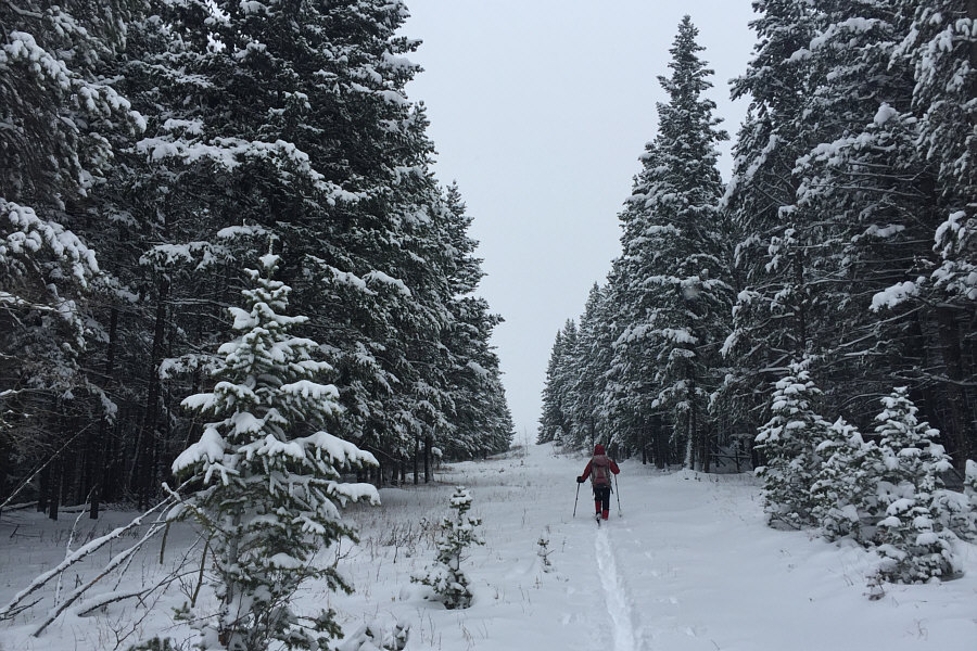
The trail enters some forest. |
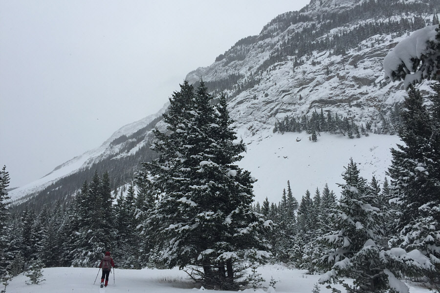 |
The route traverses partway along the base of some impressive cliffs on
Turtle Mountain. |
 |
The trail becomes increasingly more difficult to ski as it re-enters
forest.
Photo courtesy of Zosia Zgolak |
 |
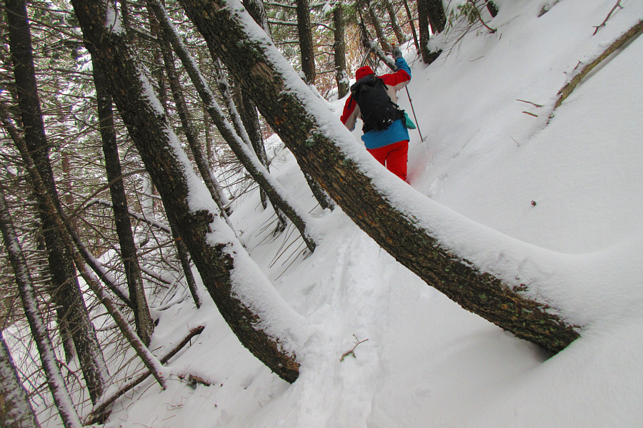
Zosia takes off her skis to skirt around a downed tree. |
 |
Sonny is not happy about walking along the banks of Crowsnest River.
Photo courtesy of Zosia Zgolak |
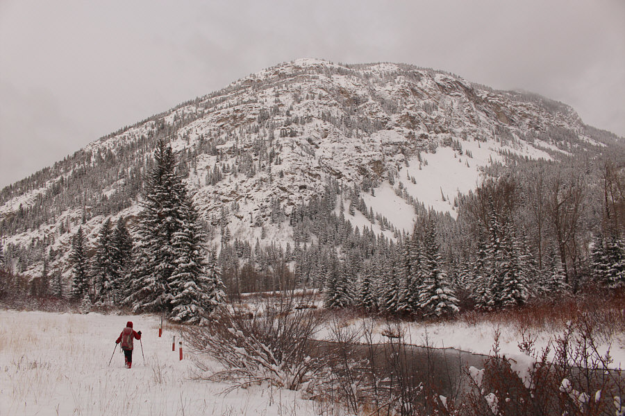 |
A small meadow provides relief from some of the bushwhacking along the
river bank. Bluff Mountain dominates the background. |
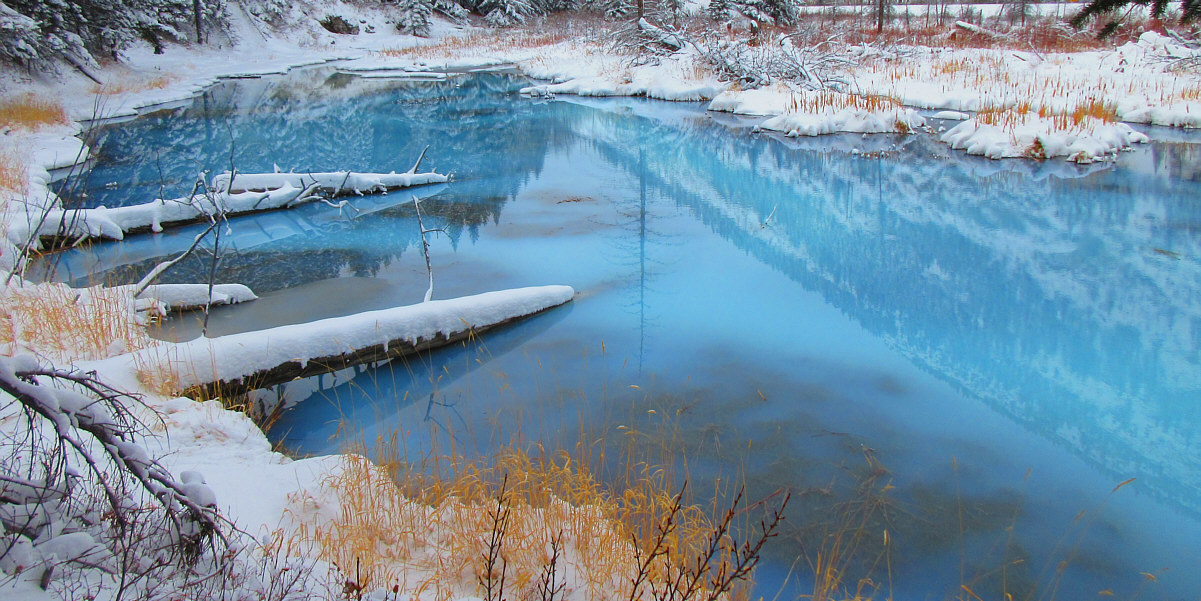
This surprising pond has a remarkable blue hue.
Photo courtesy of Zosia Zgolak
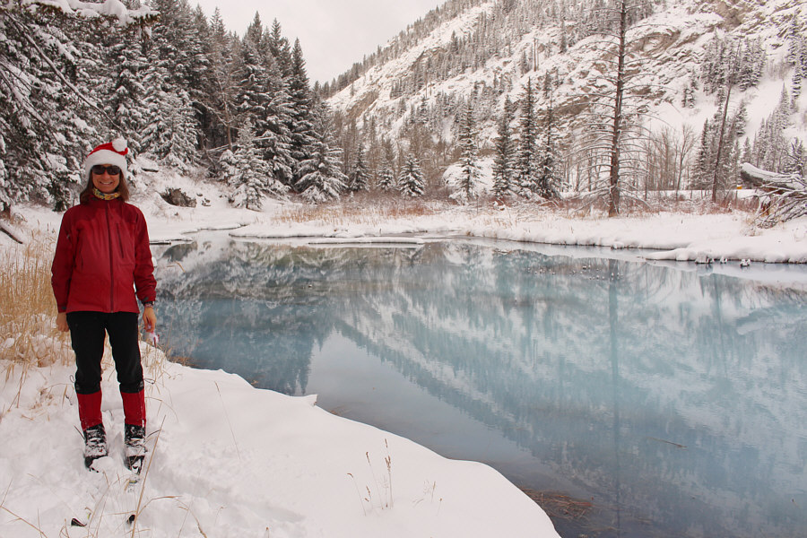 |
Despite its close proximity to the highway, the unnamed pond is
well-hidden from passing motorists. |
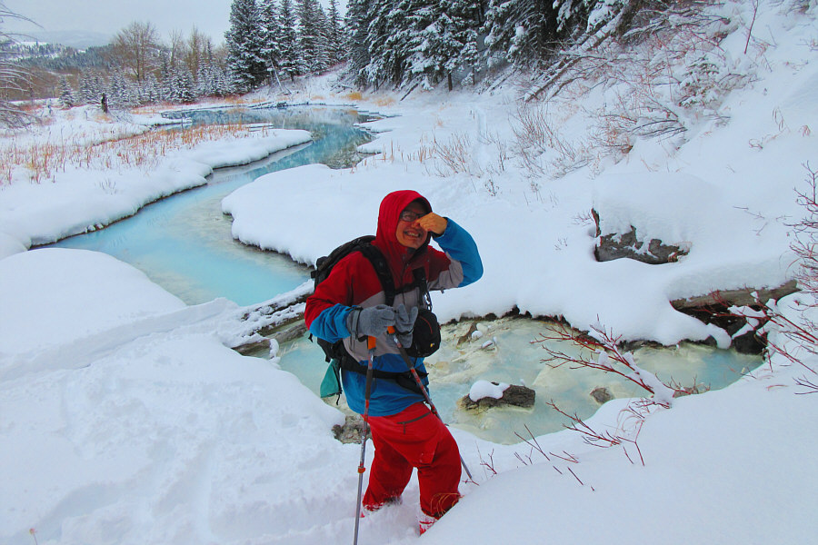 |
The route name and the pond's remarkable colour are both derived from
this sulphur spring.
Photo courtesy of Zosia Zgolak |
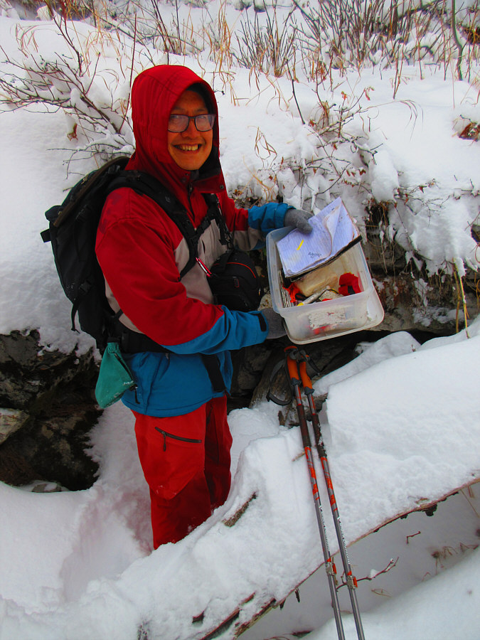 |
Sonny finds a geocache near the sulphur spring.
Photo courtesy of Zosia Zgolak |
 |
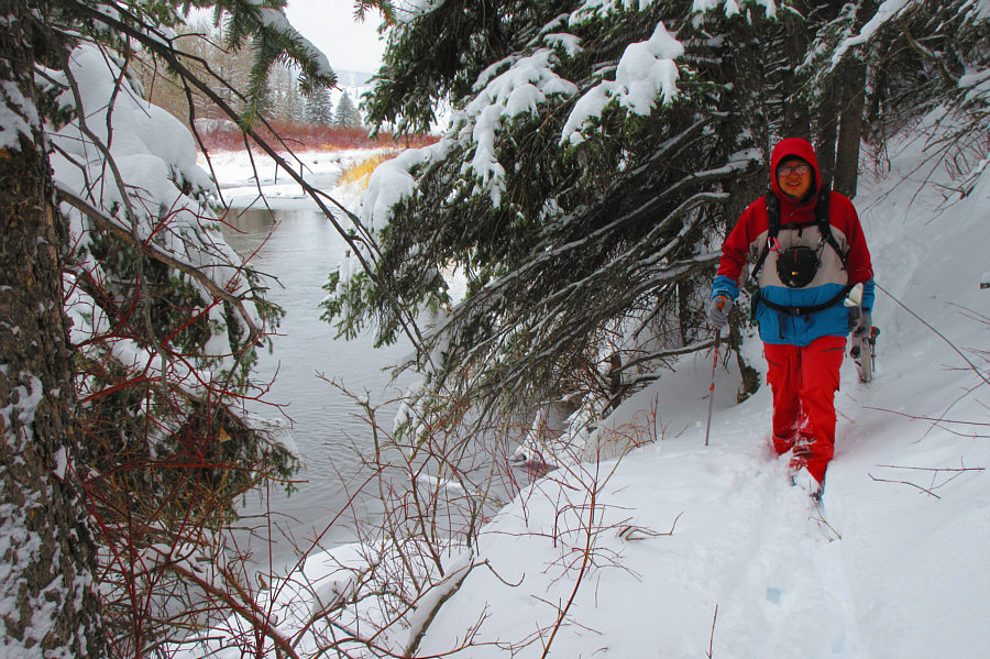
After crossing railroad tracks and the highway, Zosia heads back to
Blairmore on a pathway beside Crowsnest River. |
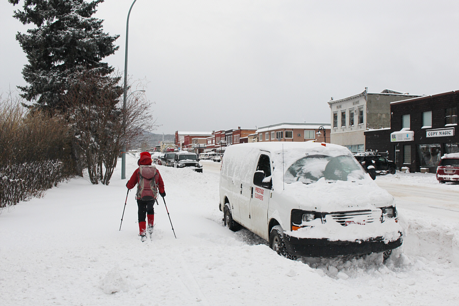 |
Zosia skis on top of a snow bank alongside the main drag (20 Avenue) in
Blairmore. |
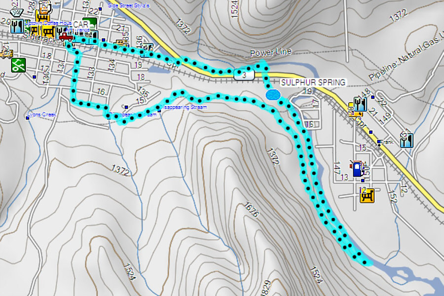 |
Total
Distance: 8.0 kilometres
Round-Trip Time: 4 hours 41 minutes
Cumulative
Elevation Gain: 140 metres
GPX Data |