BOU AVENUE
Ymir Mountain

Ymir Mountain is the iconic peak of Whitewater Ski Resort near Nelson, British Columbia, and I have been itching to climb it ever since my first visit to the area in 2016.  The mountain has a fairly easy ascent route as detailed on the West Kootenay Hiking website.  Although the peak is undoubtedly skied in winter and spring, a summer ascent assuredly dispels any concerns about avalanches.  On 10 August 2020, Zosia Zgolak and I paid a visit to the resort in hopes of climbing Ymir Mountain.

Turn onto Whitewater Road from Highway 6 about 11 kilometres south of Nelson or 29 kilometres north of Salmo.  Drive for 9 kilometres to the ski resort's large parking lots.  Unfortunately, camping is not allowed here.

From the parking lot, Zosia and I walked through the resort's base area and up the ski run coming from the basin below Ymir Mountain which is visible right from the start.  On this day, there were still some marshy sections along the ski run, and my hiking shoes unfortunately got wet early in the proceedings.  Also, an older gentleman passed us shortly after we started, but he quickly disappeared presumably on a road heading up the north side of the basin.  We soon gained the same road but only briefly before leaving it to follow a trail leading to the back of the basin.  There is a painted white rock on the ground to mark this junction.  Initially, the trail is a bit overgrown but still easy to follow, but it eventually peters out after crossing the first of several talus slopes.  Fortunately, the route up to the west ridge of Ymir Mountain is blazed with orange diamond markers although a few of these are on trees that have been toppled by avalanches and may be difficult to spot.  Regardless, if we were ever in doubt, we just kept climbing upward wherever it was least bushy.  As the trees began to thin out higher up the basin, we angled more to climber's right and scrambled onto the crest of the west ridge a little bit higher than where the blazes lead.  The remainder of the ascent entails a mix of hiking, easy scrambling, and some route-finding through bushy sections along the undulating ridge.

Zosia reached the summit well before me and ran into the same gentleman that had passed us earlier, and I met him as he was descending the west ridge.  He had climbed up the trickier north ridge of Ymir Mountain and was now descending the west ridge en route to the top of the resort's Summit chairlift to complete a loop apparently known as the Whitewater Traverse.  After joining Zosia at the summit, we discovered that the gentleman's name was Gene Van Dyk from the summit register.  In fact, this was Mr. Van Dyk's 49th ascent of Ymir Mountain since the register was placed in 2016!  We would ultimately see his name again in many other West Kootenay summit registers and sometimes multiple times in the same register.

Since our ascent went so well, Zosia and I were intrigued by Mr. Van Dyk's traverse and decided to follow him down the west ridge to the Summit chairlift.  At the time, descending an easy ski resort road back to the base area seemed more appealing than retracing our steps down the talus slopes in the basin.  After leaving the summit, we had no problems retracing our steps down the west ridge and continuing over another high point unofficially known as Prospector.  As we descended the far side of Prospector though, we ran into more and more thick bush with fewer signs of human passage, and although the ski resort road did not look that far below us, we were gradually being forced to go higher up the next unnamed bump along the ridge.  Uncertain if we could descend the far side of the next bump and unwilling to gain more unnecessary elevation, we decided to leave the ridge and slither down a very steep and rather unpleasant slope to reach the ski resort road.  Most likely, this was not the route that Mr. Van Dyk had taken, but somehow, we managed to get down to the road in one piece.  Forgoing any short cuts through more nasty bush, we climbed the road to reach the top of the Summit chairlift, and even there, I had a bit of trouble trying to figure out where the road continued down to the base area.  We eventually got on track and descended the painfully long gravel road to its terminus near the west end of the resort's large parking lots.

Our exasperating descent put a damper on what was otherwise a really nice ascent of Ymir Mountain.  In retrospect, retracing our steps down the tedious talus slopes into the basin would have been a lot less problematic and likely quicker.
Mosquitoes were pretty bad here! 
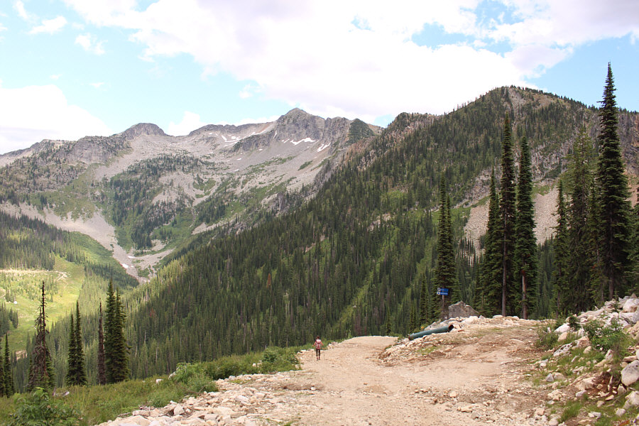
Zosia walks through the Whitewater Ski Resort base area.  Ymir Mountain is visible in the distance at far left.
Crap! My hiking shoes are wet already! 
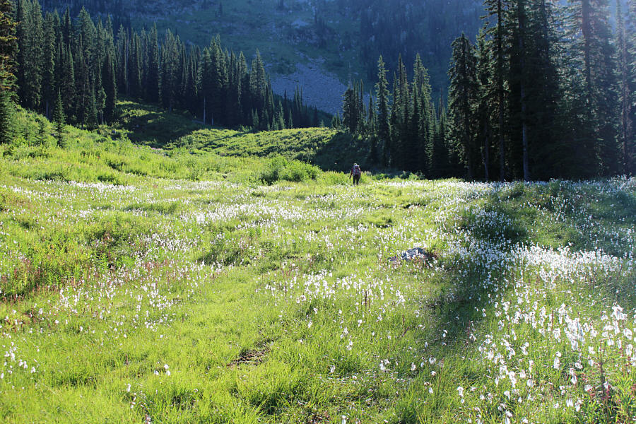
Zosia crosses a marshy section en route to the basin below Ymir Mountain.
Ribbit. A western toad is detained momentarily by Sonny.
I wonder who painted the red line on the rocks and trees... 
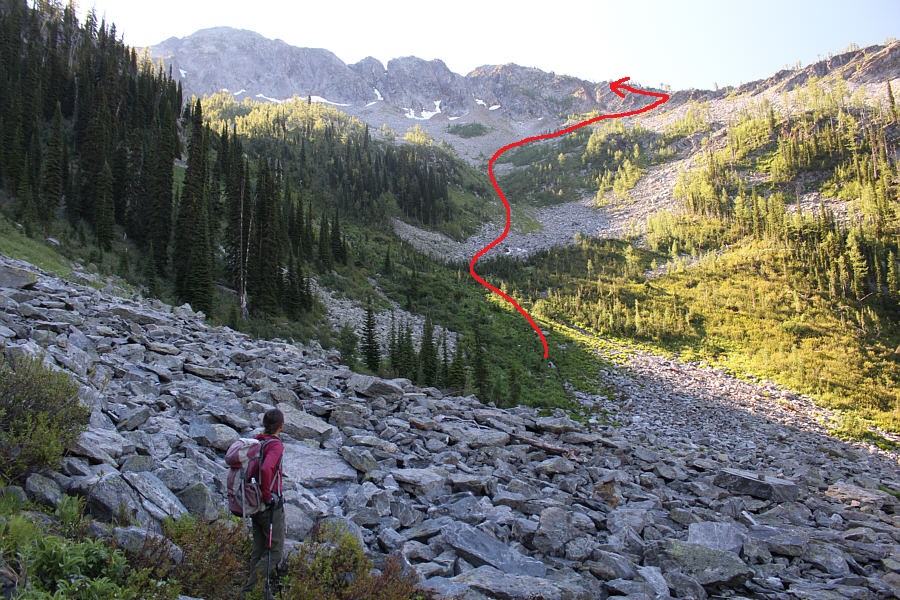
Zosia surveys the approximate route to the ridge crest at the back of the basin.
I imagine that this bowl would be great skiing in winter. 
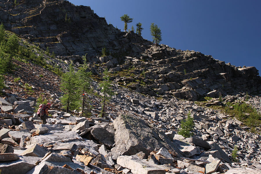
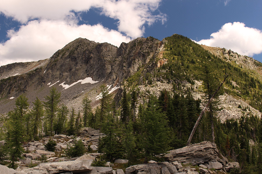
Zosia carefully works her way through a boulder field.  The route goes up the chute between the trees at left.
White Queen takes Black Knight...check! Sonny continues to grind his way up the slope.  At right is the peak unofficially known as White Queen.

Photo courtesy of Zosia Zgolak

Easy scrambling. The orange markers lead to the far right in the photograph, but Zosia would scramble directly up to the trees at centre on the ridge crest.
We're getting to the fun part of the ascent. Zosia gains the ridge crest and heads eastward.
Still some climbing left... Getting to the summit requires a bit of route-finding to avoid vegetation, but there are no technical challenges.
It's pronounced EE-MEER! Zosia and Sonny stand on the summit of Ymir Mountain (2391 metres).
Looks like a great ridge walk! The bumps along the connecting ridge southeast of Ymir Mountain all have unofficial names: Vili Peak (lower left), North Qua (left), and Qua Peak (centre).

Another area I hope to visit in the future!

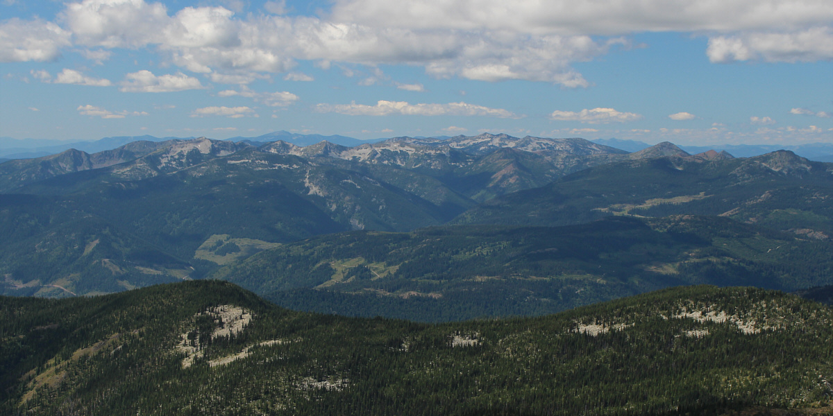
To the southwest are numerous peaks in the Bonnington Range.


More amazing places to explore in the future... Immediately to the north is the feature known as Half Dome (right).  Other peaks and ridges within West Arm Provincial Park are also visible here.
We would see Gene's name in many other West Kootenay summit registers in the days to come! Zosia signs the summit register.  Gene Van Dyk, a gentleman that she ran into both near the start of the trip and again on the summit, had already signed the register on this day.  It was his 49th recorded ascent of Ymir Mountain since the register was placed in 2016!

Not as easy as it looks from here!

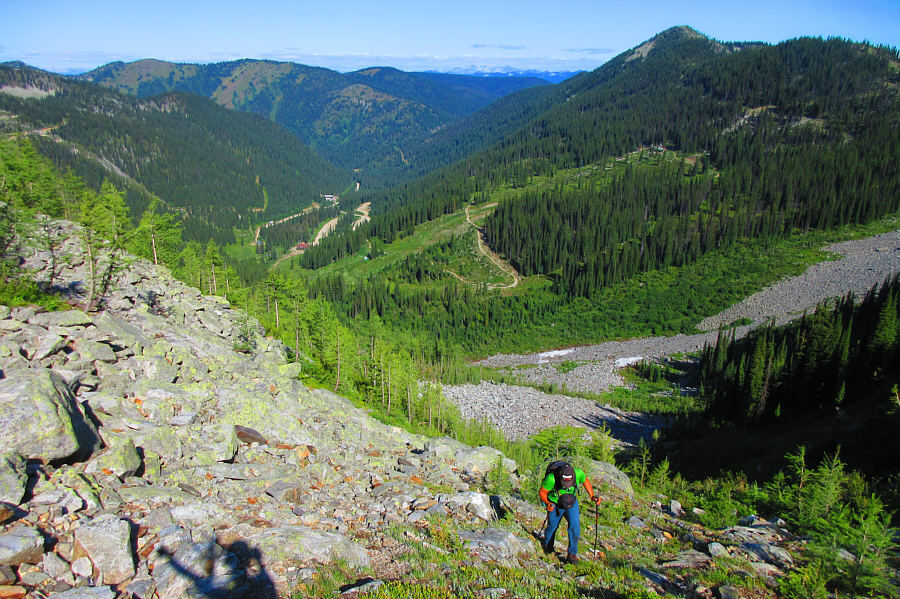
Zosia leaves the summit in hopes of descending the ski resort roads in the distance at right.


Wow, we climbed up that? Here is a look back at Ymir Mountain (left) from lower down the west ridge.
I'm not going to count it as a separate summit, but really, I should! Traversing the west ridge entails climbing over a hump unofficially known as Prospectors (2152 metres).
The ski resort's original daylodge? 
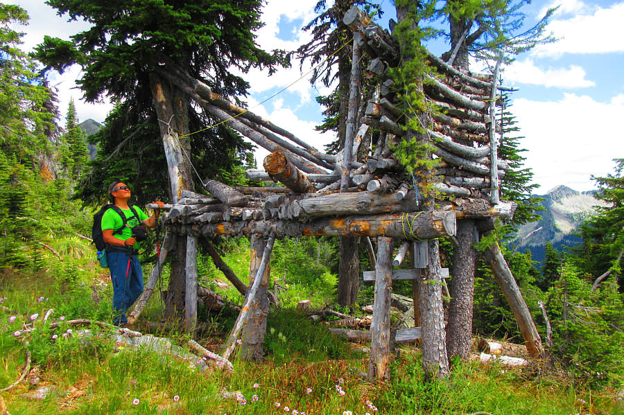
Sonny wonders about the purpose of this strange tree house along the ridge.

Photo courtesy of Zosia Zgolak

Looks like sperm... Bear grass can be found along the west ridge of Ymir Mountain.
Tyrolean traverse? Sonny comes across a strange clothes line stretched across the abyss.  The ski resort road in the background seems close, but getting to it would prove to be problematic.

Photo courtesy of Zosia Zgolak

Too bad we can't get a ride down! Zosia reaches the upper terminal of the Summit chairlift.
This alternate descent was so NOT worth it! Zosia hikes down a steep road which ultimately leads to the ski resort's parking area.  Ymir Mountain is visible at centre.
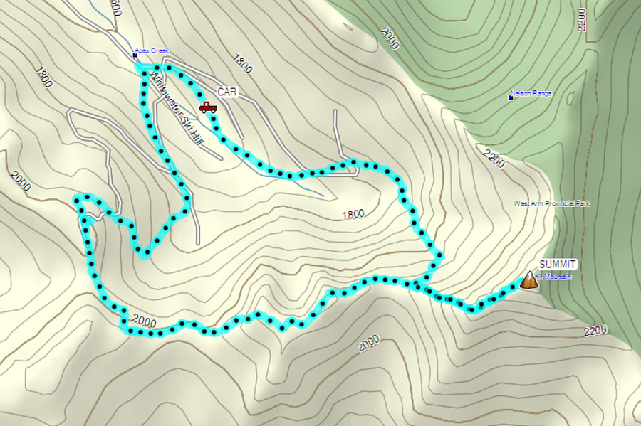
This should have been a much shorter trip than it turned out to be. Total Distance:  10.1 kilometres
Round-Trip Time:  8 hours 23 minutes
Cumulative Elevation Gain:  994 metres

GPX Data