BOU AVENUE
Blue Mountain And Screwdriver Ridge
On 23 August 2021, Zosia Zgolak and I headed to the Pincher Creek area in southwest Alberta to hike up Blue Mountain and Screwdriver Ridge.  These unofficially-named foothills were brought to our attention by Dave McMurray who did all the legwork, so to speak, of exploring the area and publishing route information.  With a so-so weather forecast in the main ranges further west, these foothills were an ideal choice for a non-committing but still rewarding ramble.

From Highway 507, turn west onto Township Road 6-2A 1.2 kilometres north of the junction with Highway 774 or 13.0 kilometres south of the junction with Highway 3.  Drive 2.9 kilometres and turn right onto a gas well access road.  Drive 350 metres and park in a small pullout before a gate which should be locked.  If the gate is open, resist the temptation to drive further.  Public motorized vehicles are prohibited beyond the gate.

Starting from the gate which was open when we arrived, Zosia and I walked north on the gas well road for about a hundred metres until we reached three white pipeline signs.  Leaving the road here, we headed west and found the nice double-track used by McMurray for one of his descents off Blue Mountain.  This double-track led us to a T-intersection on the forested lower slopes of Blue Mountain's southeast ridge.  Had we turned left here, we would have easily gained the crest of the ridge without fuss.  Instead, we mistakenly turned right and soon ended up in a large clearing which is actually a dead end of sorts since access to the ridge crest is blocked by bushes and trees.  Too lazy to backtrack, we simply thrashed through the bushes--we startled a moose here--until we reached more open slopes higher up.  Once we gained the crest of the ridge, we simply followed it northward to the summit of Blue Mountain.  Some easy scrambling and route-finding are necessary to progress up the mostly rocky ridge, but difficulties are few.
You only need to walk 100 metres along the road anyway!

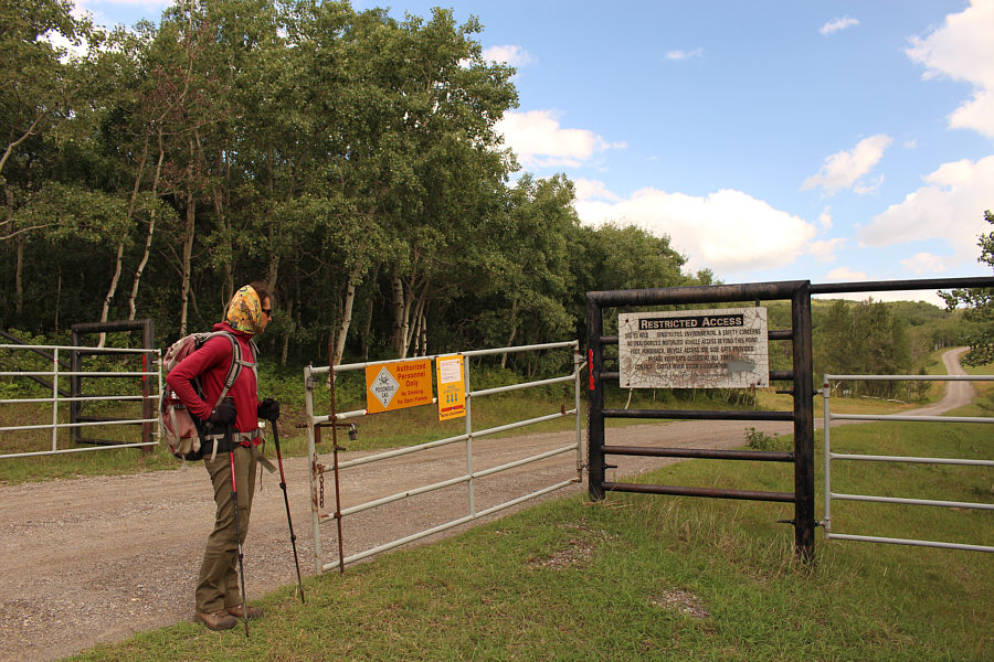
The gate along the gas well road is open, but it is imperative not to drive or park beyond here. 

Just in case you missed the first sign, there are two more signs to warn you about the gas pipeline here! 
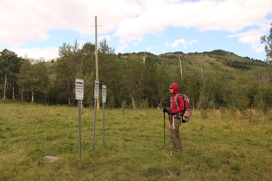
This trio of pipeline signs marks the start of a double-track heading into the forest behind Zosia.  The southeast ridge of Blue Mountain is visible in the background.
Take a left at the next intersection...trust me!

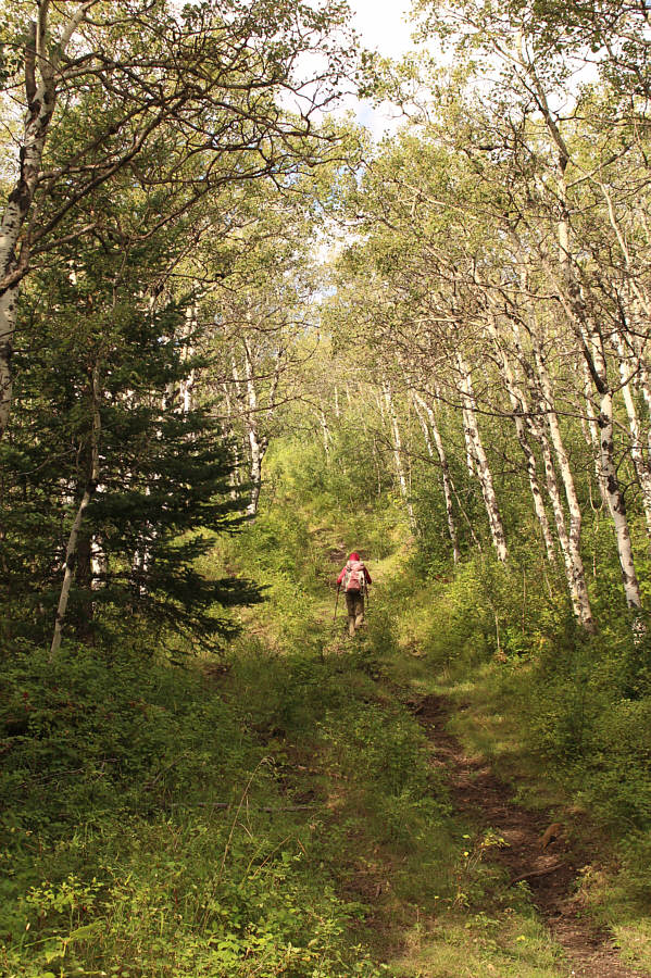
Zosia climbs up the double-track in the forest.

Oh well, just suck it up, I guess! 
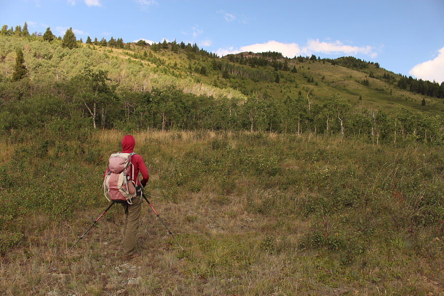
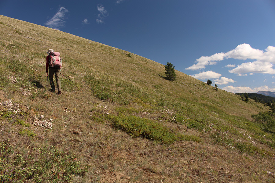
After taking a wrong turn at a T-intersection, Zosia is faced with a bushy ascent up to the ridge.
Watch for hidden moose here! 
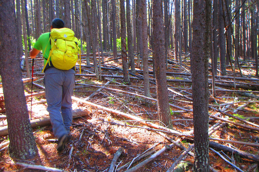
Sonny thrashes through a short stretch of bushy forest.

Photo courtesy of Zosia Zgolak

Ta da! 
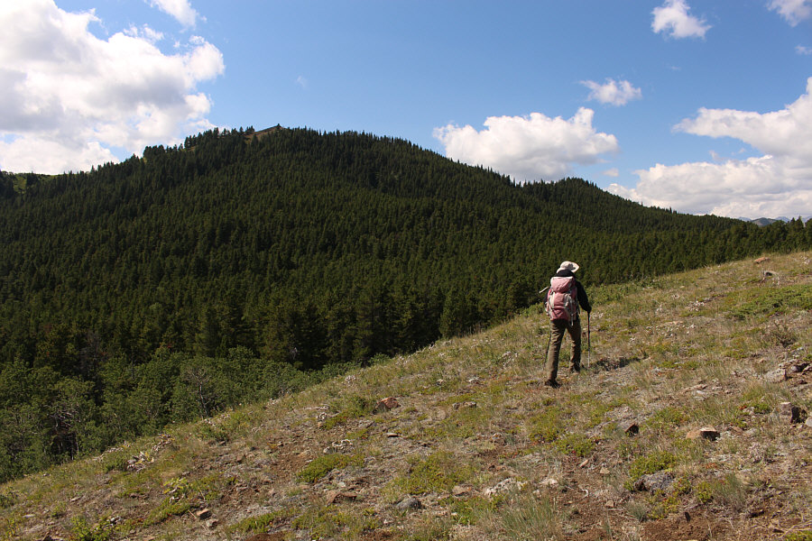
Zosia gains the crest of Blue Mountain's southeast ridge.
Mind the mud hole! 
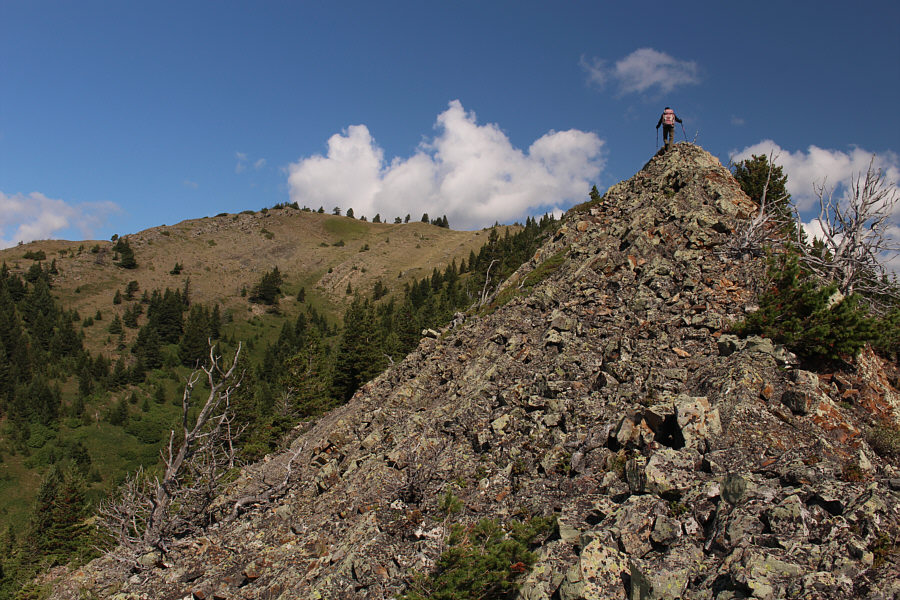
Zosia gets her first clear look at the top of Blue Mountain.
It took us about 90 minutes to climb up Blue Mountain. Zosia climbs up the final section before the summit.
We forgot to wear something blue today! 
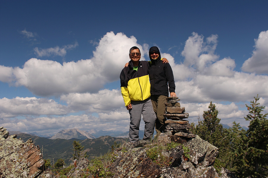
Sonny and Zosia stand on the summit of Blue Mountain (1719 metres).
It's 2.1 kilometres away as the crow flies. 
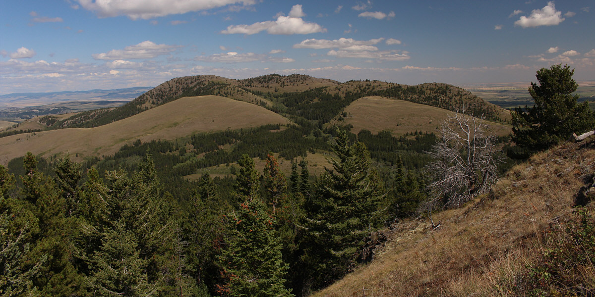
Screwdriver Ridge is at right in this view to the southwest.
After taking a short break at the summit of Blue Mountain, Zosia and I descended a semi-open ridge to the southwest with intentions of traversing to Screwdriver Ridge.  We had no significant issues until we crossed an old exploration road about halfway through the traverse.  At this point, we bushwhacked a bit to get around the south end of an intervening grassy bump before contouring northward to connect with a forested rib coming down the northeast side of Screwdriver Ridge.  This forested rib is a bit of a mixed bag with some easy terrain interspersed by scrubby undergrowth or toothpick deadfall.  With some good route-finding, we avoided getting too tangled up during our ascent, and after a final steep push, we popped out onto the open crest of Screwdriver Ridge.  We tagged all three distinctive bumps on the ridge crest before stopping for another short break.

For our return, Zosia and I descended the forested rib we came up, but we veered a little too far north and had to climb a bit to get back to our original track.  As we went back around the intervening grassy bump, we stayed further south and endured another short stretch of bushwhacking before climbing up the open west-facing slopes of Blue Mountain's southern outlier.  We eventually hiked over the top of the outlier before traversing with some difficulty across a drainage to get back to Blue Mountain's southeast ridge.  Once there, we descended past where we first gained the ridge crest and found the terminus of the T-intersection's left-hand fork that we had missed earlier in the day.  The remainder of the hike back to the gas well road was quick and easy.  Incidentally, the gate was locked shut when we returned to my car.
Looks like a bone.

Something on the ground catches Zosia's eye as she heads cross-country toward Screwdriver Ridge.

We've got some work ahead of us...

After contouring around an intervening bump, Zosia heads right aiming for a forested rib coming down from the crest of Screwdriver Ridge.

The bushwhacking here was not bad.

 Sonny steps over some toothpick deadfall while ascending Screwdriver Ridge.

Photo courtesy of Zosia Zgolak

It was a lot of work to get here!

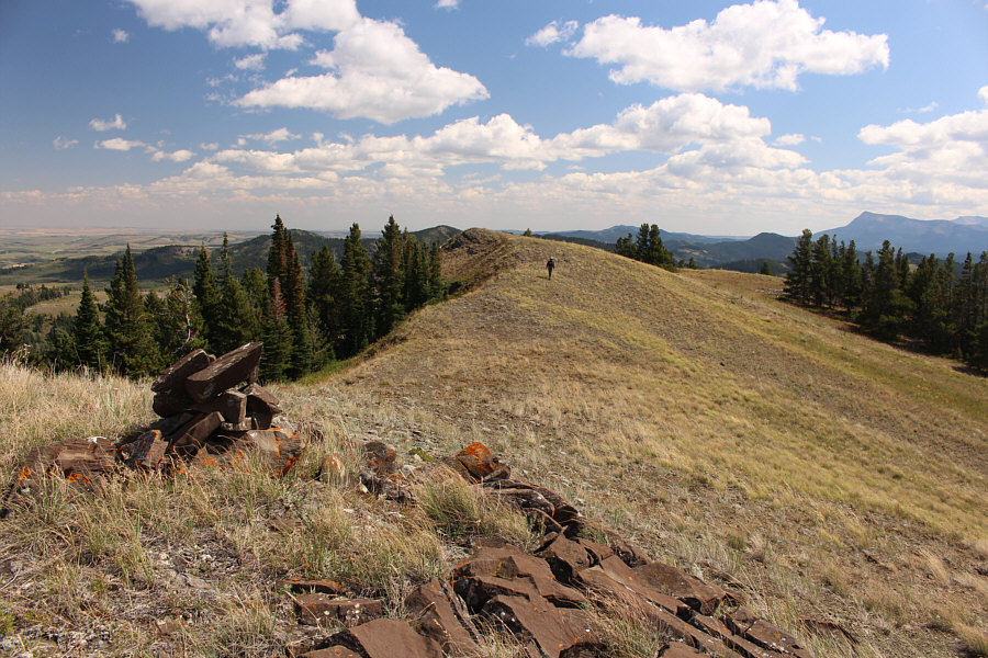
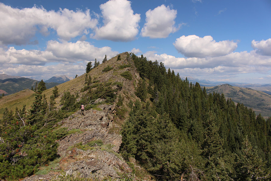
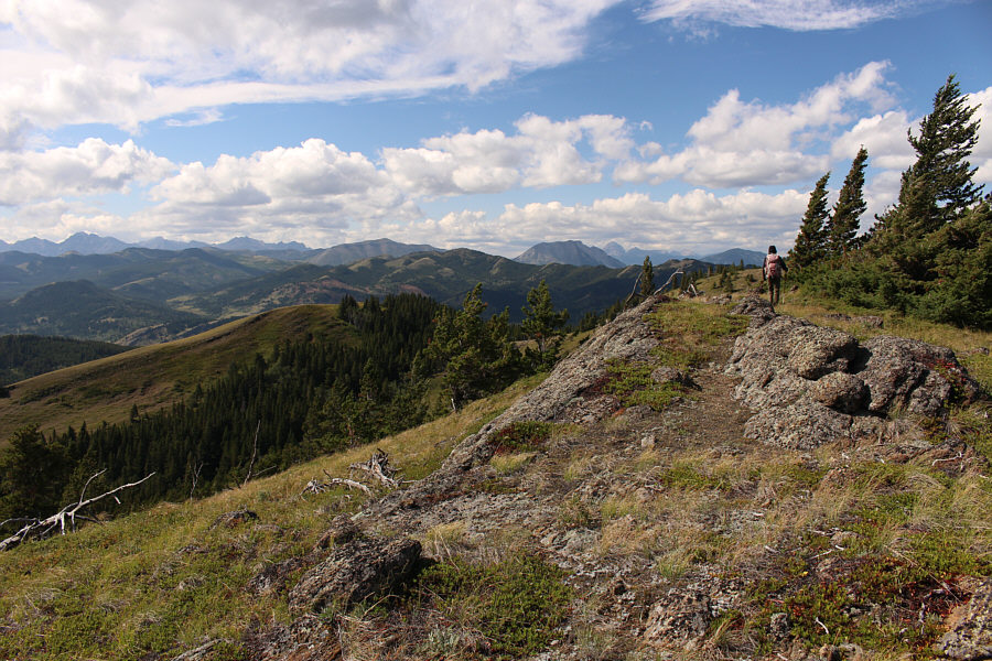
Zosia hikes along the crest of Screwdriver Ridge.

Was it worth it? Hmmm...

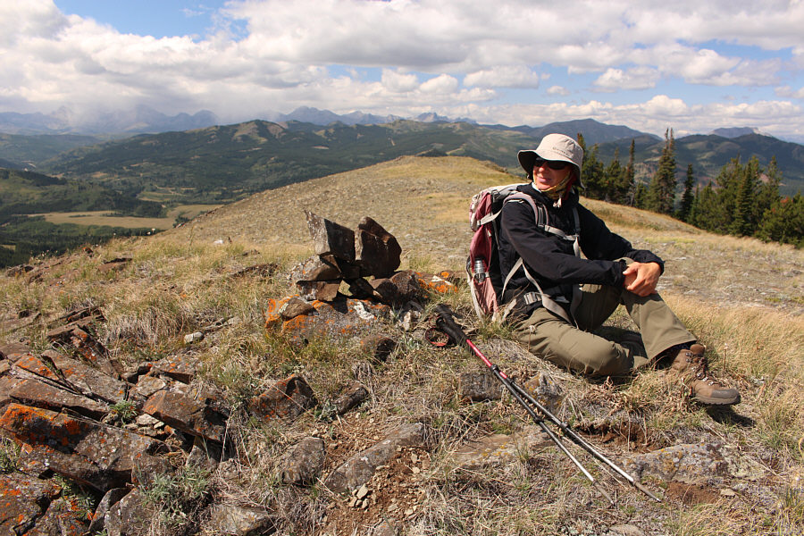
Zosia relaxes on the high point of Screwdriver Ridge (1685 metres).

Doesn't look very blue to me!

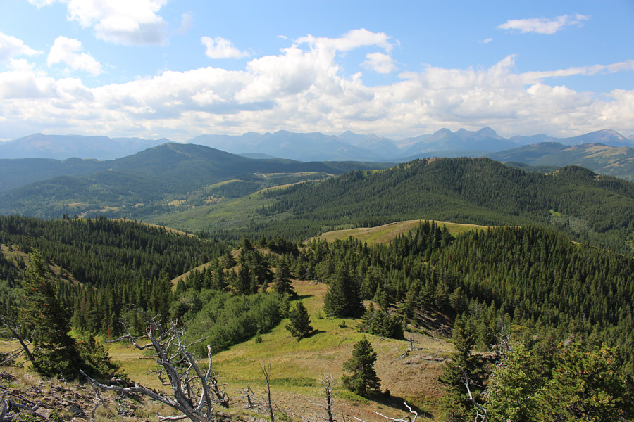
This is the view of Blue Mountain from Screwdriver Ridge.


We're not done yet!

Zosia climbs up a grassy slope on the way back to Blue Mountain.

So long, Screwdriver Ridge! We won't be back!

Here is a look back at Screwdriver Ridge from Blue Mountain.


We should have just come here instead of Screwdriver Ridge! Zosia hikes over the top of Blue Mountain's southern outlier.
Best scrambling of the day! Sonny scrambles back up to the crest of Blue Mountain's southeast ridge.

Photo courtesy of Zosia Zgolak

The enamel on the teeth still looks good!

Here is a close-up of some teeth on the bleached jaw bone of a cow.


The hip bone connected to the...leg bone...

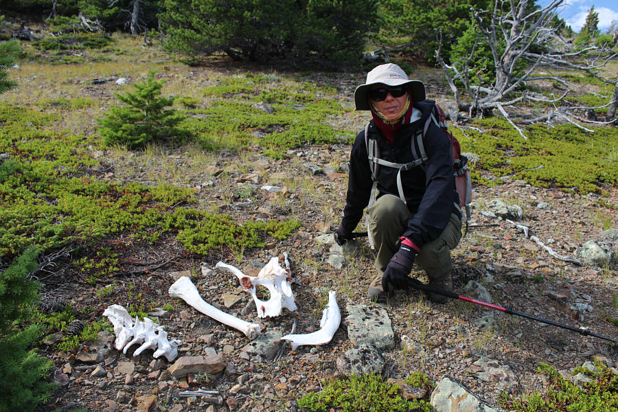
Zosia finds more bones scattered on the ridge.

A nice front-country trip when weather further west is not so nice. 
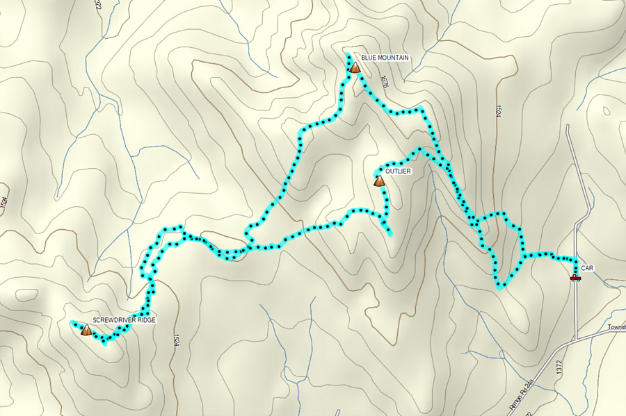
Total Distance:  11.0 kilometres
Round-Trip Time:  6 hours 41 minutes
Cumulative Elevation Gain:  977 metres

GPX Data