BOU AVENUE
Centre Mountain
Kicking off a Labour Day long weekend
camping trip, Andrea Battistel, Shaun Luong, Zosia Zgolak and I ascended
Centre Mountain in the Flathead region of southeast British Columbia on 4
September 2021. A non-technical route up the west ridge is
described by the late Rick Collier in
bivouac.com.
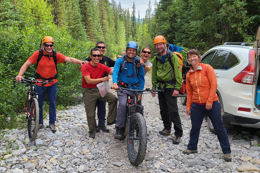
Joining us only for the day were Brad Duska, Rafal (Raff) Kazmierczak,
Dave McMurray and Andrew Nugara. They would use a different access
by riding bicycles over Flathead Pass, but since it was too difficult to
coordinate timings, we agreed to simply rendezvous somewhere up on the
mountain.
From Highway 3, turn east onto Morrissey Road about 8.8 kilometres
south of the turnoff to Fernie Ski Resort or 17 kilometres east and north
of the junction with Highway 93. Cross both the bridge over Elk
River and the train tracks before turning right at a T-intersection.
Stay on Morrissey Road and keep right at a split about 3 kilometres south
of the T-intersection (there is a cut-off road 560 metres further along
the left fork if you miss this split). From the split, drive 9.1
kilometres along Lodgepole Forest Service Road (FSR) to a junction with Wigwam FSR.
Stay left and drive 17 kilometres to a junction with McLatchie FSR.
For the most direct route, turn left onto McLatchie FSR and drive 15
kilometres to a junction with Flathead FSR (I did not drive this way and
cannot comment on the viability of McLatchie FSR). Alternatively,
stay on Lodgepole Road and drive 15 kilometres to a more southerly
junction with Flathead FSR (a big sign here reads "Sasquatch Junction").
Turn left and drive north for 19 kilometres to reach the aforementioned
junction with McLatchie FSR (there are a couple of free rustic
campgrounds along this stretch of road). From the junction with
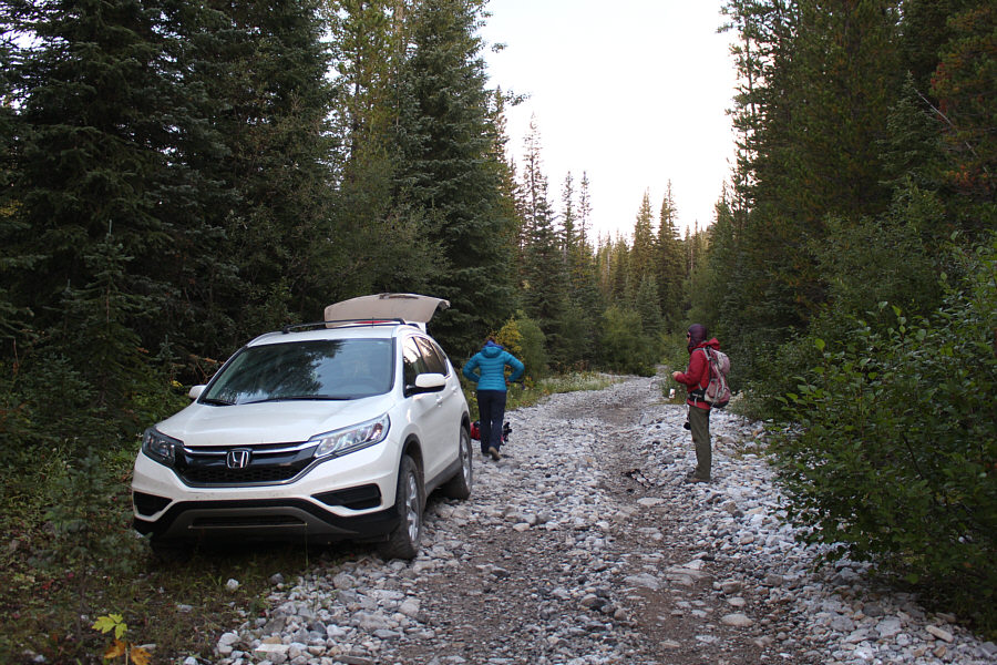
McLatchie FSR, drive north on Flathead FSR for about 4.7 kilometres and
park before a damaged bridge (49.412930, -114.640780) which crosses a
creek emanating from the basin north of Centre Mountain. The
condition of Flathead FSR deteriorates considerably past the junction
with McLatchie FSR, and a high-clearance vehicle is strongly recommended.
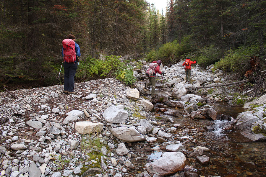
From where we parked, Andrea, Shaun,
Zosia and I crossed the damaged bridge and walked along the road for
about two hundred metres looking for any signs of human passage.
Finding none, we returned to the bridge and followed the creek upstream
for about half a kilometre before finally biting the bullet and
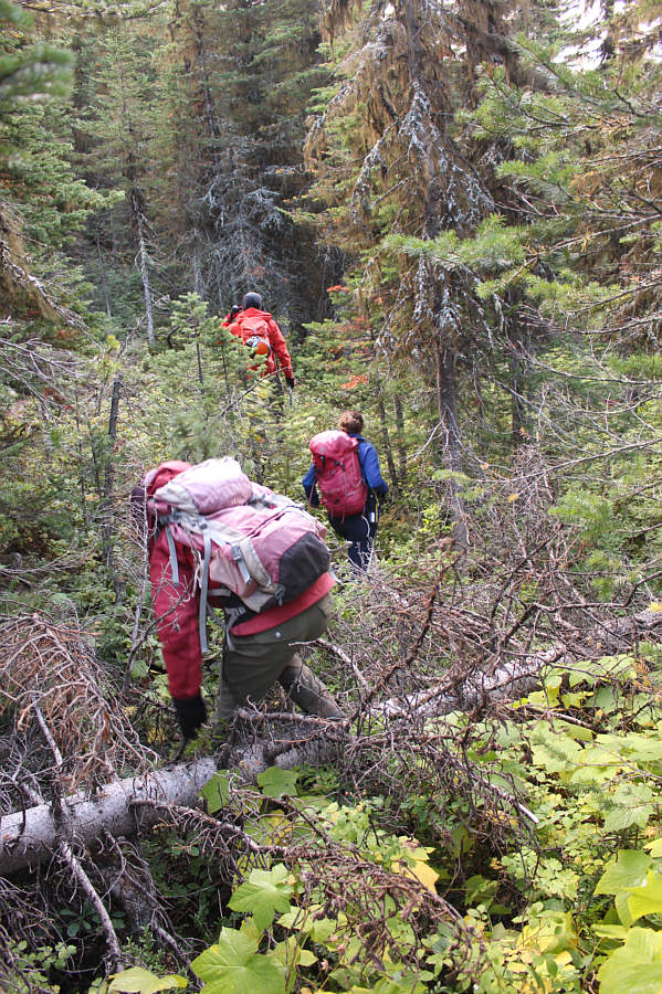
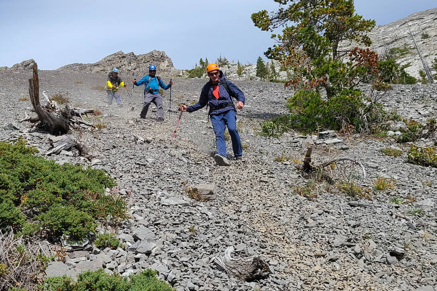
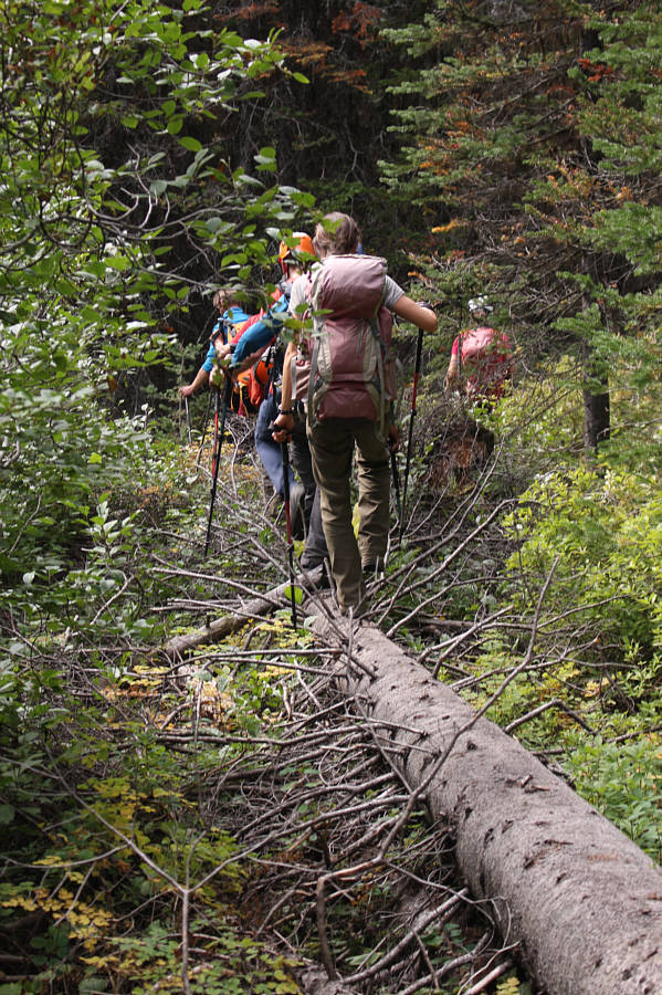
bushwhacking uphill. The vegetation is moderately thick on the
lower slopes but not terribly bad. On our way up, we passed through
a couple of large glades strewn with rubble presumably from ancient
landslides. When we reached tree line a little over ninety minutes
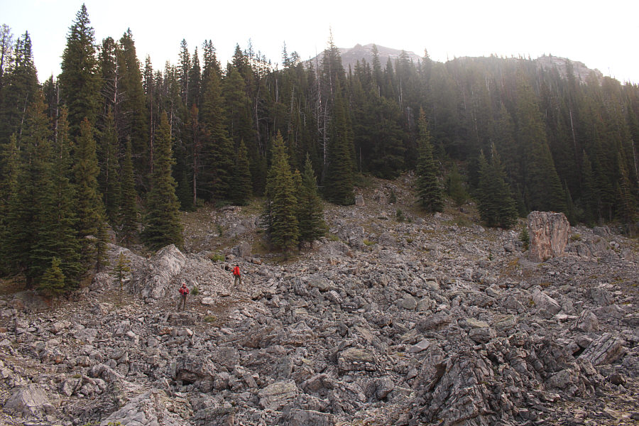
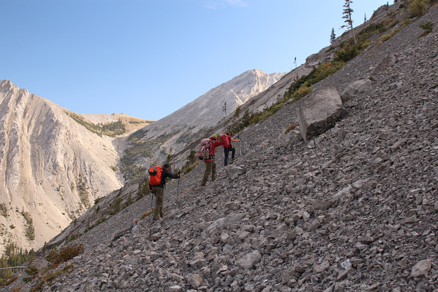
after starting out, we were faced with a huge slope of treadmill scree.
Initially, we tried traversing to climber's left in hopes of finding more
stable terrain to climb up, but ultimately, we were forced to grovel up
the loose rocks until we reached a prominent rock outcrop where the
footing was more reliable. From there, the west ridge becomes more
well-defined and easier to climb, and we had no significant problems
scrambling up to a false summit.
Beyond the false summit, there are a couple of drop-offs which add
significant challenge to the route. The first one is more difficult
and entails an exposed down-climb of about twenty metres; this is the
crux. Andrea, Shaun, Zosia and I slithered down a series of ledges
to skier's right, and although the rocks here are loose, the exposure is
not as bad as on the ridge crest. Brad, Raff, Dave and Andrew
caught up to us here, and while most of them opted to follow the same
line down, Dave stuck to the ridge crest and successfully down-climbed
it. Further along the ridge is a second drop-off which is shorter
but also tricky to descend. Fortunately, we all made it through
without incident and finished the ascent with an easy walk up to the
summit. It is interesting to note that in his trip report, Collier
describes these drop-offs as "minor scrambly spots...but nothing
serious". We were blessed with great weather on this day and hung
out on the summit for well over an hour.
Based on Collier's report of "serious
bushwhacking for 2.5 km" when he chose an alternate descent route
directly south of the summit, all eight of us agreed that it would be
better to simply retrace our steps back down the mountain.
Returning along the west ridge, we had a much easier time climbing up the
challenging drop-offs, and we had few difficulties going over the false
summit and descending to the prominent rock outcrop. At this point,
we followed the more direct route that Brad, Raff, Dave and Andrew had
taken on their ascent (they had stashed their bikes near my car and
started bushwhacking directly uphill from there). From the rock
outcrop, we veered a bit to skier's left to descend a long rubble slope,
and with such a big group, we had to be extra careful to avoid raining
loose rocks down on each other. Some of the loose rubble were ideal
for surfing, and we were able to lose a lot of elevation quickly.
Inevitably, we had to re-enter forest and suffer some more bushwhacking,
but both Shaun and Dave did a great job of leading us through this
section with minimal grief. We eventually popped out of the forest
almost right beside my car. After Brad, Raff, Dave and Andrew
retrieved their bikes, they took leave of the rest of us and rode north
to return to their respective vehicles. Andrea, Shaun, Zosia and I
piled into my car for the bumpy drive south back to our campsite where we
would have dinner before retiring for the night.
Be sure to check out Dave's
trip report.
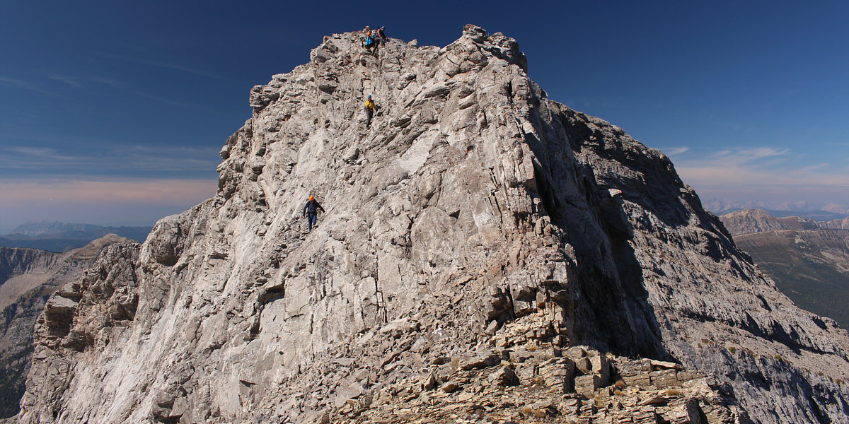
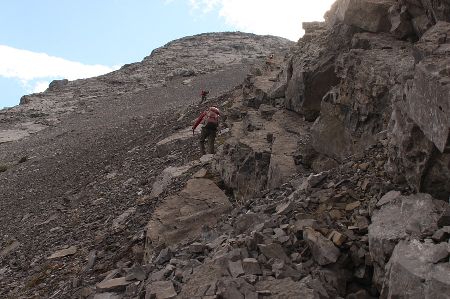
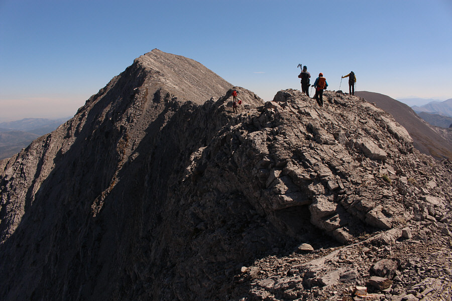
This is a more comprehensive view of the crux with
Brad, Andrew, Raff and Dave descending.
 |
Past the crux, there is at least one
more shorter but tricky down-climb along the west ridge before the
summit. |

Gathered on the summit of Centre Mountain (2595 metres)
are (top L to R) Dave, Andrew, Brad, Raff, (bottom L to R) Shaun, Zosia,
Andrea and Sonny.
 |
To the northwest is Limestone Ridge,
the highest point of which is at left and is known unofficially as
Barnes Peak. |
 |
Many of the peaks to the north along
the Continental Divide are officially unnamed. |

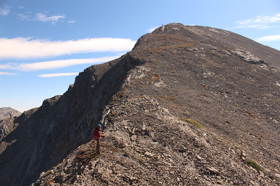
The big group heads back along the west ridge.
 |
Shaun, Andrea and Raff wait on the
false summit as Zosia carefully negotiates an exposed section along
the ridge. |

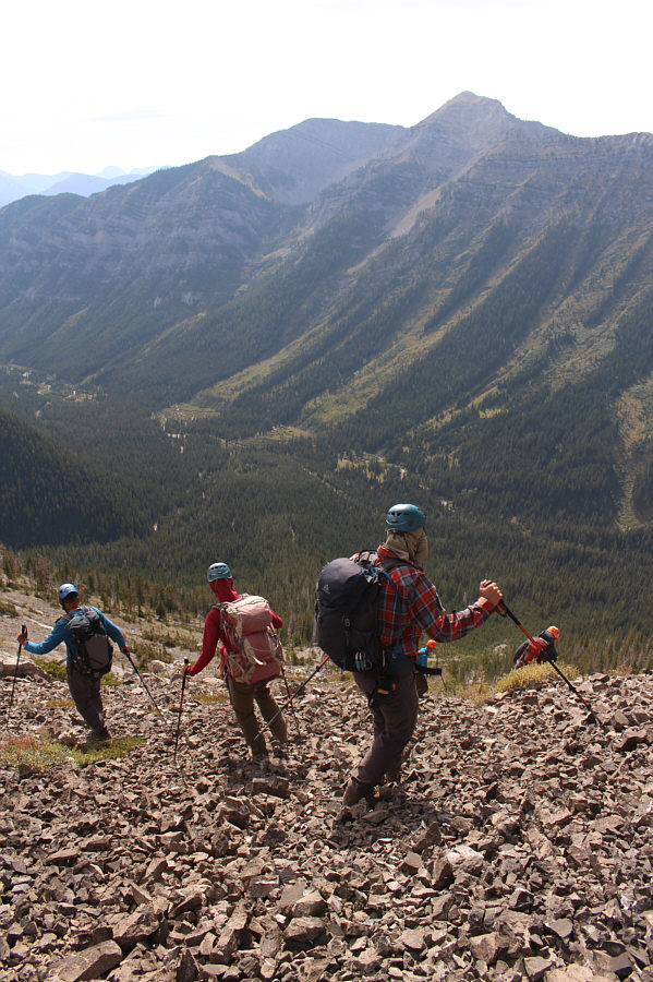
After climbing back over the false summit, the big group carries on down
the ridge.