BOU AVENUE
The Monarch
On 24 July 2021, Zosia Zgolak and I climbed
The Monarch located on the boundary between British Columbia's Kootenay
National Park and Mount Assiniboine Provincial Park. An ascent
route is described in Alan Kane's Scrambles in the Canadian Rockies
(3rd edition), but a more concise resource would be Vern Dewit's
excellent 2016
trip report.
Admittedly, I did not pay close enough attention to the details in
Dewit's trip report since I put my full trust in Kane's usually reliable
route descriptions, but as a result, we ended up experiencing some of the
same pitfalls that befell Dewit and his group.
Starting from the east end of Sunshine Village ski resort's parking lot
in Alberta's Banff National Park, Zosia and I hiked the well-maintained
trail along Healy Creek to the signed turnoff to Simpson Pass.
Turning south and crossing a foot bridge, we climbed up to the provincial
boundary at Simpson Pass, but instead of crossing over into British
Columbia, we followed the trail leading to Healy Pass for about 600
metres until we reached a signed junction for Eohippus Lake.
Turning south again, we finally crossed the provincial boundary and
entered Mount Assiniboine Provincial Park. Although Kane mentions
the possibility of taking an off-trail short cut to reach the north ridge
of The Monarch, we opted to stay on the trail and hike all the way to
Eohippus Lake since Zosia had always wanted to go there. Upon
reaching the lake, we worked our way westward along the north shore
aiming for gentle slopes leading to the north ridge of The Monarch which
is also the boundary with Kootenay National Park. From the crest of
the north ridge, it is necessary to lose nearly 200 metres of elevation
(Kane erroneously suggests that it is only a loss of about 100 metres) to
reach the base of a fairly wide gully granting access to the upper
mountain. Regretfully, we made the mistake of descending rubble
slopes close to the northern walls of The Monarch. The terrain here
is unpleasantly steep and loose, and our progress was cautiously slow.
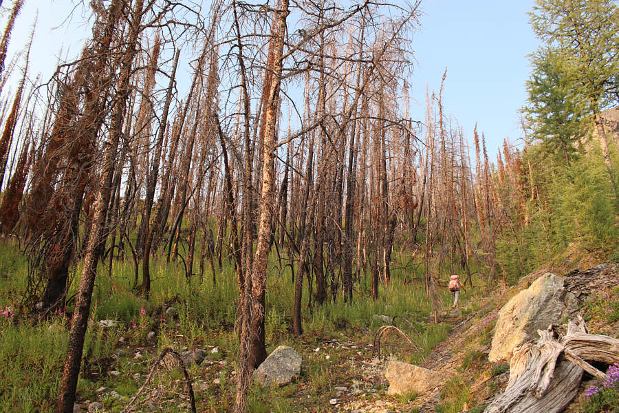
As noted by Dewit, a better option would have been to follow the edge of
a fire-ravaged forest a little further north.
In any case, Zosia and I made
it down in one piece and proceeded to climb up the access gully which was
still mostly choked with snow. Although the
snow was ideal for kicking steps, the gully is steep enough to make
ascending with crampons a must. Even then, it felt a bit awkward
and wearying front-pointing straight uphill, and we zigzagged much of the way
up the gully. More unnerving was the fact that we were vulnerable to rockfall
while in the gully, and we had a near miss when several
rocks about the size of dinner plates came crashing out of a side chute
just above us. Fortunately, we were able to dodge the shower of
rocks, but we then climbed the final few meters of the gully with a bit
more urgency in an effort to get to safer ground more quickly.
Once we cleared the gully, Zosia and I
ditched our crampons and proceeded up a long scree slope which bends left
around a tapering cliff band. After the nerve-racking ascent of the
snowy gully, it felt strangely relaxing to slog up some good old
treadmill scree. Higher up, we veered a little further to climber's
left to find more stable terrain, and we made good progress up the north
ridge to the base of the summit block. Just as Dewit lamented, the
remaining scramble up the summit block is far less trivial than Kane
suggests. Some route-finding is necessary to figure out the easiest way
up, and the crumbly rocks here are touchy to say the least. With
some careful persistence, we muddled our way up to the summit cairn
without any mishaps. It had taken us a whopping 10.5 hours to
ascend The Monarch.
Well aware of the lateness of the day, Zosia
and I stopped on the summit for only 20 minutes before commencing our
descent. We slowly down-climbed the tricky summit
block, but once we cleared the most difficult sections, we took advantage
of the abundant loose scree on this mountain to expedite our descent.
Ironically, the wildfire smoke which robbed us of what should have been
splendid summit views also protected us immensely from getting baked by
the sun. As such, the long stumble back to our crampons did not
feel so unbearable. Donning our crampons again, we re-entered the
gully and descended as quickly as we could to avoid more rockfall.
Due to the steepness of the snow in the gully, we never felt comfortable
enough to attempt glissading, and instead, we simply walked back down the
way we came up. At one point, I tripped over my own crampons and
went for a brief tumble, but luckily, I was able to stop myself from an
uncontrollable slide. We had no other accidents in the gully, and
at the base, we removed our crampons for good.
From the base of the gully, Zosia and I
dropped further down before crossing more rubble to reach the
aforementioned fire-ravaged forest. We then began a long climb back
up to the north ridge of The Monarch via the forest's edge. With
very little bushwhacking or ankle-breaking rubble present, this is indeed
a far superior route than the descending traverse we took earlier in the
day. Nevertheless, the 200-metre re-ascent of the north ridge still
felt a bit dispiriting to me especially at this late stage of the trip.
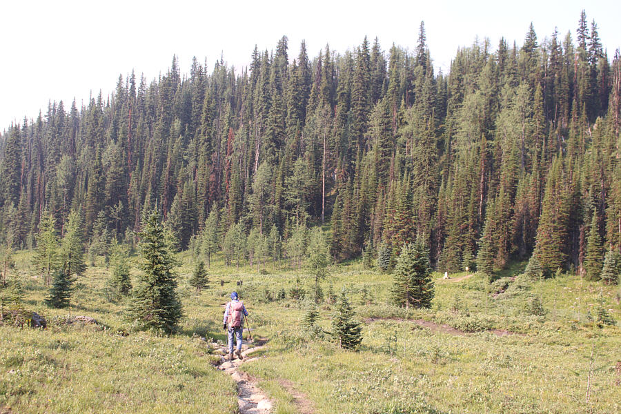
After cresting the ridge, we descended partway back toward Eohippus Lake
before taking a short cut down to a hidden meadow. We subsequently
headed northeast and circled around the shore of some unnamed
tarn before regaining the Eohippus Lake trail in waning daylight.
The ensuing hike out in the dark took us another three hours but was
otherwise uneventful.
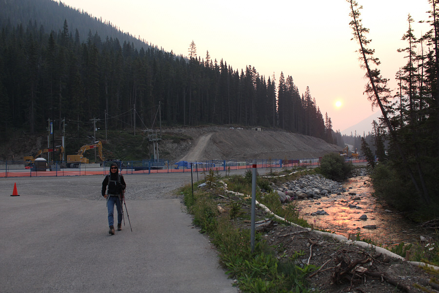 |
The sun is up already as Zosia starts the trip by hiking across Sunshine
Village Ski Resort's parking lot which is under construction. |
 |
The creek bed under this foot bridge
near the Simpson Pass turnoff is dry on this day. |
 |
Zosia arrives at Simpson Pass. The trail to Eohippus Lake (and
Healy Pass) enters the forest beside a provincial boundary marker at
right. |

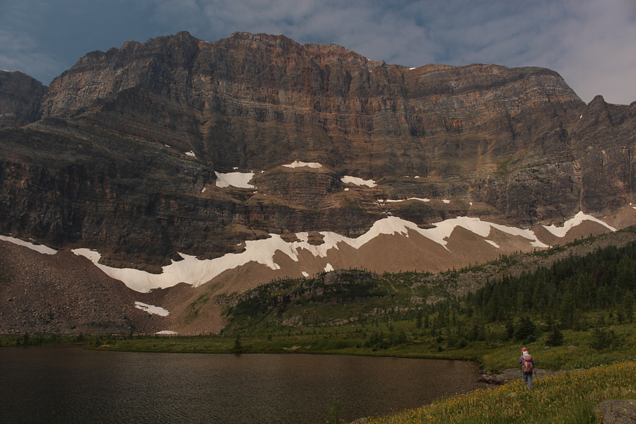
Here is one of the first clear views of The Monarch
from an unnamed lake in Mount Assiniboine Provincial Park.
 |
Monarch
Ramparts stretch away to the north across the same unnamed lake. |
 |
Zosia makes her way around the north shore of Eohippus Lake below the
impressive east face of The Monarch. |
 |
This is looking back down on Eohippus Lake from gentle slopes leading to
Monarch Ramparts. |
 |
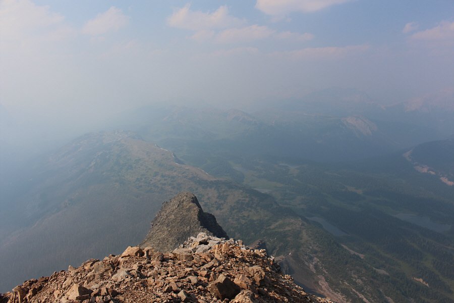
The ridge ahead is the low point between The Monarch and Monarch
Ramparts. |
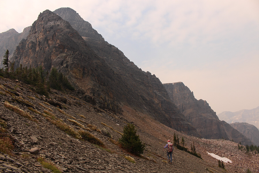 |
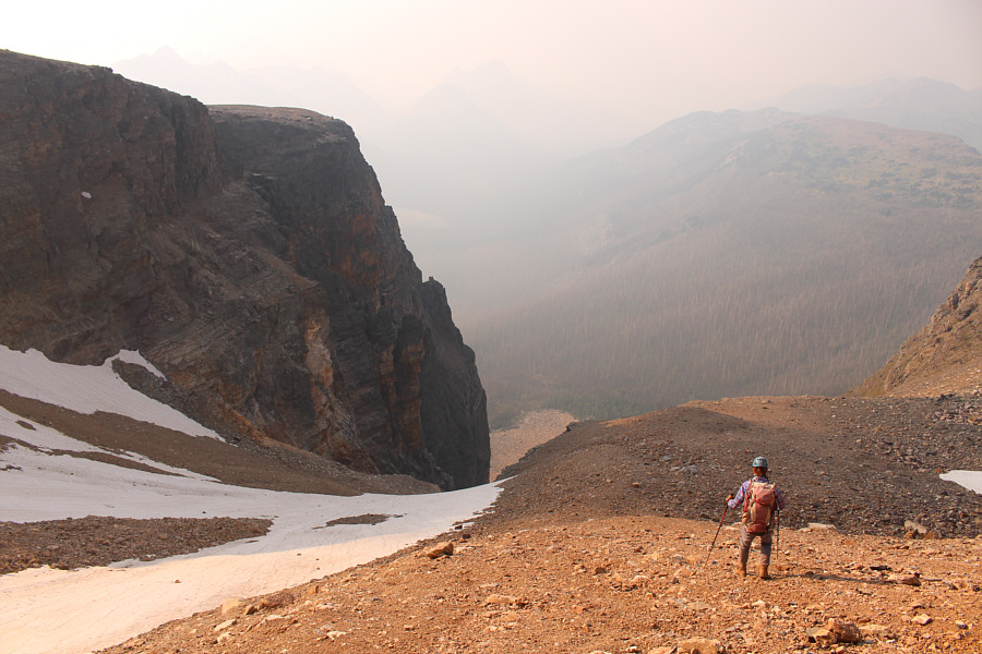
Zosia begins dropping down past the north ridge of The Monarch. |
 |
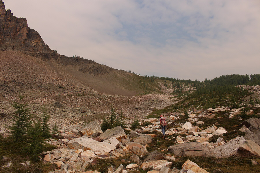
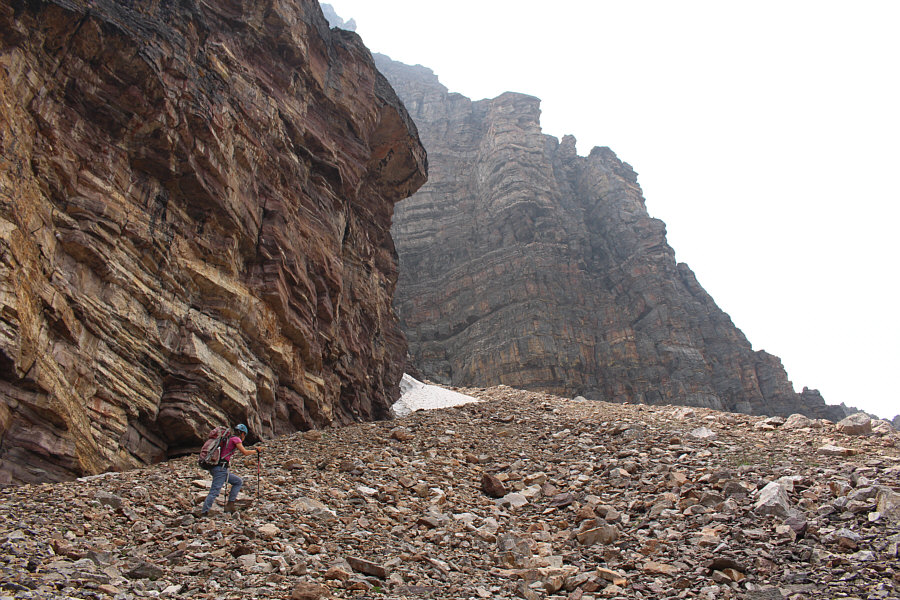
Sonny finds the uneven rocks here tedious to walk on.
Photo courtesy of Zosia Zgolak |
 |
The looseness of the rocks below The Monarch's north ridge make the
descending traverse less than trivial. |
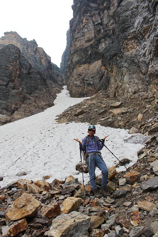 |
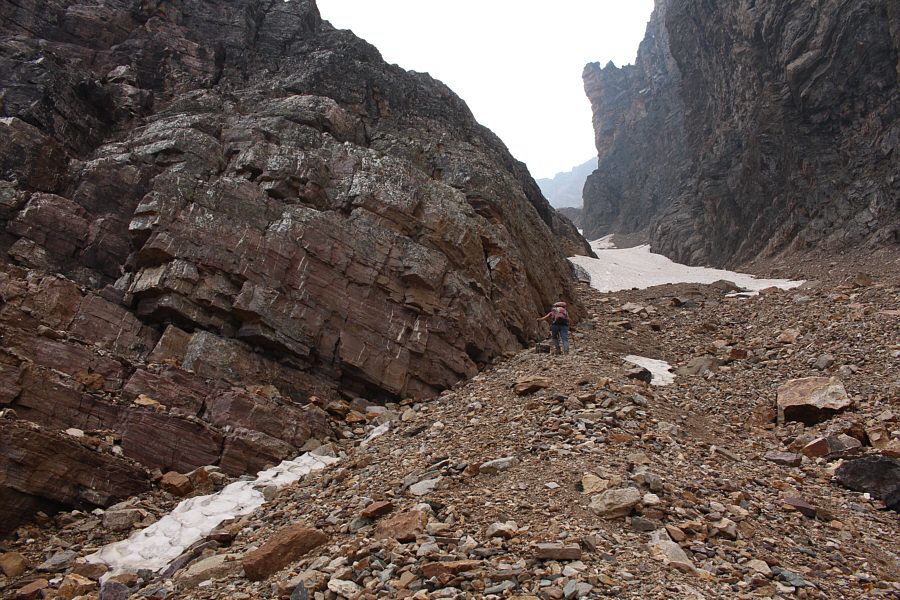
This is not the correct gully to go up. |
 |
Zosia approaches the correct access gully. |
 |
Zosia enters the access gully. |
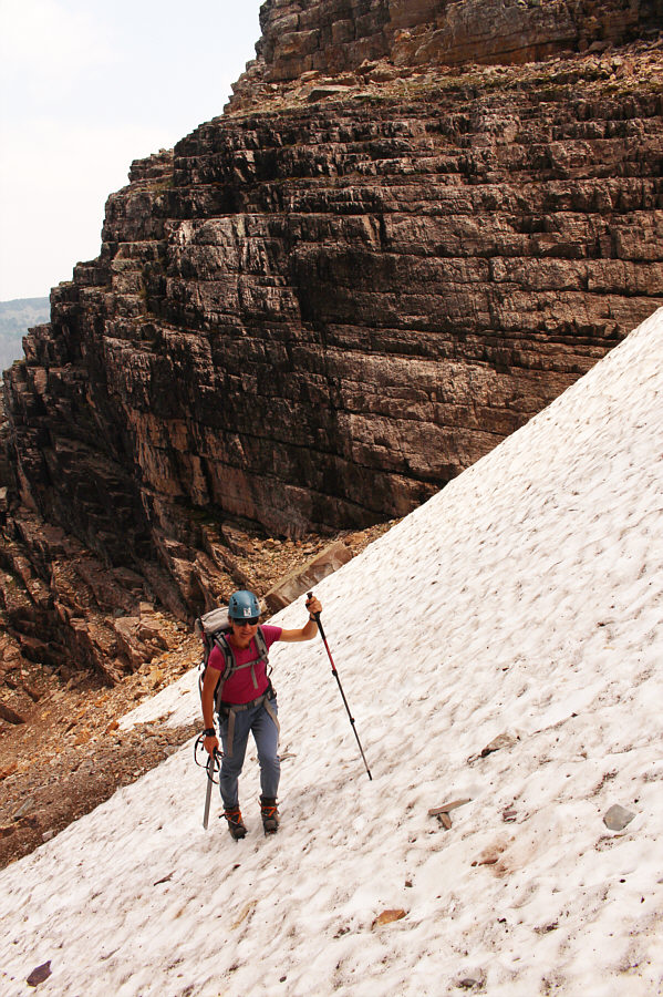 |
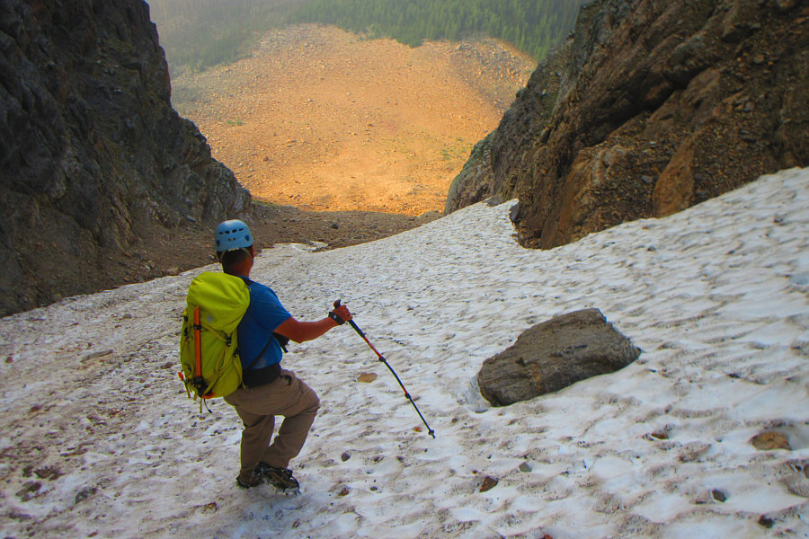
After donning crampons and taking out her ice axe, Zosia begins trudging
up the steep snow in the gully. |
 |
Climbing up the gully requires some vigilance as it is prone to dangerous
rockfall.
Photo courtesy of Zosia Zgolak |
 |
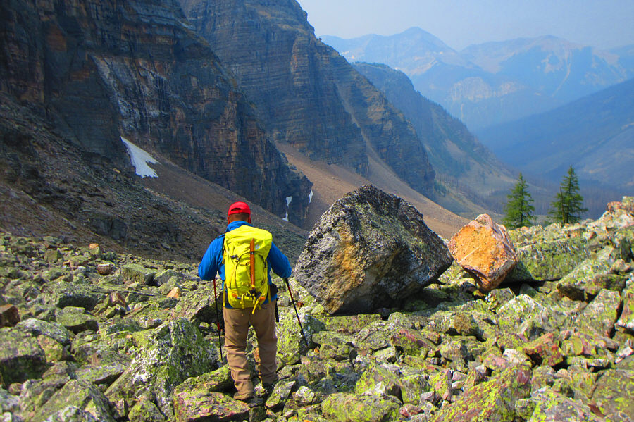
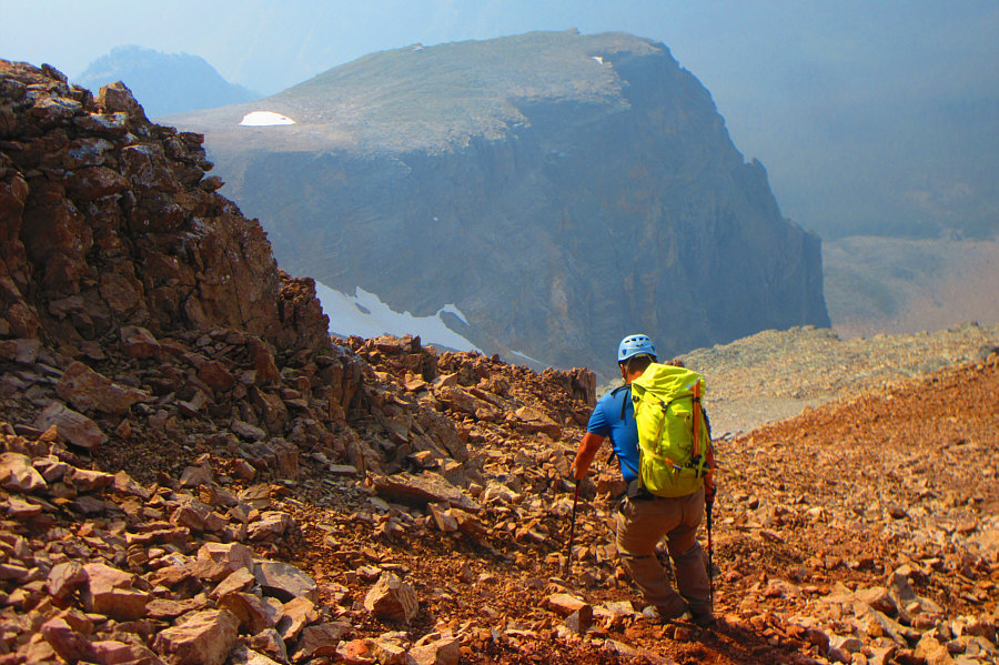
After clearing the gully and removing her crampons, Zosia proceeds up a
scree slope and will eventually angle up to the left. |
 |
The treadmill rubble here can be exasperating to ascend. More solid
scrambling can be found by going further left. |
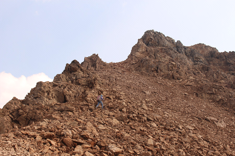 |
Zosia approaches the summit block of The Monarch. |
 |
Zosia scrambles up loose and exposed terrain on the summit block. |
 |
Zosia and Sonny take a breather on the summit of The Monarch (2892
metres). |
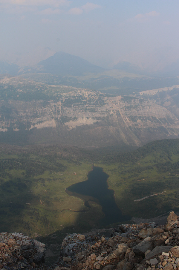 |
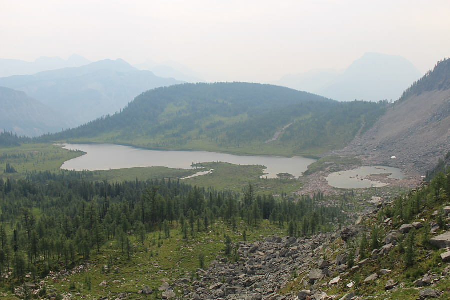
Here is the view of Eohippus Lake from the summit. Sunshine Meadows
can be seen further in the distance through the smoky haze. |
 |
Monarch Ramparts and several unnamed lakes are visible to the north. |
 |
Sonny takes advantage of the terrain's looseness to descend from the
summit.
Photo courtesy of Zosia Zgolak |
 |
A helicopter lands briefly on an outlier of The Monarch. Note the
figure wandering at the bottom of the photo.
Photo courtesy of Zosia Zgolak |
 |
Zosia makes her way back to the top of the access gully. |
 |
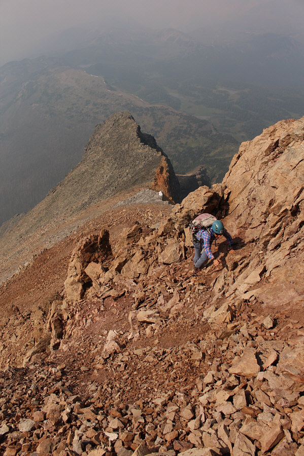
Sonny carefully descends the access gully.
Photo courtesy of Zosia Zgolak |
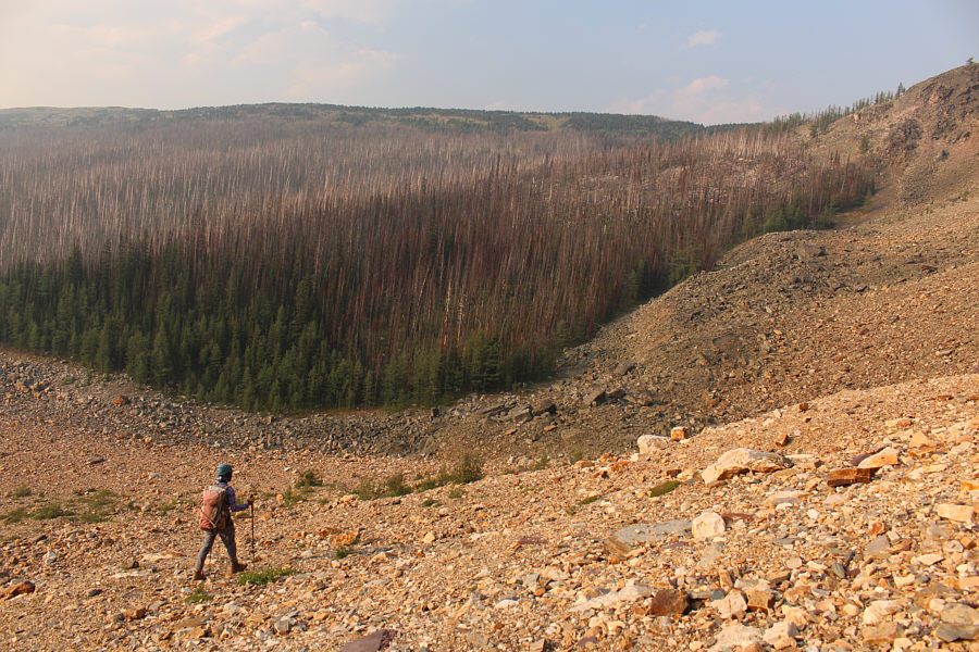 |
After exiting the gully,
Zosia aims to climb up the right edge of the fire-ravaged forest ahead. |
 |
The climb back up along the edge of the forest is straightforward. |
 |
Sonny takes a short cut back to the access trail for Eohippus Lake
(right).
Photo courtesy of Zosia Zgolak |
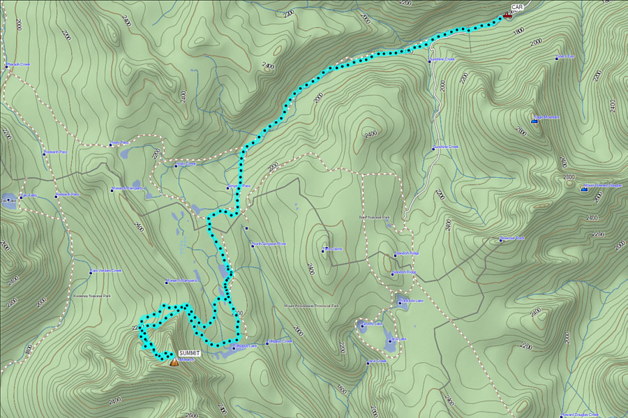 |
Total Distance: ~35 kilometres
Round-Trip Time: 18 hours 5 minutes
Cumulative
Elevation Gain: 1842+ metres
GPX Data |