BOU AVENUE
Packhorse Peak
Andrea Battistel, Shaun Luong, Zosia Zgolak and I climbed up Packhorse Peak in the Flathead region of southeast British Columbia on 5 September 2021.  I have had my eye on this peak for awhile especially since I knew of a relatively easy ascent route described by the late great Rick Collier in bivouac.com.  Given the remoteness of this peak, it makes sense to tackle it from a base camp set up in one of the BC Forest Service recreation sites in the vicinity.

From Highway 3, turn east onto Morrissey Road about 8.8 kilometres south of the turnoff to Fernie Ski Resort or 17 kilometres east and north of the junction with Highway 93.  Cross both the bridge over Elk River and the train tracks before turning right at a T-intersection.  Stay on Morrissey Road and keep right at a split about 3 kilometres south of the T-intersection (there is a cut-off road 560 metres further along the left fork if you miss this split).  From the split, drive 9.1 kilometres along Lodgepole Forest Service Road (FSR) to a junction with Wigwam FSR.  Stay left and drive 17 kilometres to a junction with McLatchie FSR.  Keep right and drive another 15 kilometres to a junction with Flathead FSR (a big sign here reads "Sasquatch Junction").  Turn north (left) and pass Upper Harvey recreation site (and the turnoff to Lower Harvey recreation site) in about 180 metres.  Continue driving another 3.7 kilometres to a bridge over Shepp Creek (Collier erroneously refers to this as "Sheep Creek").  We parked on the side of the road about 75 metres past the bridge, but a better starting point would be at the next curve another 275 metres further up the road which is where we would exit the forest at the end of the trip.

From where we parked, Andrea, Shaun, Zosia and I immediately left the road and dropped down a ramp to a rocky wash on the north bank of Shepp Creek.  We worked our way eastward through light bush for a little less than half a kilometre to reach Flathead River just north of its confluence with Shepp Creek.  After fording the river which was ankle-deep on this day, we crossed some dry flats before plunging into forest.  Route-finding is a bit complicated here due to the convergence of a couple of drainages, but the idea is to keep heading eastward aiming for an obvious gully curving up and directly to the summit.  Overall, the bushwhacking was not bad, but it did feel a bit prolonged since we took a rather convoluted route while trying to find the path of least resistance first through the forest and then later up a bushy avalanche slope.  Once we got higher, we veered over to a broad ridge to climber's left of the obvious gully.  Though steep, the broad ridge presents no technical difficulties, and we simply grinded uphill through thinning trees to the crest of Packhorse Peak's northwest ridge.  Upon gaining the northwest ridge, we took a short break before turning south (right) and hiking the remaining uncomplicated route to the summit.  Unfortunately, wildfire smoke marred much of the far-reaching views on this day, but blessed with very pleasant weather, we still hung out on top for one and a half hours.

For our descent, Andrea, Shaun, Zosia and I backtracked to the northwest ridge and easily descended the broad ridge we came up.  Eventually, thick vegetation forced us to abandon the ridge and thrash our way down the bushy avalanche slope we ascended earlier in the day.  As mentioned before, the route-finding in the forest at the foot of the mountain can be tricky, and we almost went in a circle at one point before making a course correction.  Much to our relief, we finally emerged onto the dry flats, and we were soon crossing back over Flathead River.  Back on the west side of the river, we stumbled onto a trail which makes a beeline for the road.  The trail does not quite reach the road itself, but we were close enough to get there by scrambling up a short but steep embankment and thrashing through a brief stretch of forest.  A short walk along the road brought us back to my car.
Off-trail hiking already! That doesn't bode well...

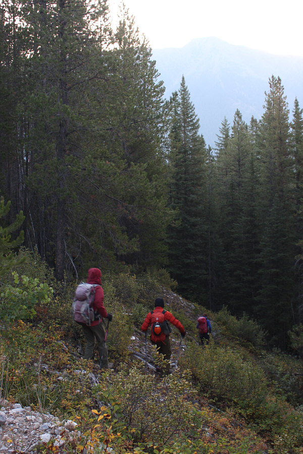
Zosia, Shaun and Andrea drop down an embankment beside the Forest Service Road at the start.

Andrea used neoprene socks while I used hip waders. 
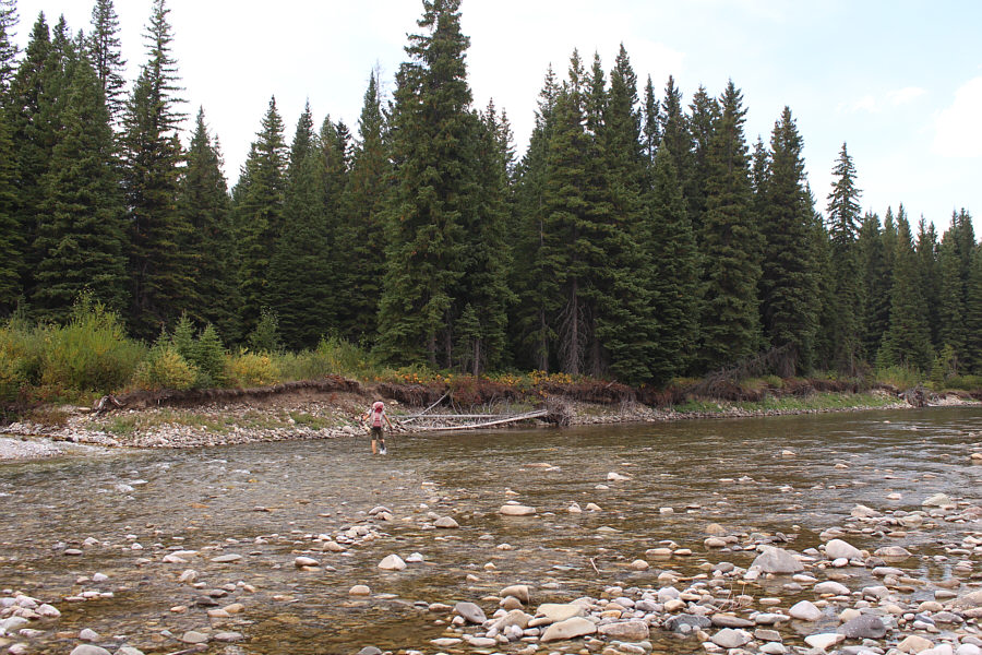
Andrea and Sonny ford Flathead River.

Photo courtesy of Zosia Zgolak

Shaun is not used to fording rivers this early! Shaun is careful with his footing as he crosses Flathead River.
Some of the bushwhacking is not bad; some of it sucks. 
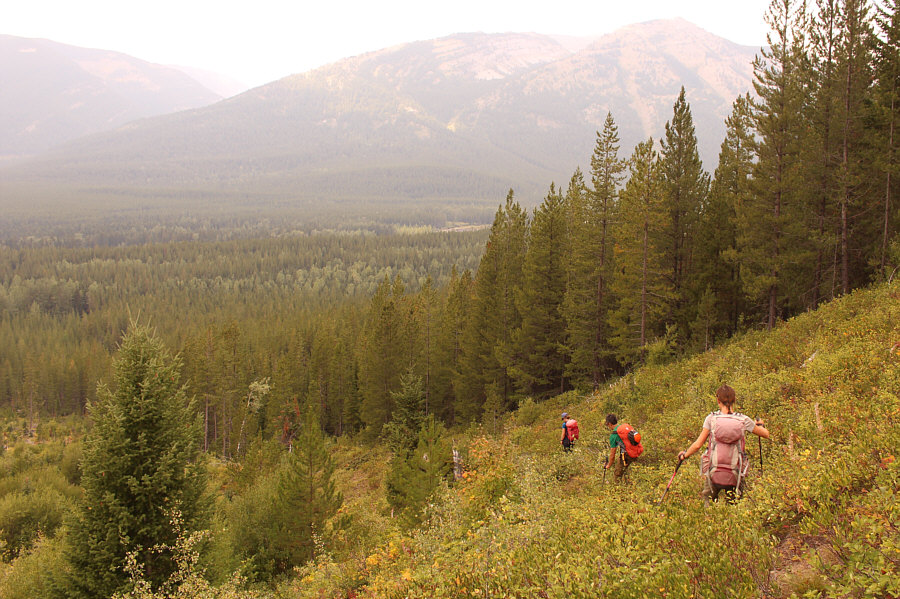
Andrea and Zosia aim for the obvious drainage (right) as they bushwhack up the slope.
Get ready for a long, steep grind... Higher up, the group keeps to climber's left of the drainage.
At least there were a few ripe huckleberries to eat here! 
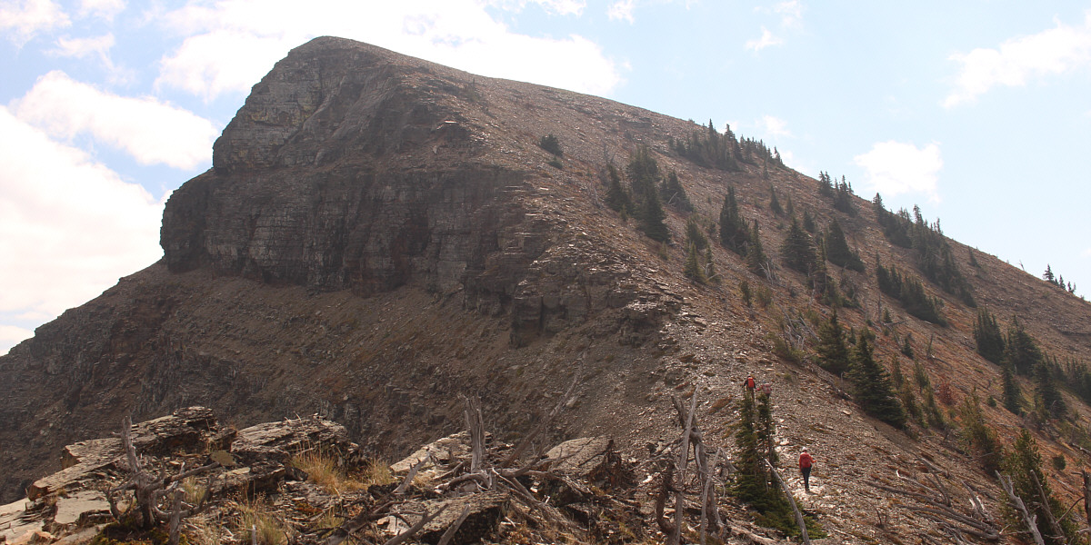
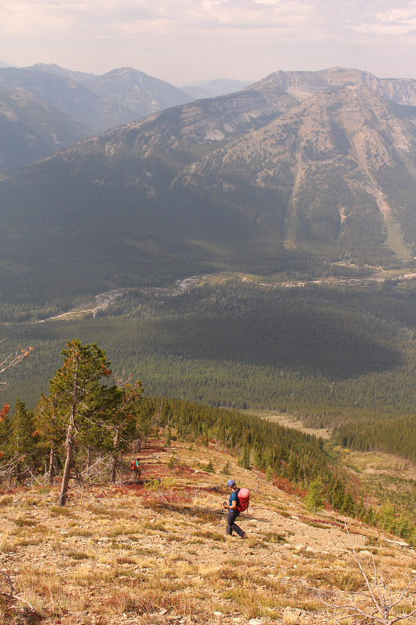
Most of the ascent is a steep but straightforward hike up this broad ridge.
Most of the hard work is behind us! The group gains the crest of Packhorse Peak's northwest ridge.

Even a packhorse could do it!

The ascent to the summit ridge poses no difficulties.


Almost there. The summit is within sight.
It wasn't pretty, but we made it! Sonny, Zosia, Shaun and Andrea take a well-deserved break on the summit of Packhorse Peak (2408 metres).
After another summer of wildfire smoke, I'm surprised there's anything left to burn in BC! 
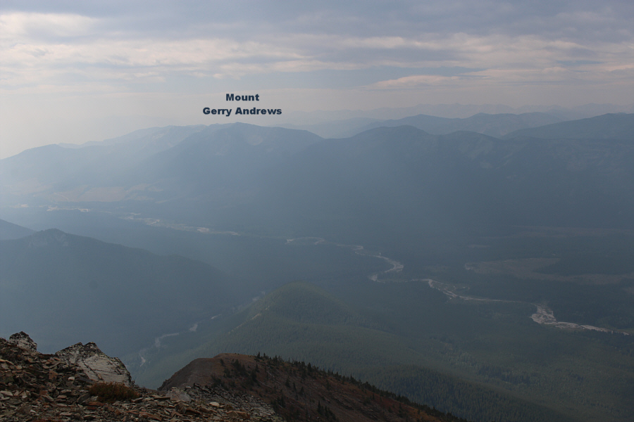
The view to the south is marred by haze from wildfire smoke.
How typical! The sunshine finally comes out just as Zosia, Andrea and Shaun leave the summit.
I'm glad we came up from the other side! Here is a more comprehensive view of Packhorse Peak's northwest ridge.

A most unfamiliar perspective!

The most striking peak to the east is Mount Haig.


Much easier going down! Andrea follows Shaun down the broad ridge that they came up.
Ugh...not again! Andrea, Shaun and Zosia commence a second round of bushwhacking on their way down.
Zosia always seems to be the first to cross any river! Zosia crosses back to the west side of Flathead River.

Adios, Packhorse Peak!

Here is a last look at Packhorse Peak as Andrea fords Flathead River.


Fording, bushwhacking and slogging...why Packhorse Peak is not destined to become a Classic! Total Distance:  10.1 kilometres
Round-Trip Time:  8 hours 28 minutes
Net Elevation Gain:  968 metres

GPX Data