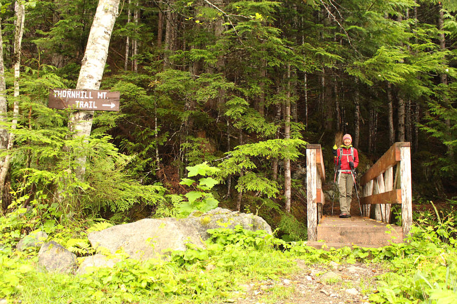
At the trailhead, Zosia is enthusiastic about hiking up Mount Thornhill.
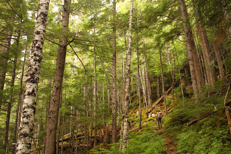
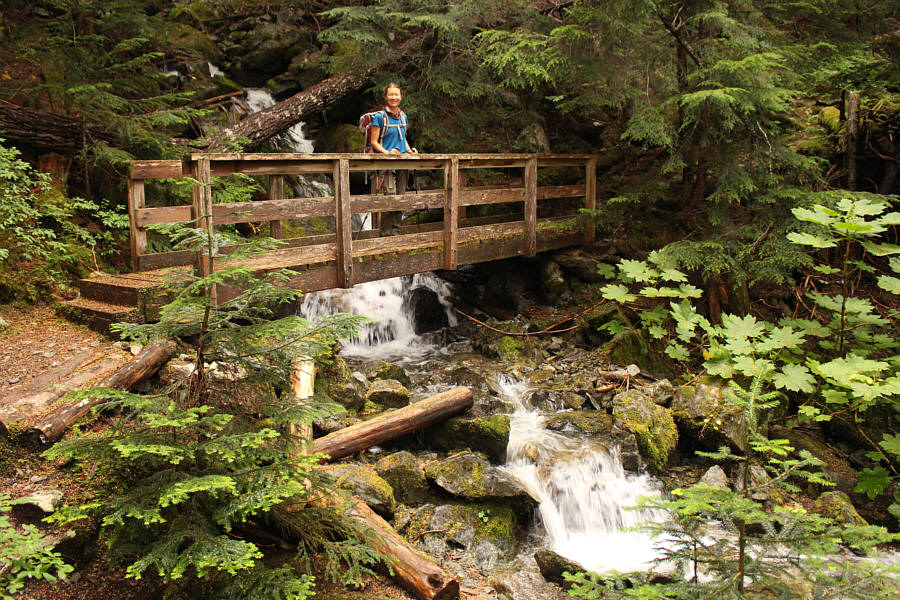
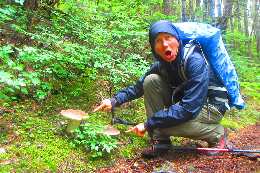
Photo courtesy of Zosia Zgolak

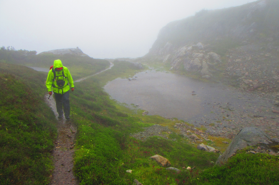
Photo courtesy of Zosia Zgolak
|
|
At the trailhead, Zosia is enthusiastic about hiking up Mount Thornhill. |
|
|
Most of the ascent is on a well-maintained trail through forest. |
|
|
Zosia stops at a bridge over a tumbling creek. |
|
|
Zosia points out some impressive
mushrooms along the trail. Photo courtesy of Zosia Zgolak |
|
|
The weather begins to deteriorate as Zosia climbs past the last trees. |
|
|
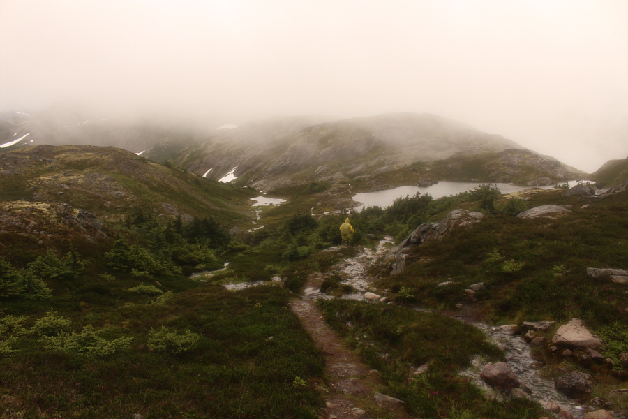
Exposed to a full rainstorm, Sonny can
only bow his head and keep walking in hopes of reaching a shelter near the summit. Photo courtesy of Zosia Zgolak |
|
|
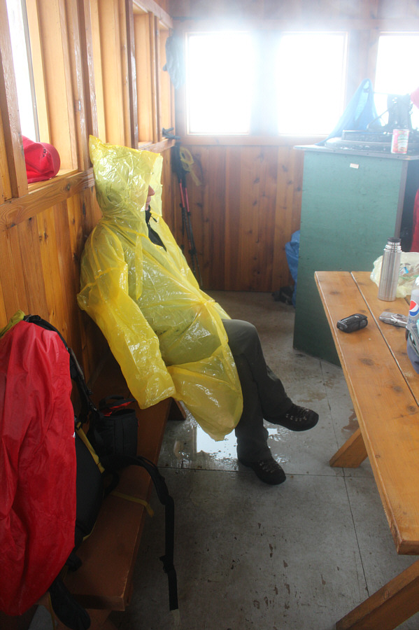
Cold and soaked to the bone, Zosia waits out the rainstorm in the shelter. The shelter was rebuilt in 2012 on the site of a former fire lookout. |
|
|
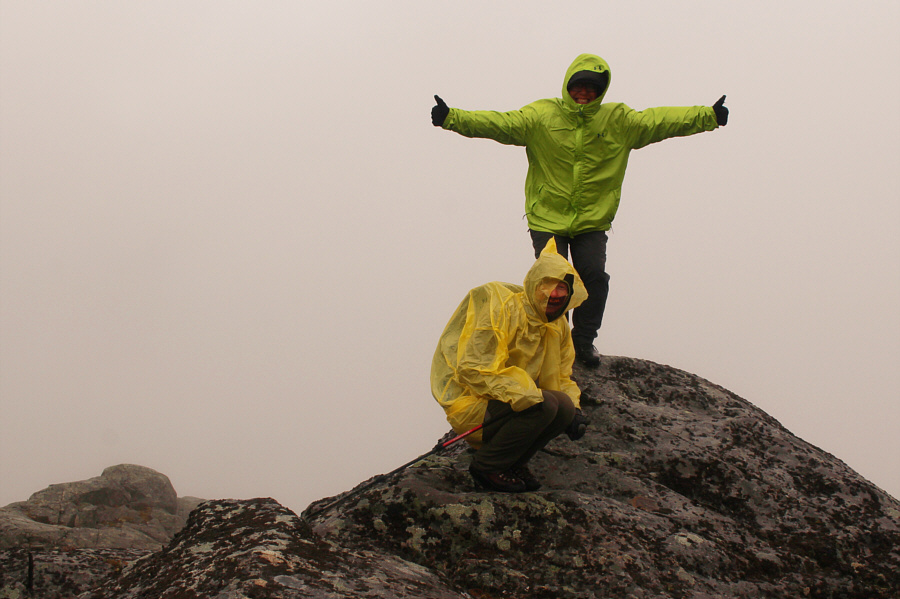
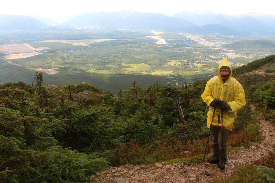
With the rain abating, Zosia and Sonny venture out to the gazetted summit of Mount Thornhill (1476 metres). |
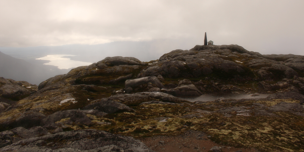
Oddly enough, the lookout shelter is about the same elevation if not slightly higher (1477 metres) than the gazetted summit. Lakelse Lake is visible at distant left.
 |
Zosia begins the long retreat down the mountain. |
 |
Still shivering in her wet clothes, Zosia can hardly believe that it is sunny and warm in the town of Terrace behind her. |
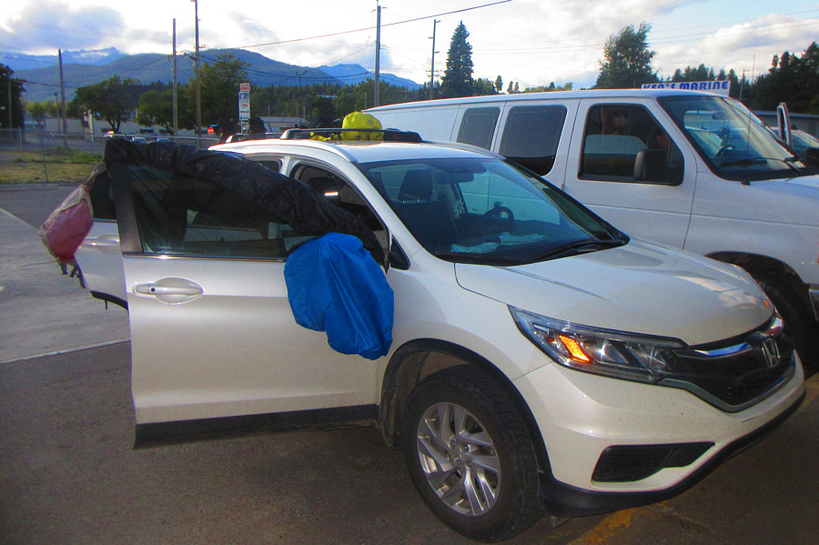 |
Sonny's car becomes a makeshift drying
rack at the local public laundromat. Photo courtesy of Zosia Zgolak |
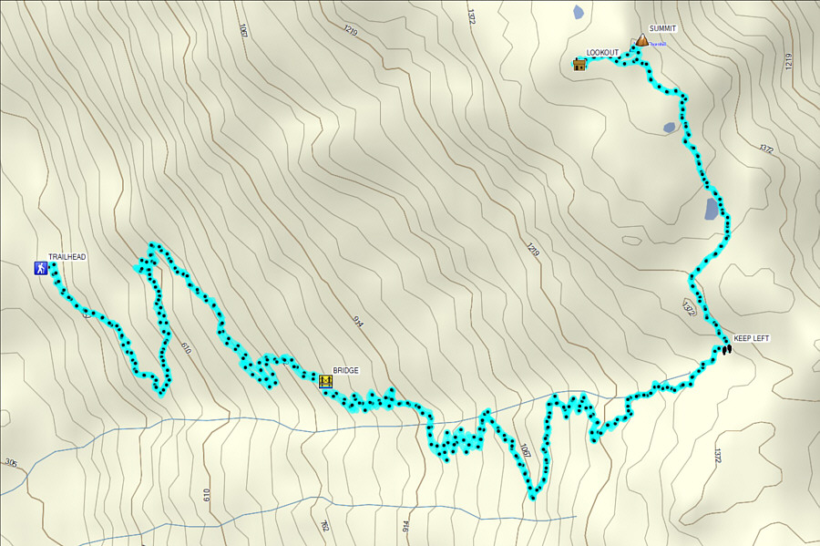 |
Total
Distance: 14.4 kilometres Round-Trip Time: 7 hours 45 minutes Net Elevation Gain: 1041 metres |