BOU AVENUE
Mount Breitenbach
Every once in awhile or perhaps more often than I realize, I manage to have a real doozy of a brain cramp.  On 10 August 2022, Zosia Zgolak and I made an attempt to climb Mount Breitenbach in Idaho's Lost River Range, and after a lengthy drive to the trailhead, we spent several hours working our way up what I presumed was Pete Creek.  Tellingly, the hike up the creek was much more arduous than expected, and given how frequently the mountain is ascended, there were surprisingly few signs of human passage.  When I finally checked the map in my GPS unit, I was shocked to learn that we had actually been hiking up the wrong valley--namely, the south fork of Jones Creek.  Although Mount Breitenbach was right in front of us, its west face looked too technical to ascend, and we immediately pulled the plug on our attempt (at the time, I was unaware that a Class 3 route exists on the west face).  To date, I am still unsure how I made such an enormous navigational blunder, but considering the maze of back roads in the area, perhaps it is not uncommon to occasionally wind up in the wrong valley.  In retrospect, this error turned out to be a blessing in disguise as the weather in the area deteriorated considerably as the day wore on.  Had we continued ascending, we surely would have been caught high up in a nasty rainstorm which lasted well into the early evening.  Instead, we regrouped in the nearby town of Mackay and waited out the rainstorm before venturing back to the mountains in search of the correct trailhead.

As already mentioned, the maze of roads along the western slopes of the Lost River Range can be really confusing to navigate.  Complicating matters are the numerous plots of private land which are scattered across some of the approaches to the trailheads.  Although easements exist, one of them for Upper Cedar Creek Road--key to accessing Mount Breitenbach as well as another 12,000-footer, Lost River Mountain--was recently closed to public traffic apparently because the private land owners were unhappy about gates being left open.  As such, Zosia and I had to explore alternate roads to get to the correct trailhead.  After a fair bit of trial and error and examining satellite imagery on my cel phone, we eventually made it to road's end at Pete Creek where we set up camp for the night.

In lieu of potentially confusing driving directions, I have provided a GPS track for the drive to the trailhead at Pete Creek (high-clearance vehicle strongly recommended).  Incidentally, the usual ascent route via Pete Creek is described in Tom Lopez's Idaho: A Climbing Guide, and the mountain is officially named after Jake Breitenbach, a guide from Wyoming who was tragically killed by icefall on Mount Everest in 1963.
Doh! Zosia finds the hike up Jones Creek to be quite arduous.  Due to a serious route-finding blunder by Sonny, this turns out to be the wrong approach for Mount Breitenbach.
Well that sucks! 
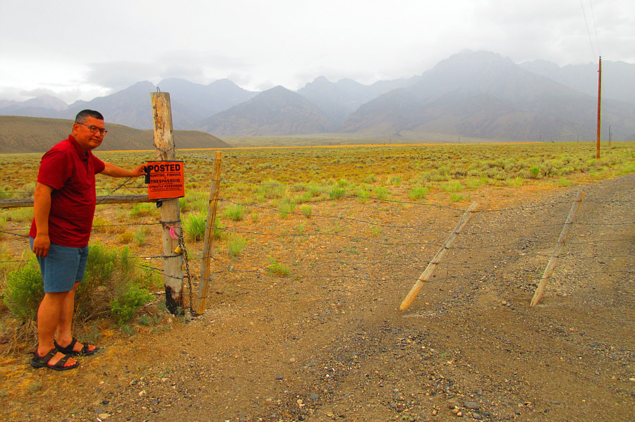
The usual access to Pete Creek trailhead along Upper Cedar Creek Road goes through private land.  Unfortunately, the easement was recently closed to public access by the private land owners.

Photo courtesy of Zosia Zgolak

After spending a very restful night at the trailhead, Zosia and I got up before dawn on the morning of 11 August 2022 and ate a quick breakfast before commencing our ascent of Mount Breitenbach.  Unlike our previous day's struggles along Jones Creek, our hike up Pete Creek was considerably easier with plenty of trails and cairns to follow.  We made good progress up the valley and eventually entered a huge amphitheatre of rubble.  Grinding up this sea of rubble was easy but also quite monotonous.  We later perked up a bit while scrambling past a waterfall tumbling over a black cliff.  We faced more rubble slopes above the waterfall, but at least there was a good trail here to follow all the way up to a high col on the ridge leading to the summit.  From the col, we easily followed the continuation of the trail up and over two false summits before finally reaching the true summit.

Zosia and I spent about an hour at the summit of Mount Breitenbach before retracing our steps back over the two false summits and down to the high col.  From there, the remainder of the descent was mostly dull and tedious.  The endless rubble was just as uninspiring the second time around, and the subsequent hike out Pete Creek was only memorable for feeling overly long.  At least we did not have to drive anywhere once we returned to the trailhead since we had plans to climb nearby Lost River Mountain the next day starting from this same spot.  Instead, we enjoyed a pleasant dinner and retired early for a second straight restful night.
Much better with a beaten path most of the way up! 
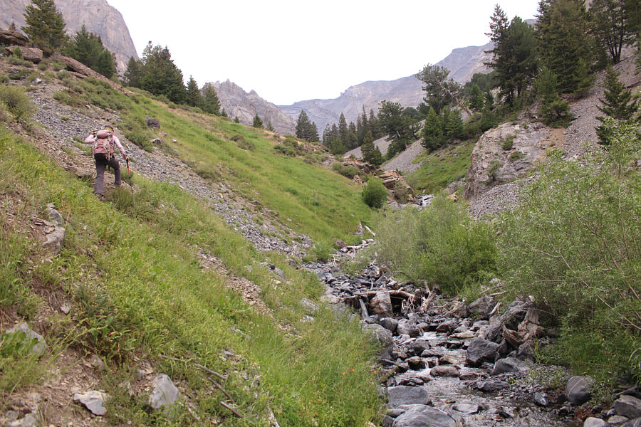
Zosia works her way up Pete Creek valley.
Oh joy. 
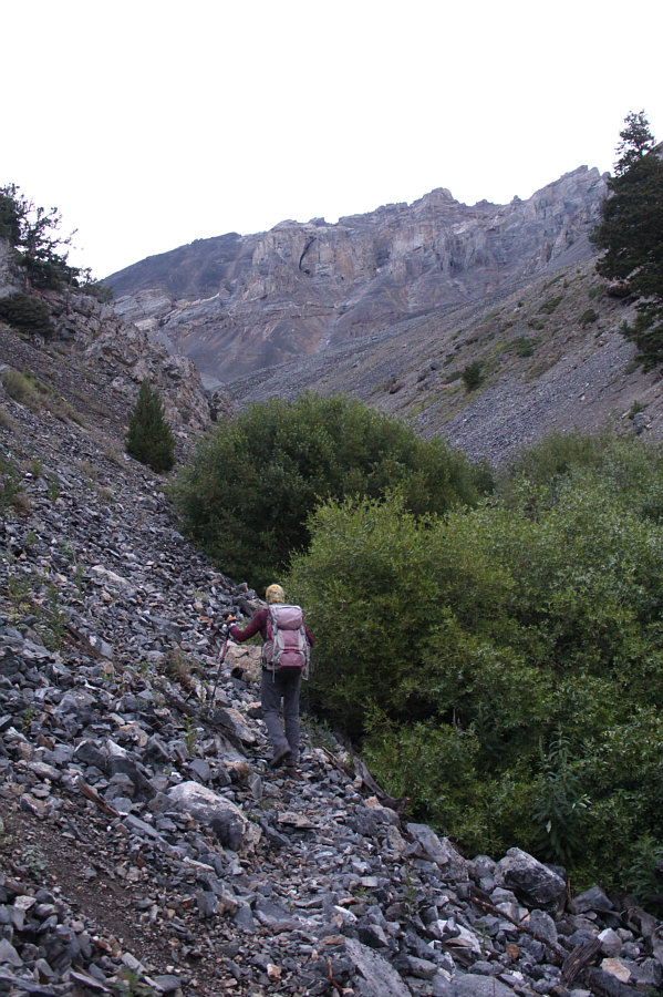
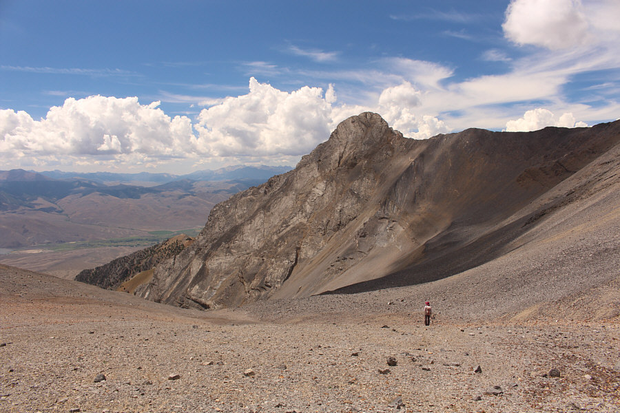
Zosia faces seemingly endless rubble at the head of the valley.

Fairly easy to ascend...almost to the point of being boring!

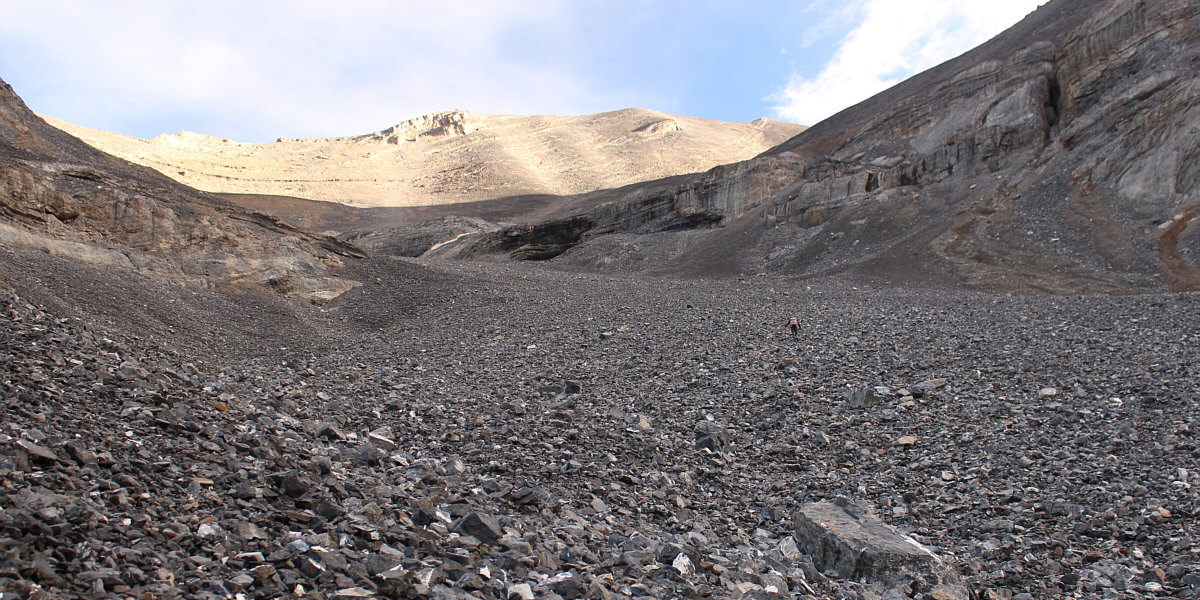
Fortunately, the rubble is not of the treadmill variety...mostly!


Eveything is bigger in the States! 
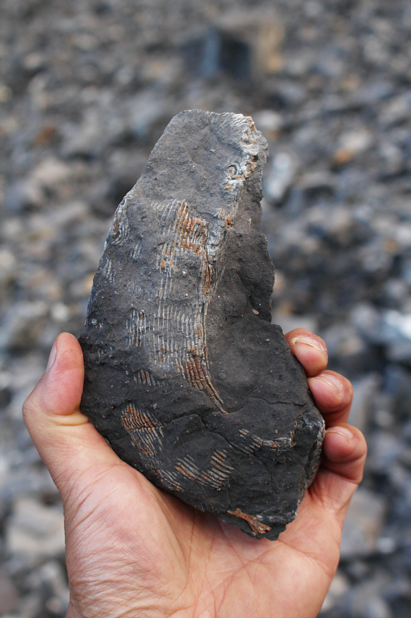
The rubble slope contains many fossils including this large horn coral.
Some easy scrambling to invigorate the proceedings!

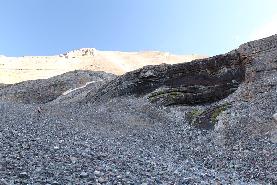
The route turns to the right just past the black waterfall but before the strip of white rock.

A new mountain range to explore!

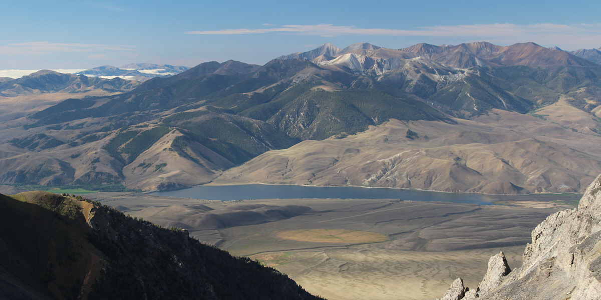
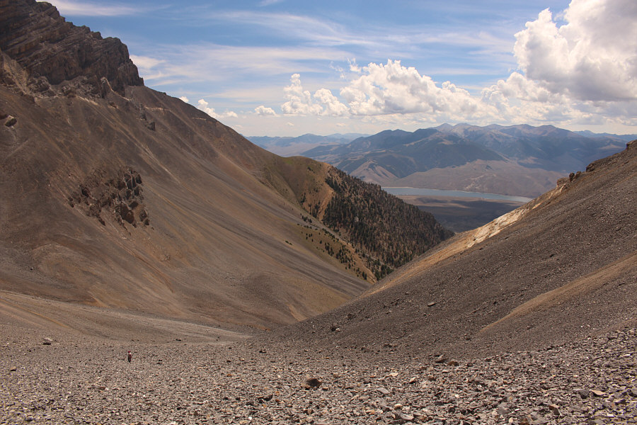
To the south is a view of Mackay Reservoir and White Knob Mountains.


It must have been bored to death with flying over the same monotonous rubble day after day! 
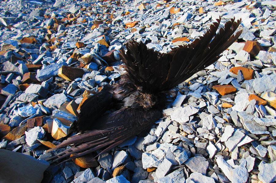
It is unclear how this crow met its demise high on Mount Breitenbach.

Photo courtesy of Zosia Zgolak

Still some slogging left, but the end is in sight! 
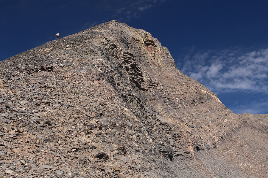
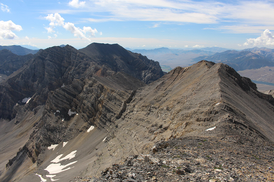
Zosia reaches a high col on the ridge leading to Mount Breitenbach's summit (far right).
At least it feels like we're getting somewhere now! 
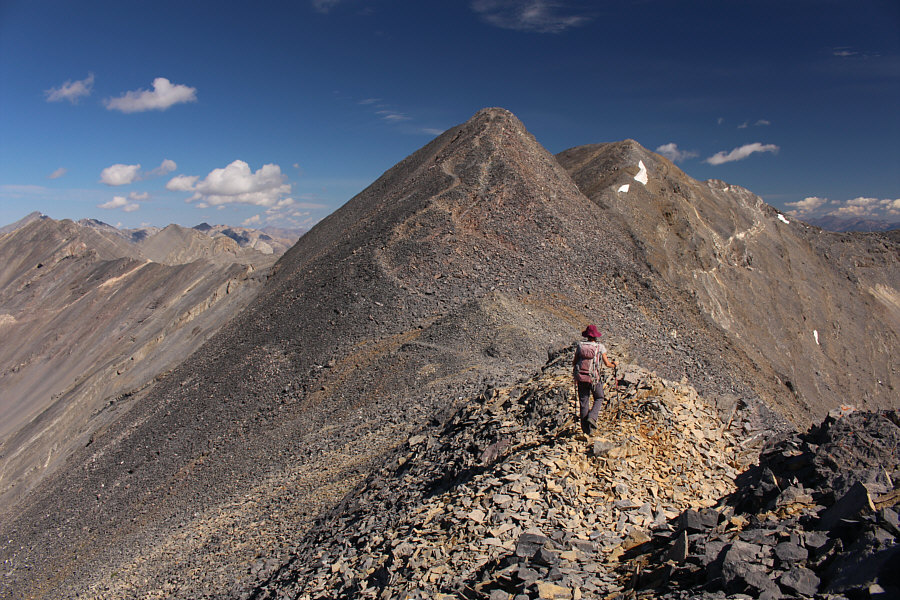
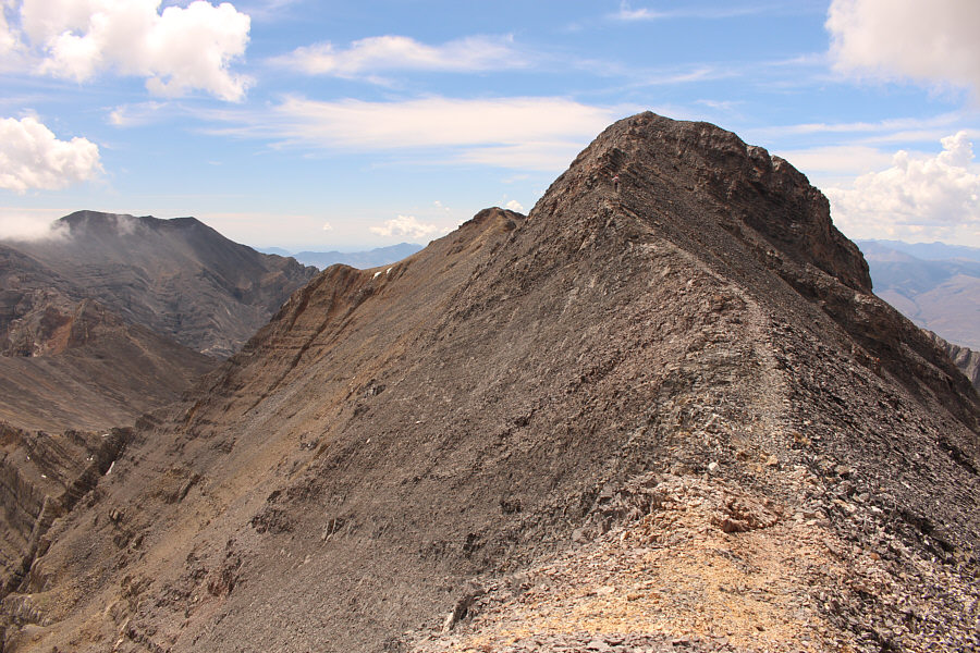
Zosia follows the ridge up to the first false summit.
Still one or two awkward spots but nothing too scary.

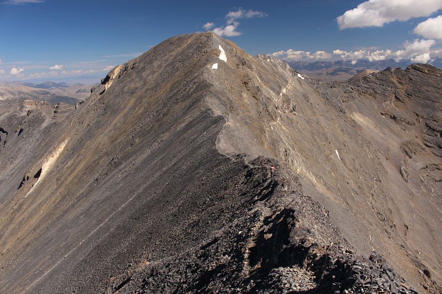
Zosia is reassured to see a trail going over the second false summit.

We got this!

Past the second false summit, Zosia makes her way up the last stretch before the true summit.

A lot of suffering to get up all these peaks but also a lot of fun!

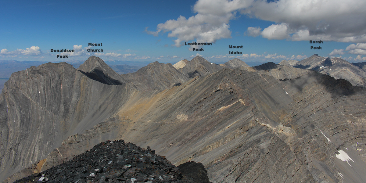
The view to the northwest from Mount Breitenbach includes five of the nine Idaho mountains exceeding 12,000 feet (3658 metres).


Another worthy peak for a future trip...

To the north is unofficially-named Mount Corruption.

Zosia has already kicked off her boots! Sonny and Zosia take an extended break on the summit of Mount Breitenbach (3698 metres).
That will be tomorrow's objective... 
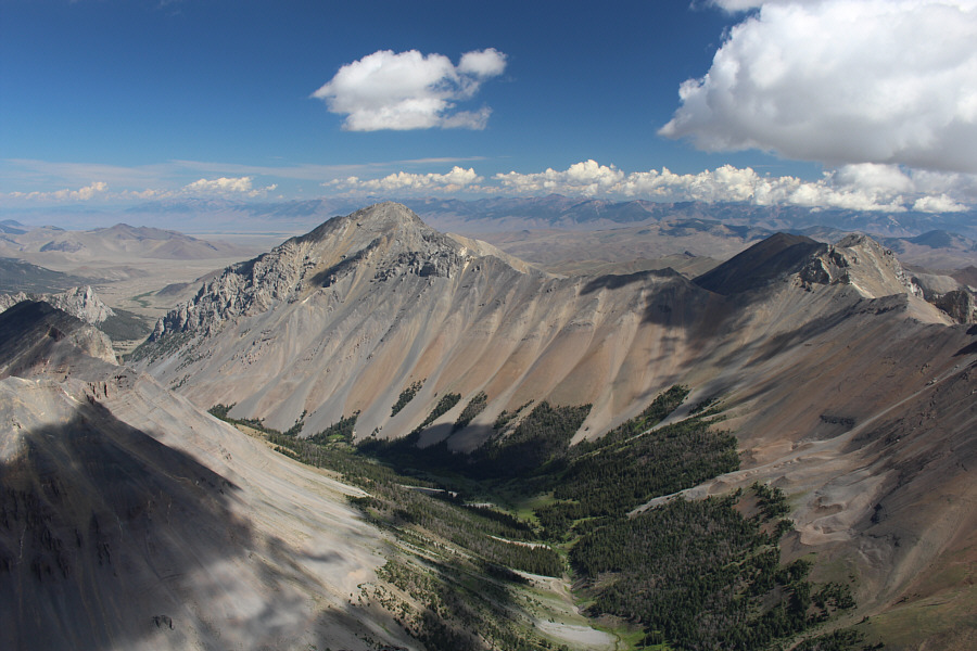
Lost River Mountain, another Idaho 12,000-footer is the dark-looking peak to the south.

I still feel like such an idiot, but I guess it all kinda worked out for the better in the end!

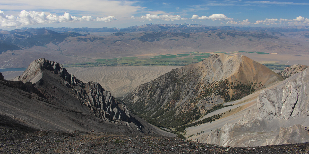
At bottom centre is Jones Creek valley which Zosia and Sonny struggled partway up the day before.  On the centre horizon are the Pioneer Mountains.


We're descending now, by the way! Zosia makes her way back up the second false summit.
If only we could ski all this... 
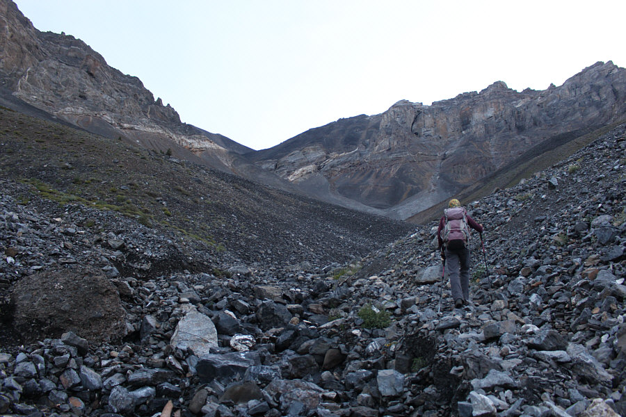
Zosia returns to the sea of endless rubble.
Rubble, rubble, toil and trouble... Here is one last peek at Mackay Reservoir during the descent.
Home, sweet home...for tonight anyway! 
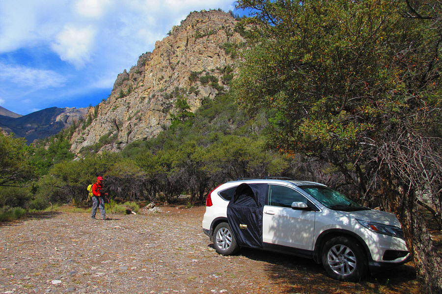
Sonny returns to camp at the Pete Creek trailhead.

Photo courtesy of Zosia Zgolak
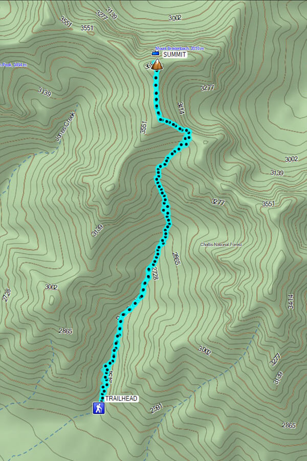
A relatively easy 12,000er to tag...as long as you find the right trailhead! Total Distance:  12.5 kilometres
Round-Trip Time:  11 hours 15 minutes
Net Elevation Gain:  1368 metres

GPX Data