BOU AVENUE
Elko Hill
On 26 August 2022, Zosia Zgolak and I hiked
up an unnamed hill located just east of the town of Elko, British
Columbia. I could not find any references for this unassuming
grassy hump and have taken the liberty to name it "Elko Hill". We
were a bit concerned about possible thunderstorms developing later in the
day, and this lowly objective fit the bill for a short and non-committing
trip.
In the town of Elko, turn east off Highway 3 onto Bate Avenue.
Drive eastward and bend right onto Main Street. Drive south for
three blocks and bend left onto Alexander Avenue. Past the
intersection with Kyrke Street, Alexander Avenue becomes Cascade Avenue
as it bends southward. At the next intersection, take a hairpin
left turn onto a gravel road (River Forest Service Road) which descends
to a bridge over Elk River. Park on the side of the road
immediately north of the bridge at a junction with a gated rough road
heading eastward.
Passing an information kiosk beside the gate, Zosia and I hiked up the
rough road which soon passes another information kiosk at what appears to
be a trailhead. Ignoring the trail heading eastward, we stuck to
the road as it runs southward along the east bank of the Elk River.
After going over a rise and dropping slightly across an open hillside, we
entered forest and soon reached a junction with a mountain biking trail
heading uphill to the east. We climbed up this trail which led us
to a vast grassy plateau. Leaving the trail here, we turned
northward and followed a faint double-track until it completely
disappeared in the tall grass. We continued heading north over
rolling terrain, and although the off-trail hiking was not too difficult,
we still appreciated the few beaten paths we stumbled on.
Due to the flatness of the terrain, the
actual high point is a little difficult to pinpoint, and even then, the
surrounding views are unremarkable. Zosia and I stopped anyway for
about half an hour before commencing our descent. We strayed a few
times from our up-track while returning across the rolling terrain and
grassy plateau, but this was of little consequence since we were still
heading in the right direction (south). Once we regained the
mountain biking trail, we easily retraced our steps all the way back to
the gate without any issues.
 |
Zosia starts hiking up a rough road past a gate. |
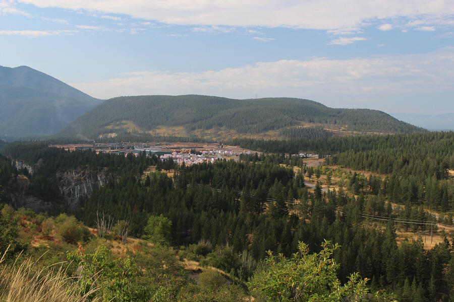 |
From the road, there is already a view to the south of
Sheep
Mountain behind a big lumber yard. |
 |
Part of the town of Elko can be seen
behind Zosia as she continues up the road. Also visible behind
her on the distant horizon are Bull Mountain and The Steeples. |
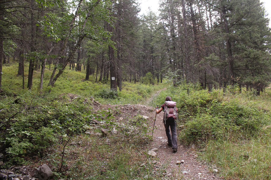 |
Leaving the road, Zosia begins to climb steeply up a mountain biking
trail. |
 |
The mountain biking trail leads to a grassy
plateau. |
 |
Zosia heads northward across the plateau. The peaks in the distance
are unnamed but part of the Lizard Range. |
 |
Zosia and Sonny stand on the high point of Elko Hill (1250 metres). |
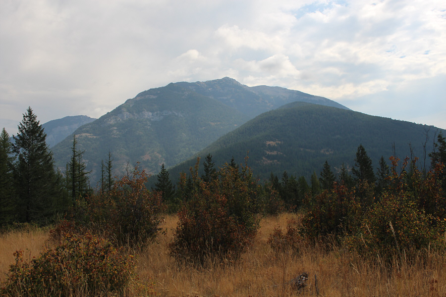 |
About the only thing visible from the high point is the western outlier
of Mount Broadwood to the east. |

Hiking back across the grassy plateau, Zosia gets
another look at Sheep Mountain to the south.
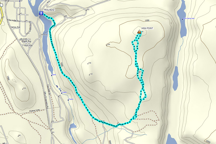 |
Total
Distance: 9.3 kilometres
Round-Trip Time: 3 hours 42 minutes
Cumulative Elevation Gain: 443 metres
GPX Data |