BOU AVENUE
Mount Grainger And Mount Sabine
On 22 May 2022, Zosia Zgolak and I drove to Canal Flats, British Columbia to climb Mount Grainger and Mount Sabine.  Both mountains are easily accessed by logging roads, and their low elevations make them ideal as shoulder-season objectives when higher peaks are snowbound.  Both ascents are also relatively short, and it is feasible to climb both summits in a single day just as Matthew Clay and Alison Sekera had done in 2020.  Following their plan in similar fashion, we tackled Mount Grainger first.

From Highway 95, turn east onto Whiteswan Lake Forest Service Road 4.5 kilometres south of the bridge over Kootenay River at Canal Flats or 36.0 kilometres north of the junction with Highway 95A.  Drive 7.1 kilometres and turn left onto a narrower gravel road.  Drive 3.8 kilometres to a Y-junction and keep right.  Drive another 1.3 kilometres and park in a small pullout next to an exploration road heading north into the forest.  Most of the approach road is in good shape and should be suitable for 2WD vehicles with high clearance.

From the pullout, Zosia and I hiked up the exploration road which is wide and easy to follow.  There are a few steep sections, but generally, the road climbs moderately through forest for about two kilometres to a small hut which looks like a biffy but was probably used as some sort of storage shed.  A flagged trail departs the road here, and we followed it up to the crest of the summit ridge which is a bit bushy but still easy to navigate.  A short climb brought us to the summit where there are still remnants of an old fire lookout.  Ironically, the summit is largely viewless, but a nearby subsidiary rock outcrop provides a partial panoramic view to the south.  We took a short break on the outcrop before retracing our steps back down the mountain.  Our descent was quick and uneventful.
Gotta love the easy drive and obvious starting point!

Zosia begins hiking up an exploration road en route to Mount Grainger.

Would have been nice to have some views along the way...

The road is steep in places but easy to follow.

It looks like Zosia is tilting the hut over! 
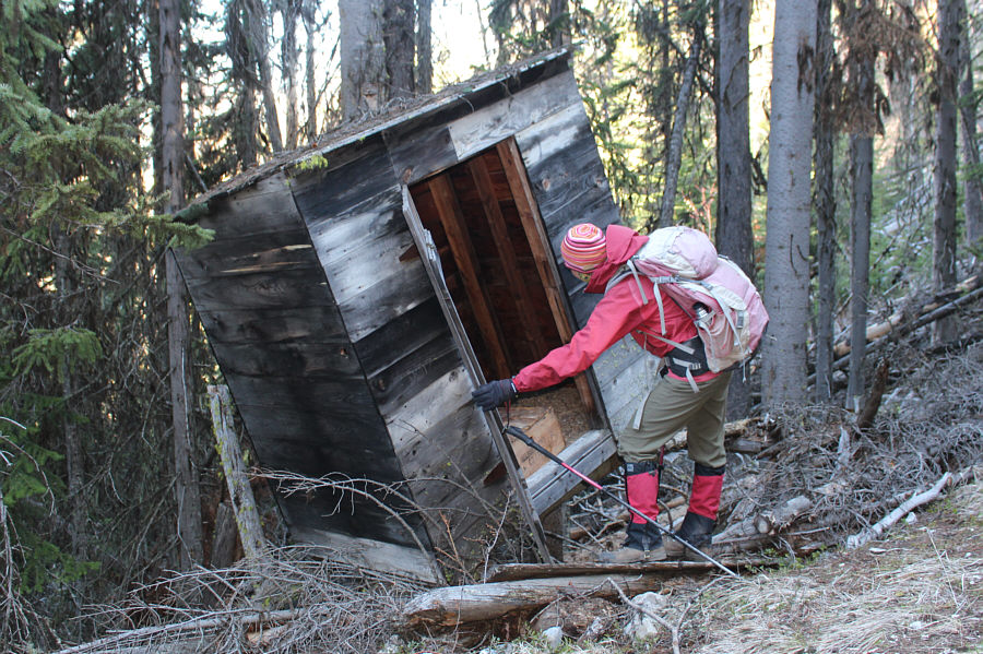
Zosia peeks inside a mysterious hut near where a flagged trail leaves the road.
This was about the only "trail" we would hike all weekend! 
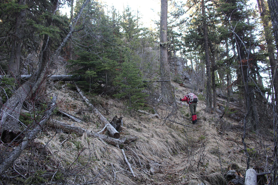
After leaving the road, Zosia climbs up a well-defined trail.
They need to chop down all the trees on the entire summit ridge! 
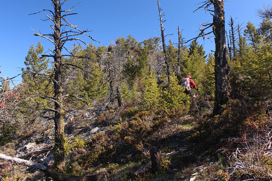
Zosia gains the bushy summit ridge.
Good candidate for the world's most useless lookout location--no views! 
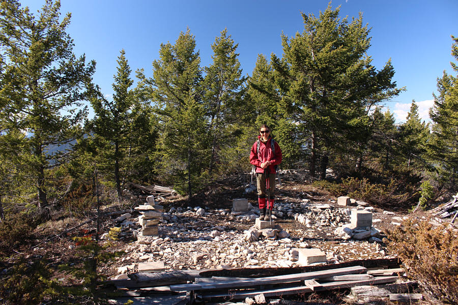
Zosia stands among the remains of a fire lookout on the summit of Mount Grainger (1803 metres).
See the moon? 
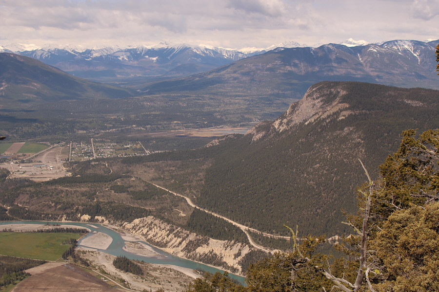
Zosia and Sonny find some far-reaching views on a rock outcrop just south of the summit.

A view to the north would have been better...

This is the view to the south from the rock outcrop with Kootenay River visible at right.


Another treed summit...wonderful. A break in the trees on the summit ridge grants this view to the west of Canal Flats (left) and Mount Sabine (right).
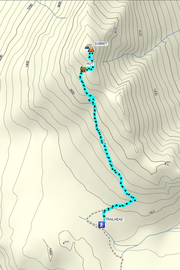
The whole trip kinda felt like...meh! Total Distance:  5.2 kilometres
Round-Trip Time:  2 hours 35 minutes
Net Elevation Gain:  436 metres

GPX Data

Upon completing our trip to Mount Grainger, Zosia and I drove to Canal Flats for a quick pit stop at the local gas station/grocery store.  We then embarked on a nerve-racking drive to approach our second objective of the day, Mount Sabine.

From Canal Flats, drive north along Grainger Road.  About 1.3 kilometres past the intersection with Beatty Avenue, make a hairpin turn to the right and up a short connector road which joins a gravel road running parallel to Grainger Road.  Immediately make a hairpin turn to the left (north) onto the gravel road.  This gravel road is quite rough and narrow for the first couple kilometres (high clearance vehicle strongly recommended), and as of this writing, there is at least one washout that is quite intimidating if not impossible to drive across.  The road improves somewhat after this initial rough section but only temporarily.  About 3.6 kilometres north of the short connector road, keep right at a Y-junction.  The road begins to deteriorate again as it curves east and then south.  I managed to scrape out an additional 1.4 kilometres beyond the Y-junction in my Honda CR-V, but more daring drivers or those with monster trucks or ATVs could probably go farther.

From where we parked, Zosia and I continued on foot along the access road for about two kilometres before turning off onto a rougher side road marked with flagging and a wooden sign that reads, "ASIMOV".  We had few difficulties following this side road for about another two kilometres to its end near the top of Mount Sabine.  There is a hang glider launch site here which grants a commanding view of Canal Flats and the Kootenay River valley.  The actual summit of Mount Sabine is on a forested knoll just east of road's end, but like on Mount Grainger, it is similarly bereft of far-reaching views.  We stopped for a leisurely break at the launch site before backtracking along the same roads to our car without any issues.  The drive out seemed a little less tense since we already knew what to expect from the access road, and slowly but surely, we made it back to Canal Flats in one piece and none the worse for wear.
Kinda looks like the road is still easy to drive! Zosia starts walking up the deteriorating access road for Mount Sabine.
Probably put up by some sci-fi fans! Zosia takes a rougher side road branching off from the access road.  A wooden sign near the flagging mysteriously reads, "ASIMOV".
You could put your hands to the rocks and call it a scramble! The final section of the side road is quite steep and rocky.
Baaaaaaaaaa! 
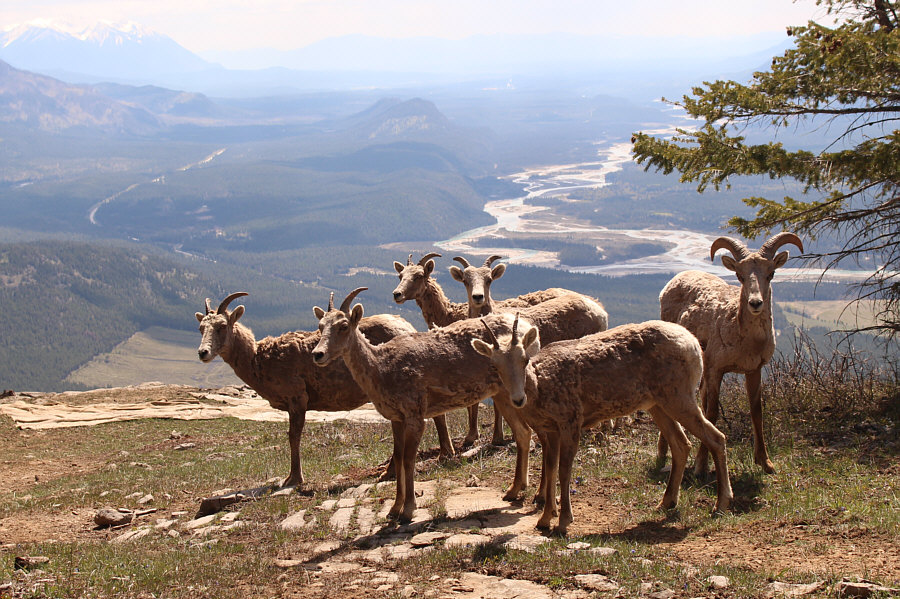
At the end of the road is a herd of sheep with a view.
Again, someone needs to log all the surrounding trees here! Sonny verifies that he is standing on the forested summit of Mount Sabine (1604 metres).

Photo courtesy of Zosia Zgolak

Yep, we were just there a few hours earlier! A break in the trees grants this view of Mount Grainger to the east.
Too bad we couldn't see Columbia Lake from here. 
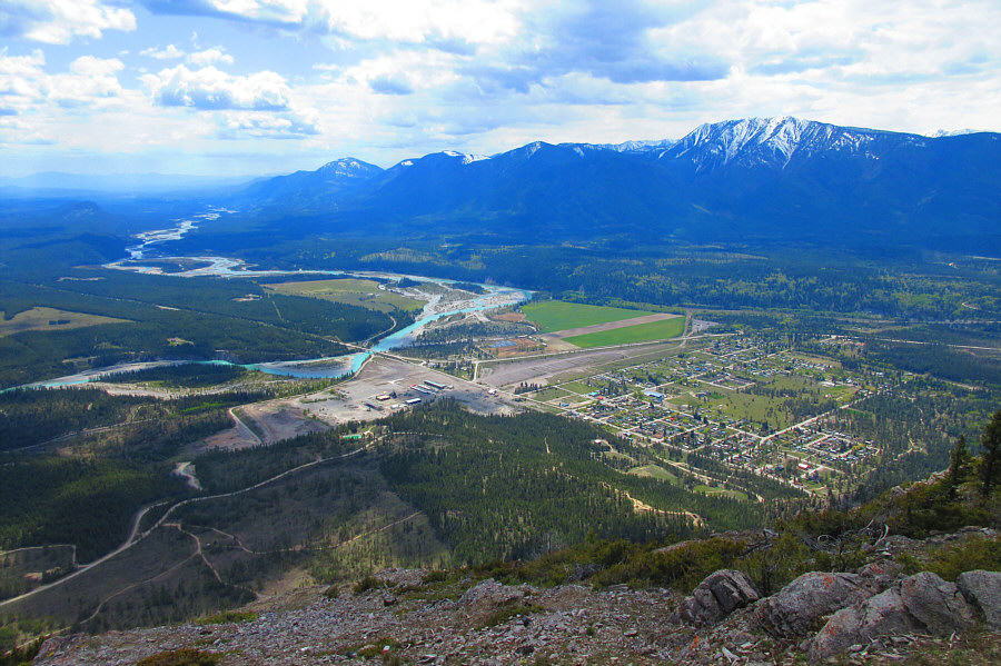
A hang glider launch site at the end of the road grants this commanding view of Canal Flats.

Photo courtesy of Zosia Zgolak

The only good reason for doing this tedious hike is this view.

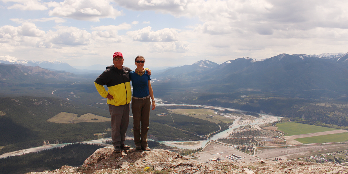
Sonny and Zosia pose together at the hang glider launch site.


R.I.P. This cross was erected on Mount Sabine in memory of a person who apparently lost a lifelong battle with Lyme disease.
If this makes you uncomfortable, bring an e-bike for the approach! 
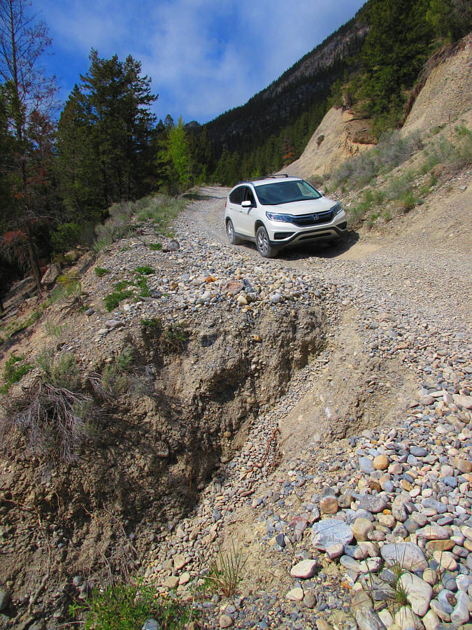
This washout along the access road is barely drivable.

Photo courtesy of Zosia Zgolak

Double-meh! Total Distance:  8.8 kilometres
Round-Trip Time:  3 hours 30 minutes
Net Elevation Gain:  501 metres

GPX Data