BOU AVENUE
Hog's Back Ridge
On 19 November 2022, Zosia Zgolak and I
skied up unofficially-named Hog's Back Ridge located at the confluence of
Muskeg Creek and Threepoint Creek in Alberta's Kananaskis Country Public
Land Use Zone. Zosia got the idea for this trip from the
Bragg
Creek & Sheep Valley Gem Trek map, and a couple of different routes
to access the ridge are described in Gillean Daffern's Kananaskis
Country Trail Guide. Because we were skiing, we would follow
the official Threepoint Creek trail which runs right over the ridge
crest, but in doing so, we would miss out on the more scenic but steeper
hikers' route on the lower east arm of the ridge. We were not even
certain if the trail would be skiable given the complete lack of snow
reports for this area, and the only way to find out was to go see for
ourselves.
From the intersection with Highway 762,
drive west on Highway 549 for 8.5 kilometres to a Y-junction just past
Mesa Butte Provincial Recreation Area. Take the left branch and
drive another 100 metres to a gated bridge which crosses Threepoint
Creek. Park here without blocking the gate.
Starting from the bridge, Zosia and I
skied along the continuation of the road which was snow-covered but also
recently plowed. We tried to ignore the frequent scraping of rocks
under our skis as we passed two junctions (keep right after 230 metres
and keep left after another 1.3 kilometres) before reaching a fenced gas
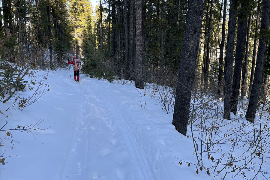
well site. Following ATV tracks, we skirted around the perimeter of
the well site before entering forest at the far (west) side. About
one kilometre further, we turned right at a signed junction with North
Fork trail and subsequently crossed over to the north bank of Threepoint
Creek. The skiing here was not overly difficult especially since we
did not have to break trail, but the variable snow coverage meant that we
had to be constantly vigilant for protruding rocks. Some washed-out
sections of trail and a few wet creek crossings also helped make the
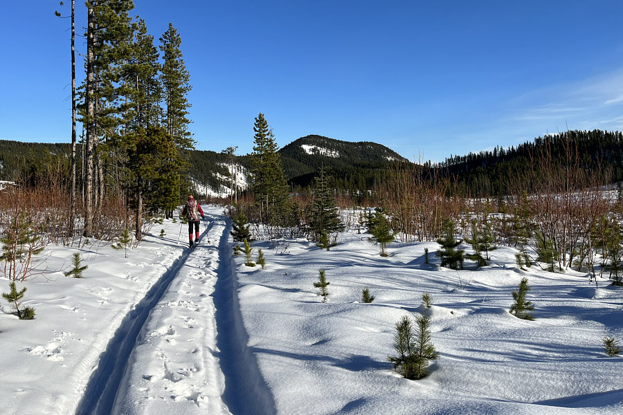
already long approach feel even longer. The trail eventually veers
north to follow Muskeg Creek before climbing out of the valley and onto
the crest of Hog's Back Ridge. At this point, we abandoned the
trail and skied north through light forest for about 350 metres to tag
the unremarkable and tree-covered high point of the ridge. The high
point is near the edge of a cut block to the east, and we stopped here
briefly for a snack break.
For our return trip, Zosia and I skied
back exactly the same way we came. Although our descent took less
time than our ascent, the overall ski out felt like a real grind both
figuratively and literally. Again, the thin snow cover made us
extra tentative especially while descending steeper hills, and we rarely
felt comfortable enough to let our skis run freely. There is also
an annoying number of uphill sections on the way out, and toward the end,
I was cursing each one that I had to wearily herringbone up.
Despite all our precautions, the bases of our skis were absolutely raked
on this trip, and it is a miracle that the skis were still gliding at all
when we finally coasted back to the bridge gate in the dark.
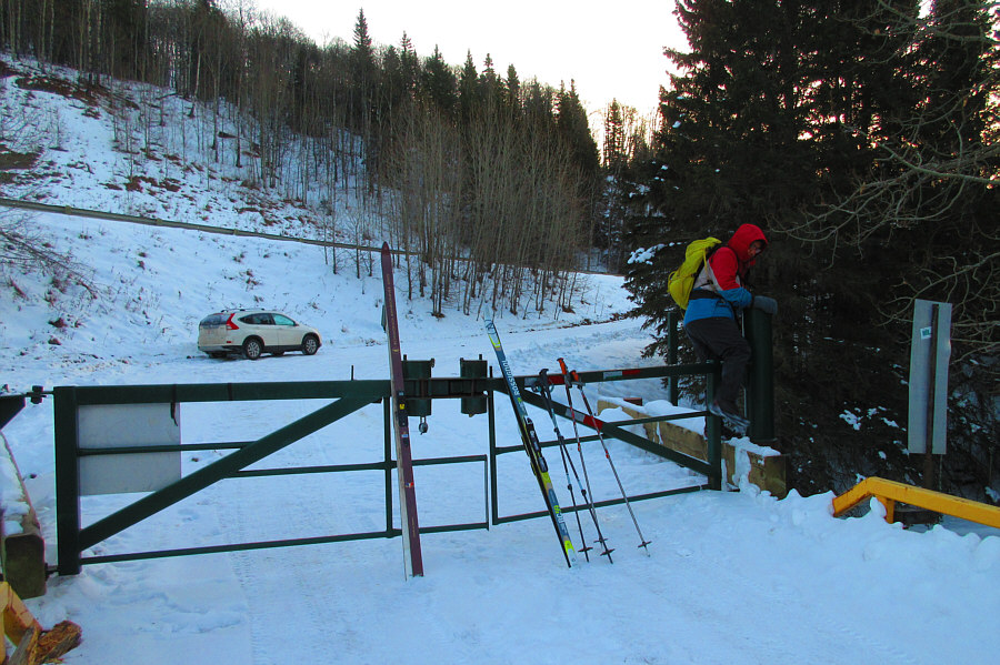 |
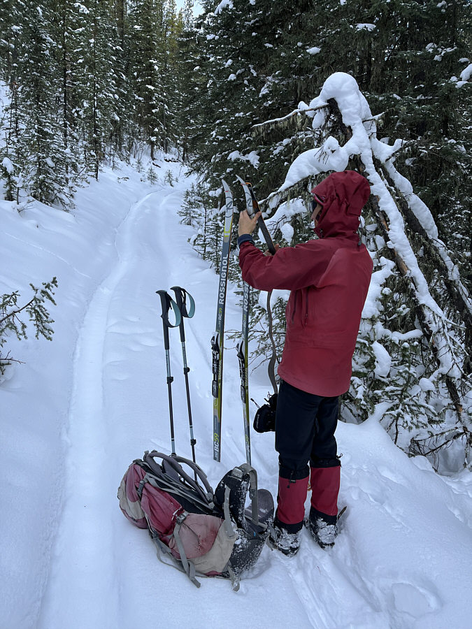
Sonny climbs over a locked gate on a bridge at the start of the trip.
Photo courtesy of Zosia Zgolak |
 |
Zosia follows ATV tracks around the perimeter of a gas well site. |
 |
Zosia picks up her skis and walks up
this steep uphill section of trail. |
 |
The already thin snow coverage is even thinner along these open
hillsides. |
 |
Zosia manages to squeeze through the
high embankment along this section of trail which was probably washed
out by the
historic
floods of 2013. |
 |
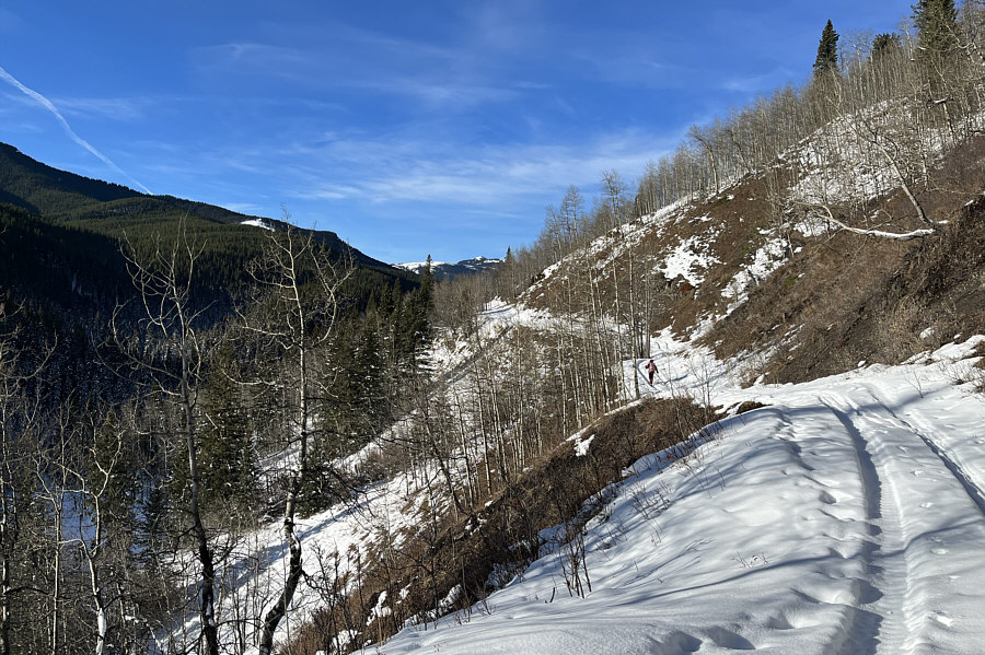
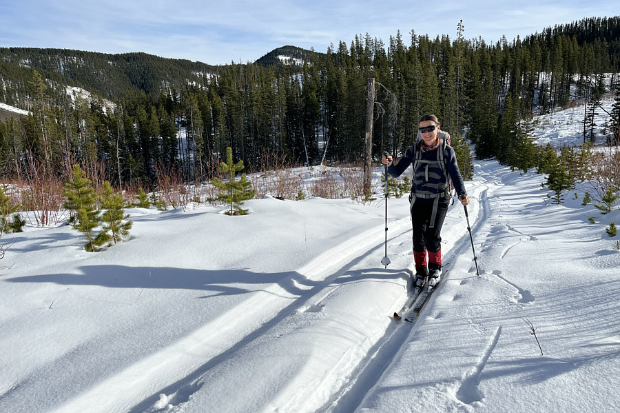
Anticipating sustained uphill sections ahead,
Zosia straps on climbing skins to her skis. |
 |
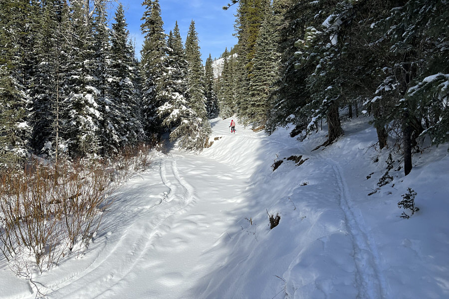
After climbing out of the valley,
Zosia enjoys warm weather while skiing through a cut block. |
 |
Gaining the ridge crest, Zosia abandons the trail to head for the high
point. |
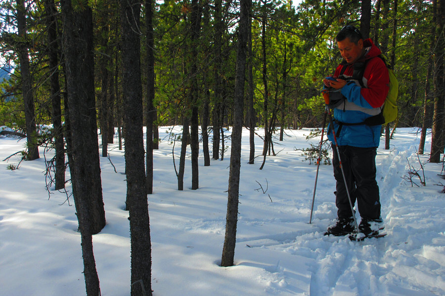 |
Sonny checks his phone to verify that he is standing on the high point of
Hog's Back Ridge (1795 metres).
Photo courtesy of Zosia Zgolak |
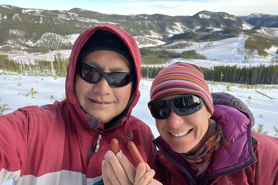 |
Sonny and Zosia show off their pork snacks at the edge of a cut block
near the high point. |
 |
Keeping climbing skins on her
skis for more control, Zosia cautiously descends this long downhill
section of trail. |
 |
This flat stretch in a cut block grants Zosia a brief respite from
the nerve-racking descents. |
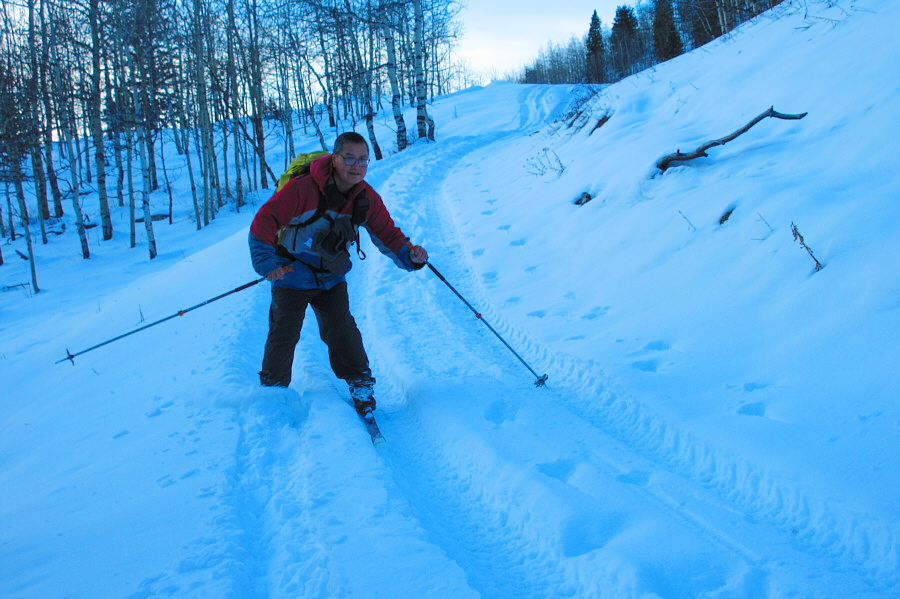 |
Sonny barely keeps himself from wiping
out while descending this hill. Photo courtesy of
Zosia Zgolak |
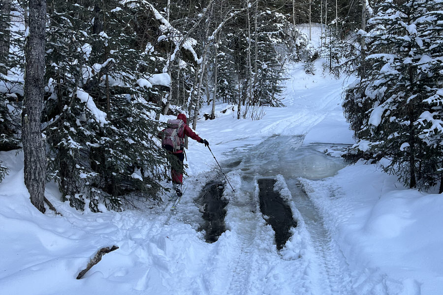 |
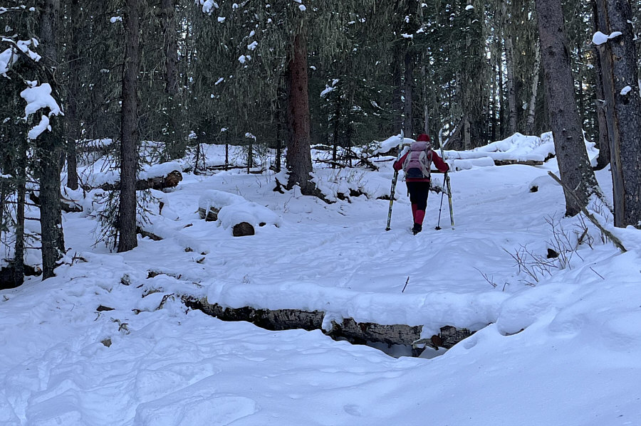
Zosia tries to avoid getting her skis wet at this
previously frozen creek crossing. It appears that an ATV drove
through here earlier and punched holes through the ice. |
 |
Total
Distance: 24.1 kilometres
Round-Trip Time: 9 hours 27 minutes
Cumulative Elevation Gain: 441 metres
GPX Data |