BOU AVENUE
Hunter Peak
On 30 December 2022, Zosia Zgolak and I climbed Hunter Peak in Texas's Guadalupe Mountains National Park.  The summit is easily accessed by well-maintained trails as described in the park's website.  Following the website's recommendation, we would ascend the steeper Bear Canyon Trail and descend via the longer but gentler Tejas Trail (counter-clockwise loop).  All trail junctions throughout are signed.

The turnoff to Pine Springs Trailhead is on the north side of Highway 62/180, 88.0 kilometres southwest of Carlsbad, New Mexico, or 14.0 kilometres north of the junction with Highway 54.  From the turnoff, drive 70 metres and turn left onto Pine Canyon Drive.  Ignore all side roads and drive 1.0 kilometre to the trailhead parking area.

Zosia and I arrived at the trailhead under a light rain.  Between driving to the visitor centre to use the washrooms there (the ones at the trailhead were inexplicably closed) and fussing with our hiking gear, we procrastinated long enough for the rain to diminish to a light drizzle before setting off along a connector trail heading north.  Crossing a wash, we intersected Tejas Trail and turned right.  At the next junction, we turned left onto Frijole Trail, and we subsequently turned left again upon reaching the junction with Bear Canyon Trail.  A long but uncomplicated climb ensued as we steadily gained elevation on the well-constructed trail which never felt too steep.  We eventually intersected Bowl Trail and turned left.  The trail was snow-covered in places here, but travel was still relatively easy.  After a short climb through light forest, we turned left again at a junction with the spur trail leading to the summit.  Other than a few slippery spots, we had no issues finishing the remainder of the ascent.  By sheer luck, Hunter Peak was the only summit in the park that was not shrouded in clouds on this day, and we enjoyed our lunch break in warm sunshine.  Surprisingly, a gentleman from Fort Worth joined us at the summit shortly after we sat down, and although we offered to share our sheltered spot with him, he was adamant about giving us some space.

When Zosia and I finished lunch and were about to depart, we offered the gentleman some Polish chocolate that Zosia had brought, and he very enthusiastically accepted it.  We then made our way back to the junction with Bowl Trail and turned left to head westward.  Ignoring a trail coming from the right (Bowl Trail makes a loop here) we continued further to a four-way junction.  Once again, we turned left to descend Tejas Trail.  The descent here felt a bit long-winded at times, but this was more than compensated by the outstanding vistas along the way.  Slowly but surely, we made our way uneventfully down to where we first intersected Tejas Trail, and after re-crossing the wash, we easily walked back to the trailhead to conclude a most enjoyable and trouble-free hike.
It's raining. 
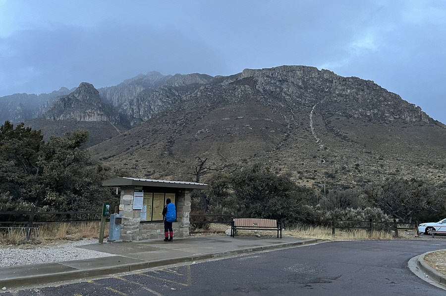
Hunter Peak dominates the background in this view from the trailhead.
We're just getting started and have a long way to go! Although Hunter Peak is straight ahead, the trail will take Zosia far to the right to avoid the cliffs.
An amazingly well-constructed trail that never feels too steep. 
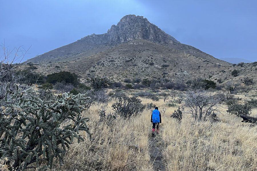
Zosia hikes Bear Canyon Trail toward the gap at centre.
Great view across the plains! 
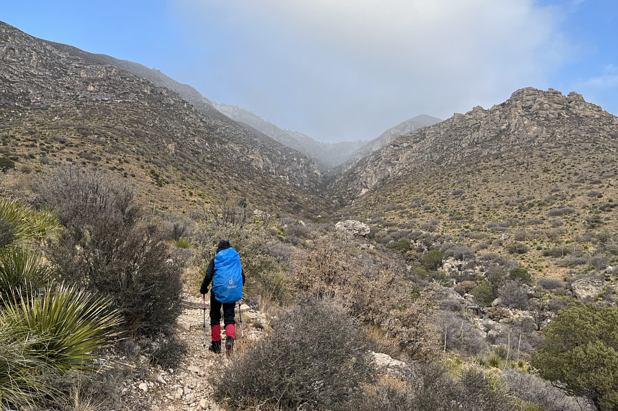
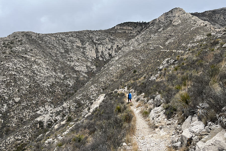
The trail makes a switchback under some rugged cliffs.
There's a good chance we might get some views from the top... 
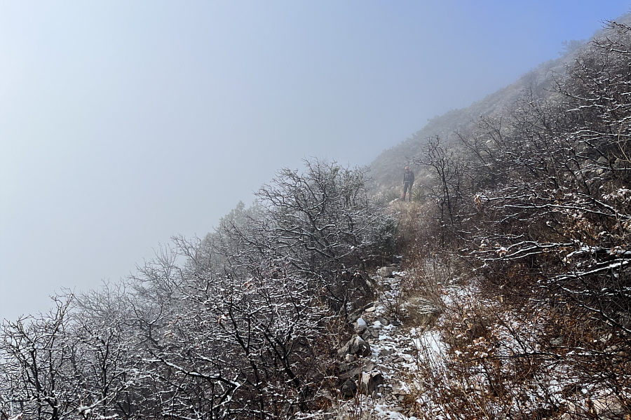
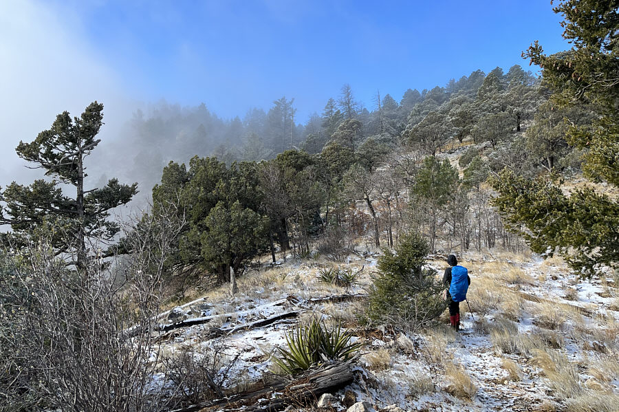
Mists dance across the slope as Zosia climbs higher up the trail.
I guess it does get cold here! Many of the bushes here are covered in rime.
Looks like some kind of tubular animal or plant. This rock appears to have some interesting fossils.
We're on the final stretch! Zosia gains Bowl Trail after climbing out of the canyon.

And the clouds even parted for us!

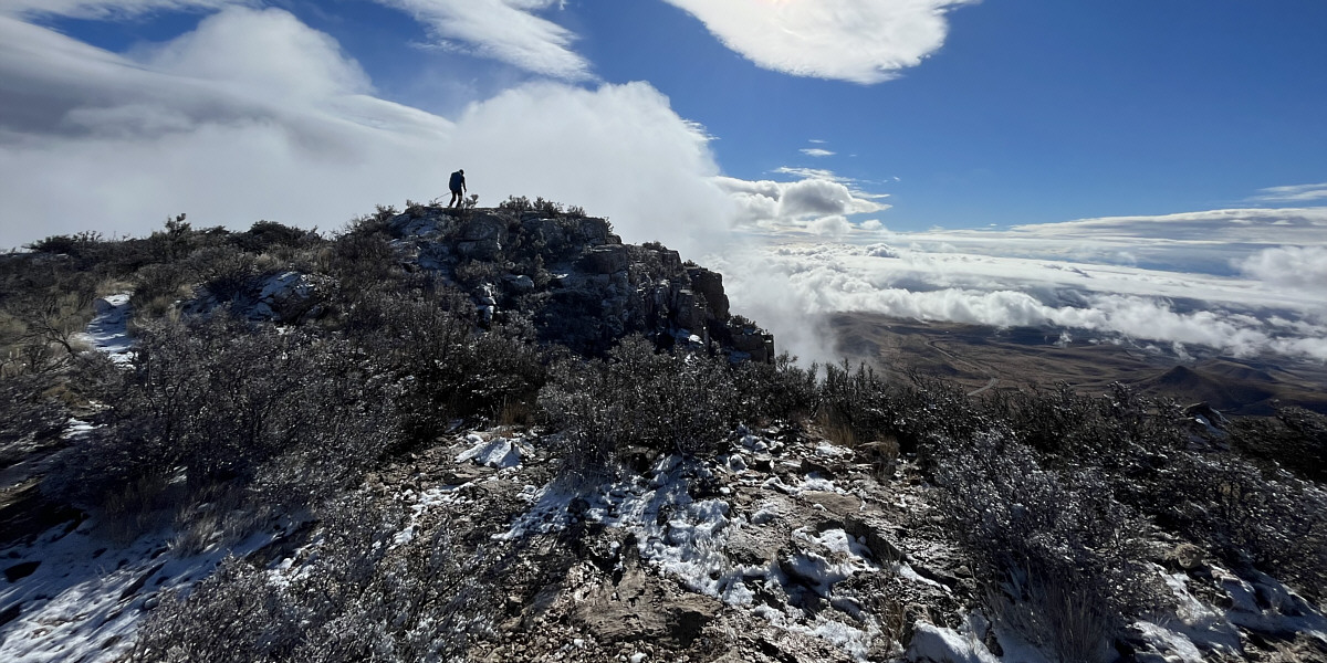
Zosia reaches the summit block of Hunter Peak.


Doesn't really feel like a summit... Zosia and Sonny stand on the summit of Hunter Peak (2560 metres).

How lucky were we to have the only sunny summit on this day?

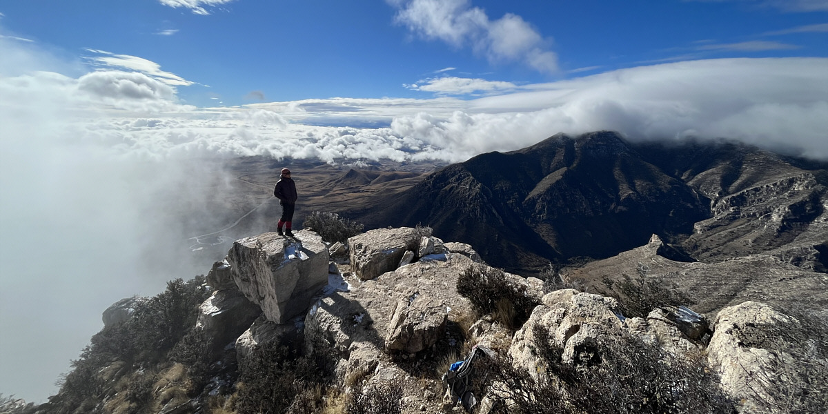
To the southwest, the top of Guadalupe Peak is still shrouded in clouds.


Loop hikes are always the best! Zosia makes her way down the alternate approach for Hunter Peak.
Such a gentle descent! 
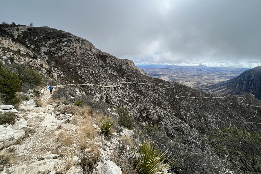
Much of Tejas Trail is laid out in front of Zosia.
We've come a long way, baby! This is looking back uphill at the trail that Zosia descended.
I guess we were just not meant to see the high point of Texas on this day!

The top of Guadalupe Peak is still obscured by clouds as Zosia continues along Tejas Trail.

It was so nice to end the hike this way.

The sky begins to clear up as Zosia hikes back to the trailhead.
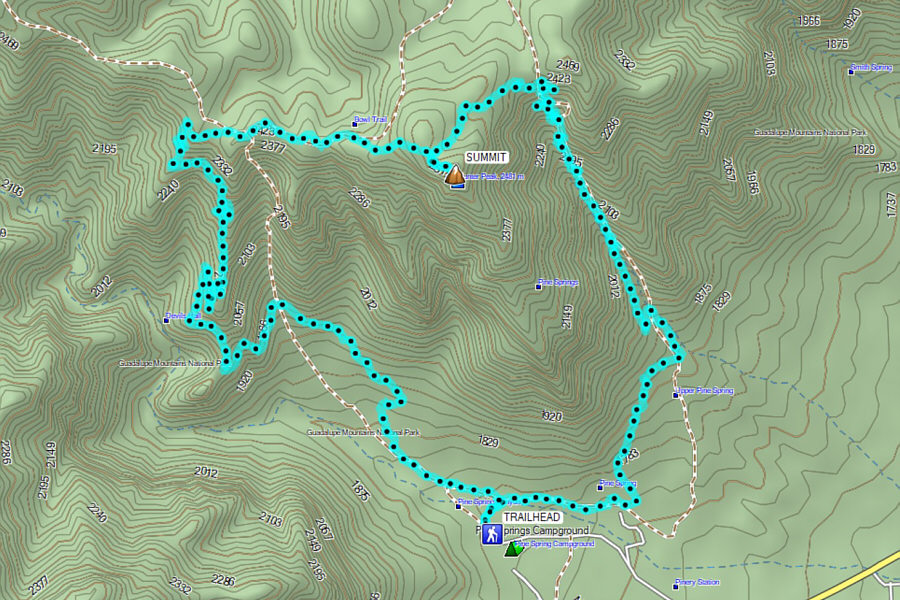
A fantastic loop hike best done counter-clockwise. Total Distance:  14.2 kilometres
Round-Trip Time:  6 hours 40 minutes
Net Elevation Gain:  778 metres

GPX Data