BOU AVENUE
Kingston Peak
Zosia Zgolak and I climbed Kingston Peak in California's Kingston Range Wilderness on 19 April 2022.  The most common ascent route via the north ridge is mostly off-trail and entails much route-finding and significant elevation gains and losses.  There are plenty of online trip reports documenting this route, and we would utilize one of the many GPS tracks found on peakbagger.com to help guide us.  Furthermore, we would use an alternate start--I got the idea from Harlan Stockman's trip report--which eschews the usual approach along a 4WD road and eliminates an unnecessary climb over a low pass near the beginning.

From I-15, take Exit 272 (38 kilometres west of Primm, Nevada or 42 kilometres east of Baker, California) and head north on Cima Road which soon becomes Excelsior Mine Road.  Drive 20 kilometres to a Y-junction and keep left.  Continue driving for 23 kilometres passing Horse Thief Camp on the right.  Drive another 3.7 kilometres and turn left onto a signed detour road.  Park in any pullout along here without blocking the detour road.  It is also possible to reach this spot from the west via the Old Spanish Highway and Furnace Creek Road (we would use this for our exit from the area).

From our starting point along the detour road, Zosia and I set off across the desert flats heading south.  I was initially unsure of which distant landmark we were supposed to be aiming for, but with the help of the GPS track, the correct route--a steep ravine--would make itself apparent the further south we traveled.  Travel was easy at first as we were able to follow numerous cattle trails, but as we approached the ravine, the scrubby vegetation began to close in on us which necessitated more route-finding and even some bushwhacking.  As we gained elevation, we found ourselves ascending the left (east) side of the ravine where we eventually picked up a rudimentary trail that led us up to a saddle on the ridge crest.  From the saddle, we followed the continuation of the trail slightly to the west and up past some striking rock formations to a small plateau.  This plateau rises gently up to the crest of Kingston Peak's north ridge, and from there, we got our first glimpse of the true summit nearly two kilometres away.  The ensuing traverse of the north ridge was arduous to say the least.  The ridge is complex with rocks and vegetation both conspiring to thwart any easy passage, and the numerous undulations are physically draining and demoralizing.  Occasionally, we came across some cairns, but they were usually more comforting than helpful.  The sustained amount of route-finding on the ridge was such that trying to describe exactly where we went is rather pointless.  Probably the best that can be said is that the traverse requires a lot of patience and maybe some blood, sweat and tears.  By the time we scrambled up to the summit, the entire ascent had taken us nearly 6.5 hours.

After taking a lengthy break on top of Kingston Peak, Zosia and I backtracked along the north ridge, but we made a few route adjustments to avoid some of the more difficult terrain which slowed us considerably during the ascent.  As a result, our return trip across the north ridge was much more efficient and seemingly less exasperating.  We eventually made it back to the small plateau and subsequently the saddle above the ravine.  We stopped for a short break there before resuming our descent.  Descending the ravine was another great test of our mental fortitude as we tried to find less bushy routes down to the desert flats while fighting our growing fatigue. Once we cleared the ravine, the scrubby vegetation slowly receded to allow for a more relaxed walk back to our car.  We subsequently drove to Las Vegas, Nevada and checked into a comfortable hotel for a well-deserved rest.

The start of an awfully long day...

Zosia heads across the desert flats aiming for the notch in the distant ridge just right of centre.

Pretty, but I'd rather have a trail here!

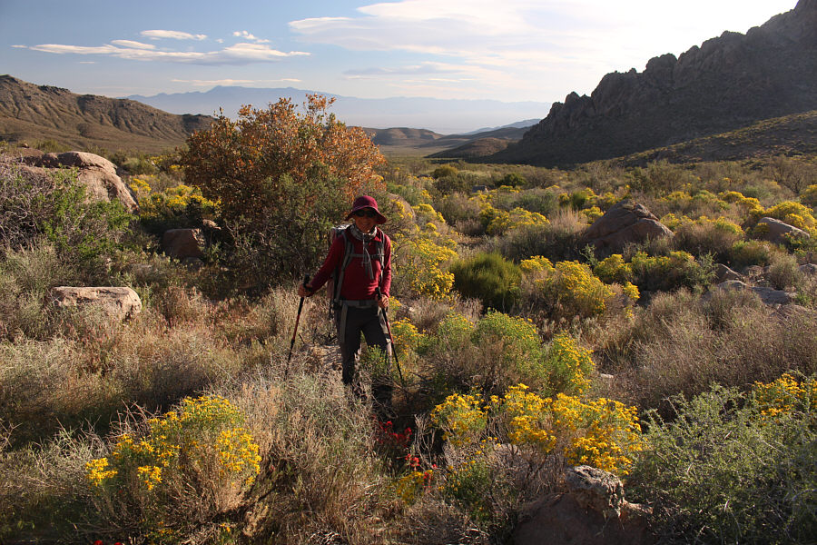
Wildflowers abound in the desert at this time of year.

A brutal climb!

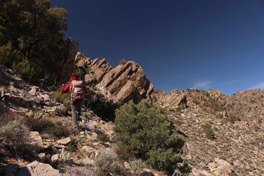
Zosia works her way up a steep ravine.

I was hoping it would be a cakewalk the rest of the way from here, but... From a saddle at the top of the ravine, a rudimentary trail passes through the trees at far left.
Look for these on the way back!

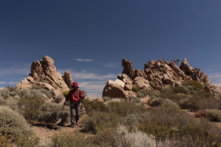
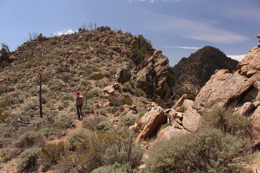
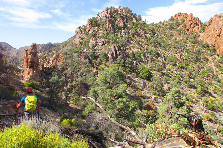
These rock formations are a key landmark near the start of Kingston Peak's north ridge.

Gettin' there ain't gonna be easy... 
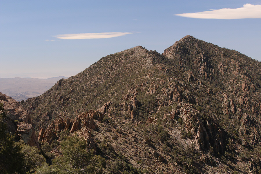
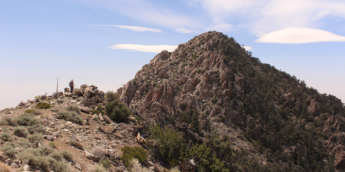
Here is the first glimpse of Kingston Peak's summit nearly two kilometres away.
Very frustrating at times! Traversing the north ridge is a route-finding nightmare.  Occasional cairns along the way are more comforting than helpful.
Already tired of all the ups and downs! Zosia approaches the top of the penultimate high point before the summit.

Nothing comes easy on this mountain!

The final summit block is every bit as complex as the rest of the north ridge.


Not fun when it's already a long day...it's best to avoid this type of terrain on the ridge. 
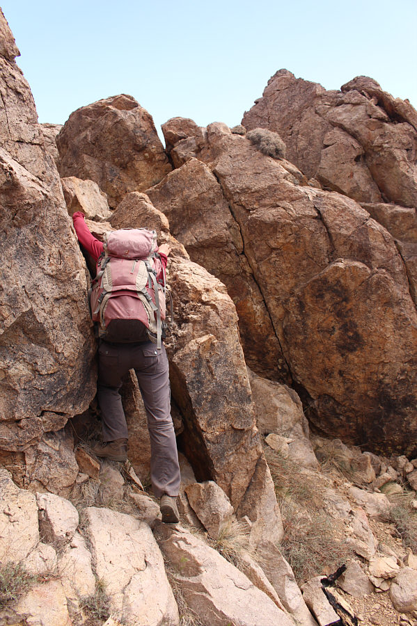
Descending into a gap before the final summit block, Zosia carefully down-climbs a difficult rock step.
We were a bit impatient here to get up the final summit block. Although Zosia would scramble up here to get up the final summit block, this is not a viable route for the descent.
What a f**cking grind to get up here! Sonny and Zosia sit on the summit of Kingston Peak (2228 metres).
This is where you have to be mentally tough to tackle the ridge a second time! 
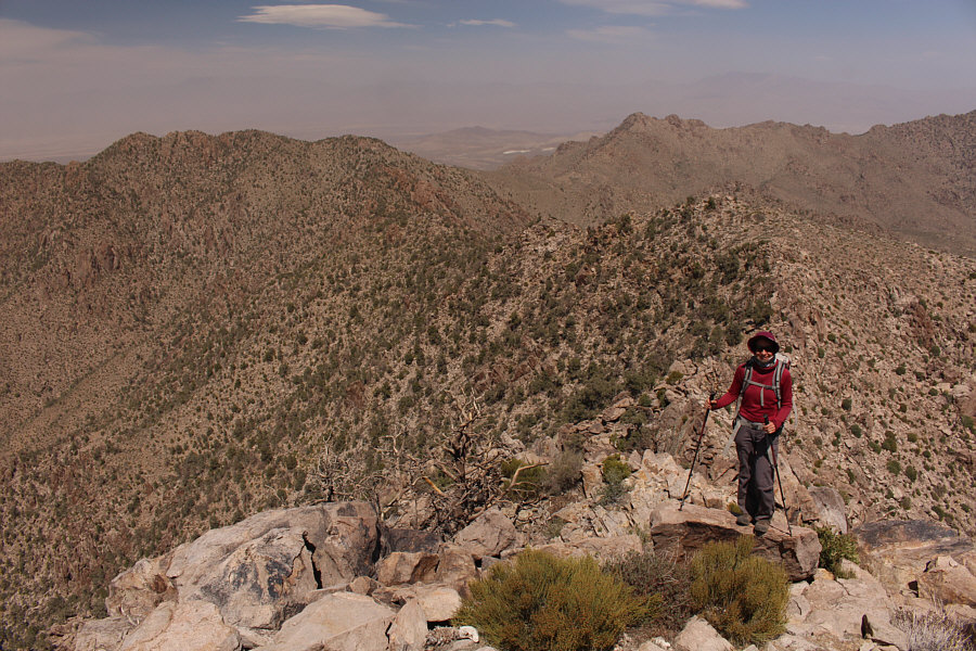
Zosia prepares to return along the north ridge which looks rather innocuous here.
That mountain was so much more enjoyable than this one! Clark Mountain is barely visible through the haze to the southeast.
Just keep it simple and avoid unnecessary scrambling. 
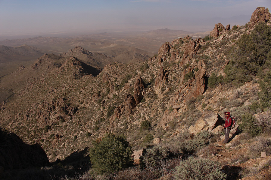
On the return trip along the north ridge, Sonny tries to avoid the more troublesome sections he encountered earlier.

Photo courtesy of Zosia Zgolak

Might have been better just to go right over the top... Zosia approaches the final bump along the north ridge and would actually circumvent it to the right.
Two more hours of misery to come... Zosia stands near the top of the ravine and now faces a long and scrubby descent.
An endurance test both physically and mentally. Total Distance:  13.8 kilometres
Round-Trip Time:  11 hours 51 minutes
Cumulative Elevation Gain:  1313 metres

GPX Data