Starting from Lusk Creek day use area (north side of Highway 68, 1.6 kilometres east of junction with Highway 40), Zosia and I crossed to the south side of the highway where we picked up a trail marked only by an equestrian sign. We climbed up an embankment and initially missed an important turnoff to the left, but it did not take us long to realize our mistake and correct our course. For the next 2.3 kilometres, we climbed steadily along the west bank of Lusk Creek until we reached a signed junction with a cutoff trail heading west. Ignoring this cutoff trail, we continued straight and soon dropped down to cross a footbridge to the east bank of Lusk Creek. We then entered the first of several cut blocks where the trail gradually veers to the southeast before re-entering forest for the final steep climb up to Lusk Pass. The trail actually crests high above the north side of the pass, but just as Daffern had warned, there are no views to speak of here. A little more than 300 metres east of the pass is a horse camp with a corral, picnic tables and an outhouse. We stopped here for a quick snack break before turning around to ski back the way we came.
       Our return ski had a little bit of 
       everything--some terrifyingly steep descents, some fantastic cruising, 
       and some annoying uphill grinds--but in retrospect, it was all quite fun.  
       Snow conditions were excellent, and other than the odd thin spot, 
       coverage was overall very good.  I had a couple of half-wipeouts, 
       but otherwise, Zosia and I both made it back to the trailhead without any 
       drama. 
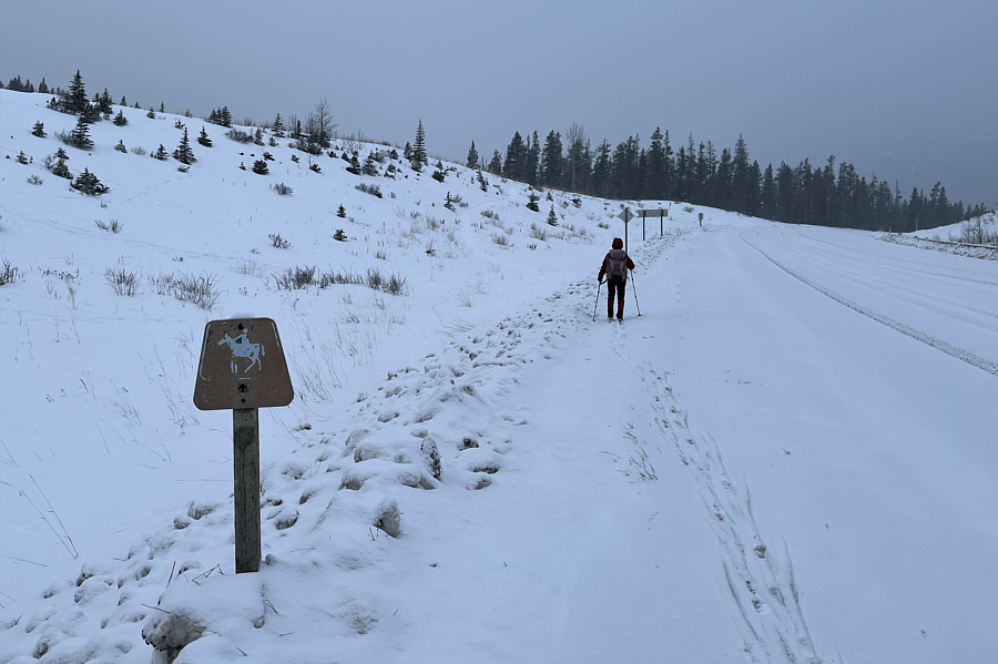
       Zosia crosses the highway to the trailhead which is visible at centre. 
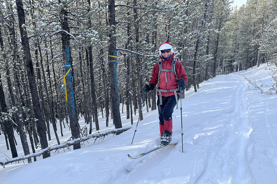
       Zosia lays down a classic herringbone pattern on one of the first steep 
       hills along the route. 
       Photo courtesy of Zosia Zgolak 
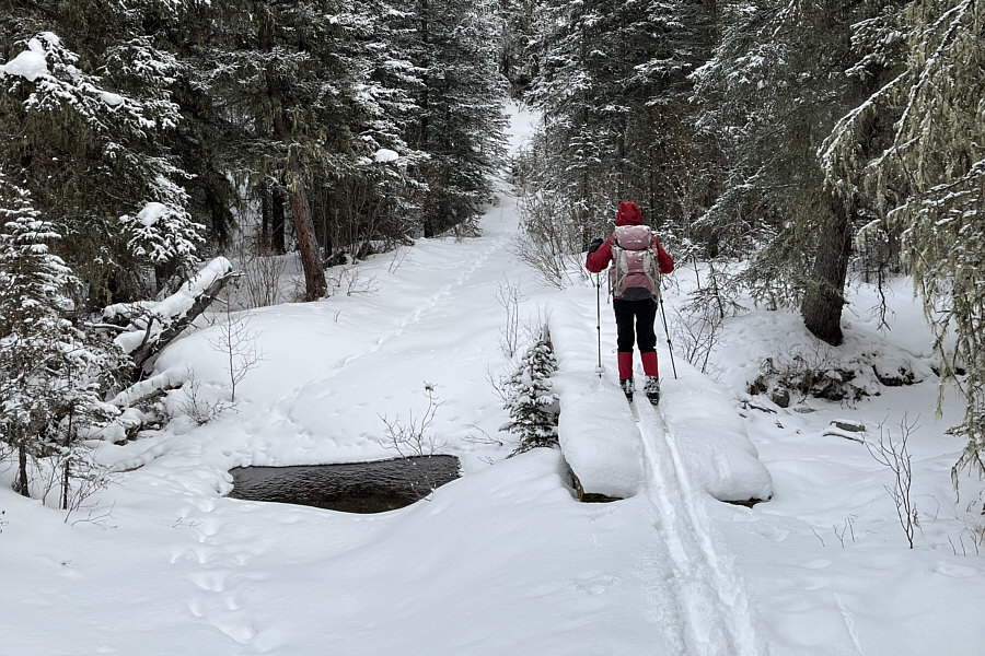
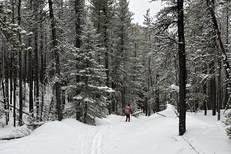
       Zosia crosses a bridge over Lusk Creek. 
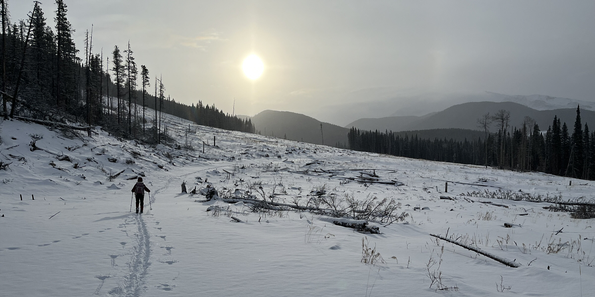
        The trail to Lusk Pass passes through several large cut 
       blocks.   
       Zosia and Sonny enjoy a bit of sunshine at a horse camp just east of Lusk 
       Pass. 
       Zosia descends one of several steep hills on the return ski. 
       This hill is less steep and allows Zosia to let her skis glide more 
       freely. 
       The view of Mount Baldy from this cut block is unfortunately obscured by 
       clouds on this day. 
       Photo courtesy of Zosia Zgolak   
       Seemingly on cue, the sky clears up just as Zosia returns to the 
       trailhead.  In the background is
       Horton 
       Hill.
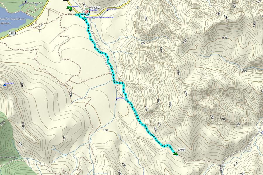


This trail junction sign has seen 
           better days. 


Zosia straps on some climbing skins 
           for the final steep push to Lusk Pass. 


Some yellow and blue flagging mark the 
           high point (~1730 metres) of the trail.  Lusk Pass is actually 
           somewhere lower down the forested slope to the left. 


Sonny enjoys some easy cruising not 
           far from the trailhead.  


       Total 
           Distance:     13.1 kilometres 
         
           Round-Trip Time:  5 hours  16 minutes
           Net Elevation Gain:  362 metres