 |
Zosia begins hiking at intersection marker 109. This is as far as street legal motorized vehicles (eg. cars or trucks) are allowed to drive. The right-hand road is the correct approach for Mount McLaren. |
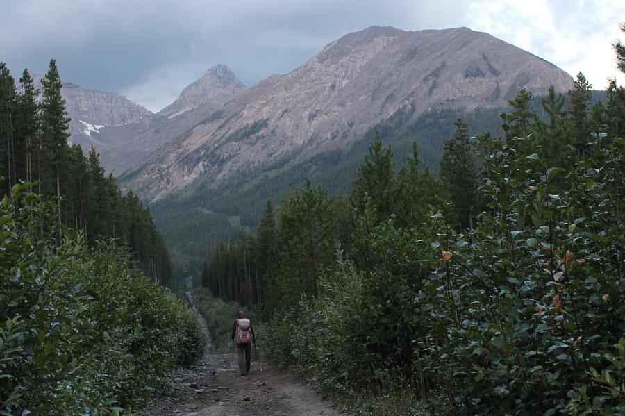 |
Mount Parrish and Mount McLaren are visible in the background as Zosia gradually descends the approach road. |
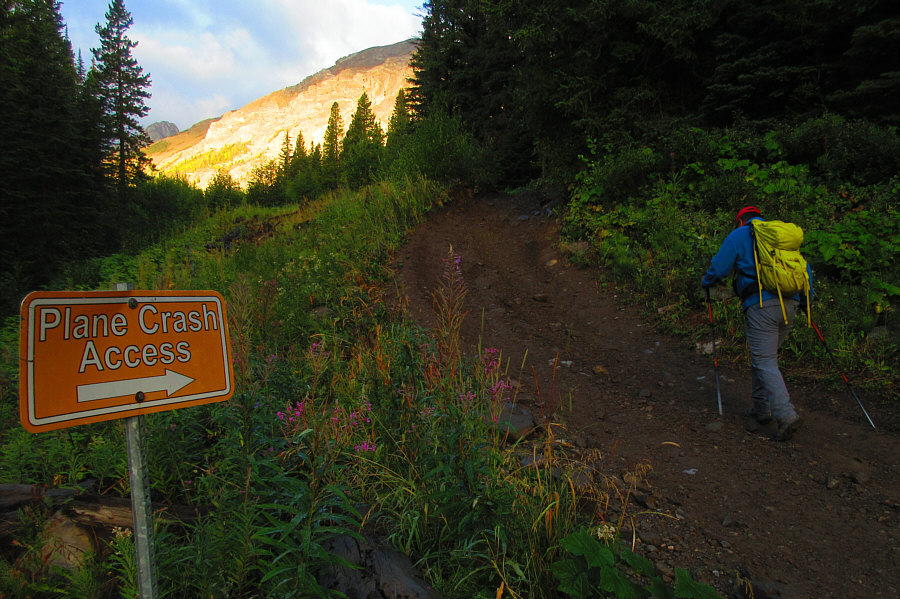 |
The North York Creek road eventually
leads to a historic
plane crash site at the head of the valley. Photo courtesy of Zosia Zgolak |
 |
The east face of Mount McLaren looms ahead. Zosia would eventually climb up the slopes at far right. |
 |
Zosia leaves the road to ascend a partially bushy avalanche slope. |
 |
Ripe raspberries are in abundance on the avalanche slope. |
 |
Zosia veers to climber's right aiming for some conspicuous pinnacles. |
 |
Zosia grinds up the east face of Mount McLaren. The approach road she descended earlier can be seen in the background at far right. |
 |
Sonny gains the north ridge of Mount McLaren. The top of Crowsnest Mountain is hidden in clouds at distant far left. Photo courtesy of Zosia Zgolak |
 |
Clouds shroud the top of Mount Coulthard (far left) as Zosia makes her way to the top of Mount McLaren. |
 |
Sonny takes the last few steps before the summit cairn. Photo courtesy of Zosia Zgolak |
 |
Sonny and Zosia stand on the summit of Mount McLaren (2316 metres). |
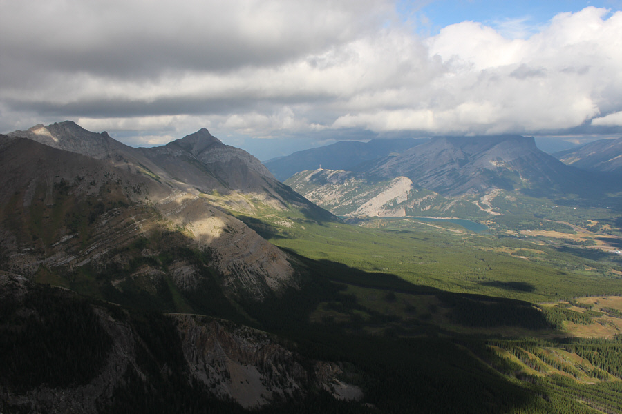 |
Sentry Mountain and Crowsnest Lake are visible to the northwest. |
 |
Zosia descends the south ridge of Mount McLaren with Andy Good Peak (centre) and Mount Parrish (right) in the background. |

Zosia reaches the col between Mount McLaren and Mount Parrish. At left is Mount Coulthard.
 |
Sonny drops down into the bowl below the col. The plane crash site is somewhere in the trees near the snow patch at far right. Photo courtesy of Zosia Zgolak |
 |
Some all-terrain vehicles (ATV) pass Zosia on the way to the plane crash site. |
 |
This is the tail section of a Royal Canadian Air Force DC-3 (Dakota) aircraft that crashed here on 19 January 1946 killing all seven airmen that were on board. |
 |
A lot of plane wreckage including this wing can be found below this beautiful cascade. |
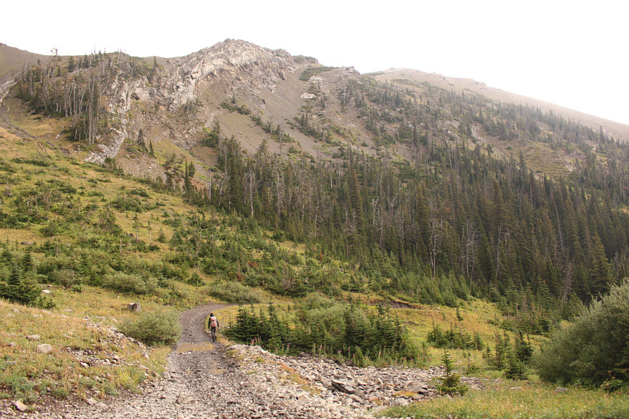 |
Zosia hikes back along the North York Creek road below the slopes of Mount McLaren. |
 |
Parts of the road are treacherously slippery on this rainy day. Photo courtesy of Zosia Zgolak |
 |
Back on the approach road, Sonny waits for a utility task vehicle (UTV) to pass by. Photo courtesy of Zosia Zgolak |
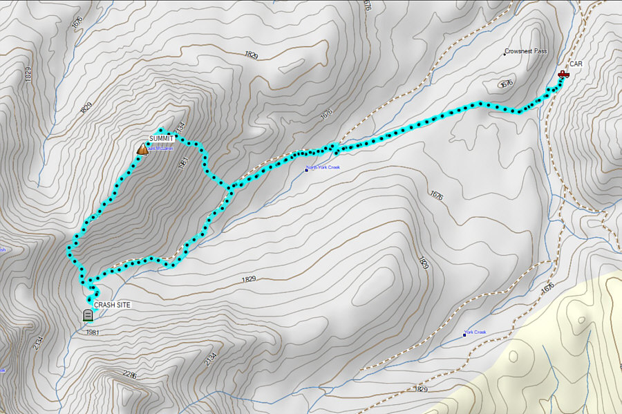 |
Total
Distance: 13.1 kilometres Round-Trip Time: 6 hours 52 minutes Cumulative Elevation Gain: 1078 metres |