BOU AVENUE
Middle Mountain
On 20 August 2022, Zosia Zgolak and I ascended officially-named Middle Mountain which is partly located in the Sheep Rock Unit of Oregon's John Day Fossil Beds National Monument.  Barbara I. Bond's 75 Scrambles in Oregon describes a loop route which entails ascents of Middle Mountain and a higher nearby peak known as Windy Point, and our original plan was to tag both summits without doing the extended loop.  Unfortunately, this part of Oregon is quite arid and really cooks during the height of summer much like the deserts of Arizona or Nevada.  In the end, we would only manage to climb Middle Mountain, and most of the ascent would be in the shade while the morning sun was still low on the horizon.

From Highway 26, turn north onto Highway 19, 127.0 kilometres east of the junction with Highway 126 in Prineville or 48.0 kilometres west of the junction with Highway 395 in Mount Vernon.  Drive 7.0 kilometres and park in a pullout on the east side of the highway just south of the bridge over John Day River.

From the pullout, Zosia and I carefully crossed the bridge along the highway to the start of an old road running along the east bank of John Day River.  We walked south along the road until it looked feasible to climb up the hillside to the east.  A few short cliff bands early on were easy enough to scramble up, and we subsequently settled into a mostly off-trail hike up the west ridge of Middle Mountain.  The only real challenge was having to climb over a barbed-wire fence just before the final rise to the top; this fence marks the boundary of the National Monument.  There are three distinct bumps on top of Middle Mountain, and although I measured the one furthest east to be marginally higher than the rest, they are all practically the same height.

The heat from the sun was already becoming unbearable when Zosia and I tagged the summit of Middle Mountain, and we quickly decided that it was not worth extending the hike to the higher Windy Point.  Instead, we backtracked a bit to take a short break in the shade of a bluff just below the summit ridge before retracing our steps all the way down to the old road without any trouble.  After walking back to our car, we drove to the nearby Thomas Condon Paleontology Center and had some lunch before heading elsewhere for our next adventure.
Watch out for speeding cars!

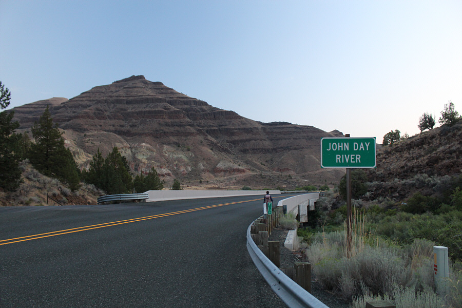
The starting point for the hike is on the far side of this bridge.

I wonder when was the last time anyone drove this road...

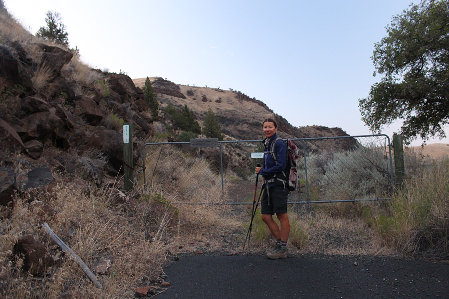
The hike starts along a gated old road.

At least the approach is nice and short! Leaving the old road, Zosia begins climbing uphill across the river from the parking spot.
Look at the bones!

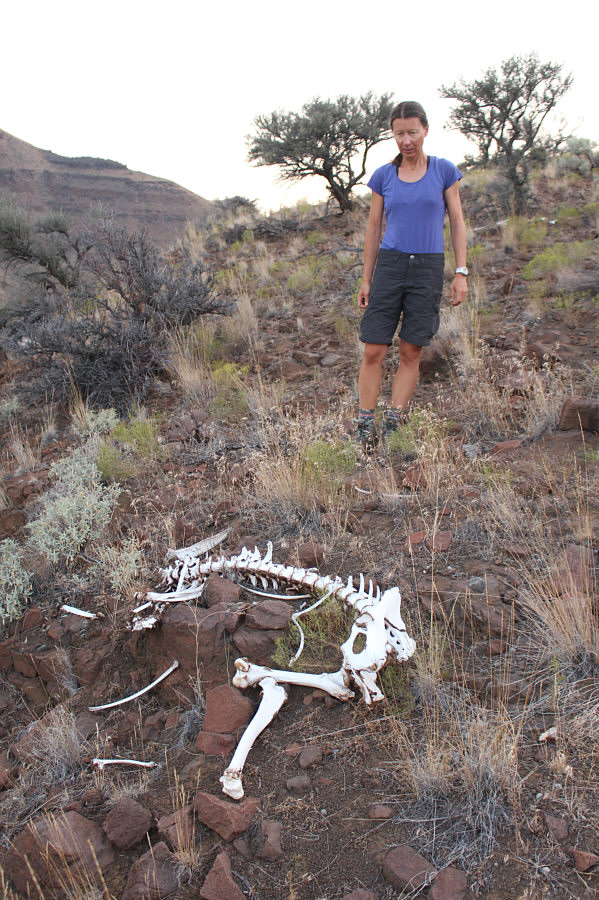
Zosia comes across some bleached bones early in the ascent.

Mostly easy off-trail hiking. Zosia ascends the west ridge of Middle Mountain.  The summit is not visible here.
Feels bloody warm already...

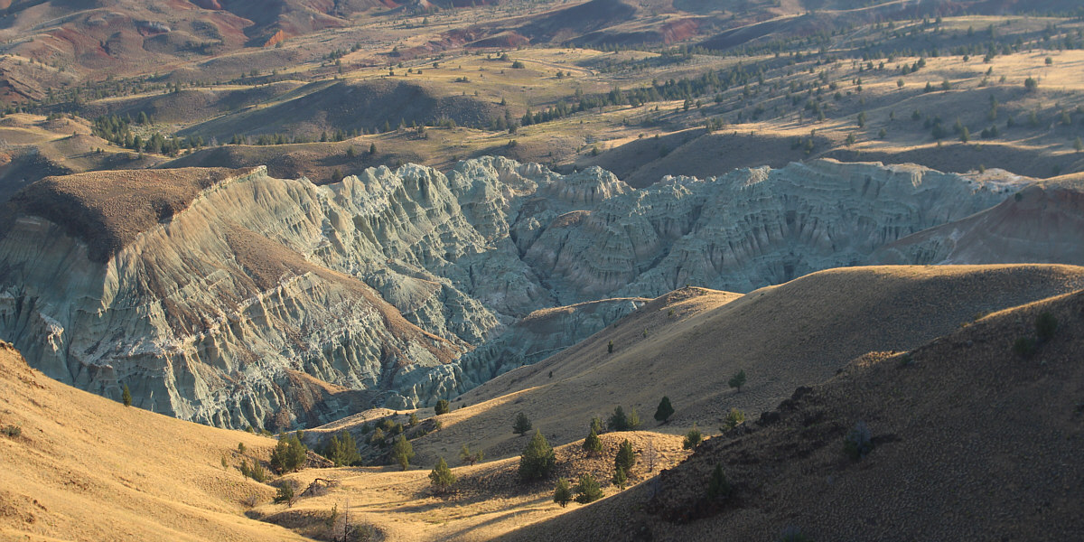
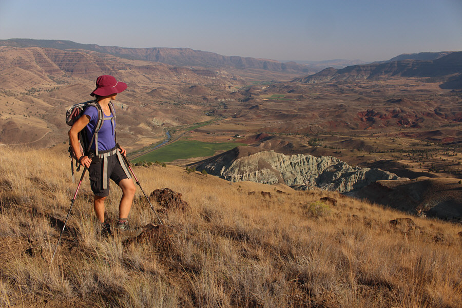
Zosia traverses a grassy slope en route to the next bump (not the summit) along the ridge.

What does she see on the other side? Zosia pauses before yet another bump on the ridge.

Might be worth a closer look if we ever come back here...

To the north is a strip of badlands known appropriately as Blue Basin.


Shoulda been called "Nipple Mountain"! Zosia drops into a slight dip before the final rise to the top of Middle Mountain.
Still not the summit apparently! Zosia approaches a knob at the west end of the summit ridge.
How do you like my sweat marks? Zosia and Sonny stand on the knob (1093 metres) at the west end of the summit ridge.
I hate summit ridges with multiple high points that are roughly of equal height! Zosia tags an intervening knob before heading to the east end of the summit ridge a short distance further.
It's only 9:30 AM, and it already feels like it's cooking out here! After tagging the true summit (1094 metres) of Middle Mountain, Zosia takes a last look at Blue Basin and the valley beyond before heading back the way she came to escape the rising heat.
Glad we're in the shade now instead of cooking on that ridge! Here is a view of Middle Mountain from the Thomas Condon Paleontology Center.

Photo courtesy of Zosia Zgolak

A short but rewarding grunt and not much else. Total Distance:  5.0 kilometres
Round-Trip Time:  4 hours 19 minutes
Net Elevation Gain:  444 metres

GPX Data