BOU AVENUE
Moose Mountain And Blue Mountain
On 24 August 2022, Zosia Zgolak and I traversed Moose Mountain in the Cabinet Mountains of northern Idaho.  The inspiration for this trip came from Seabury Blair Jr.'s guidebook, Day Hike! Spokane, Coeur D'Alene & Sandpoint.  The summit is easily reached via a good trail and can be incorporated into a loop hike that includes nearby Moose Lake.  Probably the most difficult aspect of this trip is the long drive to get to the trailhead.

From Highway 200, turn east onto Trestle Creek Road (2WD gravel), 21.0 kilometres east of the interchange with Highways 2/95 in Coeur D'Alene or 21.0 kilometres north of the intersection with Main Street in Clark Fork.  Drive eastward for 25.0 kilometres to the junction with Lightning Creek Road and turn left.  Drive 1.5 kilometres and make a hairpin right turn onto rougher Moose Creek Road (high-clearance recommended).  Drive 3.6 kilometres to road's end at the trailhead (vault toilet).

After camping the previous night at the trailhead, Zosia and I set off in the morning up the signed trail (#237) to Moose Lake.  Not far from the trailhead, we passed a signed junction with trail #24 which would ultimately be our return route.  Continuing on trail #237, we passed another signed junction (trail #36 to Lake Estelle) before eventually reaching Moose Lake.  At this point, the trail briefly skirts the western shore and then begins climbing steadily until it intersects trail #213 near the crest of Moose Mountain's east ridge.  Turning right, we followed this trail up to the summit without difficulty.

The ascent of Moose Mountain felt so effortless that Zosia and I did not feel the need to take an extended break at the summit.  Instead, we promptly dropped down the northwest ridge along trail #213 until it intersected trail #24 (access to Blacktail Lake).  We did not feel any great desire to visit Blacktail Lake and simply turned right to return to the trailhead.  The descent along trail #24 felt rather long-winded and uninspiring, but in any case, we made it back to trail #237 and the trailhead without any drama.
This trail probably sees more traffic on summer weekends.

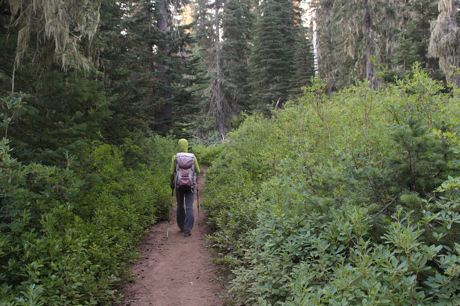
Zosia hikes the well-maintained trail to Moose Lake.

Deserted and quiet on this day.

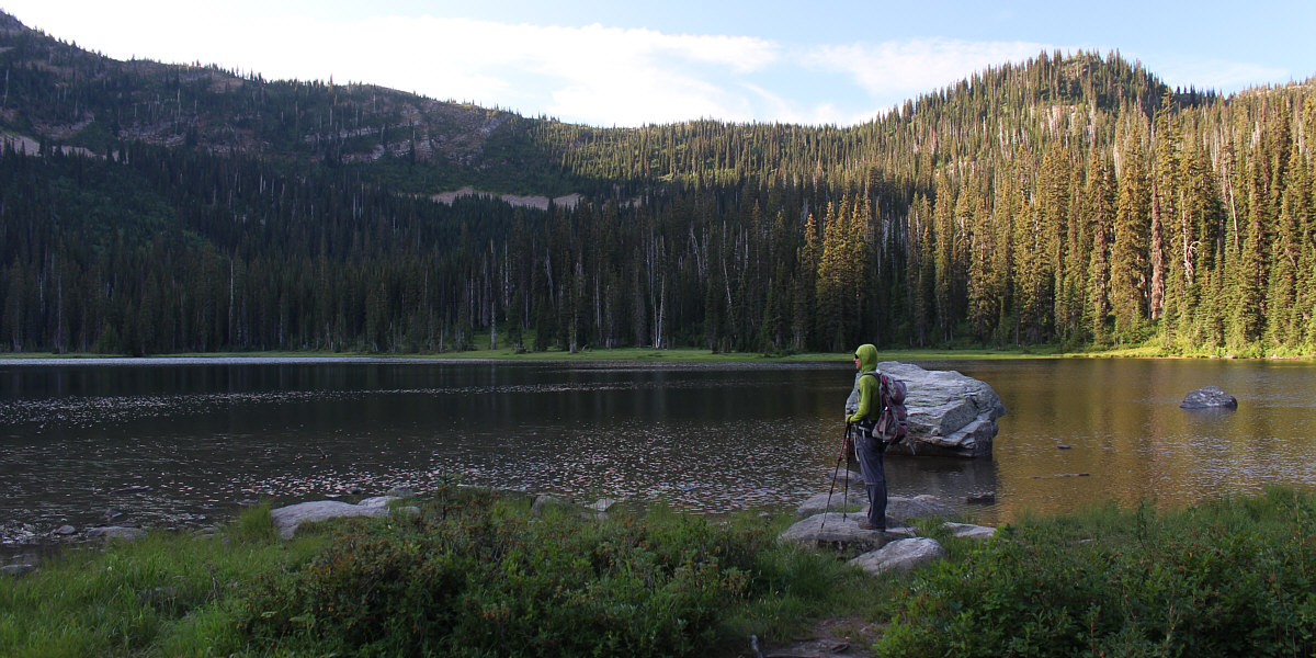
Zosia arrives at Moose Lake.


I guess it gets boggy here earlier in the summer? 
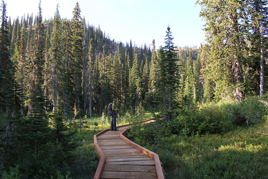
This seemingly superfluous boardwalk looks fairly brand new.

Hope it's not moving south!

A cumulonimbus cloud develops to the north.


The summit is not visible here. 
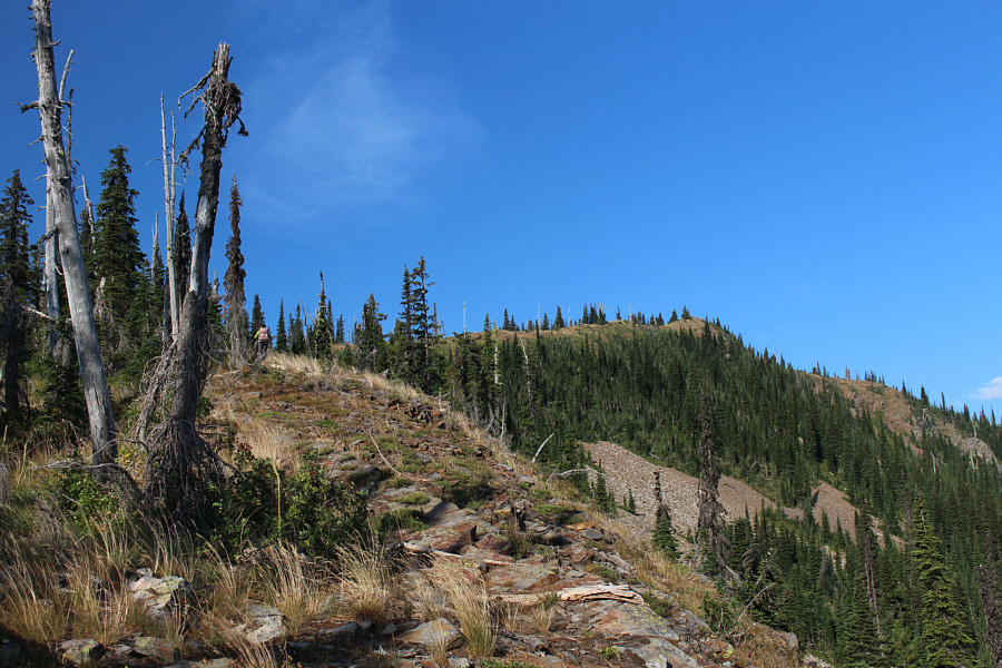
Zosia gains the east ridge of Moose Mountain.
Why didn't someone chop them down? 
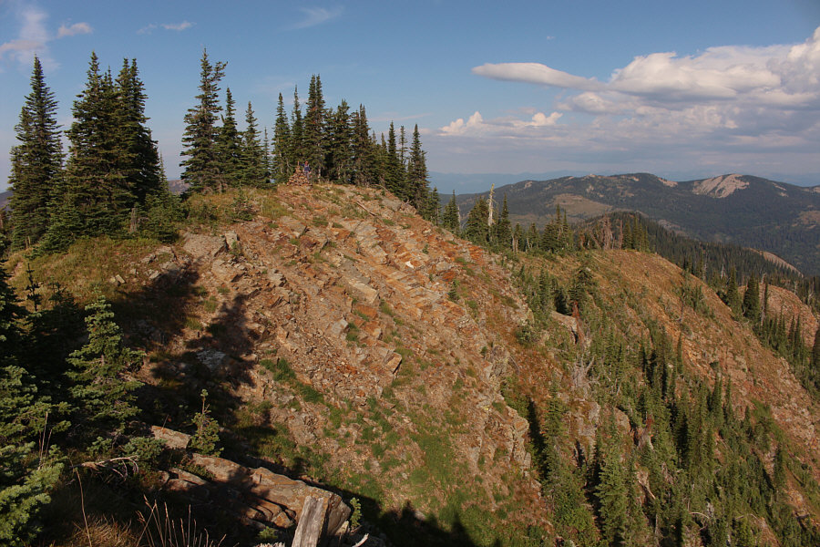
The summit of Moose Mountain is partially covered with trees.
Not as nice as our Moose Mountain near Calgary! 
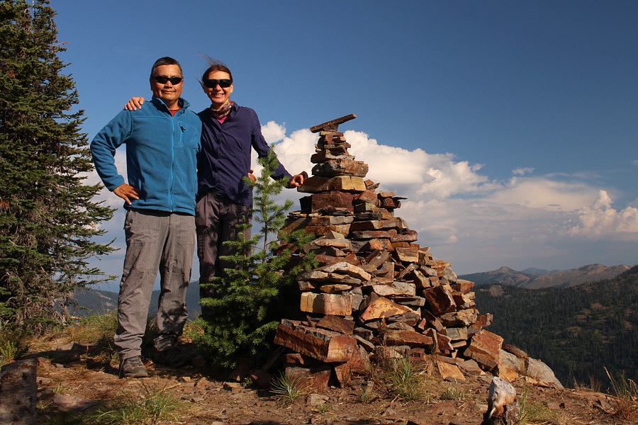
Sonny and Zosia stand on the summit of Moose Mountain (1988 metres).
Looks rather underwhelming, doesn't it? 
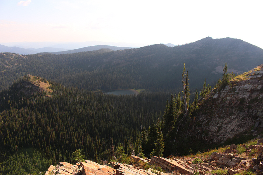
Moose Lake is visible to the northeast in this view from the summit.
There's not much to recommend this rather long-winded alternate descent route. 
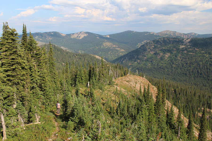
Zosia descends the northwest ridge of Moose Mountain.
Okay, maybe this makes it worthwhile to take the alternate descent route... 
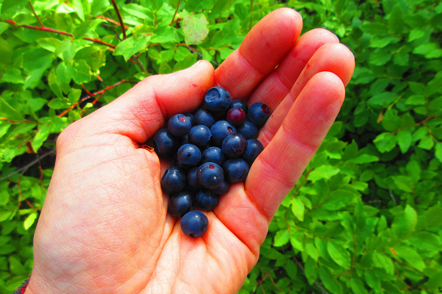
Zosia finds lots of ripe huckleberries along the trail during the descent.

Photo courtesy of Zosia Zgolak
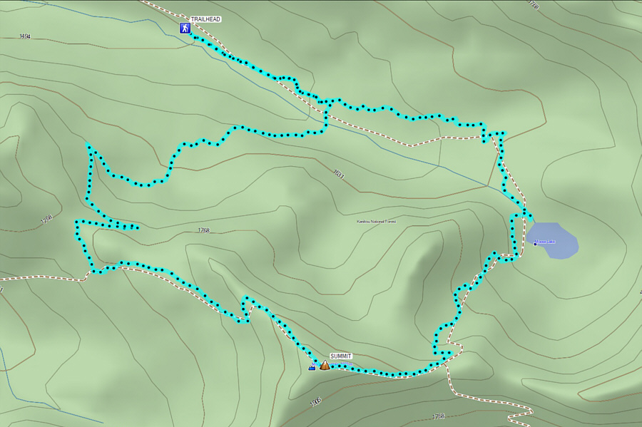
Nice easy hike but hardly worth the long drive to get here. Total Distance:  10.9 kilometres
Round-Trip Time:  4 hours 15 minutes
Net Elevation Gain:  488 metres

GPX Data

Following a lengthy drive back to Highway 200, Zosia and I stopped to play disc golf in the town of Clark Fork and also subsequently in the city of Libby, Montana.  We originally made plans to hike Blue Mountain located just northeast of Libby the following day, but when we drove up the access road, we were surprised to find that it was drivable all the way to the top.  As such, we were able to explore the abandoned fire lookout tower on the summit before sunset.  We also decided to camp there and were treated to quite a lightning show as a thunderstorm rolled through the area during the night.  Directions to Blue Mountain are as follows:

From Libby, drive north on Highway 37 across the bridge over Kootenai River.  About 600 metres past the bridge, turn left onto Pipe Creek Road (Highway 567).  Drive 11.0 kilometres, and turn right onto Blue Mountain Road (forestry road 755).  Drive 17.5 kilometres all the way to the top of Blue Mountain.  The upper half of this road has some rough spots but should still be passable for most 2WD vehicles (high-clearance recommended).
It's just begging to be climbed! 
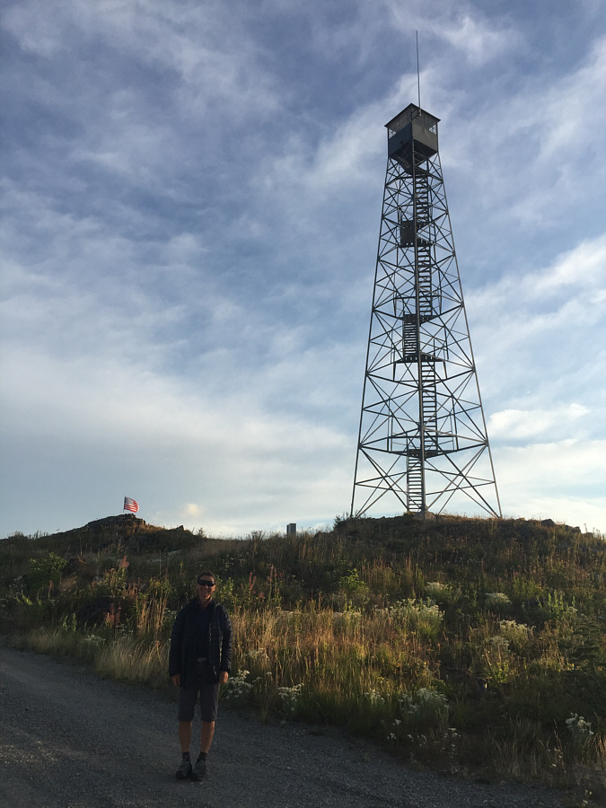
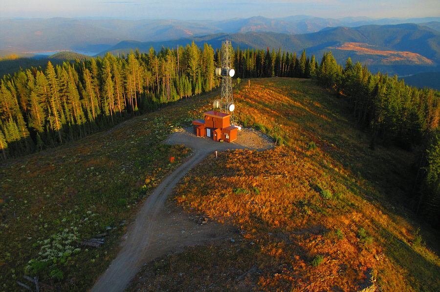
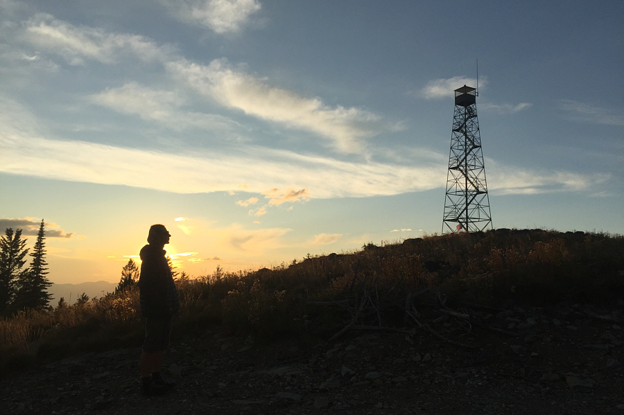
An abandoned fire lookout tower stands on the summit of Blue Mountain.
This benchmark is over a hundred years old is seems! The elevation of Blue Mountain is approximately 1841 metres.
I wonder if engineers still regularly check the integrity of this tower... 
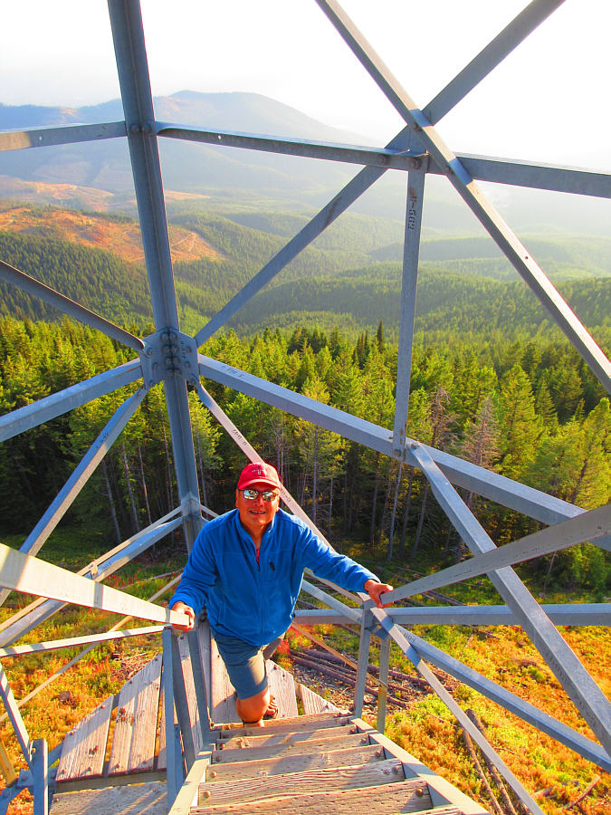
Sonny climbs up the fire lookout tower.

Photo courtesy of Zosia Zgolak

The beer cans help to balance the fire finder...I think! 
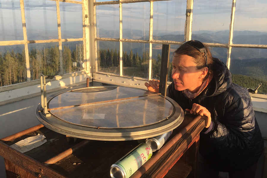
Zosia tries out the Osborne Fire Finder at the top of the fire lookout tower.
I had to open a window for Zosia to take this photo. 
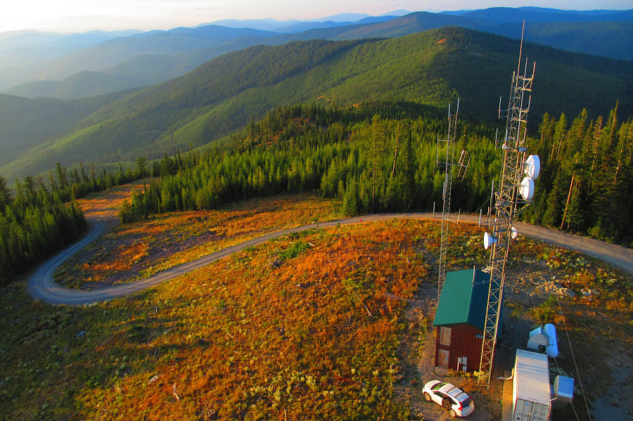
Part of Lake Koocanusa (upper left) is visible to the southeast in this view from the top of the fire lookout tower.

Photo courtesy of Zosia Zgolak

There's even Wi-Fi down there, but it's password-protected. Doh! This is the view to the northwest from the top of the fire lookout tower.

Photo courtesy of Zosia Zgolak

Good night! Zosia watches the sunset from the top of Blue Mountain.