BOU AVENUE
Mormon Peak And Lolo Peak
On 7 August 2022, Zosia Zgolak and I ascended Mormon Peak and Lolo Peak located in the Bitterroot Mountains southwest of Missoula, Montana.  A long but fairly straightforward ascent route for Lolo Peak is well-documented at summitpost.org, and die-hard peak-baggers can also tag nearby unremarkable Mormon Peak with minimal extra effort.  Relatively easy access makes Lolo Peak an attractive objective for hikers and backpackers, and even the approach trail is apparently popular with mountain bikers.

From the intersection with Highway 93 in the town of Lolo, drive west on Highway 12 for 6.0 kilometres and turn south onto Mormon Peak Road (2WD gravel).  Immediately cross a bridge and drive 3.7 kilometres to a junction.  Keep straight (right) and drive another 9.8 kilometres to the unsigned trailhead for Lolo Peak located at a hairpin turn.  The road becomes rougher (high-clearance recommended) and continues for another 2.2 kilometres to a former fire lookout site at the east end of Mormon Peak's summit ridge.

After camping the previous night at the fire lookout site, Zosia and I started the day with a very brief ascent of Mormon Peak.  Confident that nobody would be driving up there that early in the morning, I parked my car in the middle of the road just below the summit, and we simply made a beeline up the scrubby hillside.  I am not sure why this forested bump is even officially named, but the ascent from the road is so short that I waited until I reached the summit before eating my breakfast.
Oh what a beautiful morning!

Sonny gets up before sunrise at his campsite near the top of Mormon Peak.

Photo courtesy of Zosia Zgolak

Short but it's not exactly a walk in the park either!

Zosia begins the short ascent to the top of Mormon Peak.

I still can't believe this is an official summit! Zosia and Sonny enjoy some raspberry cookies on the summit of Mormon Peak (1841 metres).
Looks like the mountain is on fire! From the top of Mormon Peak, the northern aspect of Lolo Peak can be seen to the southwest.
Might as well tag this summit if you're already in the area! Total Distance:  370 metres
Round-Trip Time:  20 minutes
Net Elevation Gain:  39 metres

GPX Data

Zosia and I subsequently headed to the trailhead for Lolo Peak and began hiking a well-defined trail which winds steadily up a slope which was scorched by a wildfire in 2017.  The trail climbs over an intervening ridge before dropping down to an earthen dam at the east end of Carlton Lake.  There are no difficulties in reaching Carlton Lake, but the route is nevertheless long and, at times, uninspiring.  We stopped for a short break on the dam--the outlet stream is a good place to replenish water supplies--before continuing south along the trail for a short distance.  Where the trail begins to descend and turn eastward, we left it to ascend semi-open slopes to the west aiming for a saddle on the ridge separating Carlton Lake and North One Horse Lake.  Upon gaining the ridge crest, we followed it westward and had to circumvent a few pinnacles before reaching the north summit of Lolo Peak.  From there, we had no further difficulties descending into a broad gap before hiking up to the south (true) summit.

Zosia and I took an extended break on the south summit of Lolo Peak before retracing our steps back over the north summit.  Instead of backtracking down the ridge, we took a short cut directly down to the west end of Carlton Lake.  This descent route is steep and rugged, and although it saved us a bit of distance, I am not sure if I would wholeheartedly recommend it.  From the west end of Carlton Lake, we walked around the south shore to reach the dam and regain the main trail.  The hike out felt long especially with soaring temperatures in the late afternoon, and I was quite envious of the few mountain bikers that bombed past us on the way back to the trailhead.
It's gonna be a long day... 
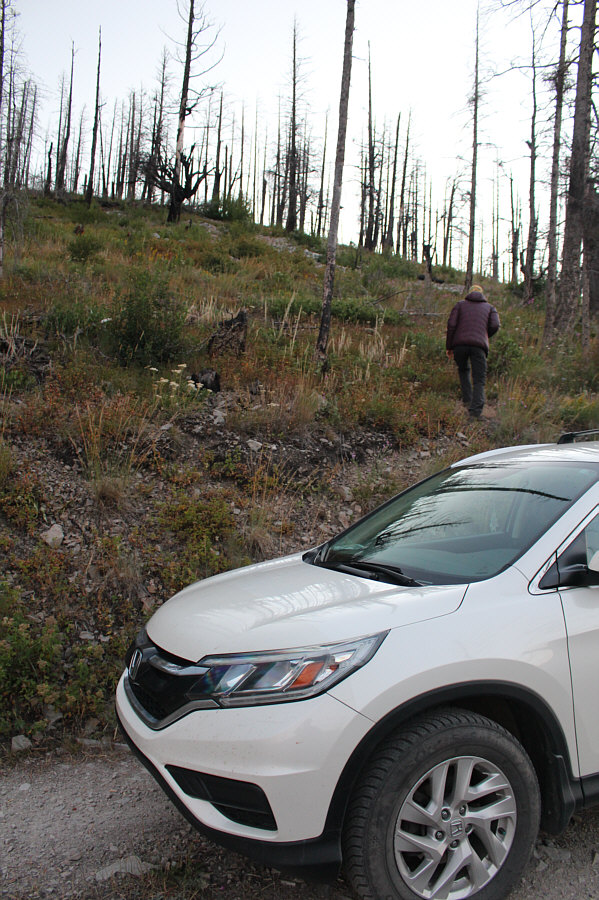
Remnants of a sign and some concrete blocks mark the start of the trail to Lolo Peak.
I saw the fires on my way home after watching the 2017 total solar eclipse. 
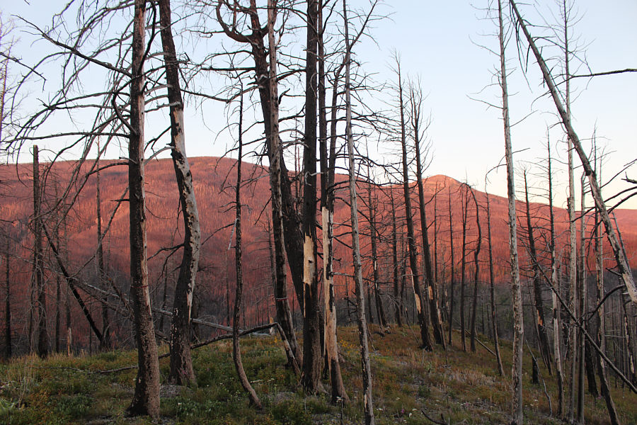
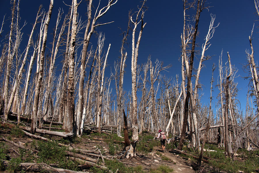
A large wildfire decimated most of the trees in this area in 2017.
Hi there! Some mule deer are startled by the presence of hikers.

Photo courtesy of Zosia Zgolak

And Missoula is somewhere in the hazy valley. 
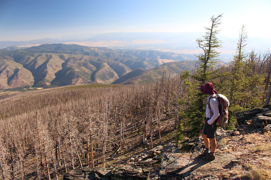
Blue Mountain can be seen at distant left from one of the first clear viewpoints along the trail.  The closer forested mound right of centre with the visible roads is Mormon Peak.
But first, we need to annoyingly lose some hard-won elevation... The easiest route to Lolo Peak's north summit (right) goes up the skyline ridge from the left.

Not the true summit.

Here is an unobstructed view of Lolo Peak's north summit above Carlton Lake.


Carlton Creek flows out the east side of the dam and is a good place to replenish your water supply. Zosia crosses an earthen dam at the east end of Carlton Lake.  The route to Lolo Peak goes up the forested slope at right.
There she is...like a beached whale! After climbing up to the ridge crest above Carlton Lake, Zosia gets her first glimpse of Lolo Peak's south (true) summit.
Looks like the lake is a bit low... 
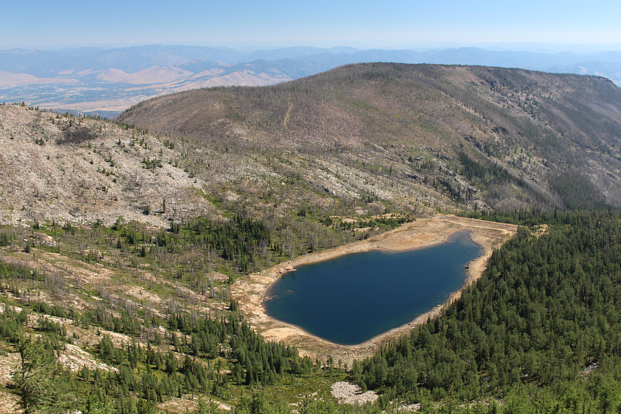
Here is an aerial view of Carlton Lake from the ridge leading to Lolo Peak's north summit.
Most difficulties can be circumvented to climber's right. 
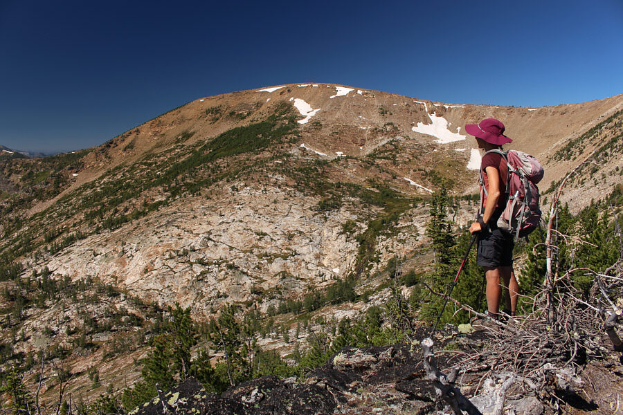
Climbing the ridge to Lolo Peak's north summit is technically easy but not necessarily straightforward.
Zosia is pointing at a survey marker. Zosia stands on Lolo Peak's north summit (2767 metres).

No problemo!

Zosia traverses the easy connecting ridge to Lolo Peak's south summit.


Second summit of the day! Zosia and Sonny stand beside a big cairn on Lolo Peak's south summit (2783 metres).
Now I wanna go climb it! 
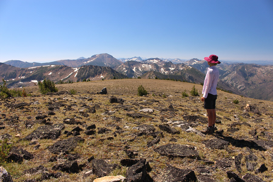
The notably big mountain to the south is Saint Joseph Peak.
Both lakes are probably seldom visited. In the basin to the east are North One Horse Lake (left) and Reed Lake (right).
Looks almost identical to the south summit. Zosia makes her way back to the north summit.
The smaller lake kinda looks nicer since it seems to be fuller... This vantage point on the ridge below the north summit grants views of both Carlton Lake and Little Carlton Lake.
The short cut was not as easy as it looked from above... Zosia takes a short cut down to Carlton Lake.
Watch out for muddy and wet spots! 
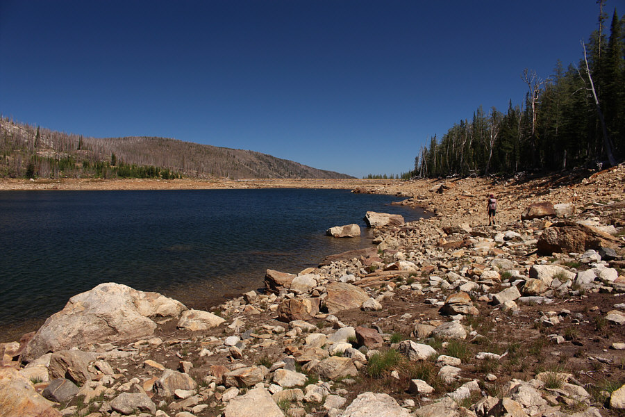
Zosia walks along the south shore of Carlton Lake.
The heat was brutal! 
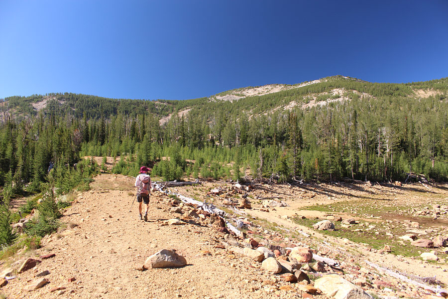
Zosia regains the main trail and settles into a long, hot and dusty walk back to the trailhead.
Pretty hard-core mountain biking! On his way out, Sonny is passed by one of several mountain bikers riding up the trail.

Photo courtesy of Zosia Zgolak
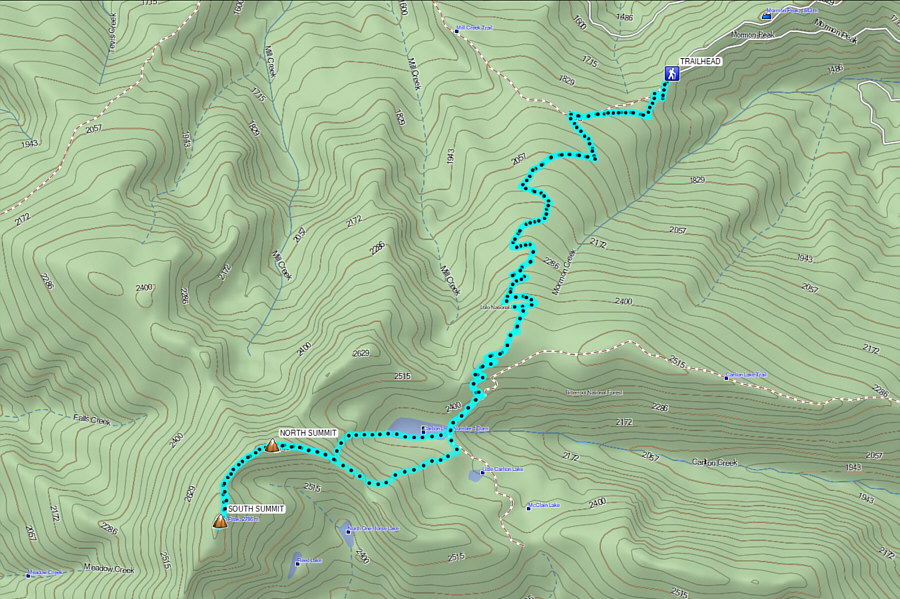
Maybe a bike'n'hike is not such a crazy idea for this peak... Total Distance:  21.6 kilometres
Round-Trip Time:  11 hours 9 minutes
Cumulative Elevation Gain:  1461 metres

GPX Data