BOU AVENUE
The Onion
On 3 September 2022, Zosia Zgolak and I ascended The Onion, an unofficially-named hump just above Bow Hut in Alberta's Banff National Park.  Although long-known to ski mountaineers that frequent the Wapta Icefield, The Onion has become immensely popular with summertime hikers thanks in part to numerous online trip reports such as the one published by Andrew Nugara who later added it to his guidebook, More Scrambles in the Canadian Rockies.  The easiest ascent route takes advantage of a well-established approach trail to Bow Hut, and although technical difficulties are few, there are some route-finding challenges as well as a few tricky stream crossings.

Starting from the The Lodge at Bow Lake (formerly known as Num-Ti-Jah Lodge; located on the west side of Highway 93, 35.7 kilometres south of the junction with Highway 11 at Saskatchewan Crossing or 40.1 kilometres north of the junction with Trans-Canada Highway near Lake Louise), Zosia and I hiked the well-trodden trail along the north shore of Bow Lake.  At the west end of the lake, the trail goes over a low ridge and crosses gravel flats before rising up some man-made steps near the entrance to a gorge.  At the top of the steps, we turned left at a signed junction and immediately scrambled over a massive chockstone wedged in the gorge.  We picked up the trail on the far side of the gorge and followed it through a bit of forest before descending slightly to more gravel flats with views of impressive Bow Glacier Falls.  The trail disappears briefly here alongside a creek, and we had to scramble over some awkward boulders until we found the trail again near the entrance to a canyon.  Unlike the winter access route which enters the canyon, the summer trail climbs high up the east bank and goes through some tedious stretches of forest before finally breaking out of the trees for good in the upper valley.  We took a bit of a wrong turn here and lost the trail again, but the wide open terrain was easy enough to navigate as we continued south toward the head of the valley.  We eventually regained the trail and followed it up a steep headwall before crossing a couple of glacial streams to reach Bow Hut.  The trail continues above the hut and essentially peters out below the south side of The Onion at the edge of the Wapta Icefield.  Following painted markers, we scrambled up a mix of rocky ribs and easy slabs until we gained a broad low-angled slope.  The remaining walk to the summit was easy.  Not surprisingly, the summit was crowded with people on this day, but we still found plenty of space to relax and enjoy lunch.  More disappointing was the haze from wildfire smoke which somewhat marred the already stunning panoramic views.

Once we finished lunch, Zosia and I wandered a little further down the north side of The Onion for better views of Bow Glacier and Iceberg Lake.  From there, we circled back to our line of ascent and carefully descended the aforementioned rocky ribs and slabs without incident.  The remainder of the long hike out was mostly unremarkable.  We had no issues with re-crossing the glacial streams below Bow Hut or scrambling over the chockstone in the gorge, and we even managed to stay on trail in the upper valley.  We made a very minor route-finding error near the west end of Bow Lake, but it was not difficult to get back on track.  A greater source of grief were the hordes of tourists milling about at the trailhead and the deplorable state of the vault toilets there.  We did not envy the Parks Canada staff who would be tasked with cleaning up the horrifying mess left in the washroom stalls.
Wow, so beautiful already. Do we really need to go any further?

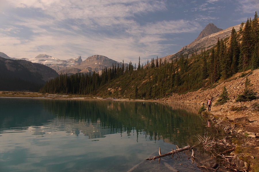
Zosia looks across Bow Lake toward The Onion at distant left.  Also visible to the right are Portal Peak and Mount Thompson.

Don't you just wanna jump in the lake?

Zosia follows some other hikers to the west side of Bow Lake.

Made for giants? Zosia climbs some giant steps near the entrance to a gorge.
There used to be a step ladder here. Who took it away?

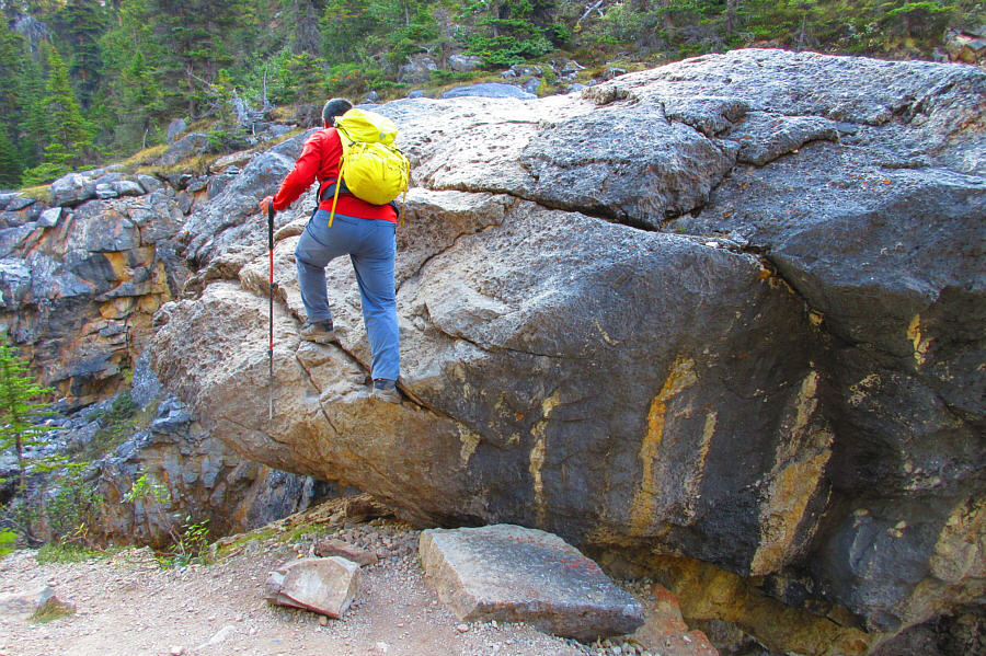
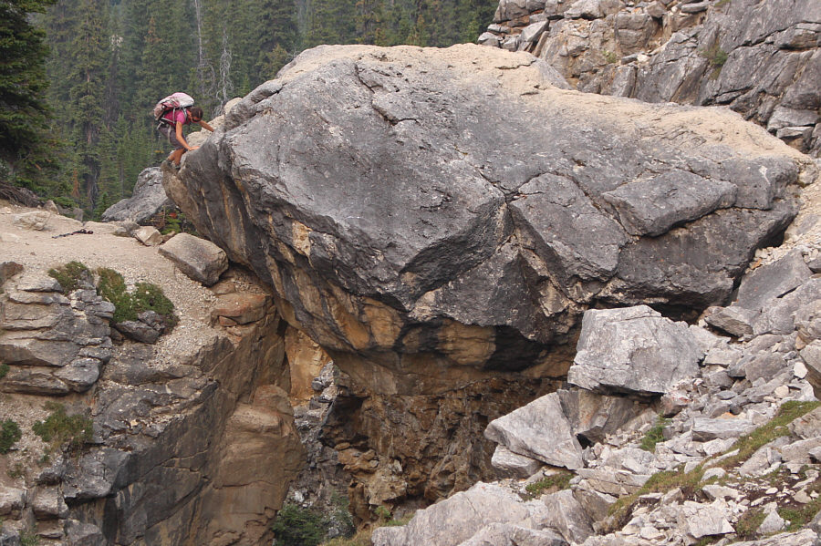
Sonny climbs onto a chockstone that bridges the gorge.

Photo courtesy of Zosia Zgolak

It's a gusher today! 
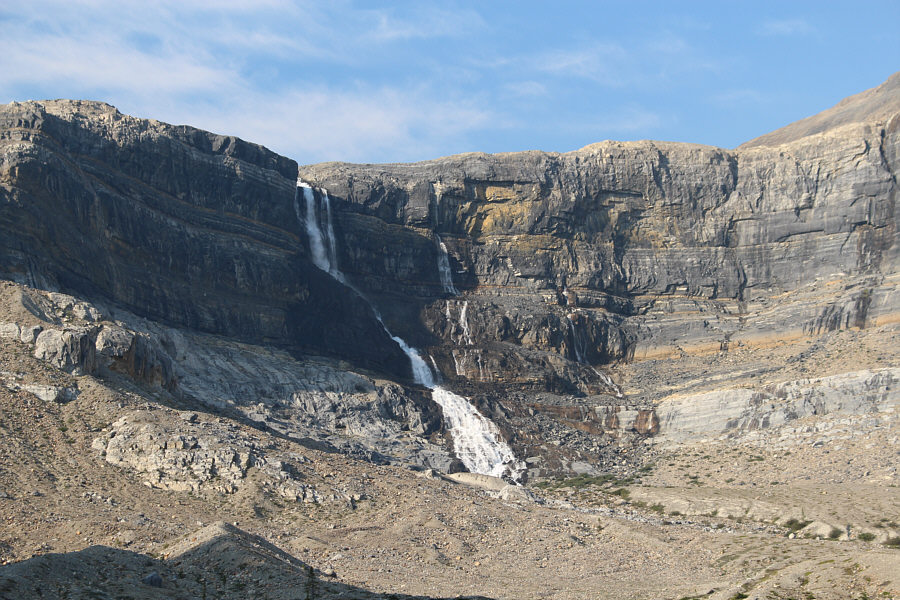
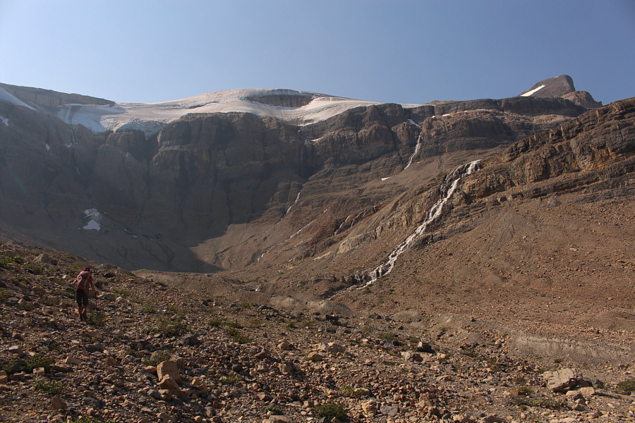
Here is a closer look at Bow Glacier Falls.
I think I prefer the winter access...

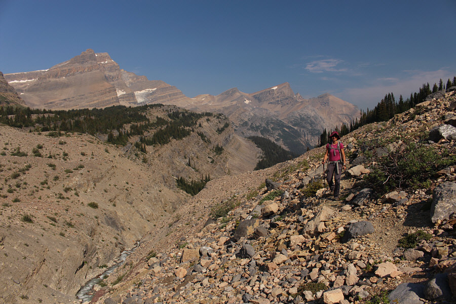
Unlike the winter access to Bow Hut which goes straight through this canyon, the summer trail climbs high above the east (left) bank.

The canyon bypass is probably the worst part of the hike.

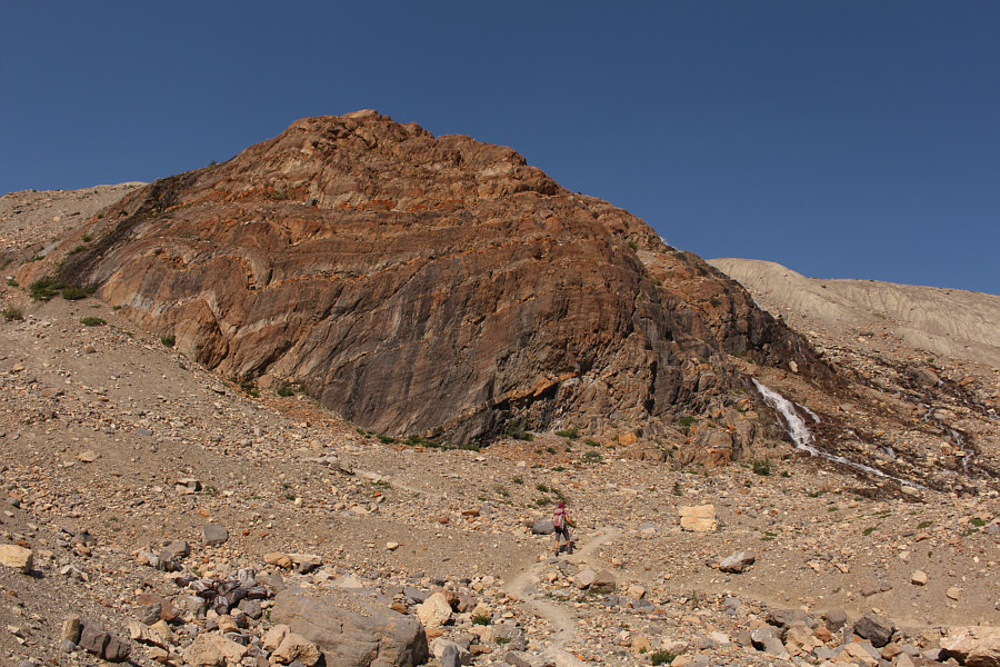
The trees thin out as Zosia progresses up the valley beyond the canyon.

Aim for the headwall to the left of the big waterfall!

Zosia loses the trail in the upper valley, but travel is still relatively easy.

Get ready for a bit of a grunt!

Zosia picks up the trail again before going up a headwall to the left.

These crossings were not easy!

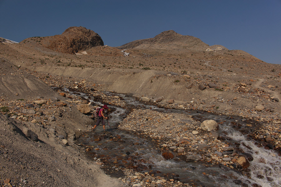
Zosia tries to rock-hop the first of two glacial streams cutting across the trail to Bow Hut which is visible at upper right.

Nice shack.

Sonny arrives at Bow Hut (2402 metres).

Photo courtesy of Zosia Zgolak

Magnificent!

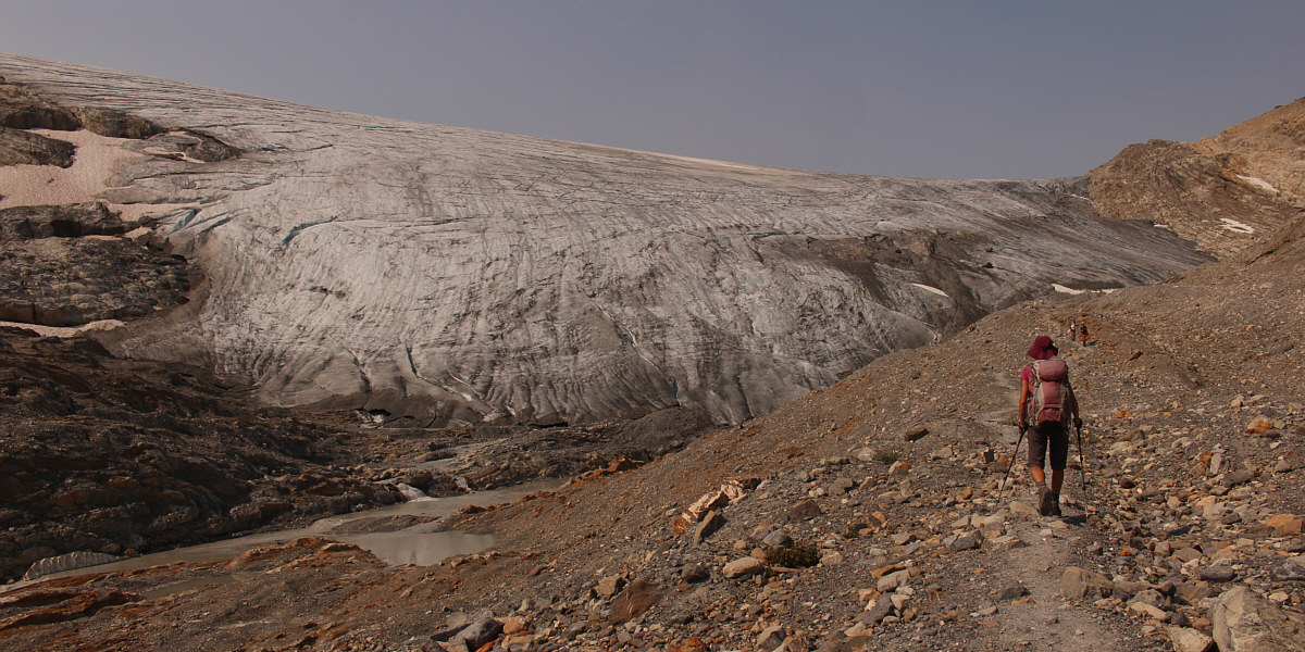
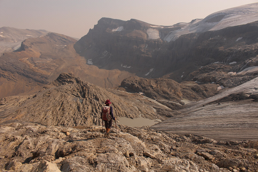
Zosia approaches the Wapta Icefield.


Just follow the crowds!

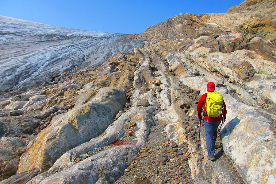
The route to The Onion goes up a series of rocky ribs on the edge of the glacier.

Photo courtesy of Zosia Zgolak

Cue the theme from "JAWS"!

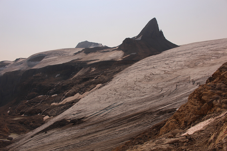
St. Nicholas Peak sticks up above the Wapta Icefield like a great shark fin.

Don't worry; the easy route goes left to avoid these rock bands!

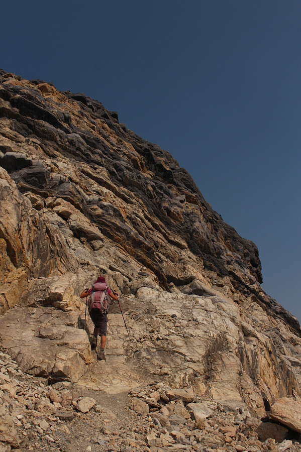
Zosia approaches some interesting rock bands while scrambling up The Onion.

No sweat...okay, maybe a little!

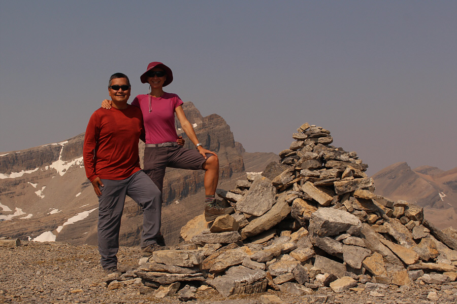
Sonny and Zosia stand on the summit of The Onion (2675 metres).
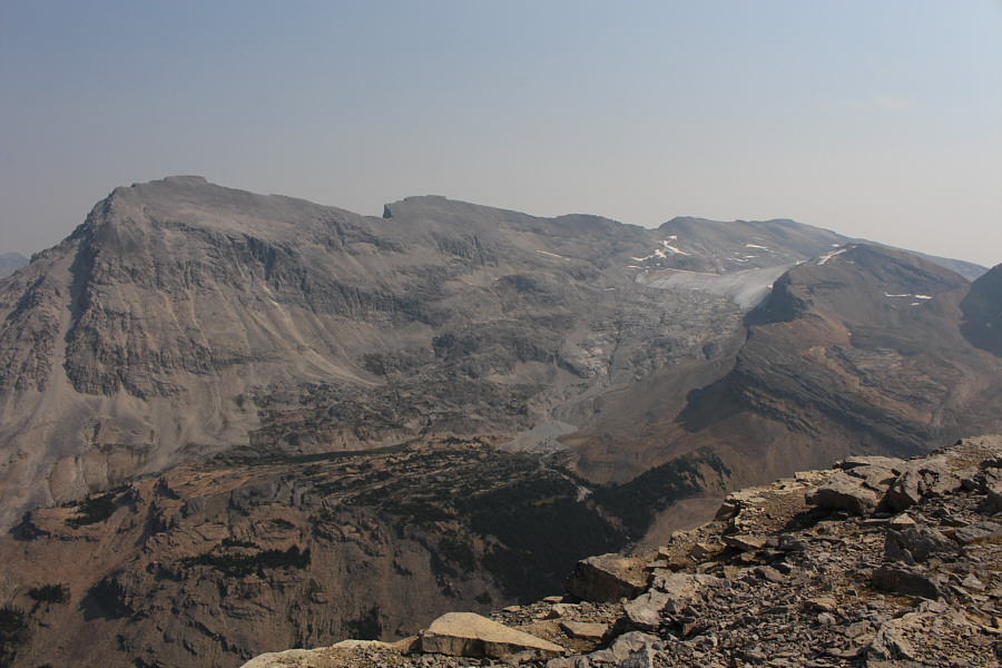
I wanna go back and ski Little Crowfoot one of these days!

The summit of Crowfoot Mountain (right) is about five kilometres away to the southeast.

Zosia looks like Homer Simpson!

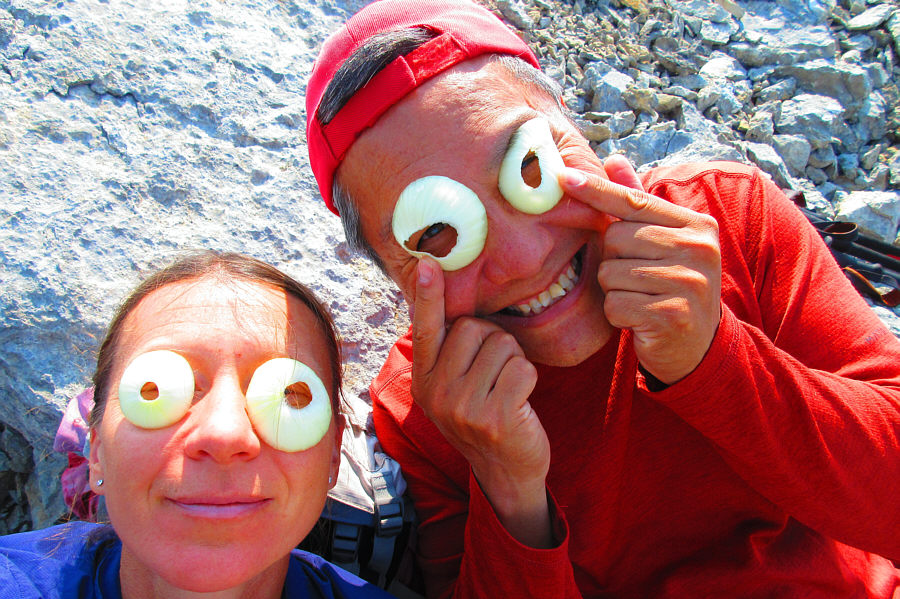
Easy ascents like The Onion always seem to attract weird characters.

Photo courtesy of Zosia Zgolak

Okay, maybe it's only a $999,999-view because of the haze!

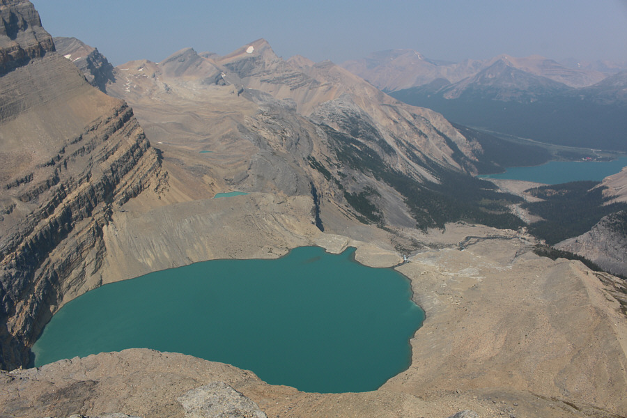
Here is the million-dollar view of Iceberg Lake and Bow Lake (far right) from the top of The Onion.  The peak with the snow patch is Mount Jimmy Simpson.

Mount Thompson looks like an unbelievably long and tedious slog...

Mount Thompson and Portal Peak almost appear as one mountain when seen from The Onion.

I suppose I should ski these peaks before the icefield disappears!

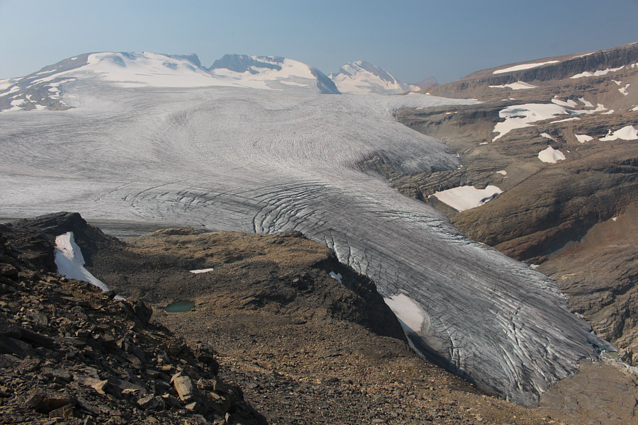
Mount Rhondda, Mount Habel and Mount Baker stretch across the northwest horizon behind Bow Glacier.

It's like we're on a different planet here!

Zosia backtracks down The Onion.

What? No skinny-dippers?

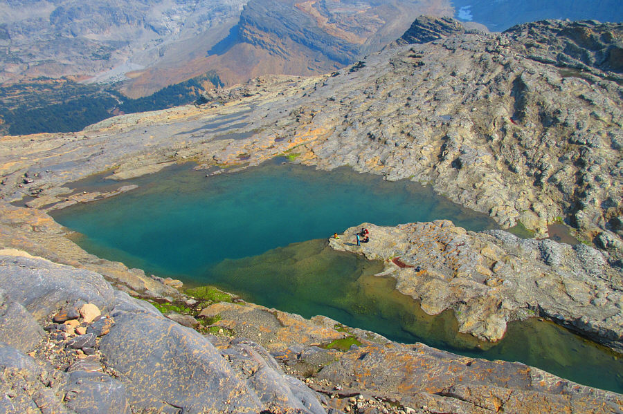
Some hikers lounge beside an unnamed tarn just south of The Onion.

Photo courtesy of Zosia Zgolak

I'm not smiling--I'm grimacing!

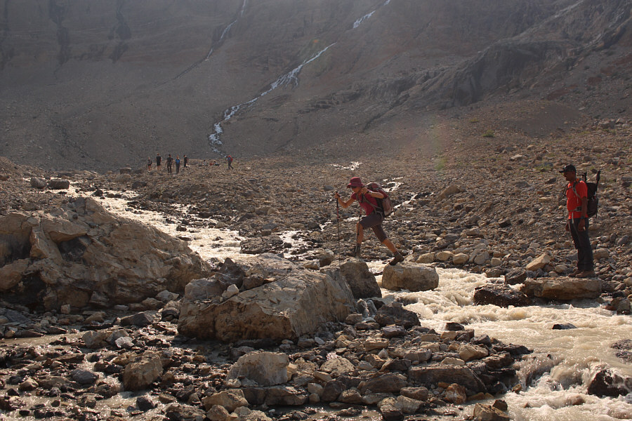
Sonny fords one of the glacial streams below Bow Hut.

Photo courtesy of Zosia Zgolak

The Slow & Steady Hikers group behind us ain't so slow!

After descending the headwall below Bow Hut, Zosia rock-hops another glacial stream in the upper valley.

I wonder what Parks Canada would do if that chockstone ever collapses...

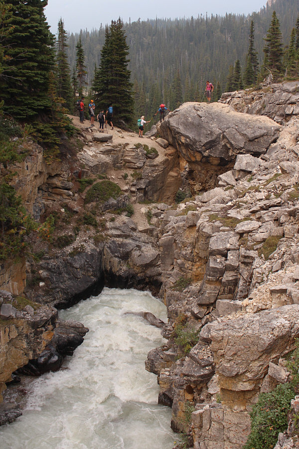
Zosia waits while another group of hikers gets across the chockstone at the gorge.

No problemo!

Zosia carefully down-climbs the chockstone.

Time to start thinking about what's for dinner...

Zosia walks back to the trailhead along the shore of Bow Lake.
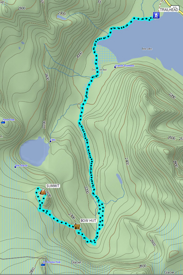
A long but very rewarding hike that is deservedly popular. Total Distance:  19.8 kilometres
Round-Trip Time:  9 hours 41 minutes
Cumulative Elevation Gain:  955 metres

GPX Data