From Las Cruces, follow University Drive eastward until it turns into Dripping Springs Road. Continue past Sonoma Ranch Boulevard and drive 8.9 kilometres to the junction with Baylor Canyon Road. Keep straight and drive another 800 metres to reach the access gate. Drive 2.0 kilometres past the gate and turn left. Arrive at a split in another 65 metres where the road makes a big one-way loop. There is a pay station here ($5.00 USD per vehicle per day or interagency pass). The trailhead with picnic area and vault toilets is just another 350 metres further.
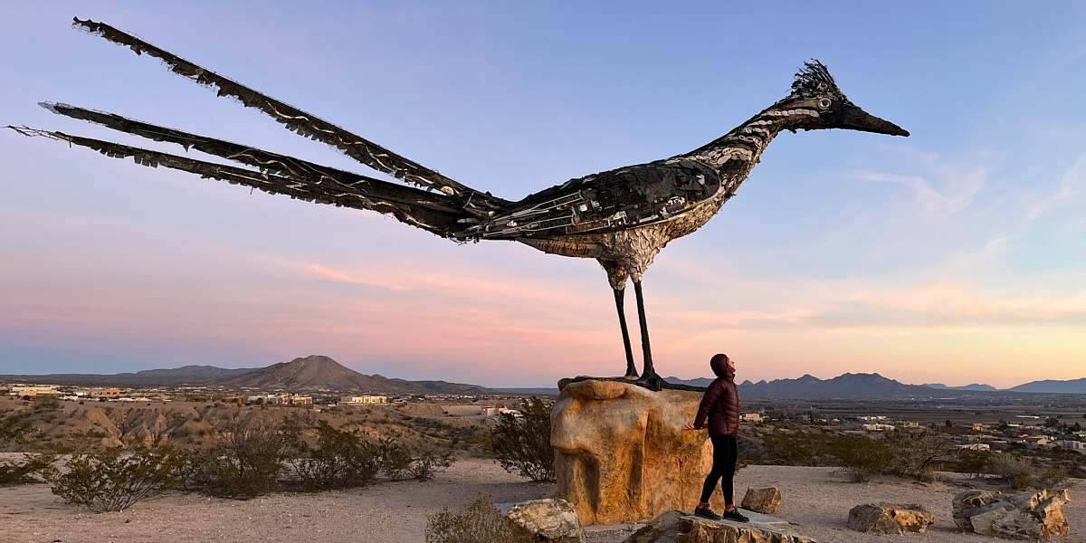
Located at a rest area just outside Las Cruces, New Mexico, this roadrunner sculpture is made with recycled materials.
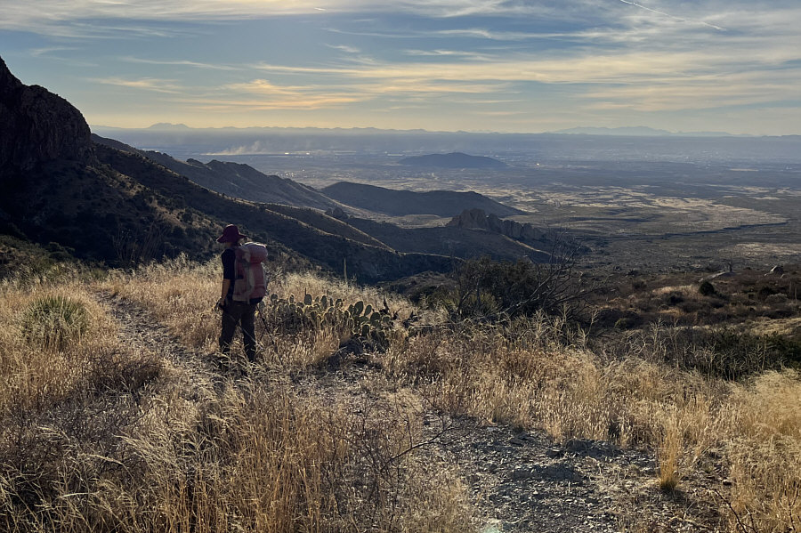
From the trailhead, Zosia and I started along the signed and well-traveled Fillmore Trail which ultimately leads to Fillmore Canyon. Before entering the canyon, the trail splits, and we followed the left branch which climbs up the north side of the canyon's drainage. Despite increasing encroachment from desert vegetation, the trail is still generally easy to follow as it winds its way gradually up the hillside toward an outcrop known as the "Yellow Rock". Somewhere along here, we ran into a young gentleman who was on his way down after seeing the sunrise from the summit. I presumed that he might have come from Baylor Canyon Road if he had started before dawn, but more astonishing to us was his claim that he ascends Organ Needle roughly every four days! I have a hard enough time repeating any ascent once let alone climbing the same peak--and not an easy one to boot--91 times a year! I guess it beats paying for a gym membership!
Beyond the "Yellow Rock", the trail becomes increasingly steeper as it rises more than 300 metres along the base of some shadowy cliffs. The trail braids in some places here, and there are even a few dips to be aware of especially on the return trip. I found this part of the ascent to be a bit depressing because it is so long and relentlessly grueling. Even when Zosia and I cleared this section and reached a small grassy plateau known as "Juniper Saddle", it was sobering to realize that we still had some 400 metres of elevation gain left. Above "Juniper Saddle", we climbed through a brief stretch of forest followed by a welcomed section of open slabs. At this point, we were passed by another gentleman who appeared to move with the agility of a trail runner. Zosia had a chance to briefly chat with this guy as he was passing her, and he appeared to be yet another local who often ascends Organ Needle though probably not as frequently as the gentleman we met earlier. Not to be outdone though, this second gentleman laid claim to the fastest ascent of Organ Needle--roughly an hour and twenty-something minutes! Zosia and I were already roughly three hours into our ascent and faced at least another hour or more of climbing; I am still having a hard time fathoming how an ascent of less than an hour and a half is even possible on this mountain. In any case, the trail runner quickly left us behind as we continued with our slow uphill grind. Vegetation closed in on us again as we climbed past the open slabs, and we had to then traverse to climber's left for about 80 metres or so before turning uphill again. The trail is a bit hard to follow here, but a few cairns help point the way. A final lengthy push up a steep and bushy gully brought us to a high col with views to the east (we bumped into the trail runner again here, and he was already descending). From the high col, we dropped down a narrow and snow-covered trail for a short distance before scrambling up a hidden gully where the crux is located.
The crux is a short but smooth section of slab that has a flake running diagonally up to climber's right. As mentioned in a few online trip reports, there is now a rope dangling over the crux. The rope seemed to be sound when I tested my weight on it, but it is always prudent to treat left-behind climbing gear with a bit of skepticism. I tackled the crux first and climbed up the diagonal flake; the trickiest move was the first one to get onto the flake. Zosia made an attempt to follow me up but ultimately backed down because she was not comfortable with the exposure. She stayed put while I scrambled up the remaining short distance to the summit. Since I did not want to keep Zosia waiting, I stayed on the summit only long enough to snap a few requisite photographs before retreating to the crux. Down-climbing the diagonal flake was expectedly challenging, and although I did not actually have to use the rope, I kept it within reach in case of a slip. Once I rejoined Zosia, we sat down to eat lunch together before commencing our descent.
For the most part, Zosia and I simply
retraced our steps back up to the high col and then down the mountain.
Along the way, we had some notable route-finding issues at the traverse,
the dips, and even lower down in easier terrain below the "Yellow Rock".
Fortunately, we were always able to get back on track quickly without
wasting too much time or effort. The final couple of kilometres
were a real race against the setting sun, and although we never resorted
to running, we kept up a fairly brisk pace. We actually made it
back to the trailhead with a few minutes to spare and drove out the
access gate without any issues.
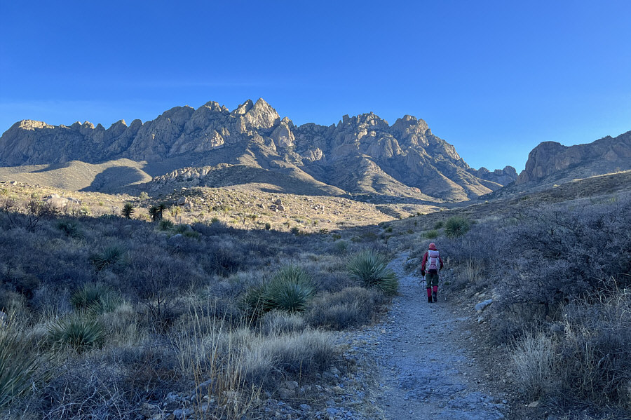
Zosia starts up a trail heading for Organ Needle which is directly in
front of her.
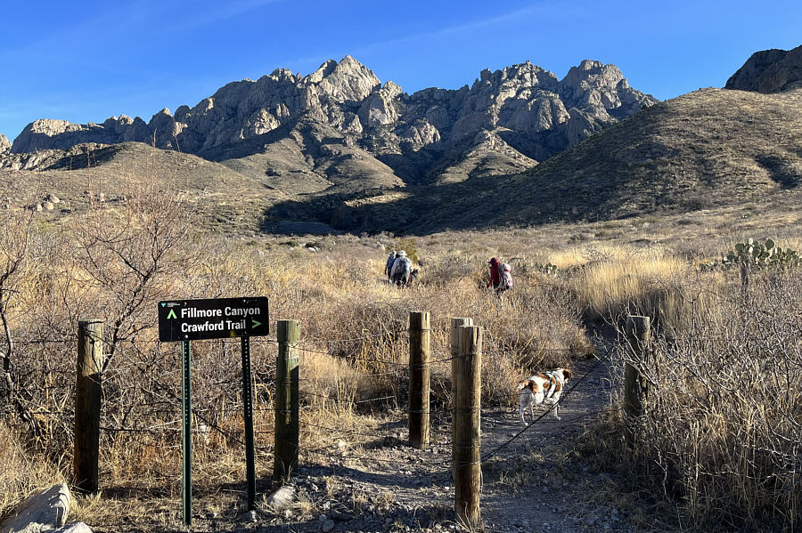
Zosia follows some other hikers at an important turnoff along the route.
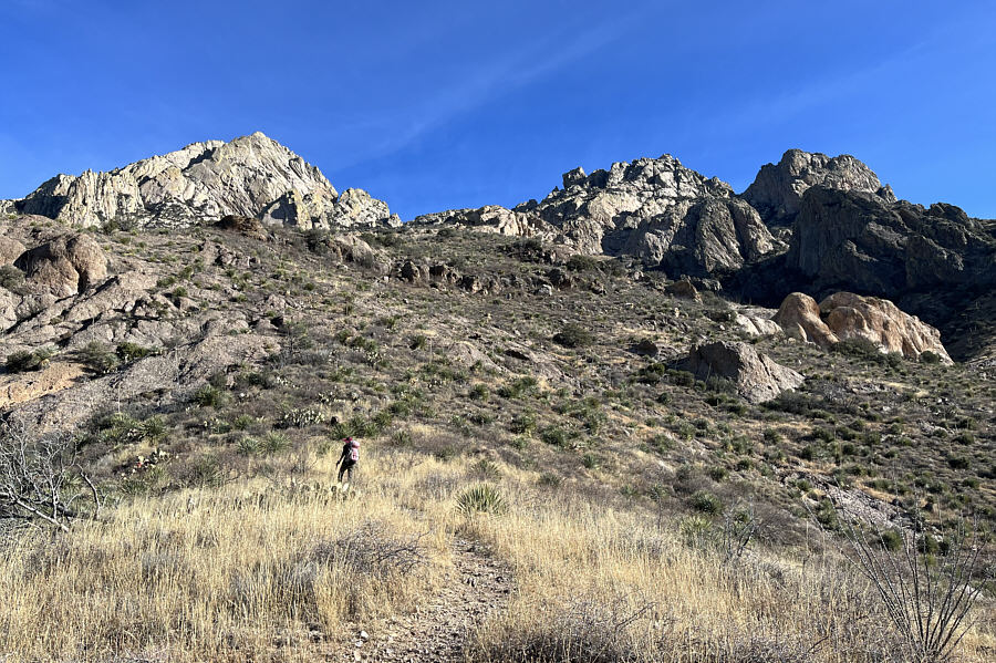
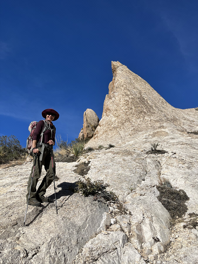
Zosia passes the "Yellow Rock" which, due to the odd perspective, looks
much smaller than its actual size. Photo
courtesy of Zosia Zgolak
Photo courtesy of Zosia Zgolak
Photo courtesy of Zosia Zgolak
Photo courtesy of Zosia Zgolak
Photo courtesy of Zosia Zgolak
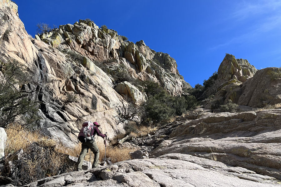
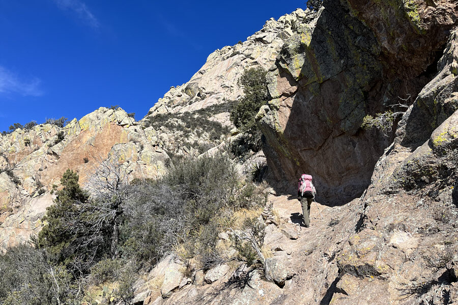
From this point, the trail heads to
the far right past the "Yellow Rock" and up beneath the shadowy
cliffs.
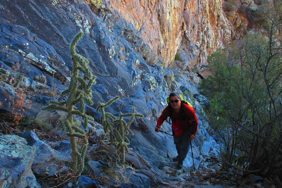
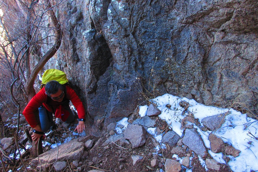
Sonny has to be wary of chollas as he
climbs the steep route along the shadowy cliffs.
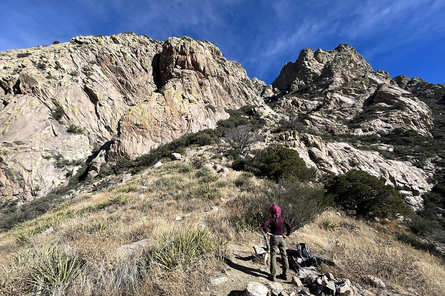
Zosia surveys the remainder of the
climb from "Juniper Saddle".
Open slabs provide a brief
respite from the narrow bushy trail.
Zosia traverses below a cliff band before resuming her upward progress.
Sonny ascends yet another steep and
bushy stretch of trail.
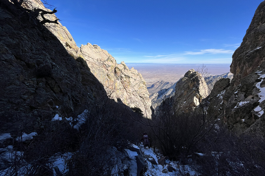
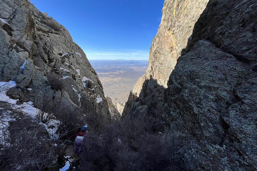
From this high col with views to the
east, Zosia makes a brief descent to access the crux (not visible
here).

Zosia arrives at the bottom of the
crux complete with climbing rope.
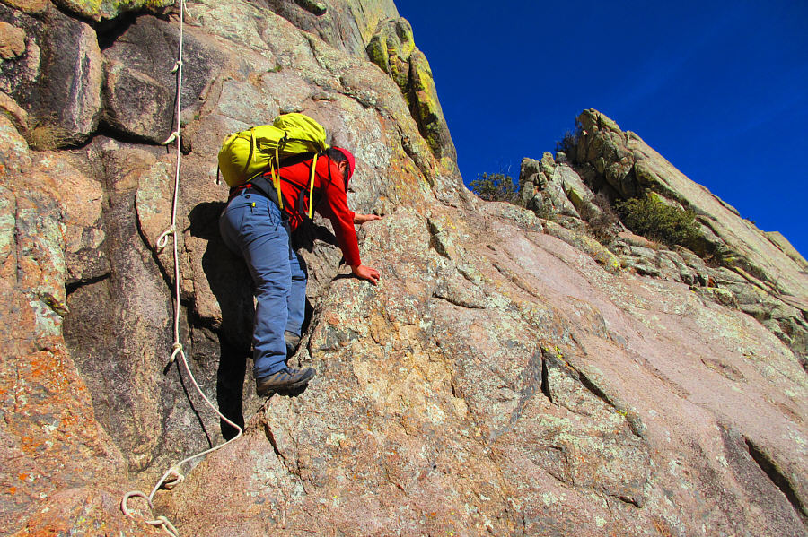
Sonny climbs an exposed flake on the
crux.
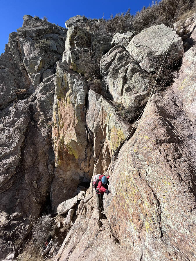
Zosia attempts the crux but would ultimately back down.
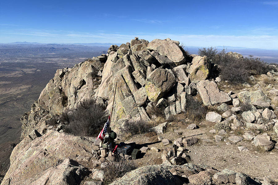
The summit register is nestled among
other interesting paraphernalia.
Sonny stands on the summit of Organ
Needle (2742 metres).
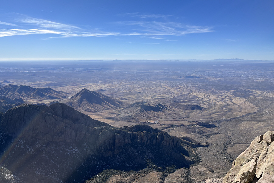
In this view to the southwest, Las
Cruces is situated on the plain at far right. On the far right
horizon are the Florida Mountains.
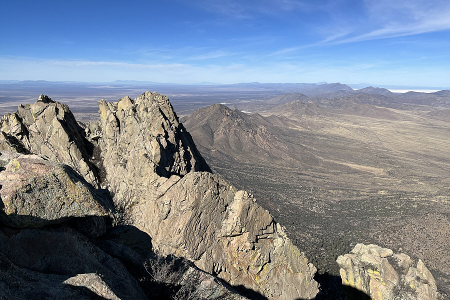
Baylor Peak (centre) is visible to the
north. Beyond the peaks at far right is a glimpse of White
Sands National Park.
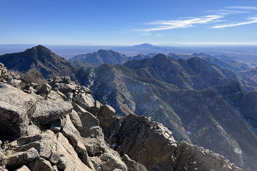
Organ Peak is at far left in this view
to the south. At centre on the horizon are the Franklin
Mountains.
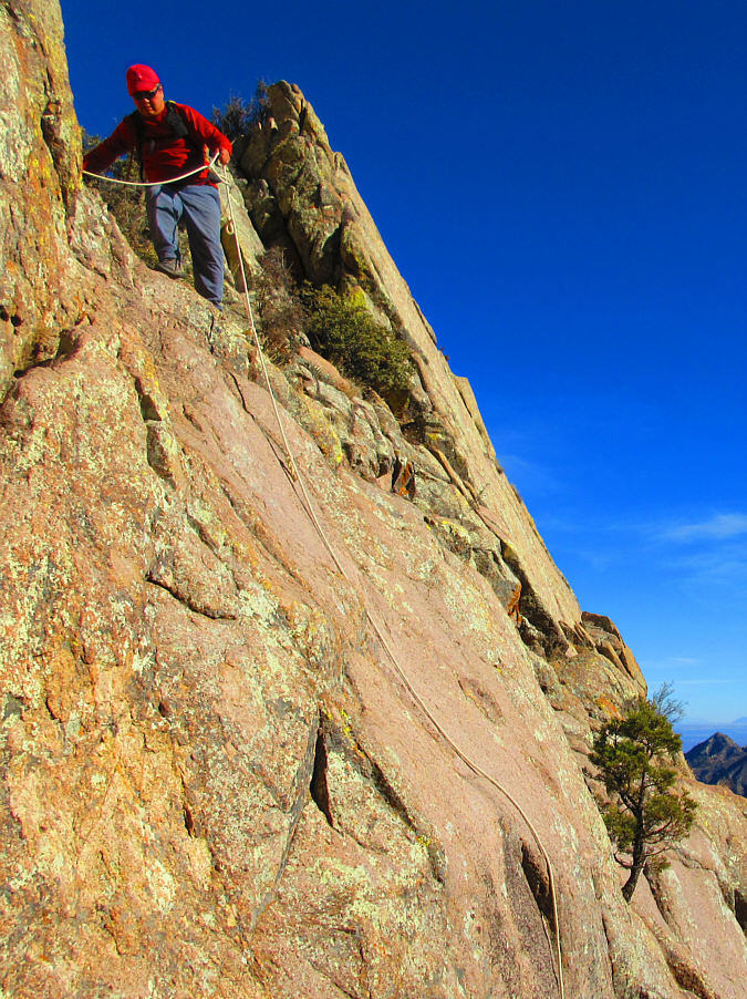
Sonny uses the rope for added security as he prepares to down-climb
the crux.
After regaining the high col, Zosia
begins a long and steep descent.
After getting off the steepest parts
of the route, Zosia settles into a long but mostly straightforward
hike back to the trailhead.
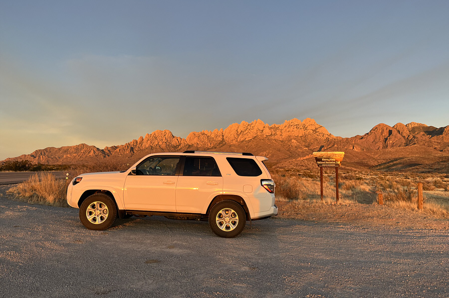
Here is a last look at the Organ
Mountains from outside the access gate just before
sunset.
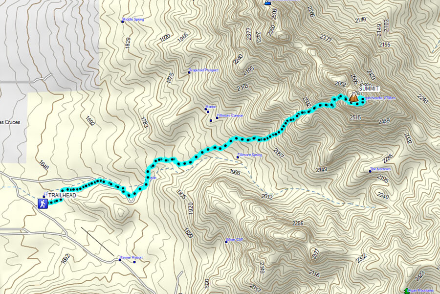
Total
Distance: 11.9 kilometres
Round-Trip Time: 8 hours 26 minutes
Net Elevation Gain: 1095 metres