BOU AVENUE
Ousel Peak

To celebrate Canada Day, Zosia Zgolak and I hiked up Ousel Peak located in the Great Bear Wilderness Area just southeast of West Glacier, Montana on 1 July 2022.  The usual ascent route follows a good trail which winds steeply up the northeast side of the mountain all the way to the summit.  If conditions are dry, there are no technical difficulties, but elevation gain is substantial.  Incidentally, the peak's name refers to a type of bird.

The signed trailhead for Ousel Peak is located on the south side of US Highway 2, 10 kilometres east of the junction with Going-to-the-Sun Road or 78 kilometres west of the junction with Looking Glass Road (MT 49).  The best place to park is a river access turnoff on the north side of the highway about 100 metres east of the trailhead.  Use extreme caution when crossing the highway since the trailhead is located along a blind curve with vehicles zipping by in both direction at speeds probably in excess of 100 kilometres per hour (the speed limit here is inexplicably a whopping 70 miles--or 112 kilometres--per hour).

After safely crossing the dangerous highway, Zosia and I settled into a moderate but steady climb up the well-defined trail.  Most of the trail rises through viewless forest, and the long uphill grind can get monotonous at times.  We encountered quite a lot of deadfall including one extensive section about two kilometres up the trail.  Although we did not have to take any drastic detours, the deadfall certainly slowed our progress.  Near tree line, we ran into lingering snow patches which sometimes obscured the trail and forced us to do a little route-finding.  Fortunately, it was fairly easy to stay on track as the forest thinned out, and we did not have much trouble reaching the summit ridge.  A lone hiker and his dog caught up to us here, and although we ended up tagging the summit together, they departed soon after.  As such, Zosia and I had the summit all to ourselves, and we stopped for a lengthy break to enjoy the fine weather and fabulous views.

Retracing our steps on descent, Zosia and I ran into a couple with their two dogs not far below the summit ridge.  We were a bit surprised to see that they were already descending without having reached the summit.  Although we tried to convince them that they were only a mere ten minutes or so from the top, they had already decided that they would just go far enough to get a partial panoramic view of the mountains to the north in Glacier National Park.  They also wanted to save some energy for a second hike to nearby Stanton Lake later that day.  The couple and their dogs disappeared quickly down the trail ahead of us, and we did not see them again.  The rest of our descent was both dull and uneventful.
This is the crux--very dangerous crossing!

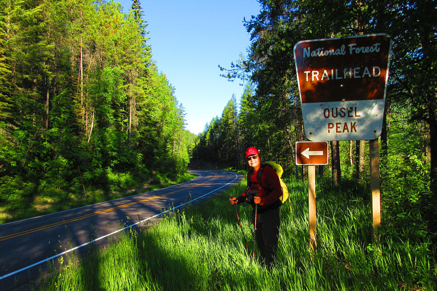
Sonny looks out for traffic before crossing the highway to the start of the trail.

Photo courtesy of Zosia Zgolak

Bring a book.

Most of the ascent of Ousel Peak is in forest like this.

But not as plentiful as you would think... Some bear grass can be found along the trail.
Somebody needs to bring a chainsaw...

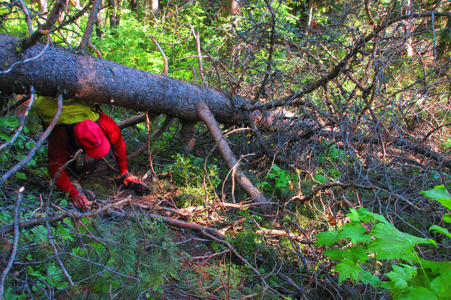
There are a few annoying stretches of deadfall along the trail.

Photo courtesy of Zosia Zgolak

The snow was almost good enough to ski!

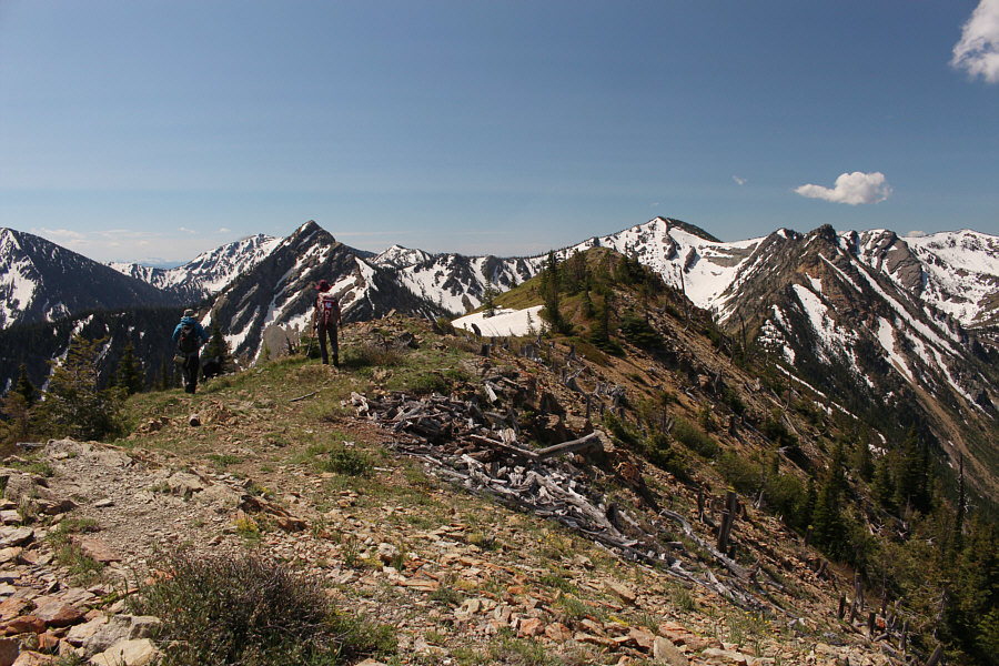
Lingering snow patches appear as the trees begin to thin out near the top.

Ty is from the Blackfeet Nation and is aspiring to become a physician. Zosia and a lone hiker with a dog head for the highest point along the summit ridge.
Happy Canada Day, eh! Sonny and Zosia celebrate Canada Day on the summit of Ousel Peak (2176 metres).
Good one to climb for Christmas, right? Mount Saint Nicholas stands out to the southeast.
Both appear to be much more rugged scrambles... The view to the south is dominated by Triangle Benchmark (centre) and Pyramid Peak (right).
Good shoulder season objectives. The most immediate landmarks to the northwest are Apgar Mountains (distant left) and Belton Hills (centre).

God, I love the mountains in Glacier National Park!

Mount Jackson (left), Blackfoot Mountain (right of centre) and Harrison Lake garner most of the attention to the northeast.


Maybe I'll climb it someday... To the east, Mount Stimson is the second highest peak in Glacier National Park.
Enjoy this view while you can since there is nothing to see lower in the trees! Here is one last look at the glorious peaks in Glacier National Park as Zosia descends from the summit ridge.
An easy but long uphill grind which is only worthwhile if you reach the top...on a clear day! Total Distance:  12.1 kilometres
Round-Trip Time:  7 hours 48 minutes
Net Elevation Gain:  1154 metres

GPX Data