BOU AVENUE
Sacajawea Peak
On 21 August 2022, Zosia Zgolak and I climbed Sacajawea Peak, the highest of the Wallowa Mountains in northeastern Oregon.  I first laid eyes on this interesting mountain range in 2010 while exploring Idaho's Seven Devils Mountains to the east, and it only took me another twelve years before I finally paid a visit!  The most direct ascent route for Sacajawea Peak is described in Barbara I. Bond's 75 Scrambles in Oregon and follows an approach that starts along Hurricane Creek.  Although some people break up the ascent over two days and camp along the way, we opted to forego hauling heavy camping gear and just climb the peak in a single long day.

In the town of Enterprise, turn off Highway 82 onto S River Street which eventually becomes Hurricane Creek Road.  Drive south for 8.1 kilometres to reach the turnoff to Hurricane Creek trailhead.  This turnoff can also be reached from the town of Joseph by turning off Highway 82 (Main Street) and driving west along W Wallowa Avenue for 3.5 kilometres.  From the turnoff, drive south for 6.0 kilometres to road's end at the trailhead (vault toilet; fee or pass required).

Zosia and I got off to a pre-dawn start along the well-maintained Hurricane Creek trail (#1807).  About 3.3 kilometres from the trailhead, a drainage cuts across the trail, and there are some signs of human passage here going down to the creek.  With our heads still in a bit of a foggy haze early in the morning, we actually missed this turnoff and hiked another 700 metres or so before realizing our mistake.  After backtracking to the turnoff, we found a good spot to ford Hurricane Creek and picked up a narrower trail on the far bank.  We briefly lost this trail in a glade not far from the creek crossing but picked it up again where it re-enters the forest.  The trail rises moderately at first, but after crossing Twin Creek, it begins to switchback steeply up the slope.  At this point, the trail climbs relentlessly gaining 540 metres over the next three kilometres.  The angle of ascent eventually eases as the trail enters the upper valley at the head of Thorp Creek.  After the brutal climb above Twin Creek, it was nice to walk on flat terrain again in the upper valley, and even though the trail was intermittent in places, route-finding was easy.  Toward the back of the valley, we started gaining elevation again as we followed the trail up a headwall to a gap from which Thorp Creek emanates.  The gap is the entrance to a large amphitheatre, but instead of entering, we turned right and began ascending the long east ridge of Sacajawea Peak.  Other than one ambiguous section over some slabs, there is a good beaten path to follow all the way up.  The elevation gain on the east ridge is nearly equal to that above the Twin Creek crossing but over half the distance.  Despite this section being clearly steeper, we somehow climbed more efficiently here perhaps because we were inspired by the spectacular scenery unfolding around us.  Much like the east ridge, the summit ridge poses no technical difficulties.  Of the two distinct high points at the top of Sacajawea Peak, the eastern one is the true summit.

While relaxing on the summit of Sacajawea Peak, Zosia and I spotted several people along the route to the peak known as Matterhorn to the south.  Matterhorn was once considered the highest point in the Wallowa Mountains but is now generally regarded as the second-highest.  Some peak-baggers tag both Matterhorn and Sacajawea Peak on the same trip by traversing a Class 3 intervening ridge, and we even saw a couple of guys working their way toward us as we were getting ready to descend the way we came.  Our descent of the east ridge felt a bit tedious but went without a hitch.  After dropping down from the gap to the flats of the upper valley, we made a brief stop beside Thorp Creek to cool off and replenish our water supply.  When we resumed hiking, we passed a small party who looked like they were searching for a good place to camp, and later on, we met a very large group of backpackers who still had quite a bit of climbing ahead of them to reach the upper valley but were doing so during the hottest part of the day.  Neither Zosia nor I envied their position, and even descending was unbearable for us in the hot afternoon sun especially on the switchbacks just above the Twin Creek crossing.  Thankfully, we had another chance to cool off in Twin Creek and then again when we forded Hurricane Creek for a second time.  The remaining hike back to the trailhead felt a little long but was otherwise straightforward.  Heavy rain in the weather forecast for the next day prompted us to move on from the area, but I am eager to return in the future to explore more of the Wallowa Mountains.
We have a long day ahead of us...

Early in the morning, Sacajawea Peak is already visible from the trail along Hurricane Creek.

The icy waters cleared the fog in my head!

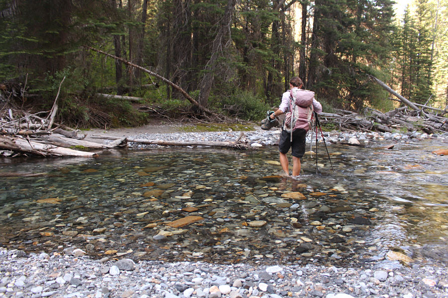
After missing an important turnoff and backtracking for about 700 metres, Sonny fords Hurricane Creek.

Photo courtesy of Zosia Zgolak

Some flagging would help here! 
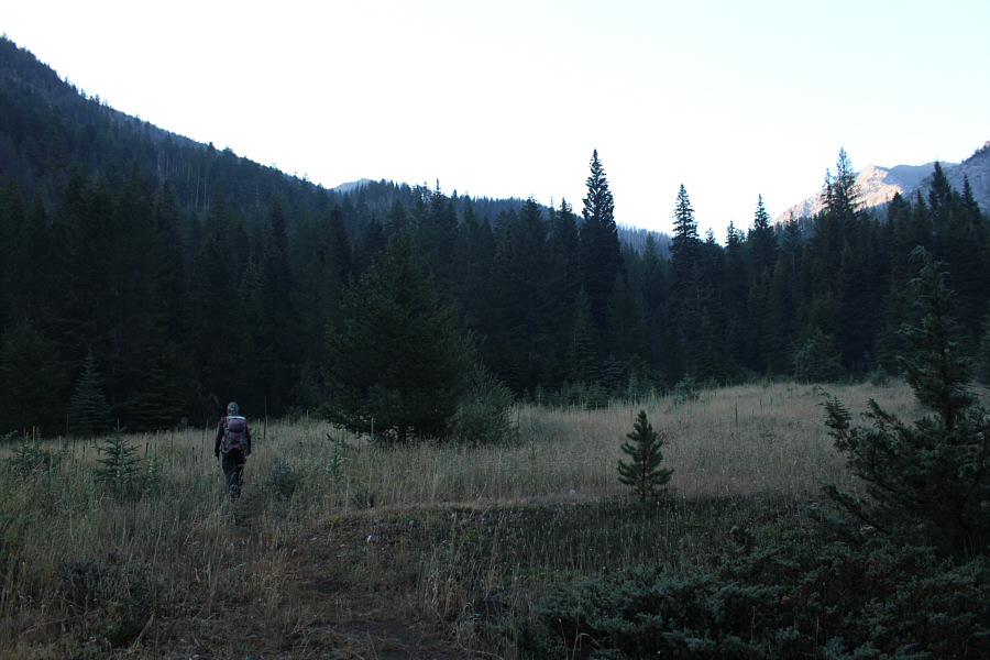
Not far from the ford of Hurricane Creek, the trail disappears somewhat in this glade but strengthens again near the trees on the far side.
Simply brutal.

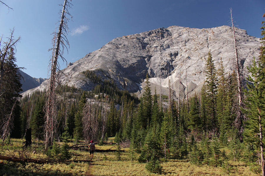
Just past a crossing of Twin Creek, Zosia begins a long and grueling ascent up the trail which gains 540 metres over the next three kilometres.

Luckily, there wasn't too much of this! Sonny has to duck under some fallen trees along an overgrown section of the trail.

Photo courtesy of Zosia Zgolak

Very enjoyable hiking here but we still have a long way to go!

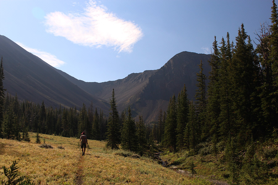
The northeast face of Sacajawea Peak comes into view as the trail levels out in the upper valley.

Lots of great camping spots here with a reliable creek nearby. 
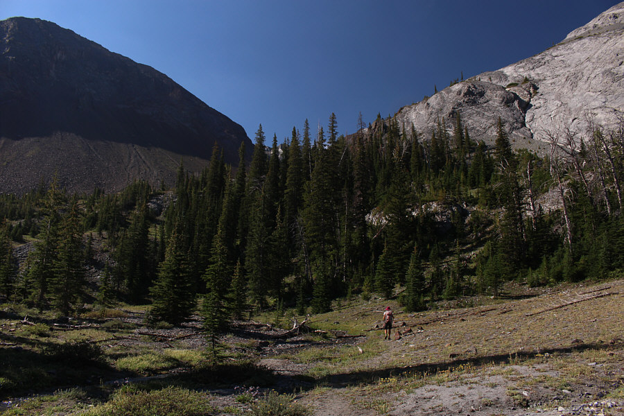
Zosia ventures further into the upper valley.
Stick to the trail here; you won't regret it! The trail briefly goes to the right here before rising up the headwall toward the gap at centre.
This is probably the last good place to replenish water bottles. Zosia follows the trail to the gap.

Quite the stunning view, eh?

The ascent route turns to the right just past where the wall of brown rock tapers out.


Another steep grunt, but at least there are some nice views! Zosia climbs up the east ridge of Sacajawea Peak.
Is it gold or evidence of an extinction event that happened millions of years ago? 
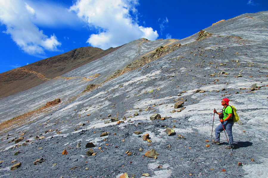
Sonny is intrigued by the distinct band of rock cutting across the southeast face.

Photo courtesy of Zosia Zgolak

I feel like "Hurwal-ing" right now! 
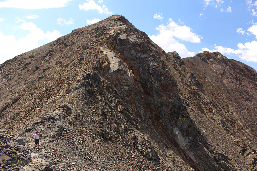
Sonny continues to grind up the east ridge.  Behind him is the ridge known as Hurwal Divide.

Photo courtesy of Zosia Zgolak

I think we're gonna make it...

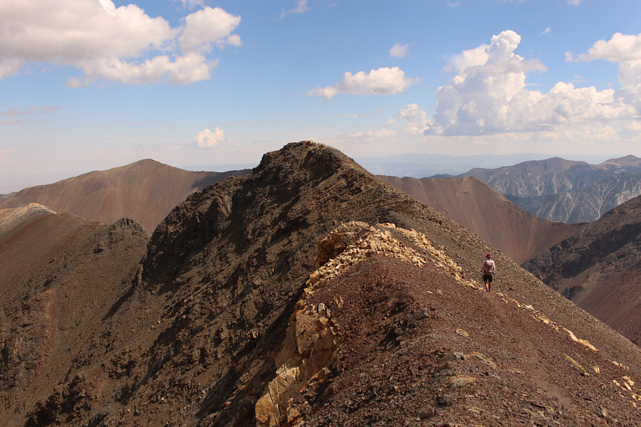
Zosia gains the summit ridge.


No problemo here; looks worse than it really is! Zosia drops into a dip just before the east summit.  The west summit is visible at far right.
Kinda looks higher... Zosia heads to the west summit to see if it is higher.
The "other bump" always looks higher! Zosia returns to the east summit which is clearly higher from this vantage point on the west summit.
Strange that there's no register or even much of a cairn here! Zosia and Sonny stand on the east (true) summit of Sacajawea Peak (2989 metres), the highest point in the Wallowa Mountains.

Definitely wanna climb this one if we ever come back here...

Dominating the view to the south is the peak known as Matterhorn (right) which was once thought to be the highest point of the Wallowa Mountains.


That tarn is probably seldom visited. 
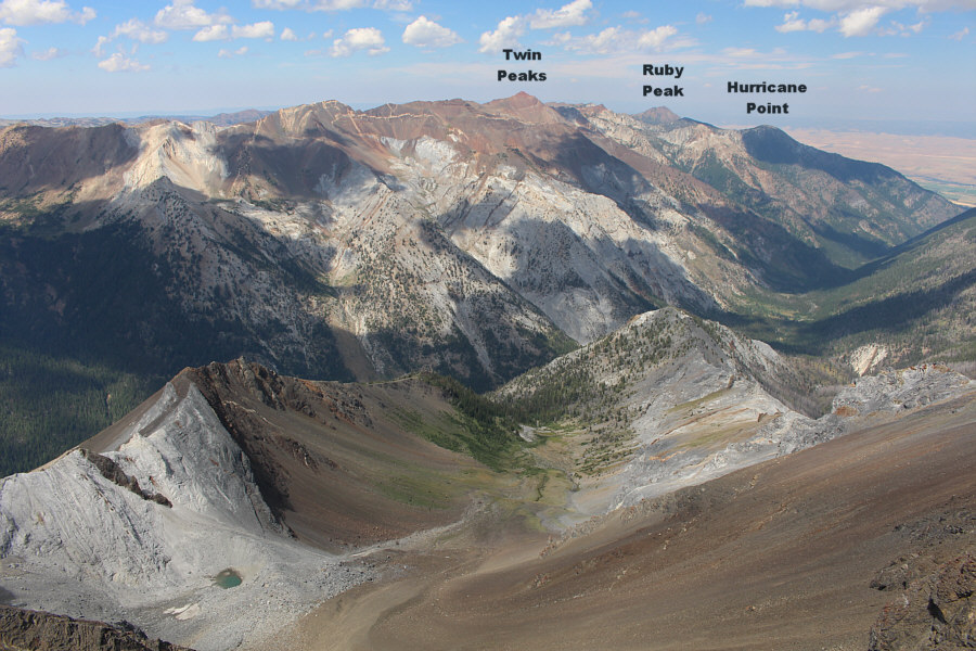
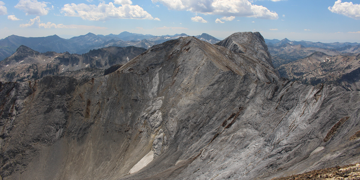
Hurricane Creek valley is visible at far right in this view looking north.  Note the tiny tarn at bottom left.
It's all downhill from here...mostly! Sonny makes his way back down the east ridge.

Photo courtesy of Zosia Zgolak

I don't think I have any soul left after all these descents... The hot afternoon sun makes an already soul-sucking descent even more unpleasant.

Photo courtesy of Zosia Zgolak

Feels refreshing after the hot and dusty descent! Zosia fords Hurricane Creek for a second time.
What a beast of a mountain! Here is one last look back at Sacajawea Peak from Hurricane Creek trail.
A long but technically easy ascent. Total Distance:  23.7 kilometres
Round-Trip Time:  13 hours
Net Elevation Gain:  1447 metres

GPX Data