 |
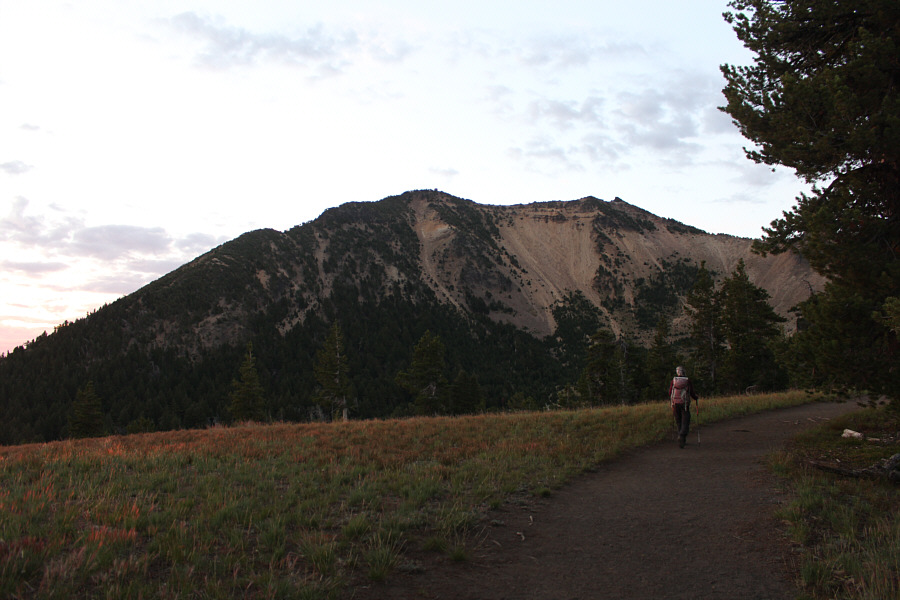
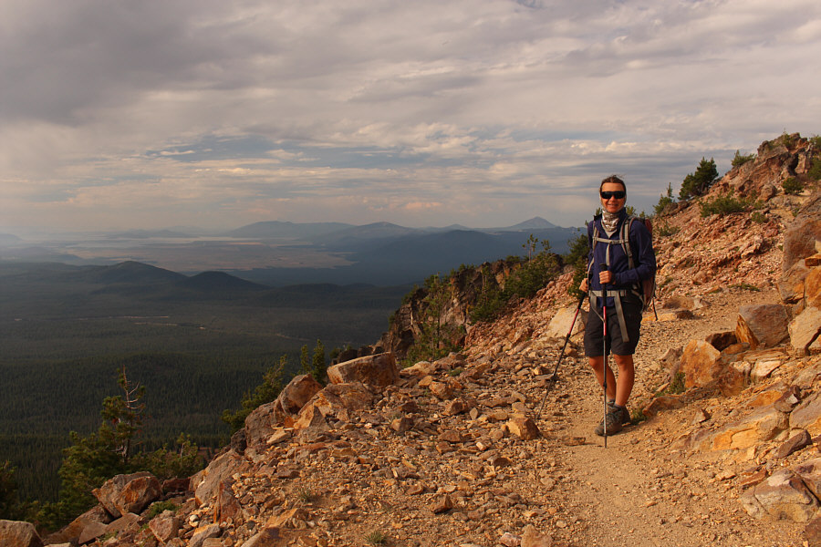
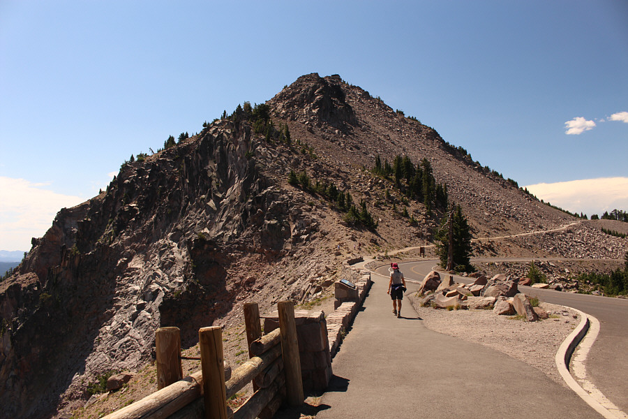
Zosia starts up the trail to Mount Scott which is in the background. |
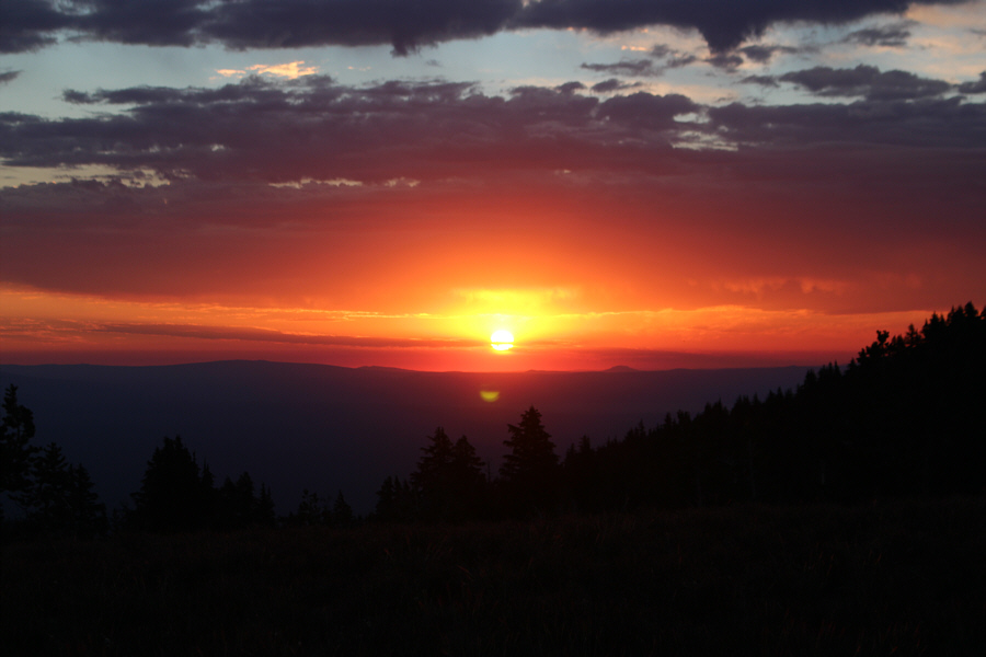 |
The sun rises over Crater Lake National Park. |
 |
The trail to the top of Mount Scott is very pleasant. |
 |
Shafts of sunlight poke through the clouds at this viewpoint near the summit ridge. |

Zosia approaches the top of Mount Scott along the summit ridge.
 |
The most notable landmarks that are clearly visible to the north on this day are Diamond Lake and Mount Thielsen. |
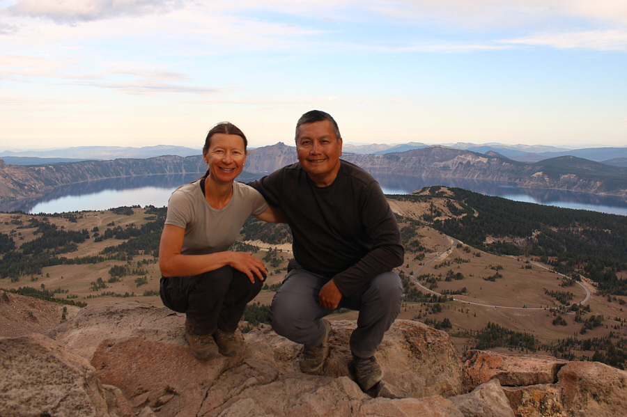 |
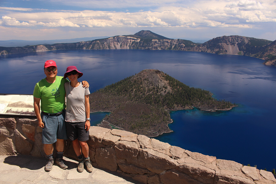
Zosia and Sonny crouch on one of the rocks at the top of Mount Scott (2719 metres), the highest point of Crater Lake National Park. |
 |
Here is the survey benchmark on the summit of Mount Scott. |
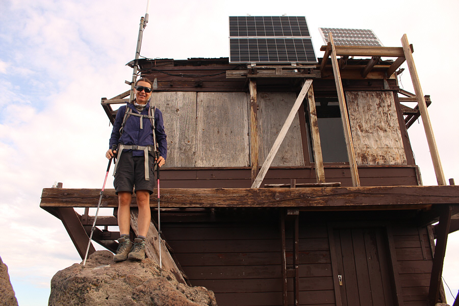 |
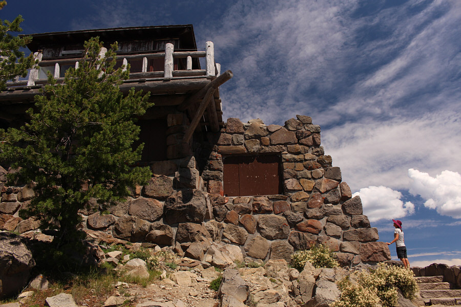
The fire lookout atop Mount Scott is boarded up on this day. |
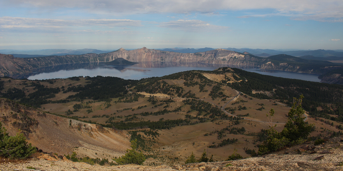
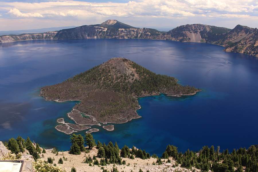
Here is the most comprehensive view of Crater Lake from the summit ridge of Mount Scott. Directly above Wizard Island is The Watchman.
 |
Upper Klamath Lake (distant left) and Mount McLoughlin (on horizon behind Zosia) are visible far to the south. |
 |
Total
Distance: 7.4 kilometres Round-Trip Time: 3 hours 25 minutes Net Elevation Gain: 373 metres |
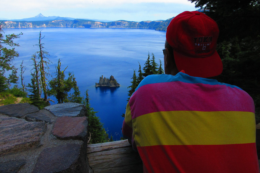 |
Sonny observes
Phantom Ship from a viewpoint along Sun Notch loop trail. On
the horizon at far left is Mount Thielsen. Photo courtesy of Zosia Zgolak |
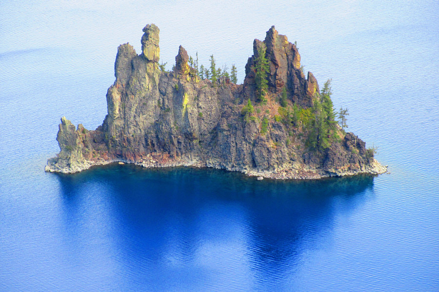 |
Here is a closer look at Phantom Ship. Photo courtesy of Zosia Zgolak |
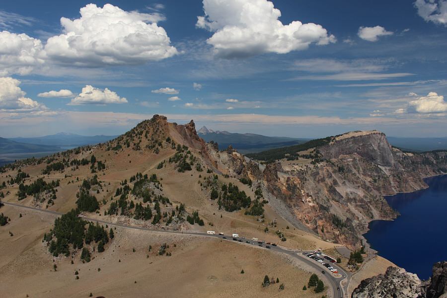
The trailhead for The Watchman is located along West Rim Drive, 6.0 kilometres west of the junction with the turnoff to Rim Village or 3.4 kilometres south of the junction with Crater Lake Highway North.
Like Mount Scott, an active fire lookout sits atop The Watchman and is easily accessed by a short, well-maintained trail which is perhaps one of the busiest in the park. It took Zosia and me 34 minutes to climb to the top, and the crux of the trip was waiting for an oblivious Chinese tourist fiddling with his camera to move out of the way so that we could take a self-timed photograph of ourselves on the summit. Our subsequent descent took a mere 20 minutes. By the time we returned to our car, rain clouds were brewing over the area, and we decided to end our visit and drive out of the park.
 |
Zosia begins hiking the easy trail that goes up The Watchman. |

The view of Wizard Island from the trailhead for The Watchman is already pretty good. Left of centre across the lake is Mount Scott.
 |
Zosia reaches the base of the fire lookout atop The Watchman. |
 |
The view of Wizard Island from the top of The Watchman is hardly different than that from the trailhead. |
 |
Sonny and Zosia stand atop The Watchman (2440 metres). |
 |
Hillman Peak (left) and Llao Rock (distant right) are the next two high points along the rim of Crater Lake. |
 |
Total
Distance: 2.9 kilometres Round-Trip Time: 1 hour 15 minutes Net Elevation Gain: 120 metres |