BOU AVENUE
Ant Hill
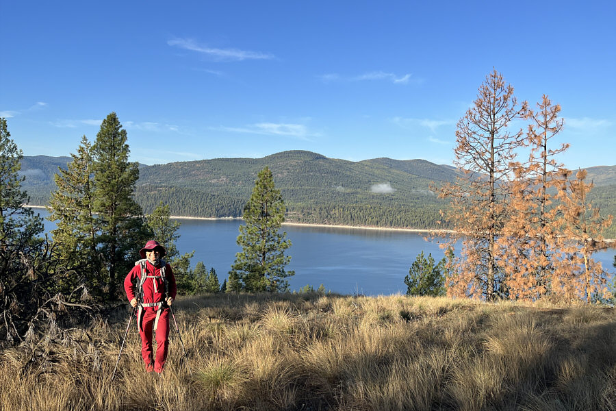
Wrapping up the Canadian Thanksgiving long
weekend on 9 October 2023, Zosia Zgolak and I hiked up officially-named
Ant Hill located on the east side of Lake Koocanusa in Montana's Kootenai
National Forest. I could not find any information online about this
objective, but from perusing satellite maps, I felt that Ant Hill would
be a suitably short objective with easy access that still had the promise
of some far-reaching views. I also noticed a mysterious road
running up the west side of Ant Hill, but I felt that the broad southwest
ridge would make for a more gentle and aesthetic ascent route.
Starting from a pullout (48.509106, -115.263227) on the side of Highway
37 along Lake Koocanusa, Zosia and I walked south along the shoulder of
the pavement for about 250 metres in order to circumvent a tapering cliff
band. We then headed up a lightly forested slope, effectively
gaining the southwest ridge of Ant Hill. Travel was easy, and we
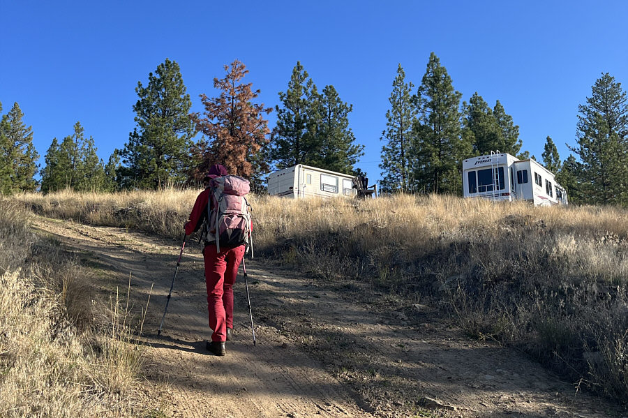
had no issues with route-finding. Surprisingly, we came across
several deserted encampments of RVs, makeshift homes and construction
equipment about two-thirds of the way up. While most of Ant Hill
sits within Kootenai National Forest, my phone's mapping application
labels the section of land where the encampments were located as "Nature
reserve" which I presumed to mean public land. We were both baffled
that development would be allowed here, but with no one around to provide
an explanation, we simply passed through and finished our ascent of Ant
Hill.The top of Ant Hill is flat,
and far-reaching views are somewhat obscured by trees. After
tagging the nebulous high point, Zosia and I retreated to a lower but
more open section of the southwest ridge to stop for a break. When
we resumed hiking, we returned to the encampments and descended an access
road, the very same one I had noticed on satellite maps on the west side
of Ant Hill. The road conveniently led us without fuss down to the
highway, and at the entrance, we found a locked gate and a "no
trespassing" sign. I would later learn from the Montana land
ownership
website that there is indeed a small parcel of private land here, but
aside from the one near the highway, we did not see any other "no
trespassing" signs anywhere else on Ant Hill. From where we emerged
onto the highway, we had an easy 1.3-kilometre walk back to the pullout
to complete our loop.
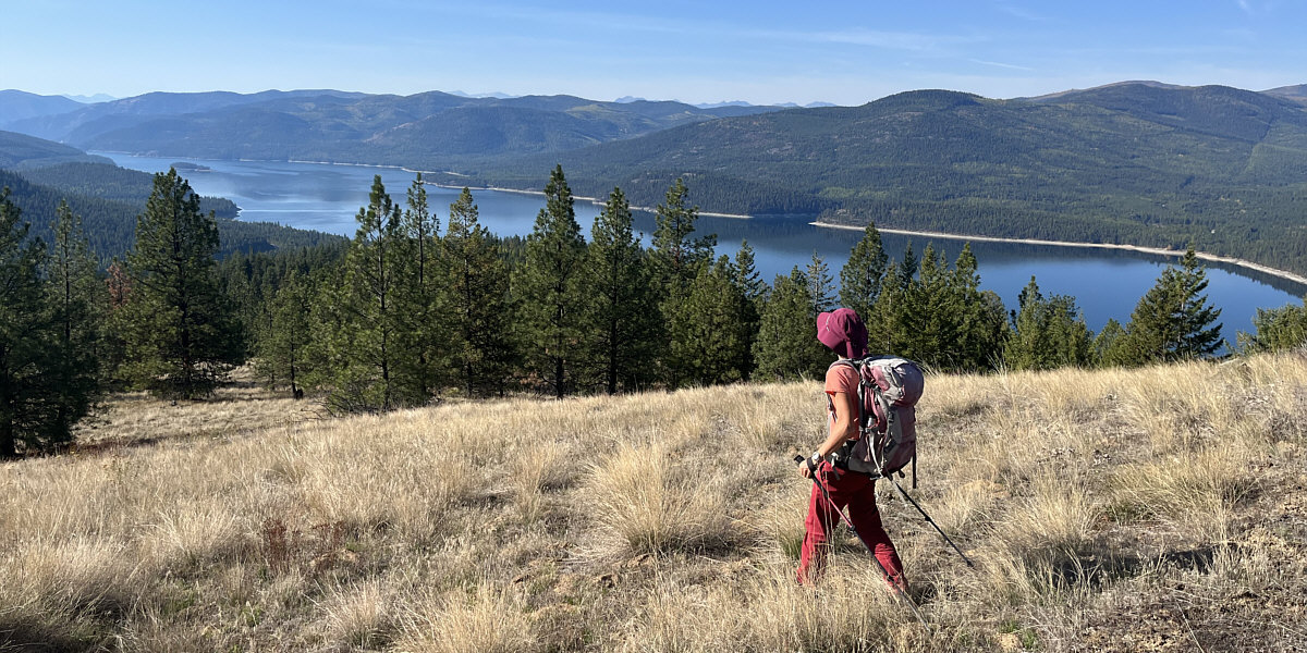
Zosia takes a last look across Lake Koocanusa before
resuming her descent.