After signing the summit register and taking a short break, Leslie, Zosia and I retraced our steps, more or less, along the crest of the massif and down the big rubble slope we came up. Descending the rubble slope was probably the most nerve-racking part of the entire trip as we tried to avoid raining loose rocks down on each other. I slipped and bruised my left arm at one point, but otherwise, we managed to get down to the faint trail without too much grief. Instead of following the faint trail completely out, we abandoned it at some point to drop down easy slopes and visit the most noticeable open mine shaft in the area. This shaft runs horizontally into the mountain only for a short distance and is relatively safe to explore. When we had our fill of mining exploration, we followed the mine shaft's access trail back to the mining town and subsequently settled into an uneventful but seemingly protracted descent back to the trailhead.
 |
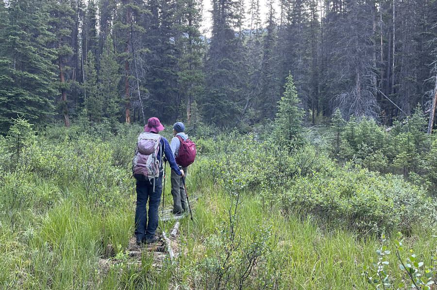
Zosia and Leslie carefully cross the highway to the start of the trail on the left side of the unnamed creek. The Protection Mountain massif can be seen beyond the trees at right. |
 |
Remnants of an old boardwalk are still helpful for navigating through some initial marshy sections of trail. |
 |
The trail rises at a moderate but steady gradient up the forested slope. |
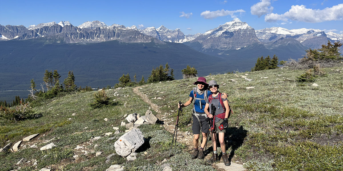
Zosia and Leslie break out of the trees near the site of an old mining town. Many of the famous Ten Peaks and mountains near Lake Louise can be seen across the valley behind them.
 |
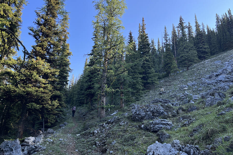
Leslie and Sonny continue up a trail beyond the old mining town. Photo courtesy of Zosia Zgolak |
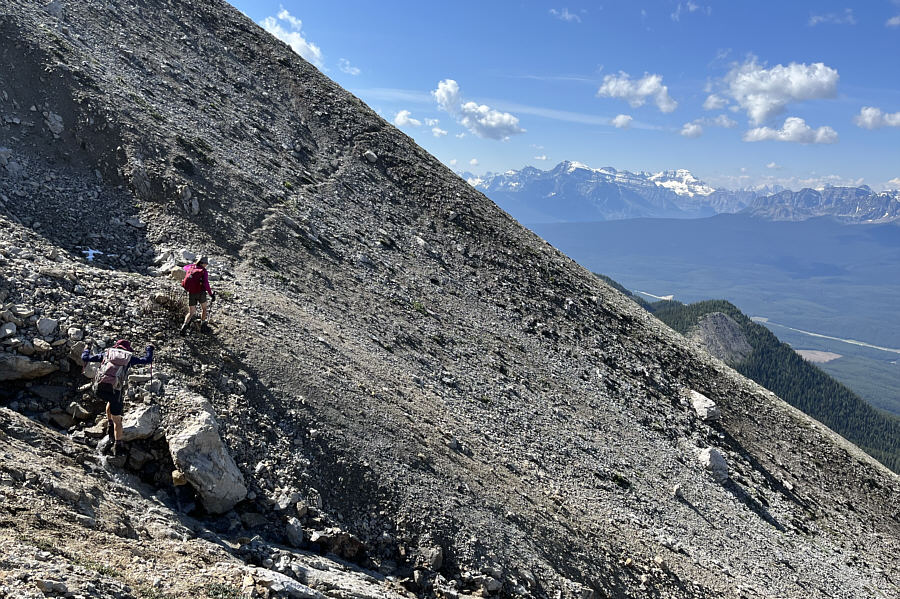 |
The faint trail here goes past what appears to be a collapsed mine shaft and leads to a big rubble slope. |
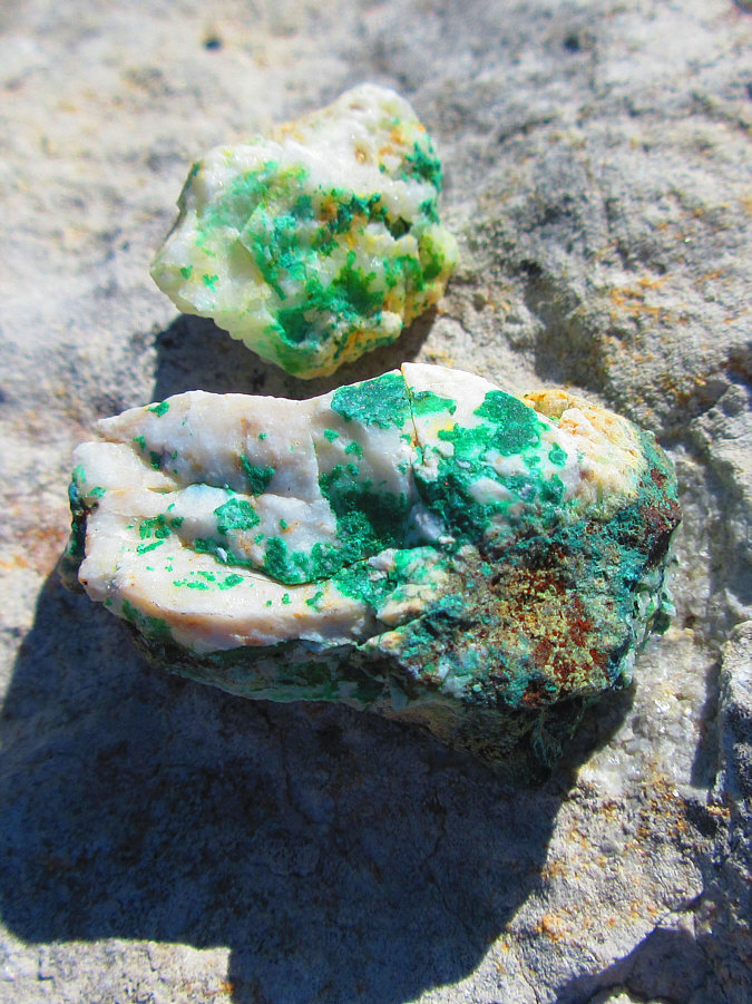 |
Some small rocks near the collapsed
mine shaft have what appears to be traces of copper ore. Photo courtesy of Zosia Zgolak |
 |
The snow on the upper mountain likely came from a recent fresh dump. |
 |
Leslie and Zosia gain the crest of the Protection Mountain massif. Armor Peak is in shadow at far right. |
 |
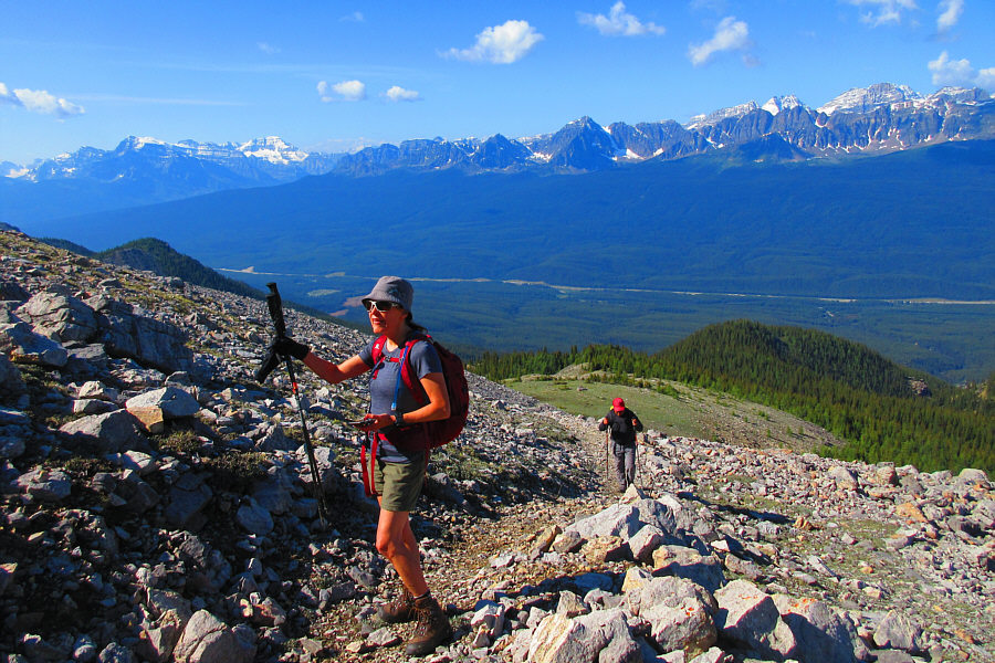
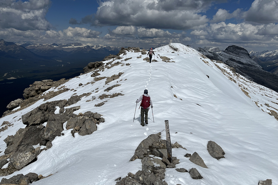
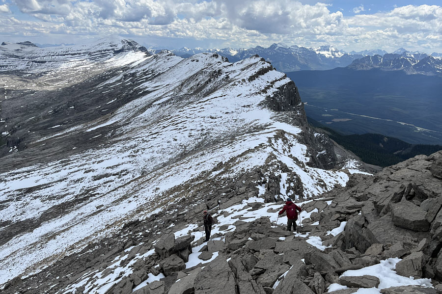
There are a few high points to climb over or bypass along the intervening ridge to Armor Peak. |
 |
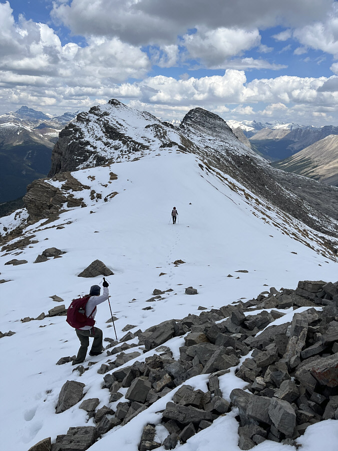
Zosia and Leslie are barely visible making their way across the last dip before the summit block of Armor Peak. |
 |
The summit block offers some easy hands-on scrambling opportunities. |
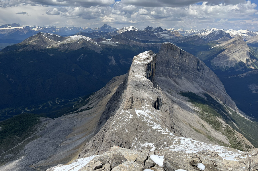 |
The unnamed high point immediately north of Armor Peak is lower in height but exceedingly more spectacular. |
 |
Pulsatilla Mountain and an intermittent lake grab all the attention to the east. "Mitella" is the unofficial name given to the lake according to several online sources. |
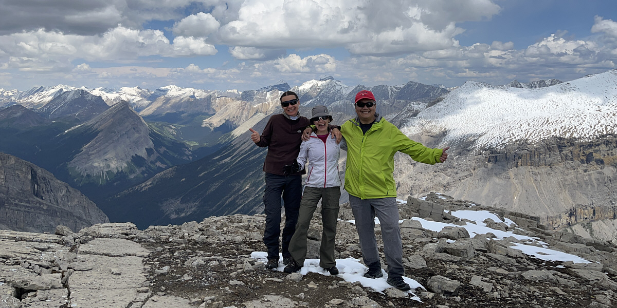
Zosia, Leslie and Sonny stand near the summit of Armor Peak (2896 metres).
 |
Zosia and Leslie descend the summit block to begin the long retreat back across the ridge. |
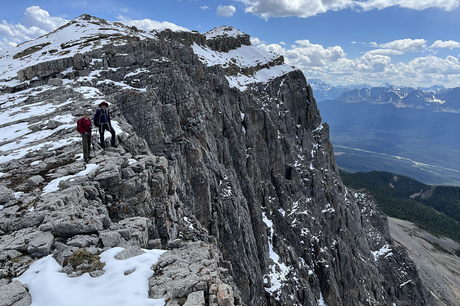 |
Leslie and Zosia stop to peer over the western cliffs of the Protection Mountain massif. |
 |
The walk back along the ridge is lengthy but straightforward. |
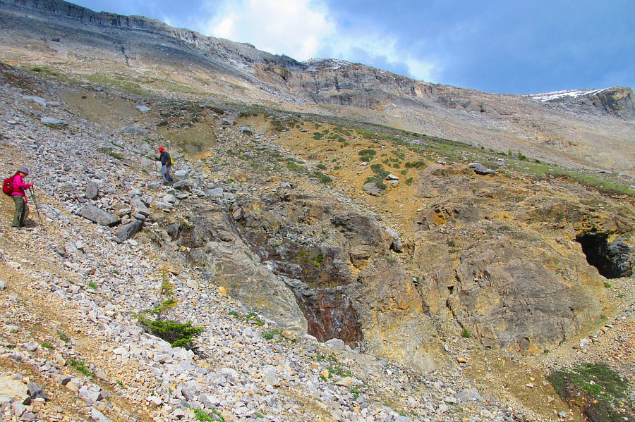 |
After a steep descent from the crest
of the Protection Mountain massif, Leslie and Sonny make their way to
the mine shaft at far right. Photo courtesy of Zosia Zgolak |
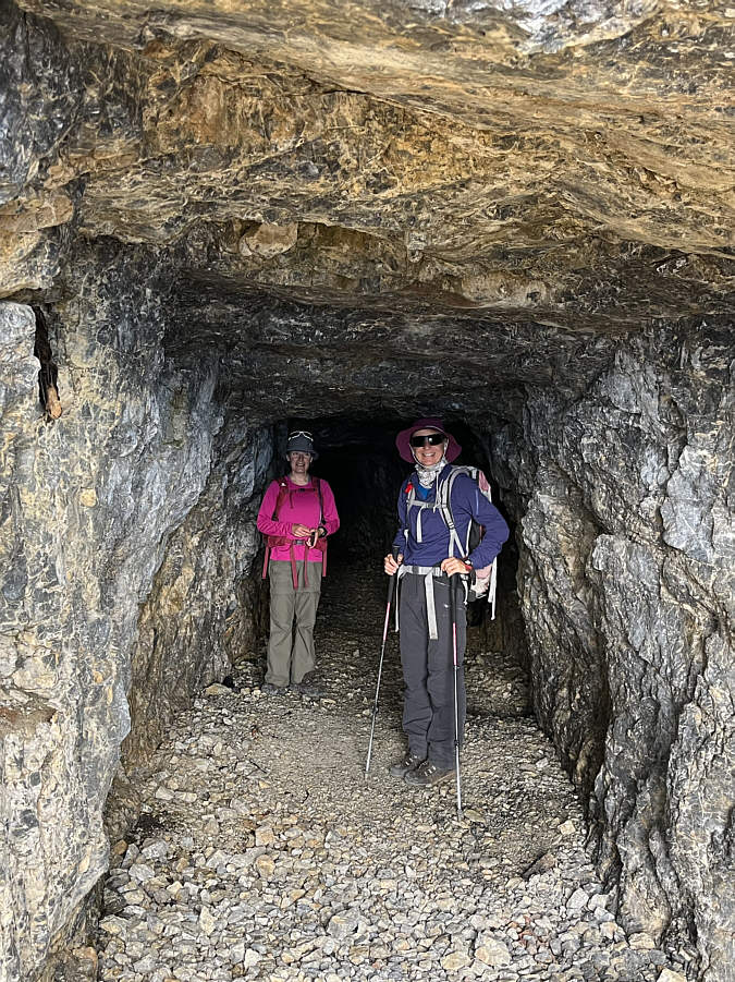 |
The mine shaft does not extend very deep into the mountain. |
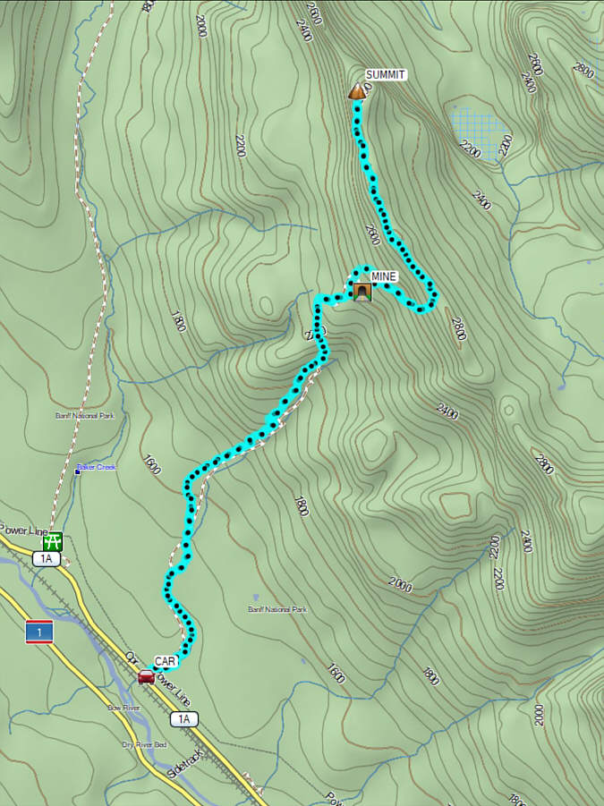 |
Total
Distance: 21.9 kilometres Round-Trip Time: 12 hours 55 minutes Cumulative Elevation Gain: 1465 metres |