BOU AVENUE
Coronado Peak And Miller Peak
On 6 January 2023, Zosia Zgolak and I ascended Coronado Peak and Miller Peak located in the Huachuca Mountains of southern Arizona.  Excellent trails lead to the tops of both peaks from Montezuma Pass which is easily accessed by a good gravel road.  The trail to Miller Peak is actually part of the famed Arizona Trail which spans the entire state between Mexico and Utah.  Due to its close proximity to the Mexican border, the trail is also unfortunately a popular thoroughfare for human and drug smuggling although, by most accounts, conflicts with hikers are exceedingly rare.  Part of the reason for this might be because most illicit activities probably happen at night when the area is normally closed to public access.  It is also reassuring to know that the US Border Patrol maintains a heavy presence here.

From Highway 92, turn south onto Coronado Memorial Road, 17.0 kilometres south of the junction with Buffalo Soldier Trail in Sierra Vista or 28.0 kilometres west of the junction with Naco Highway in Bisbee.  Drive south for 3.2 kilometres before bending west on Montezuma Canyon Road.  Continue driving for 6.7 kilometres at which point the pavement ends.  Drive another 3.3 kilometres up a winding 2WD gravel road to a large parking lot and picnic area with vault toilets at Montezuma Pass.  Park here.

From the south end of the parking lot at Montezuma Pass, Zosia and I started the day with a quick jaunt up Coronado Peak.  The signed trail is short and easy to follow, and we had no problems reaching the summit in about 20 minutes.  After snapping some photos and signing the summit register (located at a nearby interpretive kiosk), we promptly returned to Montezuma Pass.
Oh what a beautiful morning!

The sun rises on Montezuma Pass.

The grasses look like they're on fire!

Zosia hikes the easy trail leading to the top of Coronado Peak.

Already almost there! Zosia approaches the final rise before the top.
A peak for those who like instant gratification!

Zosia and Sonny stand on the summit of Coronado Peak (2094 metres).  Left of centre in the background is Miller Peak.

We're looking mostly into Mexico here. Near the summit is an interpretive kiosk.  The distant pointy peak on the left horizon is Sierra San José in Mexico.
Doesn't look like much from up here! The most notable landmark in this view to the southwest is the wall marking the boundary between Mexico and the United States of America.
Do you really need a GPS track for this one? Total Distance:  1.4 kilometres
Round-Trip Time:  43 minutes
Net Elevation Gain:  91 metres

GPX Data

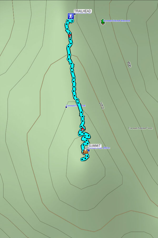
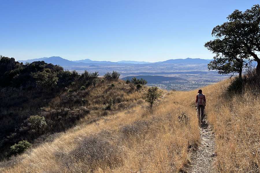
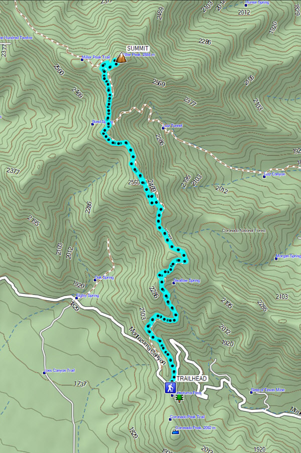
For our second hike of the day, Zosia and I crossed to the north side of the road going over Montezuma Pass and found the signed 
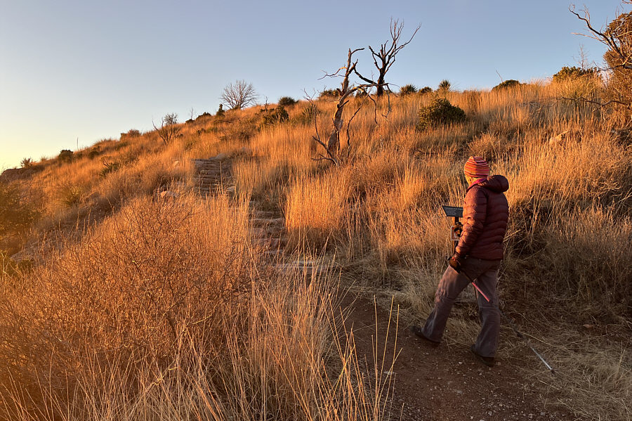
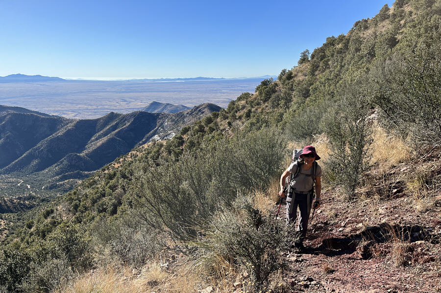
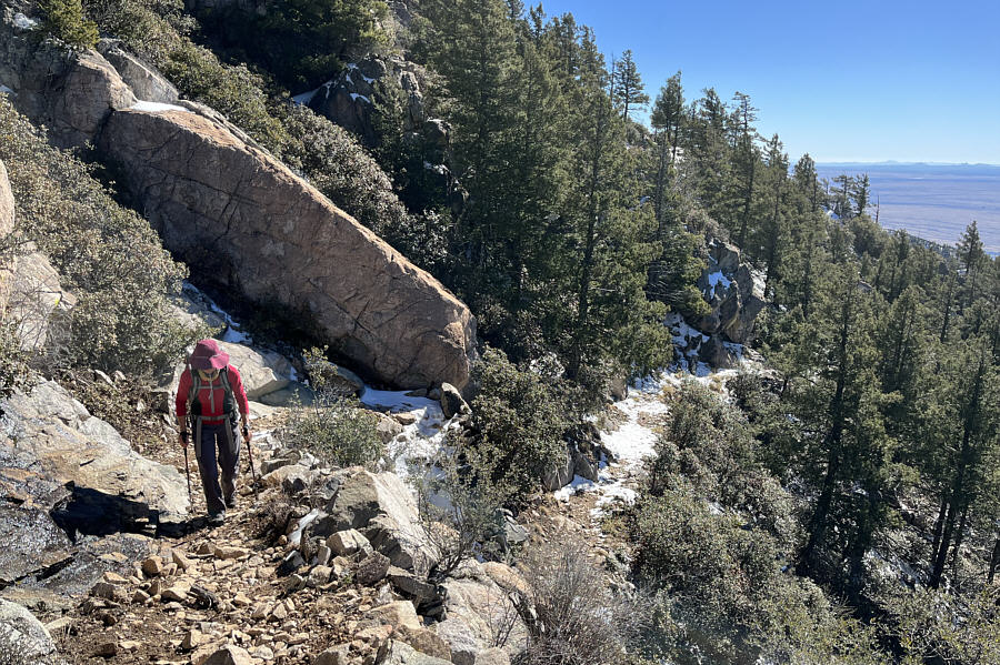
trailhead for Miller Peak.  We then embarked on a long and steady climb along the well-constructed Arizona Trail which winds up Miller 
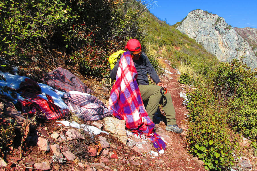
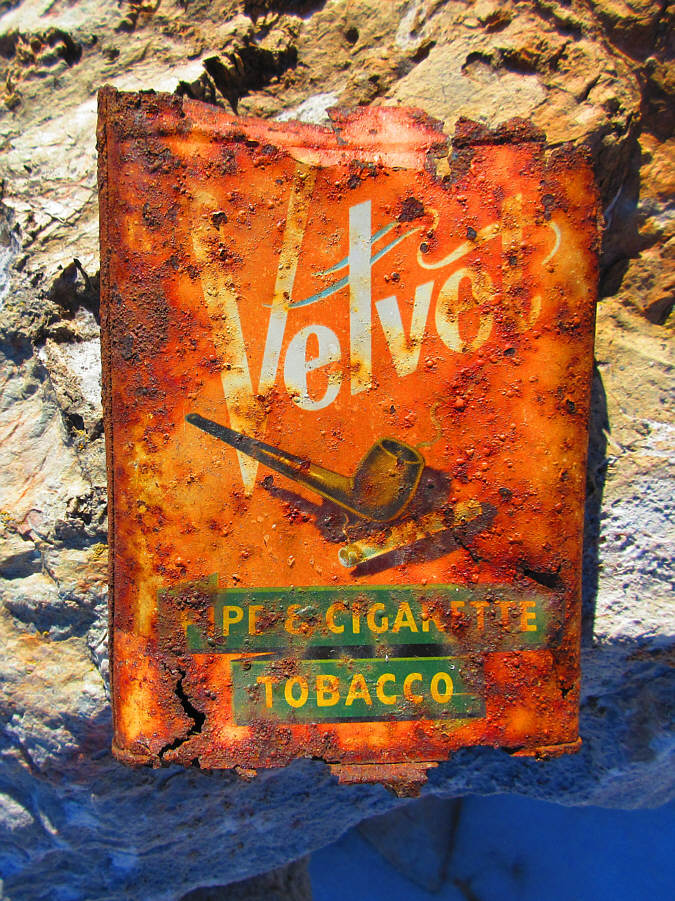
Peak's south ridge.  Throughout the trail, we found plenty of detritus--food, clothes, blankets and garbage--presumably left behind by illegal aliens making their way northward, but on this day, we did not see a single soul while we were hiking.  Apart from a few slippery snow-covered sections of trail and the overall length, we had little trouble hiking all the way up to the summit of Miller Peak.  At the 
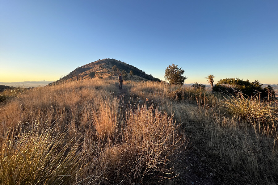
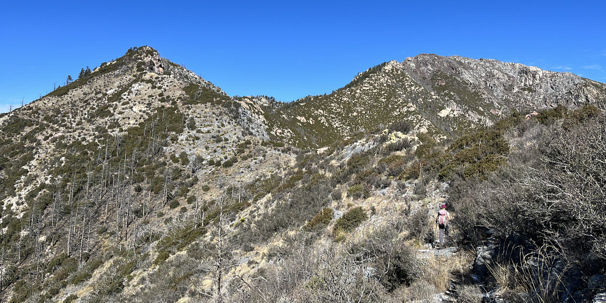
summit are remnants of what was once a fire lookout.

Zosia and I took a well-deserved break on the summit before faithfully retracing our steps back to the trailhead.  Much like the ascent, our descent was largely uneventful, and we made it back to Montezuma Pass in less than 2.5 hours after leaving the top.
We're hiking the Arizona Trail! Zosia begins her ascent of Miller Peak from this trailhead on the north side of Montezuma Pass.
Unlike the last couple of days, we actually get to hike mostly in sunshine for this trip!

Zosia is already warm after a steady ascent from Montezuma Pass.  Coronado Peak is barely visible just left of centre.

We found evidence of people camping at the entrances anyway.

There are several adits like this one along the trail.  All have been permanently barricaded probably to prevent people from entering or using them as shelters.

Still far away!

Zosia gets her first glimpse of Miller Peak (far right) since leaving the top of Coronado Peak.

'Cause it's no fun...being an illegal alien!

Sonny appears to be cleaning his ear with one of several blankets left on the side of the trail presumably by illegal aliens.

Photo courtesy of Zosia Zgolak

Slowly but surely we're getting there...

While Miller Peak is at right, the trail can be seen traversing around the subsidiary bump at left.


Feels just like the Canadian Rockies!

Higher up, Zosia enters terrain which is predominantly coniferous forest instead of desert scrub.

That's a big dead tree!

The trail to Miller Peak branches off Arizona Trail at this junction.

I wonder how much I could get for this on eBay...

A rusted tobacco tin sits among the rocks at the summit of Miller Peak.  This brand of tobacco was apparently popular in the 1950s.

Photo courtesy of Zosia Zgolak

Second summit of the day!

Zosia and Sonny stand on the summit of Miller Peak (2881 metres) which is the site of a former fire lookout.

Will have to come back for Carr Peak in the future...

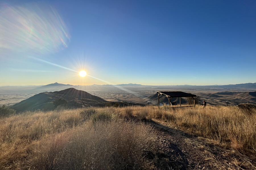
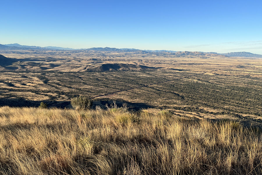
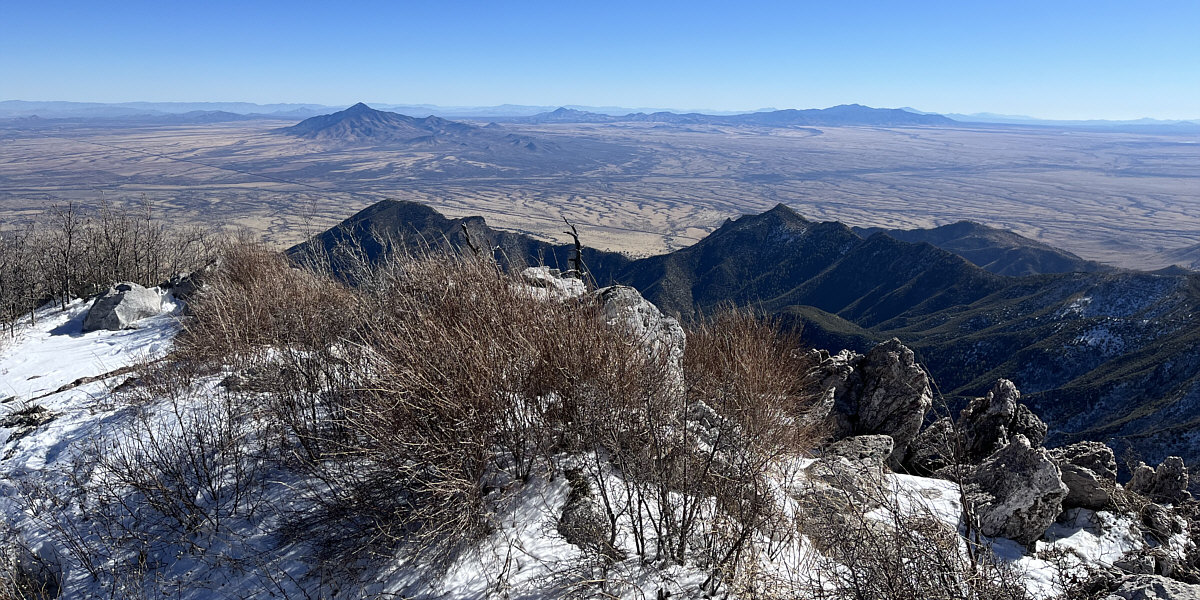
Carr Peak dominates the view to the north.


Sierra San José (distant left) would be a sexy peak to bag!

Bob Thompson Peak (left) and Montezuma Peak (right) are the next closest mountains to the southeast.  The Mexico-USA boundary wall is also visible.


Up in Smoke? Many of the pine trees on Miller Peak were destroyed in 2011 by a wildfire suspected to have been caused by human or drug smuggling activity.
It took us less than 2.5 hours to return to the trailhead.

The return trip is very pleasant in the afternoon sun.

A thoroughly enjoyable hike from start to finish! Total Distance:  16.4 kilometres
Round-Trip Time:  7 hours 10 minutes
Net Elevation Gain:  884 metres

GPX Data