BOU AVENUE
Hero Knob

Asieh Ghodratabadi, Ali Shariat, Zosia Zgolak and I climbed Hero Knob in Alberta's Peter Lougheed Provincial Park on 1 October 2023.  This unofficially-named eastern outlier of Mount Smith-Dorrien is most often associated with a popular backcountry ski tour known as Sweet Sixteen, but as far as I know, surprisingly few skiers bother to tag the actual summit of Hero Knob.  Zosia and I discovered the reason for this when we skied up there earlier in the year and found the summit ridge to be uncomfortably narrow and tricky to negotiate because of cornices.  We wisely backed off but vowed to return on foot under drier conditions.  Unfortunately, we perhaps left our return a little bit late as the mountains recently received a significant dump of snow, but I hoped that the route would still be reasonably safe to hike.  For reference, the hiking route is described in Gillean Daffern's Kananaskis Country Trail Guide, and Willski's blog is also a helpful resource.

The unsigned trailhead is located on the west side of Highway 742 (Smith-Dorrien/Spray Lakes Trail), 14.0 kilometres north of the junction with Kananaskis Lakes Trail or 49.0 kilometres south of the junction with Three Sisters Drive.

From where we parked, Asieh, Ali, Zosia and I dropped down the embankment entering an obvious corridor through the trees.  We soon crossed a marshy flat and then forded Smith-Dorrien Creek.  Although I was the only one who brought hip-waders, the crossing was short enough to only necessitate putting on one hip-wader.  As such, we all got across fairly quickly, and nobody had to get their feet wet.  On the far side of the creek, we followed an old road climbing into the valley just east of Hero Knob.  The road was a bit of a mixed bag--sometimes it was wide and easy to follow while other times it was overgrown or choked with annoying deadfall.  We lost the road when we entered a clearing at the bottom of an avalanche slope but picked it up again after a brief bushwhack.  We eventually reached road's end at some ponds and had to muddle our way through another short stretch of bush before entering the upper valley.  At this point, we tried to follow a faint path through a sea of low shrubs, but we were soon just bashing through them to get to the headwall at the back of the valley.  I recalled that this was much easier in the spring when we could simply ski over all the snow-covered shrubs.  To get up the headwall, we climbed up an obvious rocky drainage and then made a single switchback and rising traverse to reach the upper bowl.  Here, we turned northward to cross a short dip before ultimately gaining the south ridge of Hero Knob and climbing to the same spot where Zosia and I had previously stopped short.  Instead of attempting to stay on the crest like I did last time, we traversed below it to climber's right until we had bypassed all difficulties.  When it looked feasible, we climbed back onto the crest and reached the narrow summit after scrambling up a short but mildly exposed step.

Since the summit is a bit exposed, Asieh, Ali and Zosia retreated down the ridge until they found a safer spot to stop for a break.  I stayed behind on the summit hoping for a break in the clouds to snap some photos of distant peaks, but I eventually gave up and descended to join the others.  When we resumed our descent, we pretty much retraced our footprints down the ridge and headwall and out the valley.  Not surprisingly, the footing was slippery especially on steeper sections such as the headwall, but fortunately, no one went for an involuntary tumble.  Upon returning to Smith-Dorrien Creek, we all successfully hopped across without having to don my hip-waders although I think our boots were already wet to varying degrees anyway from hiking in the snow.  The subsequent short walk to the highway brought our heroic adventure to an end.

Hmmm...maybe we should have brought snowshoes or skis...

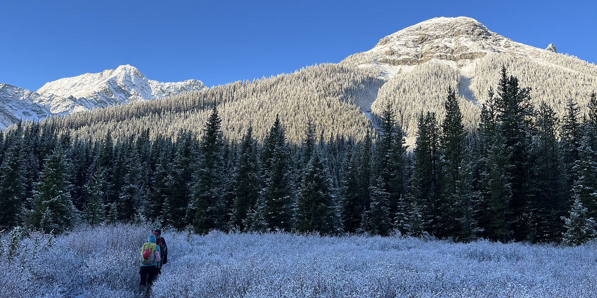
Hero Knob (right) looks brilliant in the morning sun.

It took us about 10 minutes to all get across, but nobody got their feet wet! Zosia and Ali help guide Asieh as she fords Smith-Dorrien Creek with only a single hip-wader.
Hmmm...seemed a lot easier in winter!

The group has to contend with snowy deadfall on some parts of the approach.

Photo courtesy of Zosia Zgolak

Time to put on the sunscreen?

The group stops for a short break in a clearing partway up the valley.

There is apparently an easier ascent route than this one.

Zosia climbs up a rocky drainage below a headwall.

The little larch that could...

Zosia strokes a small larch tree near the top of the headwall.

Two thumbs up!

Sonny, Asieh and Ali enjoy the warm sunshine beside another golden larch tree.

Photo courtesy of Zosia Zgolak

I'm still amazed that people ski off the ridge in the background.

Zosia, Ali and Asieh continue their ascent in the upper bowl.

Wasn't this supposed to be a bluebird day?

The top of Hero Knob is obscured by mist.

Now I know why I didn't try to do this last spring!

The group traverses below the ridge crest, but the terrain here is both loose and slippery.

Gotta really watch your step here especially in snowy conditions!

The slope alarmingly drops away on both sides of the ridge near the top.

Asieh was ready to quit just before this last step!

Zosia waits for Asieh and Ali to scramble up the last tricky step.

Not a spacious summit!

Ali, Sonny, Asieh and Zosia crowd the summit of Hero Knob (2513 metres).

And Sweet Sixteen is out of view at the bottom!

To the west are Mount Smith-Dorrien (centre), Prairie Lookout (right of centre) and Mount Murray (right).

It's all downhill from here, baby!

After taking a break, the group heads back down the same way.

This would be so much better on skis...and with more snow!

Asieh carefully follows Ali and Zosia down the snowy slope above the headwall.

And with pretty golden larches to boot!

The group drops down the same rocky drainage they ascended earlier.

Photo courtesy of Zosia Zgolak

Making a big splash!

Ali forgoes using hip-waders to re-cross Smith-Dorrien Creek.

I'd rather ski this, but this is probably the safest way bag Hero Knob. Total Distance:  9.1 kilometres
Round-Trip Time:  6 hours 59 minutes
Cumulative Elevation Gain:  718 metres

GPX Data