BOU AVENUE
Hualapai Peak

On 23 December 2023, Zosia Zgolak and I climbed up Hualapai Peak located in Hualapai Mountain Park southeast of Kingman, Arizona.  Our inspiration for this ascent came largely from Bob Spirko's 2014 trip report.  With easy access and a good trail to follow, I thought that this hike would be a slam dunk, but as it turned out, tagging the summit would not be so easy.

From the I-40 in Kingman, take Exit 51 and head south on CR20 (Stockton Hill Road).  After crossing Historic Route 66, CR20 becomes CR157 (Hualapai Mountain Road).  Drive CR157 for 18 kilometres and turn right to enter Hualapai Mountain County Park (day use fee of $10 USD).  Keep right past the entrance and drive another 1.1 kilometre along the paved Aspen Park Trail to a locked gate.  Park anywhere before the gate without blocking the road.  A vault toilet is located about 90 metres past the gate.

Starting at the locked gate, Zosia and I walked up the continuation of the road for about 2.5 kilometres to a signed junction with multiple roads heading in different directions.  There are signs here, but they are easy to miss.  The correct road heads southeast and goes past some buildings and what appears to be an old campground (Camp Levi Levi).  Passing a signed junction for "Potato Patch Loop", we dropped into a dip before climbing up to a saddle east of the peak (Spirko went off-trail to shortcut this section of road).  From the saddle, we turned westward up the road and followed it to its terminus below the summit rocks of Hualapai Peak.  We inadvertently missed the correct turnoff at one of the last switchbacks in the road, and this created a great deal of grief for us.  We initially tried to ascend a promising crack in the summit rocks but backed down when the route became too technical.  We then circled further around the south side of the summit block and tried to scramble up the southwest aspect.  This entailed a lot of heinous bushwhacking, and while we were clearly off-route, we were too stubborn to back off at this point.  After a lot of thrashing and cursing, we finally pulled ourselves up to the summit boulders.  Gaining the highest boulder requires an exposed traverse on a sloped ledge with very tenuous holds.  While Zosia was content to just tag the summit benchmark on a marginally lower boulder, I gave the highest boulder a try despite some slippery conditions due to recent precipitation.  The exposed traverse was not too difficult for me going up, but I had a much tougher time coming back down due to the lack of good holds.  Fortunately, the grip on my hiking boots held as I stepped across the most exposed part of the ledge and back to safety.

For our descent, Zosia and I found the correct route on the northeast side of the summit block and easily descended to the road without trouble.  There was a cairn here, but we had completely missed it because it was hidden behind a rock right where we had shortcutted the last switchback.  I built a second cairn here that is more readily visible from the section of road below the switchback.  After retracing our steps back to the aforementioned signed junction for "Potato Patch Loop", we opted to take the loop trail just as Spirko had done on his descent.  This trail seems to be a bit more long-winded than the road, but it is also far more scenic.  We ultimately popped out onto the main road near the vault toilet and were soon back at the gate and our car to conclude the trip.
There's a disc golf course nearby in case you don't feel like hiking! Zosia begins the hike at a locked gate.
No ice cream today!

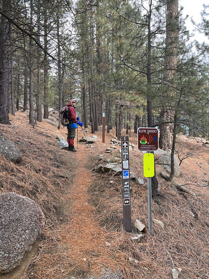
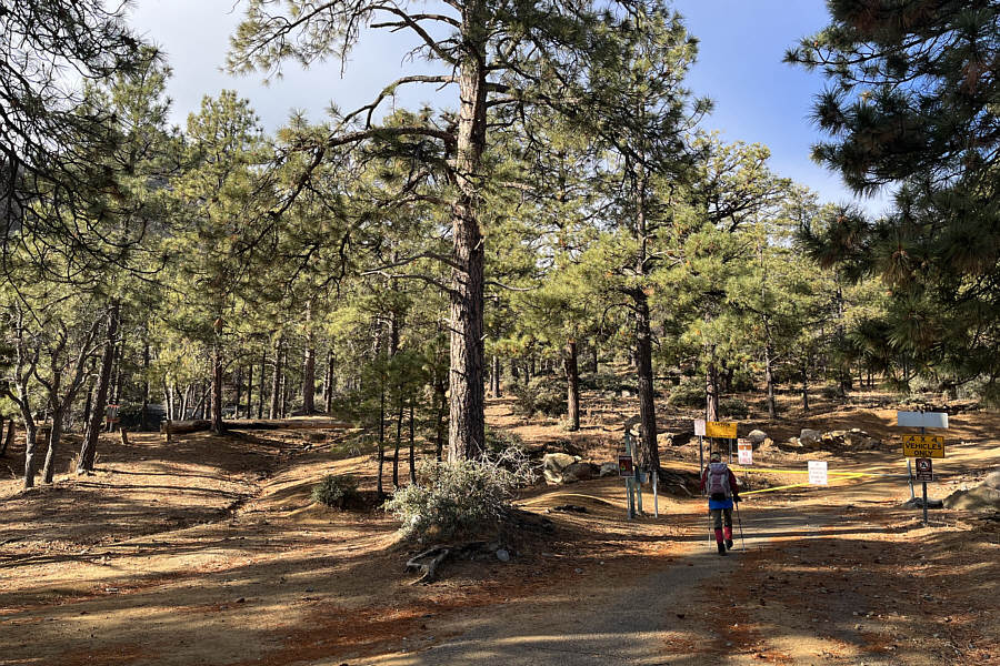
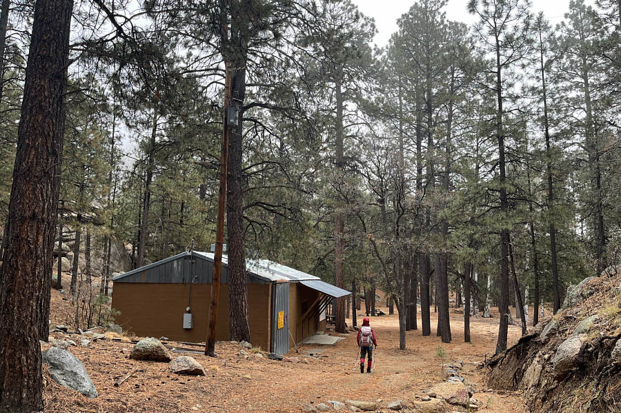
Zosia passes some sort of concession/storage building on the way to Camp Levi Levi.

Annoying dip coming up! Sonny passes the signed turnoff for "Potato Patch Loop".

Photo courtesy of Zosia Zgolak

Back in the saddle again!

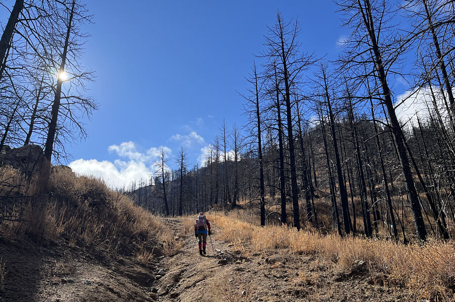
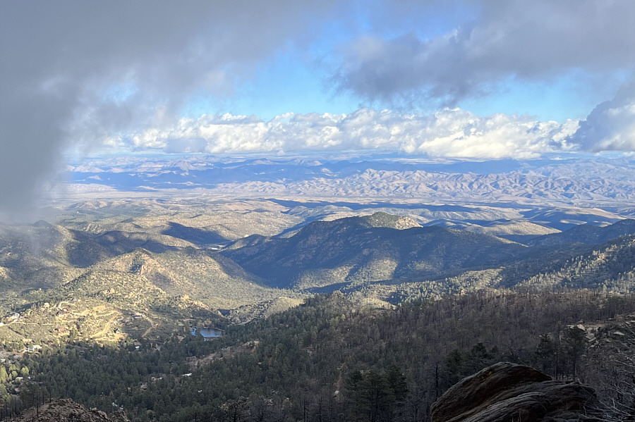
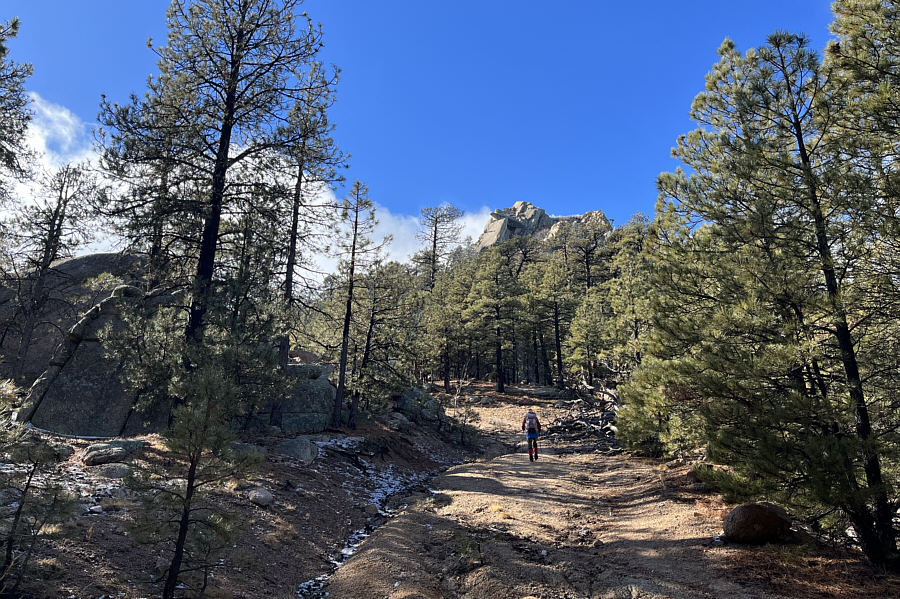
Zosia climbs up to a saddle east of Hualapai Peak.

Almost there? Well, not quite... The summit is finally within sight.
We already missed the correct turnoff!

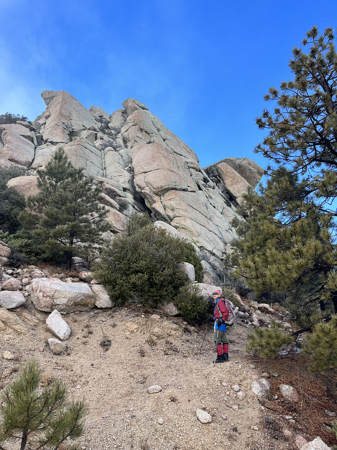
At road's end below the summit block, Zosia is wondering where to go next.

Not this way! Sonny scrambles up a promising crack but would soon back down since this route is only for technical rock climbers.

Photo courtesy of Zosia Zgolak

Also not the correct route, but we're gonna come up this way regardless!

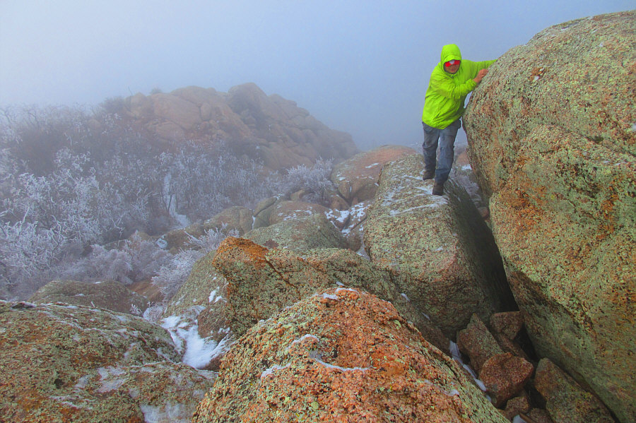
Sonny squeezes his way past nasty bushes onto some boulders on the southwest side of the summit block.

Photo courtesy of Zosia Zgolak

Thankfully, the worst is over! Zosia enjoys some bush-free scrambling near the top of the summit block.
The highest boulder looks innocuous enough from here...

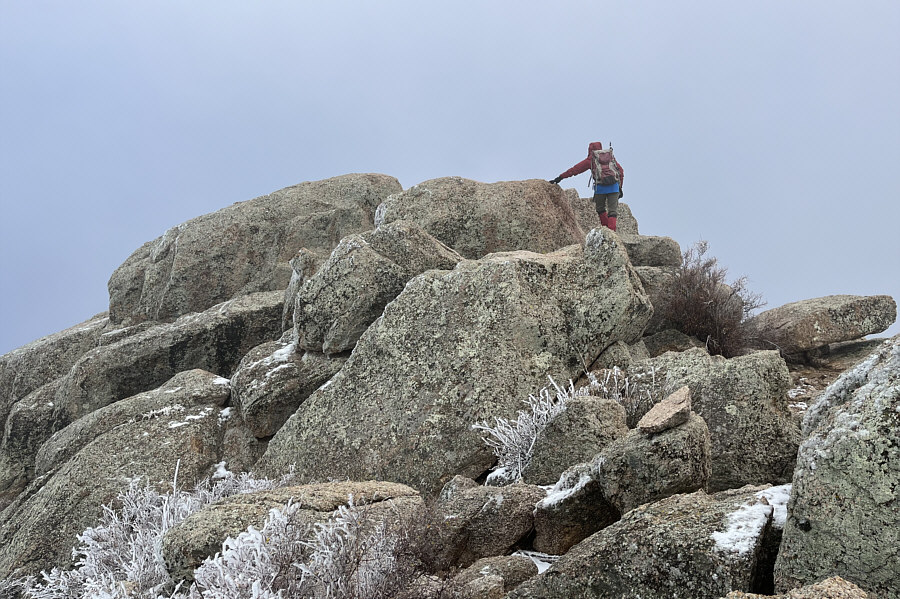
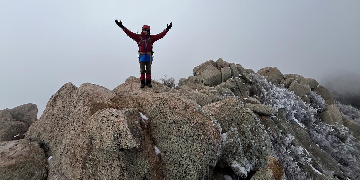
Zosia checks out the various boulders on top of Hualapai Peak.  The highest boulder is the one on the left while the boulder she is touching has the summit benchmark.

Oddly, that's NOT the summit benchmark behind my left foot! Sonny stands on the true summit of Hualapai Peak (2548 metres).

Photo courtesy of Zosia Zgolak

The gazetted summit.

Zosia stands on the marginally lower boulder that has the summit benchmark.


More exposed than it appears in the photo! After tagging the highest boulder, Sonny carefully makes his way back along an exposed and slippery ledge.  This is the crux.

Photo courtesy of Zosia Zgolak

A little bit of scrambling/down-climbing required. Zosia descends the correct route off the summit block.
We totally missed this since we took a short cut just left of the tree beside Zosia. This is looking back up the correct access route for the summit block from the road.  Note the cairn near Zosia and the overhanging rock high above.
Annoyingly, there's more uphill hiking to come! Zosia takes the trail for "Potato Patch Loop" as an alternate descent route.
More places to explore in the future! A break in the clouds grants some far-reaching views to the east.
This made the alternate descent worthwhile. Zosia passes some impressive cliffs during the descent.
Would've been a far easier trip had I read Bob's trip report more carefully! Total Distance:  14.0 kilometres
Round-Trip Time:  6 hours 26 minutes
Net Elevation Gain:  490 metres

GPX Data