BOU AVENUE
Lusk Ridge West

On 3 June 2023, Shelley Milutinovic, Bob Parr, Zosia Zgolak and I explored the western half of Lusk Ridge--aptly named Lusk Ridge West on Open Topo Map--located in Alberta's Kananaskis Country Public Land Use Zone.  This was a follow-up to a previous hike up Lusk Ridge which Zosia had organized but did not participate in due to illness.

Starting from the south side of Highway 68 (4.5 kilometres east of junction with Highway 40 or 16 kilometres west of junction with Homestead Road), Shelley, Bob, Zosia and I hiked along a well-defined trail climbing up a wide corridor through the forest.  Shortly after where the trail bends eastward, we abandoned it to climb up a cut block which eventually turns into a forested ridge.  Bushwhacking here was light, and we even found a flagged trail of sorts to follow up the ridge.  Higher up, we emerged onto open slopes and traversed under some rocky bluffs before veering westward across a forested dip.  As we crossed the dip, we had the misfortune of wandering into an area of thick bush as we passed the north side of an unnamed knob.  Thankfully, the misery here was short-lived, and we soon emerged onto an open ridge crest just northwest of the knob.  Momentarily ignoring the knob, we continued heading northwest over a semi-forested hump to reach a viewpoint overlooking Highway 68 at the end of Lusk Ridge West.  We took a short break there before backtracking over the hump and ascending the unnamed knob where we surprisingly found a geocache.  I consider this unnamed knob the high point of Lusk Ridge West.

After signing the geocache's register, Shelley, Bob, Zosia and I turned eastward and re-crossed the forested dip, this time with much less difficulty.  We then climbed up to the same viewless high point on the main summit of Lusk Ridge that I had visited the year before, and it was just as underwhelming without snow cover.  From there, we headed north and descended the same broad ridge used for the ascent on my previous trip.  Although we did not have to contend with lingering snow this time, I still found the route-finding to be somewhat tricky in a few spots.  In any case, we made it down without too much grief to some familiar cut blocks which ultimately led us back to the same trail we started on and subsequently to the highway.
It would be a steep and possibly difficult scramble to go directly up to the viewpoint from here. 
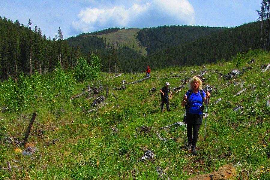
The group starts hiking up a wide corridor through the forest and would later reach a viewpoint situated on the forested hump in the distance which is the end of Lusk Ridge West.
Did I mention how much I love hiking in cut blocks?

Zosia and Shelley abandon the trail to ascend a cut block.

Somebody else has been here! Bob follows flagging tape up the forested ridge.
It's better to go left of the knob!

From here, the group would cross the forested dip and traverse to the right below the unnamed knob ahead.

That's one way to scratch an itch! 
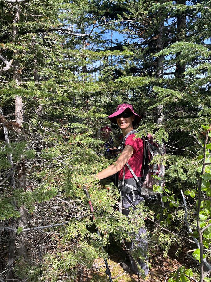
Zosia seems to genuinely enjoy bushwhacking.

Pretty impressive for a lowly front-range hill!

The open ridge crest northwest of the knob grants far-reaching views including that of Barrier Lake.


This detour is not really worth the extra effort in retrospect, but we went anyway! 
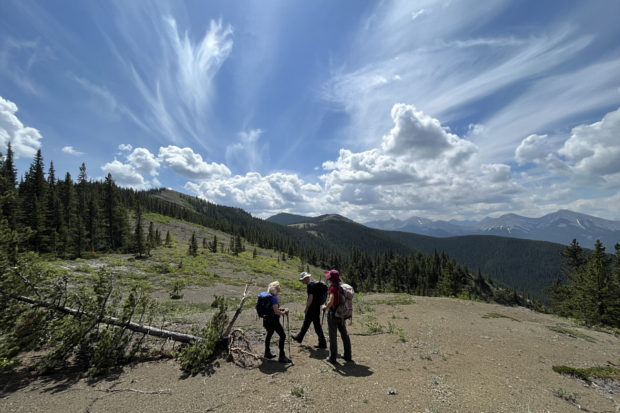
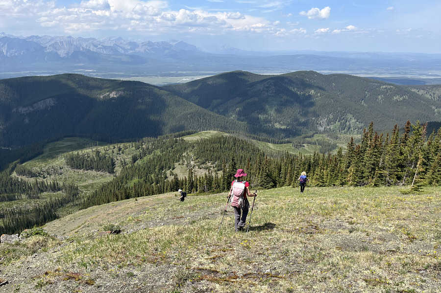
The group heads northwest toward the end of Lusk Ridge West.
Part of the "Can't Decide" crew! Sonny, Zosia, Bob and Shelley pose together on a viewpoint at the end of Lusk Ridge West.
That's a wild-looking sky! The group retraces its steps along Lusk Ridge West.
Let's go bag this summit! 
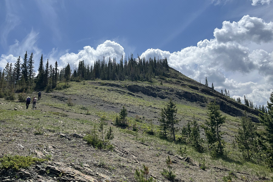
The knob that was bypassed earlier can be easily ascended on its northwest side.
The geocache register has a lot of familiar names! The group stops for a break on top of the unnamed knob (2007 metres) which is the highest point of Lusk Ridge West.  At far right is main summit of Lusk Ridge.
Lusk Ridge is full of surprises! 
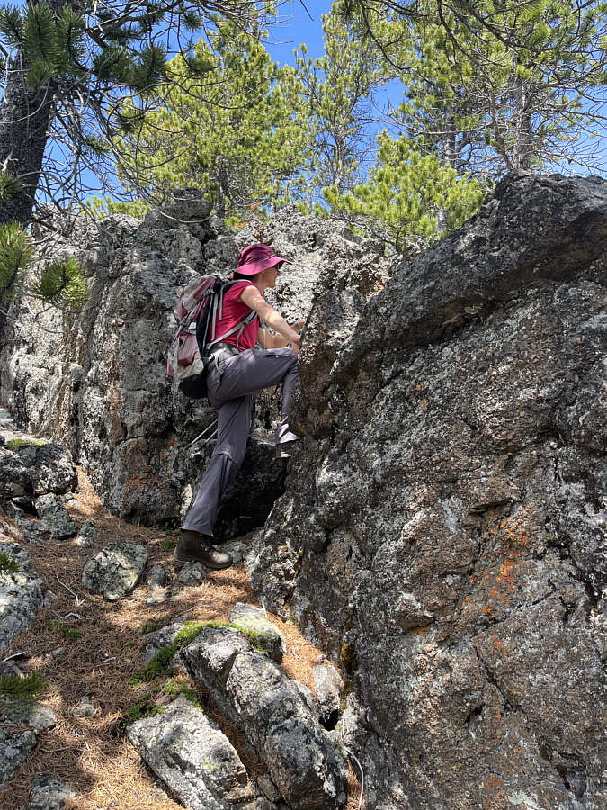
Zosia finds some light scrambling while ascending the main summit of Lusk Ridge.
The dog knows where that hand has been... 
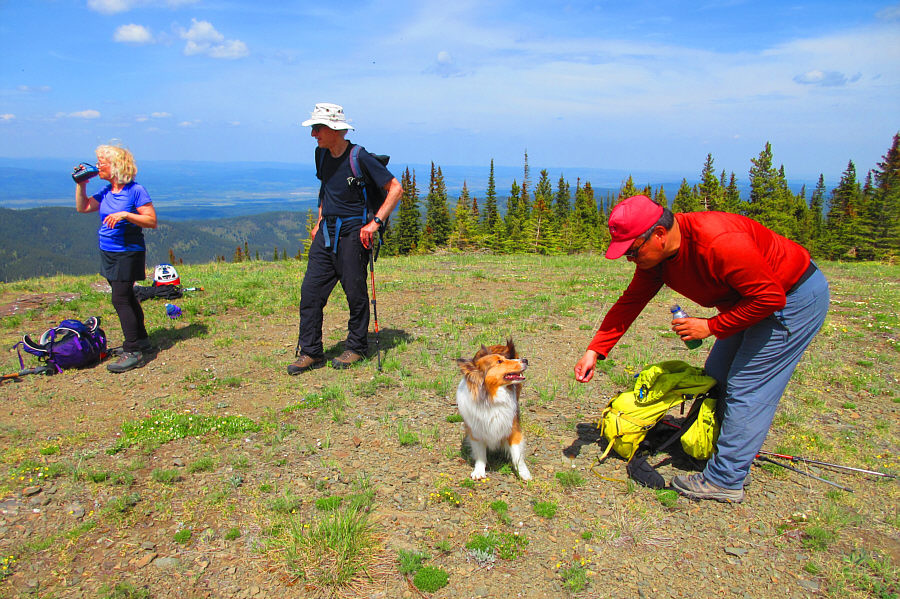
While Shelley and Bob relax in a clearing north of the viewless high point (2075 metres) of Lusk Ridge's main summit, Sonny tries to coax a dog into licking his hand.

Photo courtesy of Zosia Zgolak

Still some tricky route-finding on the way down... Bob, Zosia and Shelley descend a broad ridge en route to the cut blocks to the left.
It's best to exit the ridge to the left somewhere along here. Near the bottom of the broad ridge, the group gets one last look at Barrier Lake in the distance.
The hot sun is getting to be unbearable... Sonny, Bob and Shelley hike out along a cut block with their descent ridge visible behind them.

Photo courtesy of Zosia Zgolak

Entails all the best that Lusk Ridge has to offer! Total Distance:  11.9 kilometres
Round-Trip Time:  7 hours 9 minutes
Cumulative Elevation Gain:  742 metres

GPX Data