BOU AVENUE
Miller Peak And San Jacinto Peak

On 28 December 2023, Zosia Zgolak and I hiked up San Jacinto Peak in California's Mount San Jacinto State Park.  We drew most of our inspiration from Bob Spirko's 2022 trip report.  The ascent is very popular largely because of easy access in the form of a good trail and the convenient Palm Springs Aerial Tramway.  We would also tag officially-named Miller Peak--one of the many outliers of San Jacinto Peak--since it is not that far off the main trail.

From Highway 111 in northwest Palm Springs, turn west onto Tramway Road.  Drive 5.2 kilometres to a manned gate.  Pay the parking fee ($15 USD) and follow the given directions to the appropriate parking lot.  The lower tram station is about 900 metres beyond the gate.

Just as Spirko had done, Zosia and I arrived at the lower tram station early in order to get a good parking spot.  We then joined an already long queue of people waiting for the tram ticket sales to begin.  After purchasing our tickets ($30.95 USD per adult), we boarded the first tram of the day departing at 8:00 AM.  The 10-minute ride to the upper tram station was awe-inspiring as we whisked past spectacular cliffs and enjoyed breathtaking views of the desert landscape to the north.  Upon disembarking, we promptly exited the upper tram station and descended a paved pathway to reach a ranger station with washrooms about half a kilometre to the west.  We stopped here to register ourselves and obtain a free permit which is required for hikers venturing beyond the ranger station.

From the ranger station, Zosia and I followed signs for San Jacinto Peak along a well-maintained trail which crosses to the south side of Long Valley Creek before rising steadily through mature forest.  The trail was generally snow-covered throughout our hike, but we never felt the need to don our ice cleats.  After passing a backcountry campground, we climbed up to an important junction at Wellman Divide.  Here, we turned right to ascend a rising traverse where the forest begins to give way to short but dense bushes.  About 2.0 kilometres north of Wellman Divide, the trail makes a sharp switchback to the left, but we turned right to scramble up nearby Miller Peak.  The short ascent of the rocky outcrop is mildly exposed but well worth the short detour.

After tagging the summit of Miller Peak, Zosia and I returned to the main trail and resumed our ascent of San Jacinto Peak.  At the next signed junction, we turned right and passed a public shelter before climbing up the last slippery section of trail to the top.  The summit of San Jacinto Peak was busy but not too crowded when we arrived, and we found a nice spot to stop for lunch.

When we had our fill of food and far-reaching views, Zosia and I returned the same way back to the ranger station.  Though uneventful, the descent felt long and monotonous especially in the forest.  After dropping off our permit at the ranger station, we trudged back up to the upper tram station amidst throngs of casual tourists.  We killed some time by visiting the small museum there and the observation deck before lining up to wait for the next tram going down.  By the time we arrived at the lower tram station, it was already dark, but I was astonished to see crowds of people still waiting to go up.  The lights of Palm Springs at night are surely a sight to see from up high, but after our long day, Zosia and I were more than happy to just return to our car and drive to our next adventure.

The foreground is a popular place for visitors to "walk" their dogs.

The morning sun shines on the San Jacinto Mountains in this view from the Palm Springs Visitor Center.

Already hosed by the $15 USD parking fee! Zosia arrives at the lower tram station of the Palm Springs Aerial Tramway.
Oooooohhhh!!!

The Palm Springs Aerial Tramway boasts "the world’s largest rotating tram car".  A one-way ride takes about 10 minutes, and for each ride, the tram gains (or loses) nearly 1800 metres over a distance of about 4 kilometres.

Photo courtesy of Zosia Zgolak

Breathtaking! Wind farms are visible in the valley in this view from the tram on the way up.

Photo courtesy of Zosia Zgolak

Good way for the rangers to track trail usage and account for everyone on the mountain.

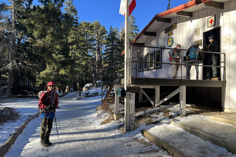
Zosia stops at this ranger station to obtain a free wilderness permit.  Washrooms with running water are also available here.

No problemo! This crossing of Long Valley Creek is a little tricky due to the slippery footing.
Apparently no toilet seats here--squatting only!

Zosia stops to use one of the outhouses at a backcountry campground along the trail.

Lotsa big trees!

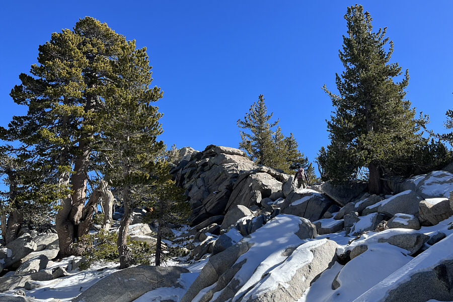
Zosia hikes through typical forest in this area.

First good views since leaving the upper tram station. 
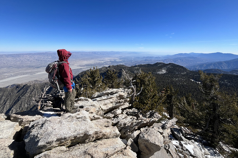
At Wellman Divide (an important trail junction), Zosia enjoys some far-reaching views to the south.
Not on our agenda for today! The sharp horn in the distance is Cornell Peak.
No wonder it took so long to hike this far!

Barely visible left of centre, the upper tram station looks close but is actually well over 3 kilometres away as the crow flies.

Doesn't look like much of a worthwhile summit from here! At centre is Miller Peak, another outlier of San Jacinto Peak.
A more interesting ascent than expected!

Shortly after leaving the main trail to San Jacinto Peak, Zosia scrambles up Miller Peak.

Delightful scrambling! The route to the top of Miller Peak is surprisingly airy.
Sure, it's only an outlier, but we still made an effort to get here! Zosia and Sonny sit on the summit of Miller Peak (3176 metres) with San Jacinto Peak visible in the background.
Can you spot Eagle Mountain, Salton Sea, Rabbit Peak or Toro Peak? 
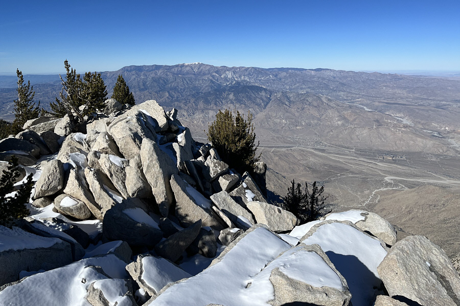
This is looking southeast from the summit of Miller Peak.
Location, location, location!

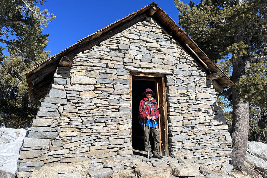
Zosia visits a public shelter not far from the summit.

I think the elevation of 10,834 feet is a bit generous! Sonny and Zosia sit on the summit of San Jacinto Peak (3296 metres).
More intriguing peak-bagging objectives for the future! The most prominent peaks on the western horizon are Santiago Peak (left) and Mount San Antonio (right).
Very high on my to-do list for the next time I'm down this way! San Gorgonio Mountain--the highest mountain in southern California--is the white-capped peak to the north.

That is one killer rabbit (peak)!

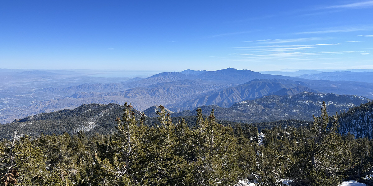
Most notable in this view to the southeast are Salton Sea, Rabbit Peak (centre), and Toro Peak (right of centre).


Probably don't want one of these dropping on your head! Zosia picks up a couple of big pine cones near the end of the hike.
Kinda brutal to climb this after a long hike! After returning the wilderness permit at the ranger station, Zosia hikes back up to the upper tram station.
Glad we don't have to walk down! Zosia waits to take the tram down the mountain.
Still feels like a long day even with an easy trail! Total Distance:  ~17.1 kilometres
Round-Trip Time:  7 hours 21 minutes
Cumulative Elevation Gain:  ~770 metres

GPX Data