BOU AVENUE
Mount Minerva Hoyt And Quail Mountain
On 27 December 2023, Daniel Dufresne, Aga Sokolowska, Zosia Zgolak and I hiked up Quail Mountain, the highest point in California's Joshua Tree National Park.  The mountain poses no technical difficulties and can be approached from several different directions.  We would use a modified version of the route described by Stav Basis which includes an ascent of Mount Minerva Hoyt, an outlier of Quail Mountain.  Minerva Hoyt was a leading advocate for desert conservation and one of the driving forces in the creation of the park.

Starting from a pullout (34.056678, -116.222308) on the south side of Park Boulevard, Daniel, Aga, Zosia and I hiked southwest across the desert flats aiming for the entrance to Johnny Lang Canyon.  Where we crossed Quail Springs Historic Trail, we picked up another trail--Lang Mine Trail--entering the canyon but lost it briefly before picking it up again further south.  We then settled into a lengthy but easy march southward along this trail.  At one point, we made a wrong turn up a drainage, but we quickly got back on track once we realized our mistake.  About 3.9 kilometres from its junction with Quail Springs Historic Trail, the Lang Mine Trail crosses a drainage to climb up the final few hundred metres to the mine site.  Choosing to forego the mine site, we abandoned the trail at this point and simply grinded up open grassy slopes to the ridge above.  We easily reached the summit of Mount Minerva Hoyt shortly after gaining the ridge.  From there, we continued southward on a beaten path dropping into a dip separating Mount Minerva Hoyt from Quail Mountain.  We ultimately lost the path, but climbing out of the dip, we quickly gained a good trail on the east ridge of Quail Mountain.  The remainder of the ascent to the top was straightforward.  The benchmark (gazetted summit) is located at the north end of the summit plateau while the register is tucked in some rocks at the more scenic south end.  Both ends of the summit plateau are roughly of equal height.

After taking a well-deserved break, Daniel, Aga, Zosia and I retraced our steps to the summit of Mount Minerva Hoyt without any issues.  We accidentally discovered a register there on our way back and stopped to sign it.  Instead of dropping back down to where we left the Lang Mine Trail, we opted to descend the broad ridge north of Mount Minerva Hoyt.  Despite the lack of a beaten path, we encountered few difficulties hiking down the ridge.  Near the ridge's terminus, we dropped down a steep slope to skier's right into a draw which we followed out to where it intersects the Lang Mine Trail.  Somehow, we overshot the trail, but as before, we were able to make a course correction fairly quickly.  The remaining hike out Johnny Lang Canyon and back across the flats to the pullout was uneventful.
But it's cold outside!

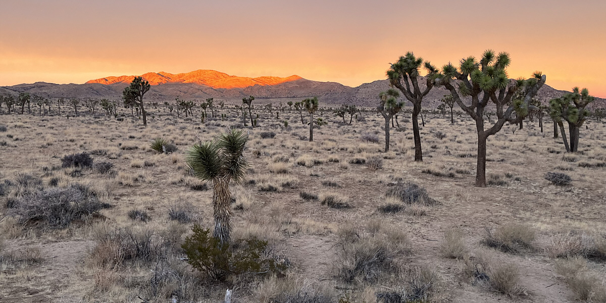
Dawn breaks at Joshua Tree National Park.

Photo courtesy of Zosia Zgolak

Oh what a beautiful morning!

Morning sunlight illuminates the top of Quail Mountain.


An easy warm-up walk!

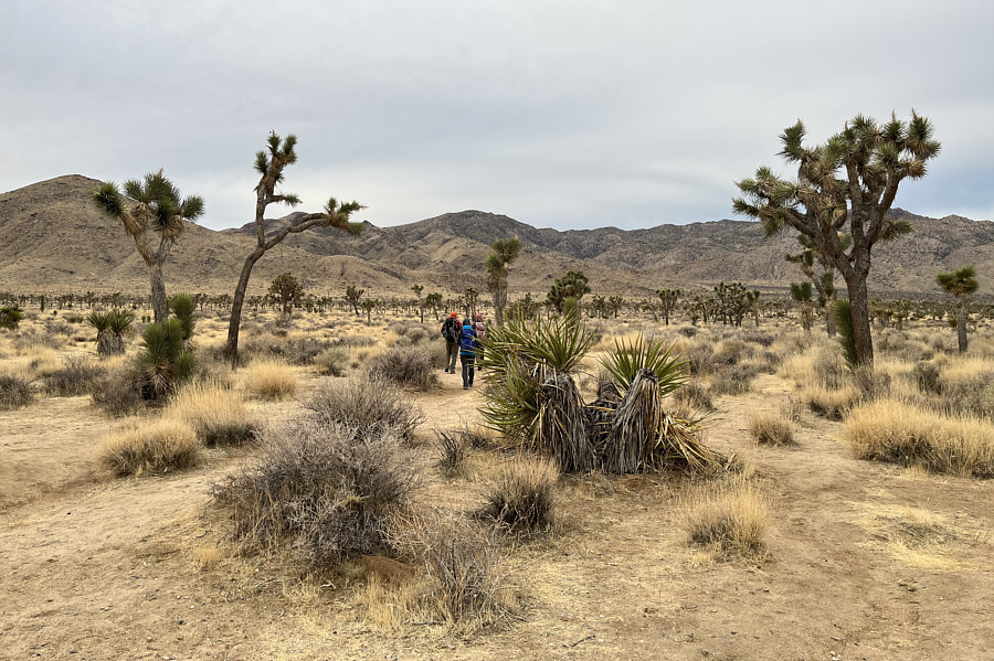
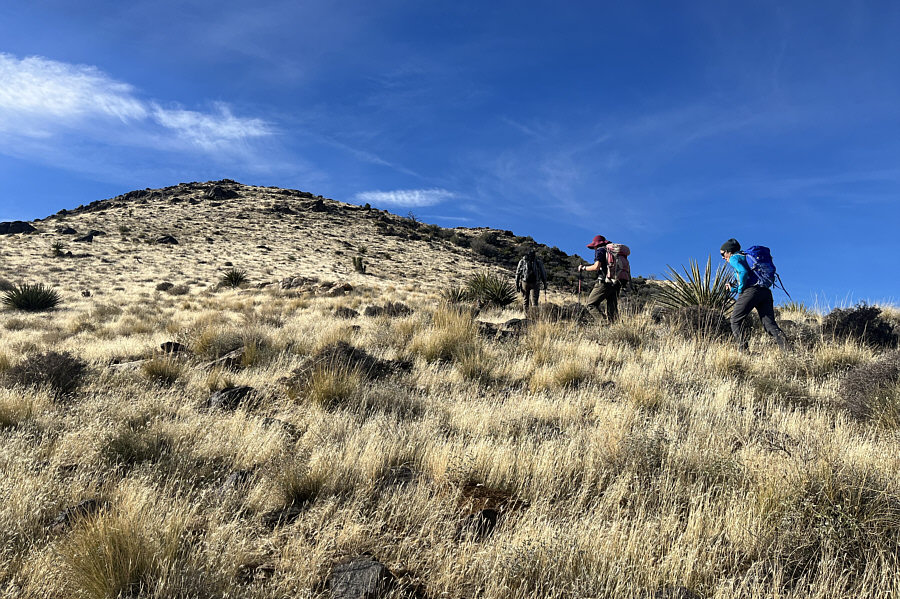
Daniel, Aga and Zosia start hiking across the flats aiming for Quail Mountain (centre).

The trail greatly simplifies route-finding! 
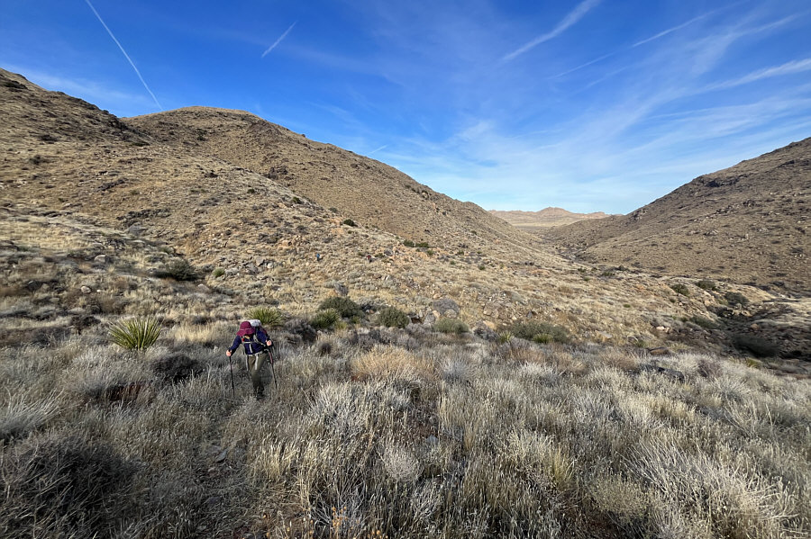
The group finds a good trail--Lang Mine Trail--heading up Johnny Lang Canyon.
It's hard to give up a good trail!

Although the sides of Johnny Lang Canyon look inviting to ascend, Zosia continues to follow the trail.

This is probably a good place to leave the trail and head uphill. The trail ultimately leads to Lang Mine which is somewhere on the distant ridge.  The group would abandon the trail before climbing up to the mine site.
Finally climbing in earnest! 
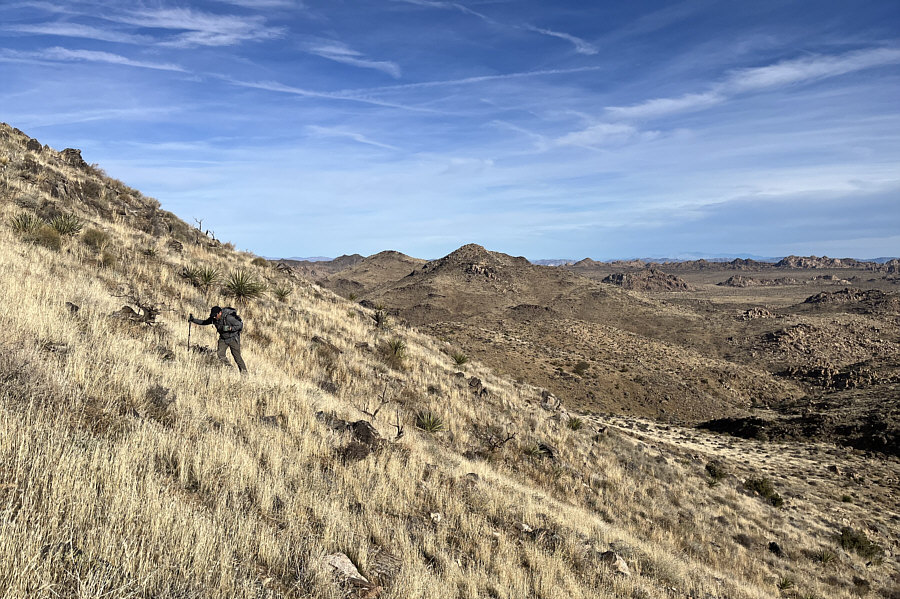
After abandoning the trail, Daniel climbs up moderately steep slopes.
No difficulties here!

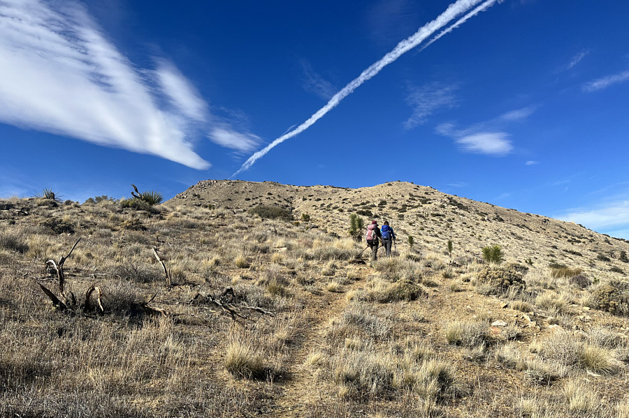
The group approaches the top of Mount Minerva Hoyt.

The limp wrist seems to be a commonality among all these "trees"!

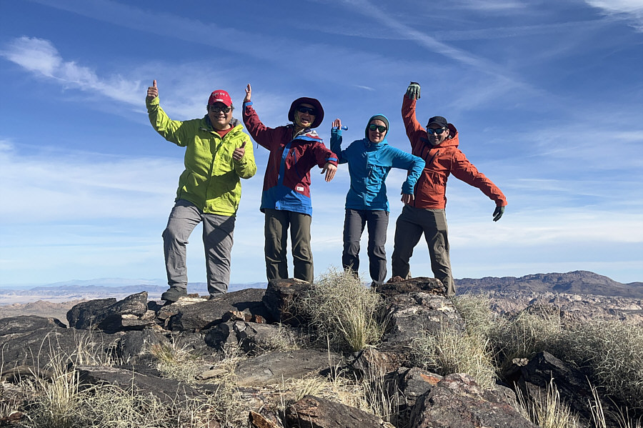
Sonny, Zosia, Aga and Daniel mimic Joshua trees on the summit of Mount Minerva Hoyt (1649 metres).

Aga and Daniel hiked Ryan Mountain the day before.

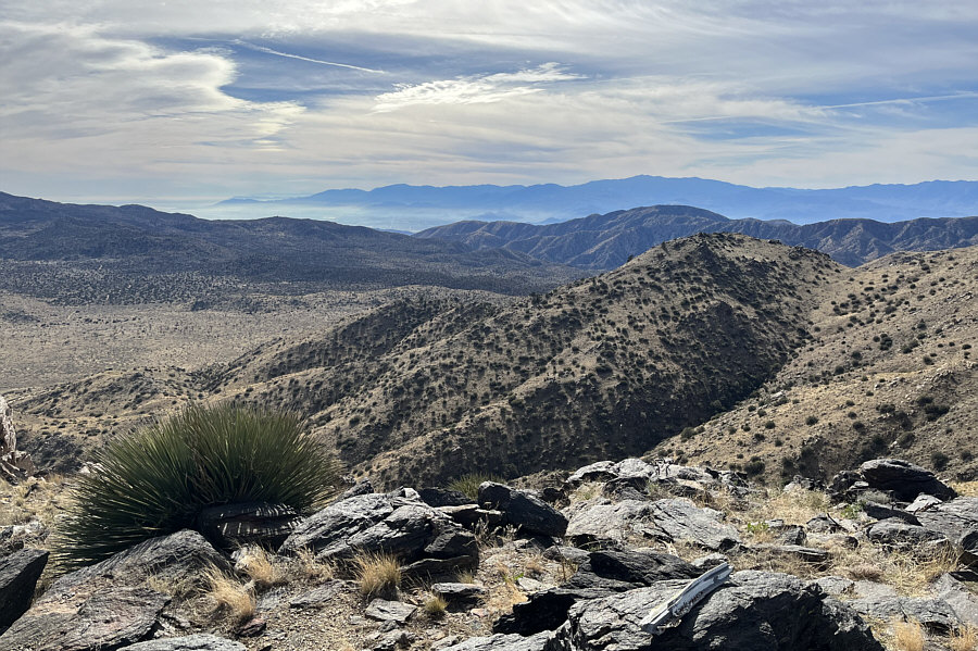
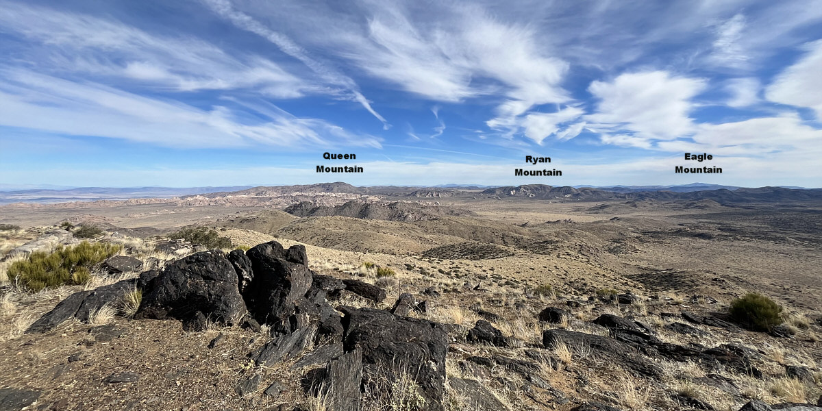
Ryan Mountain (left of centre) is the most recognizable peak in this view to the southeast.

Still about 2 km of hiking to get there!

Here is the view of Quail Mountain (right) from the top of Mount Minerva Hoyt.


Easy finish!

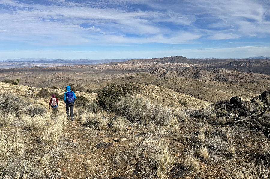
The group picks up a good trail on the east ridge of Quail Mountain.

Nice plumage?

Sonny, Zosia, Daniel and Aga mimic quails near the gazetted (north) summit of Quail Mountain (1771 metres).

Lots to see here!

The view to the south from the south summit of Quail Mountain includes Toro Peak (right horizon), part of the city of Palm Springs (left of centre), and even a sliver of Salton Sea (far left).

The giants of Southern California.

San Jacinto Mountains (far left) and San Gorgonio Mountain (right) stand out to the west.

Mount Minerva Hoyt is virtually invisible from here!

This is looking east from the south summit of Quail Mountain.


Some folks take a more direct descent route down the north side of Quail Mountain, but this apparently entails more technical route-finding.

Zosia and Aga start heading back to Mount Minerva Hoyt (centre).

Somehow, we missed seeing the register when we first climbed up here! Back at the top of Mount Minerva Hoyt, Zosia drinks some water while Aga signs the summit register.
Daniel has already disappeared into the terrain somewhere up ahead.

Zosia and Aga opt for an alternate descent route down the broad north ridge of Mount Minerva Hoyt.

The glorious ridge walk comes to an end. Nearing the end of the north ridge, the group begins to drop down the slope to the right.
That was a steep drop--good thing we weren't ascending this way!

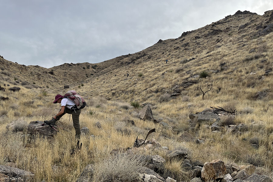
Zosia tightens her shoelaces in a draw while waiting for Daniel and Aga to catch up.

Wouldn't want to be a tree-hugger here!

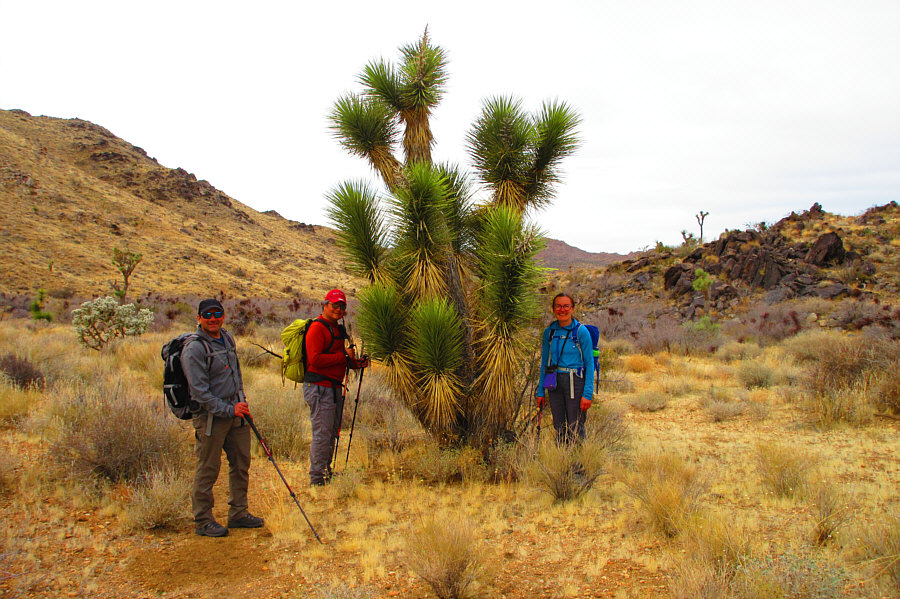
Daniel, Sonny and Aga pose with a Joshua tree on the hike out.

Photo courtesy of Zosia Zgolak

Great hike with just the right length, the right amount of challenge, and the right companions! Total Distance:  17.1 kilometres
Round-Trip Time:  8 hours 12 minutes
Cumulative Elevation Gain:  683 metres

GPX Data