BOU AVENUE
Silver Peak

On 5 January 2023, Zosia Zgolak and I hiked up Silver Peak located on the east side of the Chiricahua Mountains in southeastern Arizona.  An excellent trail grants easy access to the summit which used to be topped by a fire lookout building.  Curiously, most maps show a lower benchmark a short distance east of the lookout site and designate this as the gazetted summit of Silver Peak.  Naturally, we would try and tag both summits in one go.

From Highway 80, turn west onto Highway 533 (Portal Road), 44.0 kilometres south of the interchange with I-10 at Exit 5 in New Mexico or 85.0 kilometres north of the junction with Highway 191 in Douglas, Arizona.  Drive 12.0 kilometres to a junction with Paradise Road and keep left.  Continue on the paved Forestry Road 42 (Cave Creek Road) for 2.5 kilometres to a pullout on the right.  Park here.  If needed, vault toilets should be available for use at Stewart Campground about 850 metres further up the road (the ones at the visitor centre just before the pullout may not be open depending on the season).

From the pullout, Zosia and I immediately took a right turn at a signed junction, and in another 220 metres, we took a left turn at a second signed junction.  For the next two kilometres or so, the trail makes numerous gentle switchbacks up open slopes with already fantastic views of the surrounding landscape especially to the south.  We noticed some evidence of the trail being re-routed perhaps recently, but this did not create any route-finding confusion for us.  Past this initial scenic section, the trail makes a long traverse around the northeast aspect of Mount Sceloporus and subsequently across the north side of Silver Peak before rising up another series of switchbacks to the summit ridge.  The only issue we had on this day was the abundance of snow covering the otherwise easy trail.  Although previous hikers had already broken trail for us, we still had to be careful with the slippery footing.  When we arrived at a storage shed on the summit ridge, we left the main trail and headed east along a bushy path to reach the gazetted summit of Silver Peak in about 180 metres.  After tagging the cairn there, we returned to the storage shed and continued along the main trail past a dilapidated outhouse and up to the true summit and former fire lookout site.  While the original building is gone (apparently burned in a thunder and snow storm in October 1992), the concrete stairs and foundation are still there as well as a stone water tank.  We stopped here for an extended break to eat lunch and sign the summit register.

For our descent, Zosia and I simply backtracked along the main trail.  The hike out was long and felt monotonous at times, but otherwise, we had no issues whatsoever.

We would be hiking in shadow a lot on this day!

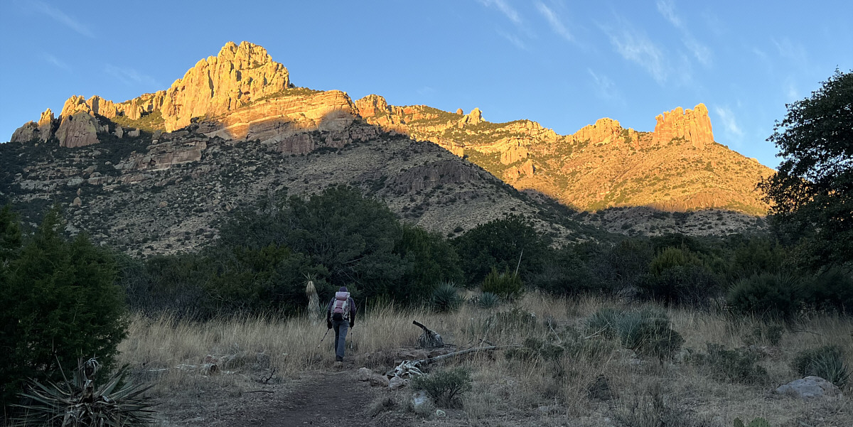
Morning sunshine lights up outlying pinnacles of Mount Sceloporus as Zosia hikes in shadow.

And now you know the difference! 
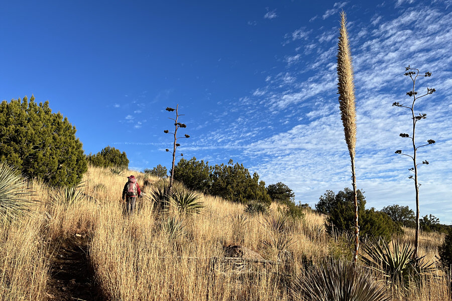
The fuzzy stem is from a sotol plant while the branched stems are from agave plants.
This would be a good hike during hot weather; you're always in the shade!

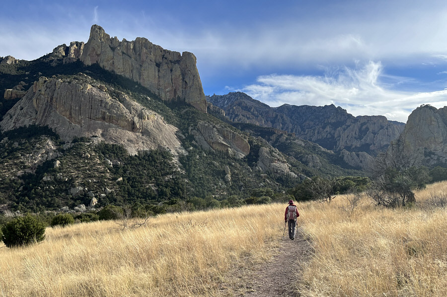
Silver Peak (right) comes into view as Zosia traverses the northern side of Mount Sceloporus.

Fortunately, someone already broke trail for us! 
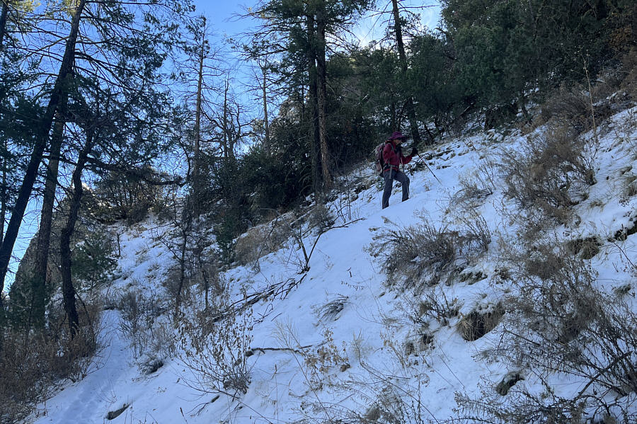
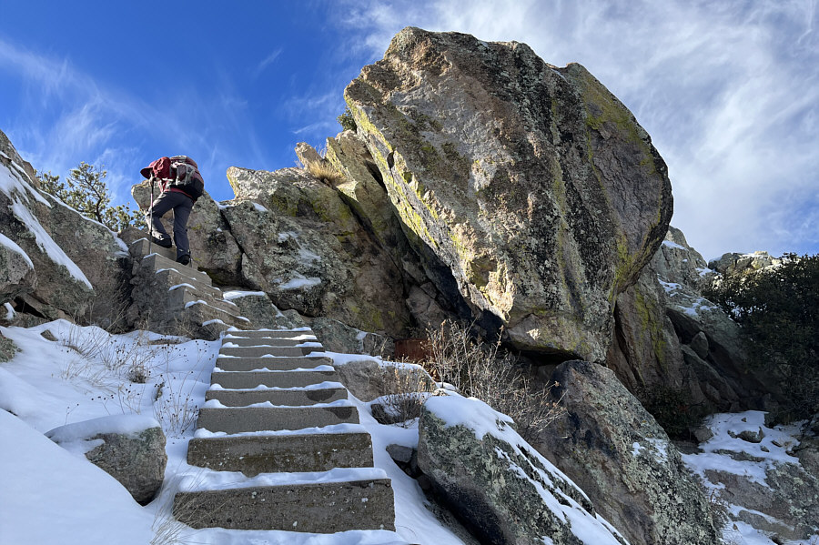
Zosia ascends snow-covered switchbacks on the north slope of Silver Peak.
Some light bushwhacking but not too bad.

Zosia hikes the length of Silver Peak's bushy summit ridge.

My GPS reading was about 11 feet lower. Zosia and Sonny find a sign on the gazetted summit of Silver Peak (2428 metres).
On some maps, Silver Peak is considered part of Mount Sceloporus.

To the east, Mount Sceloporus is of similar height with a similar bushy summit.

Yes, the lookout is definitely higher!

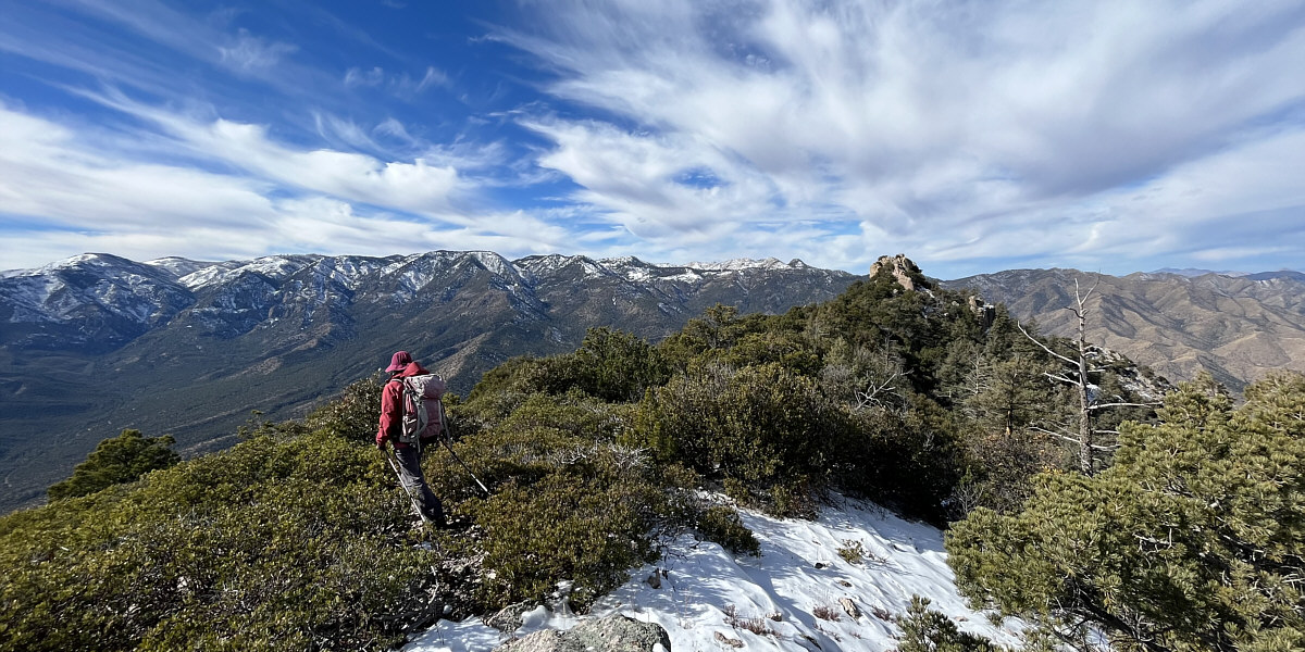
The main spine of the Chiricahua Mountains is visible to the left of Silver Peak's lookout site.


A bit slippery with the snow.

Zosia climbs concrete steps to the lookout site.

There was a dead lizard floating inside the water tank. Sonny checks the elevation while standing atop a stone water tank at the lookout site.

Photo courtesy of Zosia Zgolak

Should we count this as a second summit?

Sonny and Zosia stand atop the lookout site (2439 metres) which is the true summit of Silver Peak.

Now on my to-do list for the future! Located about twenty kilometres away, Cochise Head (left of centre) is the most striking peak to the northwest.
Arizona's Crazy Horse Memorial?

This rock outcrop resembles a human head.

Or is it the other way around? Zosia pokes at an agave plant.

Photo courtesy of Zosia Zgolak

Ironically, there are better views here than from the summit of Silver Peak! Cathedral Rock towers over the valley as Zosia makes her way back to the trailhead.
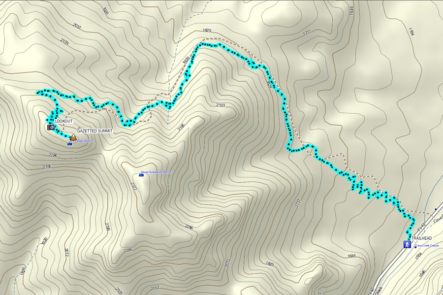
A long but uncomplicated hike. Total Distance:  17.3 kilometres
Round-Trip Time:  7 hours 46 minutes
Net Elevation Gain:  923 metres

GPX Data