BOU AVENUE
Caprock Canyons State Park

Carrying on with our tour of the Texas panhandle, Zosia Zgolak and I visited Caprock Canyons State Park on 2 April 2024.  The park is part of the same escarpment which comprises Palo Duro Canyon State Park some 80 kilometres to the northwest, but Caprock Canyons is also home to the State Bison Herd of Texas.  Indeed, the first thing we saw was a herd of bison as we arrived at the park's visitor center to obtain our day-use pass.  From there, we drove to the Lower Prong Trailhead to begin a loop-traverse of John Haynes Ridge.  A well-maintained and signed trail simplifies the traverse, but there are a few steep and rugged sections both at the east end of the ridge where we first climbed up and also near the west end where we descended to South Prong Little Red River.

Zosia and I went off-trail at one point to tag what we thought was the high point of John Haynes Ridge based on a marked point on my Gaia map (sourced from opentopomap.org), but we actually missed the true high point (according to peakbagger.com) by mere metres near the last junction before the trail drops down to the river.  Regardless, the most interesting part of the traverse was the descent to the river, and we marveled at the striking canyon walls here which reminded me a lot of some places in southern Utah.  The hike out along the river felt a little long-winded but was otherwise straightforward.  Upon reaching the Upper South Prong Trailhead, we walked along the paved road for about a kilometre to return to the Lower Prong Trailhead and complete our loop.
Oh give me a home where the buffalo roam... Caprock Canyons State Park is home to the State Bison Herd of Texas.

Photo courtesy of Zosia Zgolak

Zosia loves trailhead reading material! Zosia reads an information board at Lower Prong Trailhead with John Haynes Ridge visible in the background.
We'll head them off at the pass! Zosia follows North Prong Spur trail through this gap near the east end of John Haynes Ridge.
A short and easy climb!

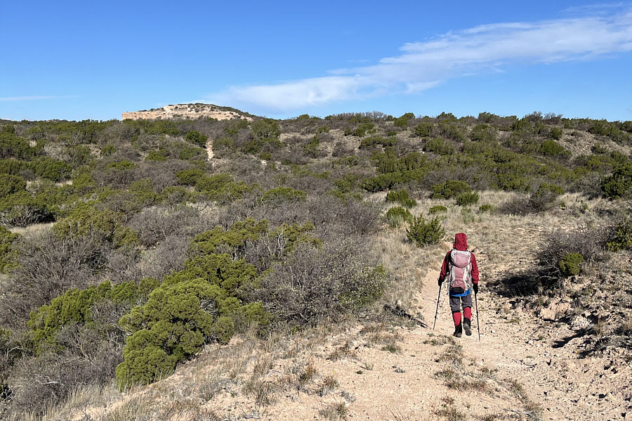
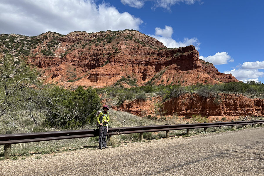
Zosia turns off onto Haynes Ridge Overlook Trail which basically goes up the slope at centre.

We originally were planning to do the loop here...

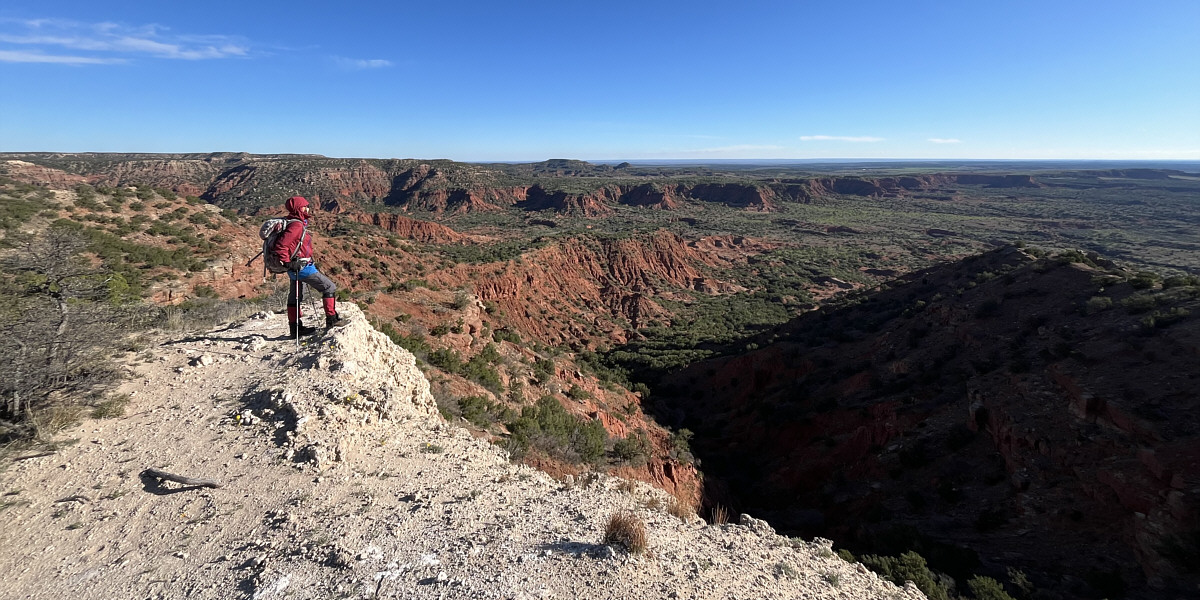
Here is a comprehensive view of North Prong Little Red River valley.


We thought it was the true high point...doh! 
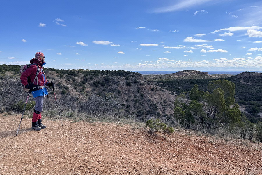
The bump in the distance is a false high point on John Haynes Ridge.
A little bit of a thrash to get here... Going off-trail to climb the false high point, Zosia looks back at the east end of John Haynes Ridge.
Probably better views from here than the true high point! Sonny and Zosia stand on top of the false high point (955 metres).
Cruisin' again! Zosia gets back onto Haynes Ridge Overlook Trail after leaving the false high point in the background.
In case you were itching for some scrambling on the ridge! The trail circumvents this rocky bluff on the ridge.
Oh well, there will be plenty more summits for us to conquer in this world! Zosia takes one last look back at the false high point at distant right.  The true high point of John Haynes Ridge is actually somewhere on the bushy ridge behind Zosia.
Nicer views here than from the top of the ridge! Sonny pauses near a striking pinnacle during his descent into South Prong Little Red River valley.

Photo courtesy of Zosia Zgolak

Feels like we're in Utah instead of Texas! 
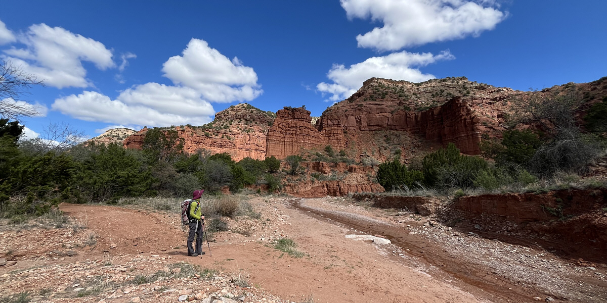
Zosia passes some impressive cliff bands as she hikes along South Prong Little Red River.

Not as "grand" as the Grand Canyon but also a lot less crowded here!

Zosia takes another look at the cliffs along the south side of John Haynes Ridge.


Glad we're not bushwhacking here! Sonny passes a large patch of cacti on his hike out the valley.

Photo courtesy of Zosia Zgolak

Watch out for motorized traffic! Zosia finishes the loop hike along the main access road.
They are larger than Richardson ground squirrels. 
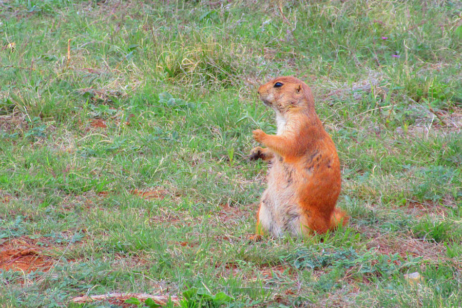
Black-tailed prairie dogs abound at Honey Flat Camping Area.

Photo courtesy of Zosia Zgolak

Nice horns! A lone bison grazes near Lake Theo Tent Camping Area.

Photo courtesy of Zosia Zgolak

Very pleasant hike in a beautiful area. 
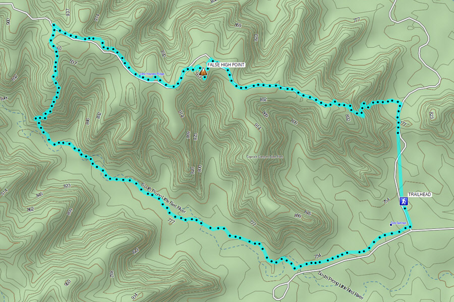
Total Distance:  ~9.9 kilometres
Round-Trip Time:  4 hours 29 minutes
Cumulative Elevation Gain:  ~233 metres

GPX Data