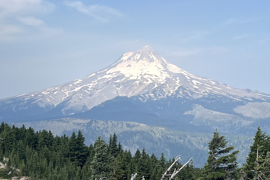
Here is a closer look at Mount Hood.
|
|
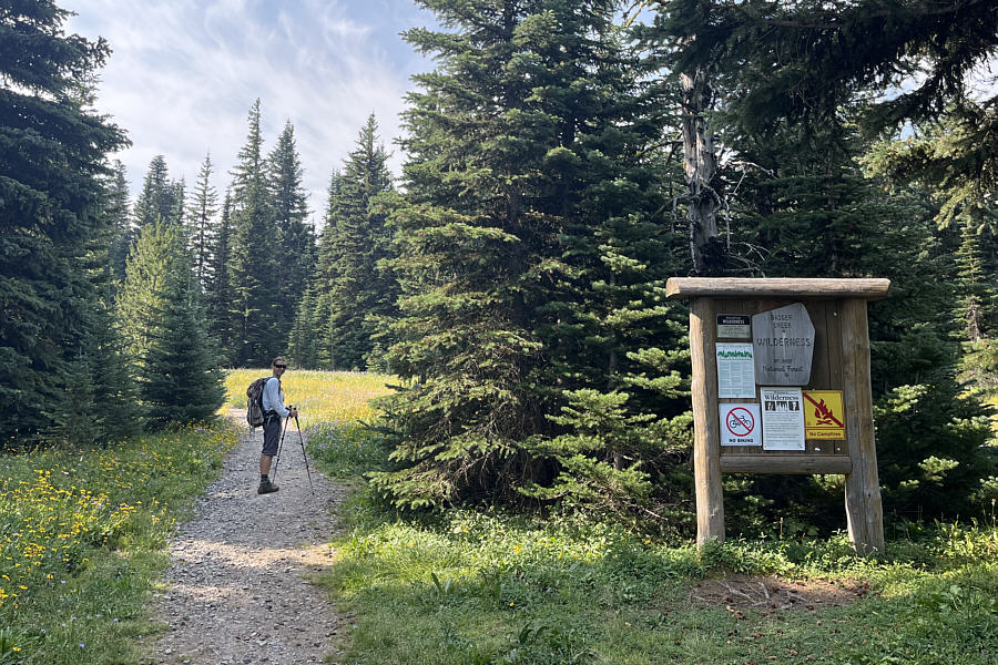
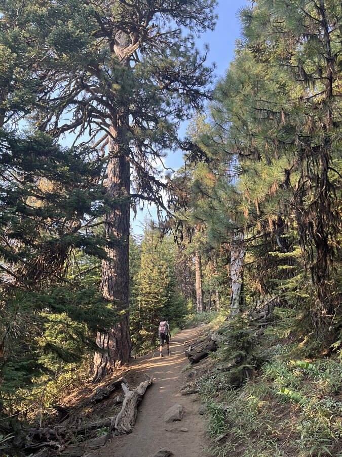
Zosia begins hiking the short trail to Lookout Mountain. |
|
|
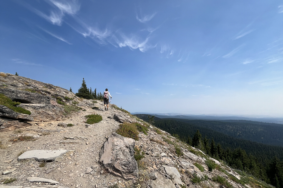
Zosia winds her way up the last few metres before the summit of Lookout Mountain. |
|
|
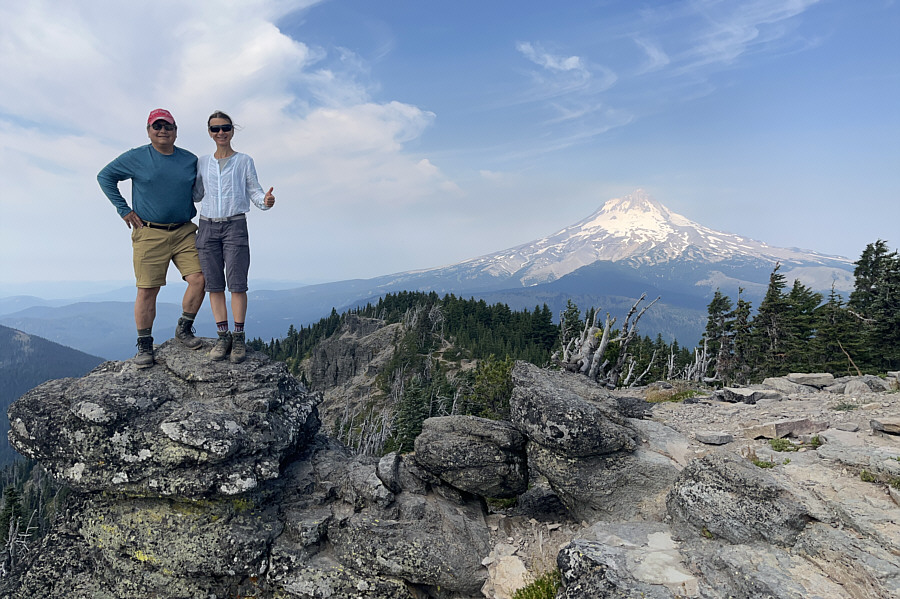
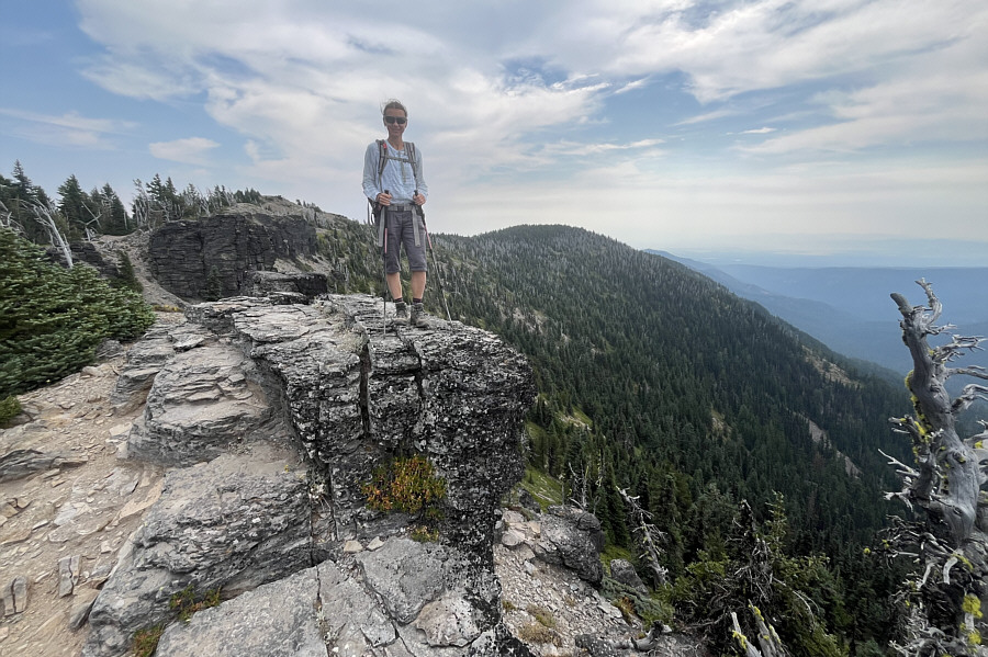
Sonny and Zosia stand on a rock outcrop near the summit of Lookout Mountain (1994 metres). |
|
|
Here is a closer look at Mount Hood. |
|
|
Zosia stands on another rock outcrop west of the summit. |
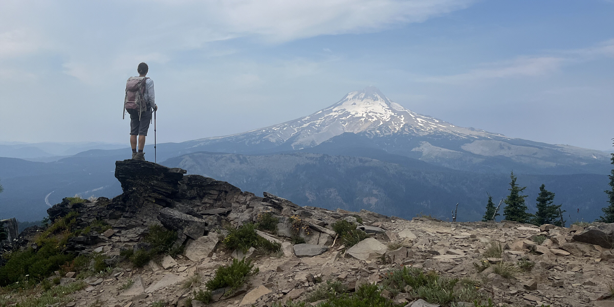
This viewpoint is near the west end of Lookout Mountain's summit ridge.
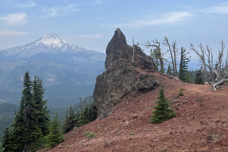 |
Zosia scrambles on one of the more striking pinnacles on Lookout Mountain. |
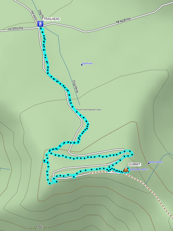 |
Total Distance: 4.8 kilometres Round-Trip Time: 2 hours 23 minutes Cumulative Elevation Gain: 164 metres |
From Highway 126/20, turn north onto paved NF11 32.0 kilometres east of the junction with Highway 22 or 8.4 kilometres northwest of the junction with West Hood Avenue in Sisters. Drive about 300 metres and keep straight (left) on NF11. Drive 5.8 kilometres and turn left onto FR 1110 (2WD gravel). Drive 8.3 kilometres to road's end at the signed trailhead (toilet available).
The top of Black Butte is the site of an active fire lookout and is easily accessed by an excellent trail. My original plan was to camp at the trailhead and hike up Black Butte the next morning, but when Zosia and I arrived with some daylight to spare, we opted instead for a late-day ascent. Just like on Lookout Mountain, it is virtually impossible to get lost on the trail up Black Butte although there is certainly more elevation gain. Occasional sign posts along the way help identify local flora or point out sites of past wildfires. At the top, there is a sign essentially asking visitors to respect the privacy of the fire lookout custodian. As such, we steered clear of the active fire lookout tower and instead headed further west to visit a viewing platform located just past an older fire lookout building. Ironically, wildfire smoke obscured many of the faraway peaks that would have been visible from the viewing platform, but the available vistas were still sublime.
As the sun began to set, Zosia and I quickly retreated on the same trail we came up. We even made it back to the trailhead without having to use our headlamps in the growing darkness. Best of all, we had the trailhead all to ourselves and enjoyed a blissful night of rest sleeping there.
 |
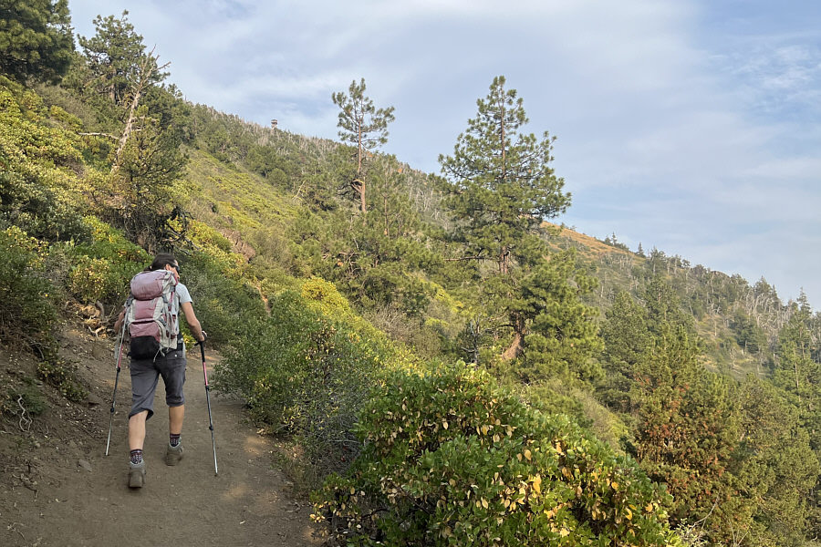
Zosia hikes the trail up Black Butte late in the day. |
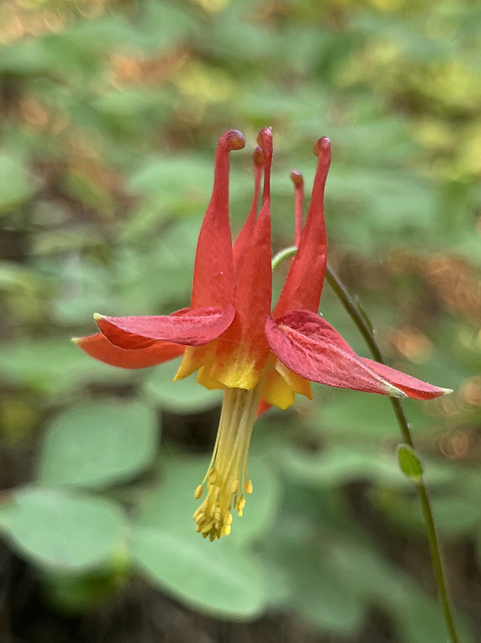 |
Columbines can be found throughout the forest on Black Butte. |
 |
Numerous sign posts along the trail help identify local flora. |
 |
An active fire lookout sits atop Black Butte, and here is the first glimpse of it from the trail. |
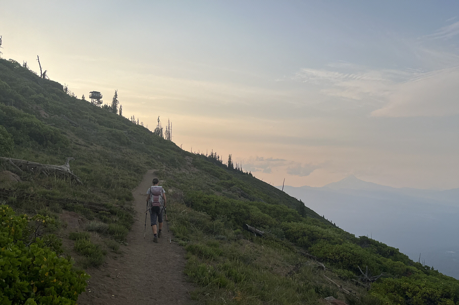 |
Zosia hikes along the shady east side of Black Butte. Visible in the hazy distance at right is Mount Jefferson. |
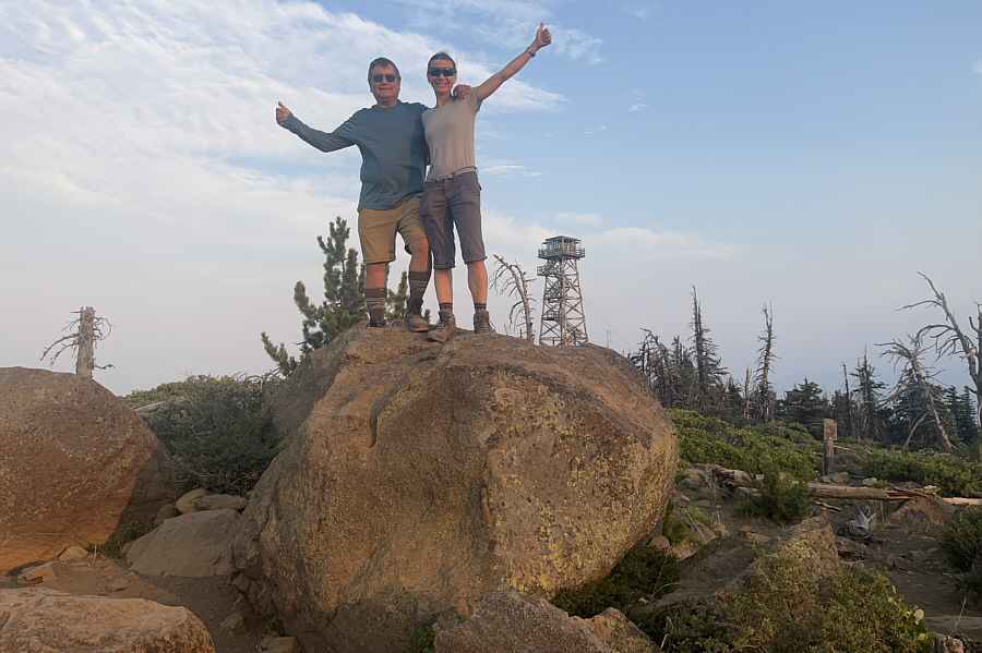 |
Sonny and Zosia stand on the likely high point of Black Butte (1964 metres). The sign at right essentially asks visitors to respect the privacy of the fire lookout custodian. |
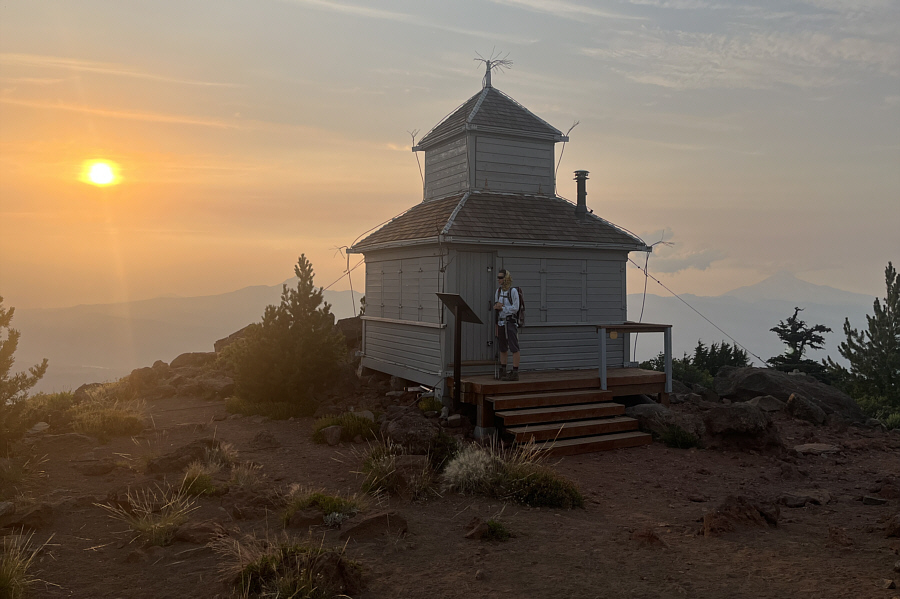 |
Further west of the high point is this older fire lookout which has been restored as a historic building. |
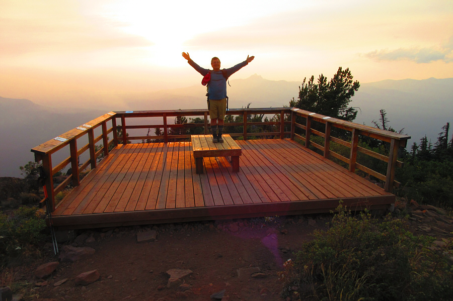 |
Sonny stands on a well-designed
viewing platform just beyond the older fire lookout. Photo courtesy of Zosia Zgolak |
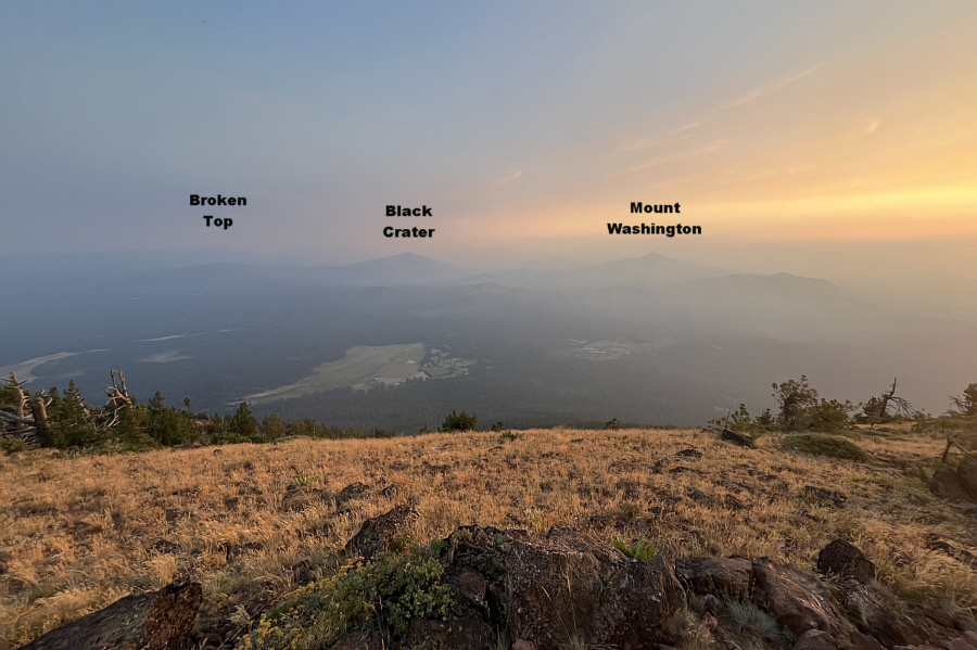 |
Haze from wildfires obscures more distant peaks, but some of the closer peaks can still be identified. |
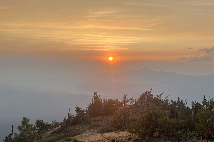 |
The sun dips lower on the western horizon. The silhouetted peak at right is Three Fingered Jack. |
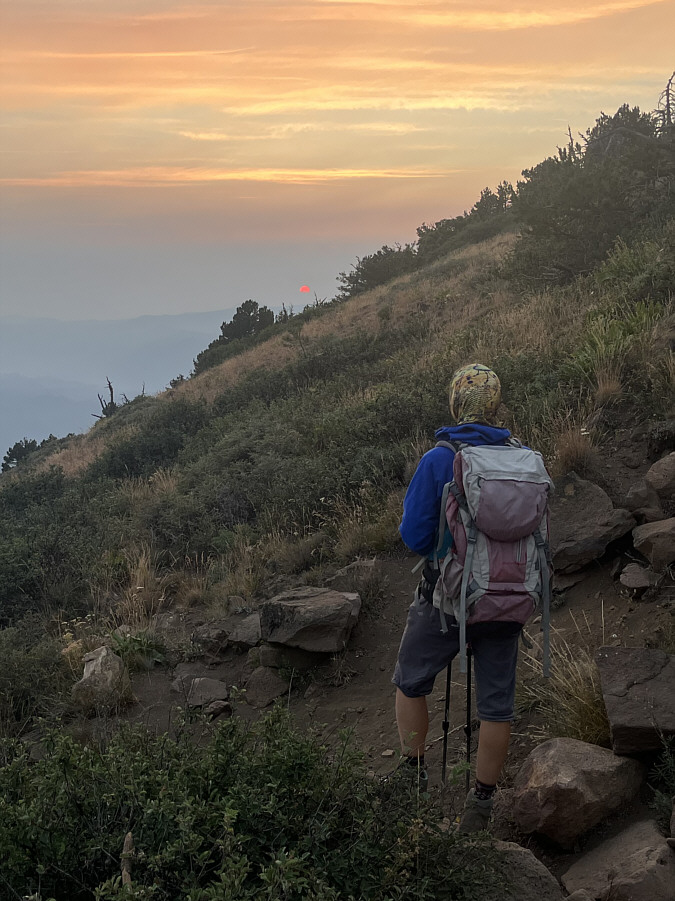 |
Already on her way down, Zosia pauses to watch the smoky sunset at the end of the day. |
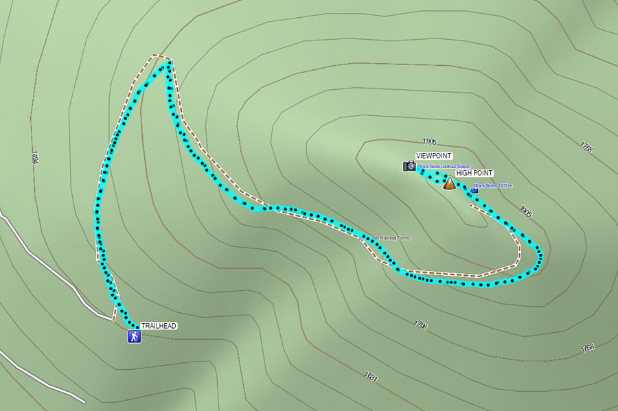 |
Total Distance: 6.6 kilometres Round-Trip Time: 3 hours 12 minutes Cumulative Elevation Gain: 442 metres |