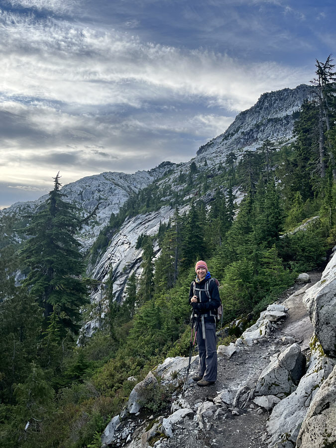
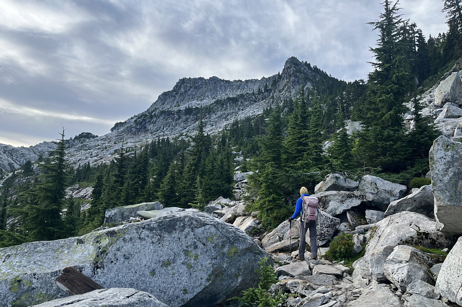
The terrain opens up higher on the mountain. The top of Mount Pilchuck is visible at upper right.
|
|
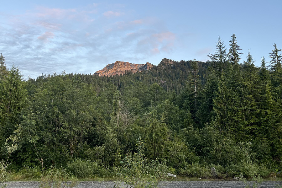
Here is a view of the top of Mount Pilchuck from the trailhead during the previous evening. |
|
|
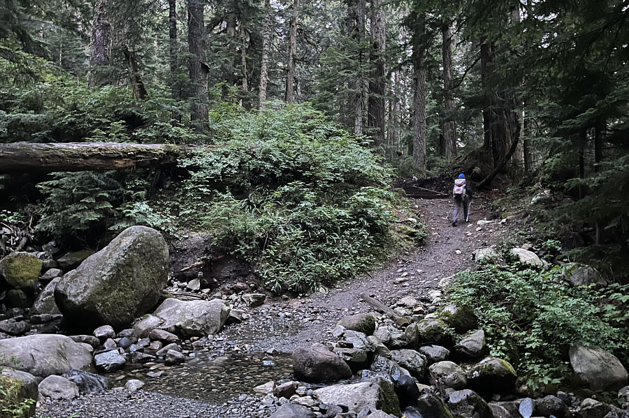
Zosia hikes the easy-to-follow trail through old-growth forest. |
|
|
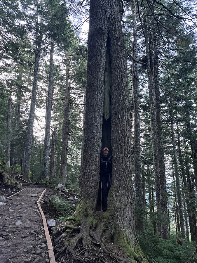
Zosia is seemingly stuck inside this tree beside the trail. |
|
|
The terrain opens up higher on the mountain. The top of Mount Pilchuck is visible at upper right. |
|
|
Here is a more complete view of the top of Mount Pilchuck from the rocky bowl below. |
|
|
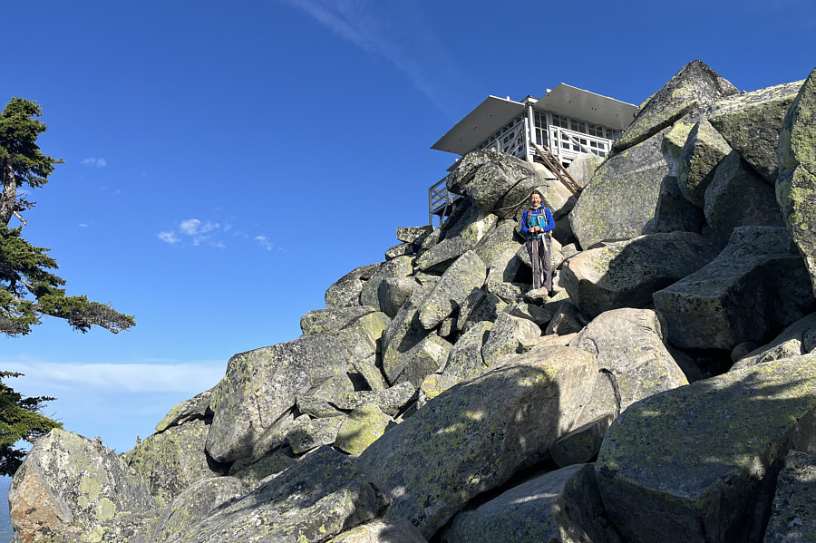
Mount Pilchuck's fire lookout is perched on top of a pile of big boulders. |
|
|
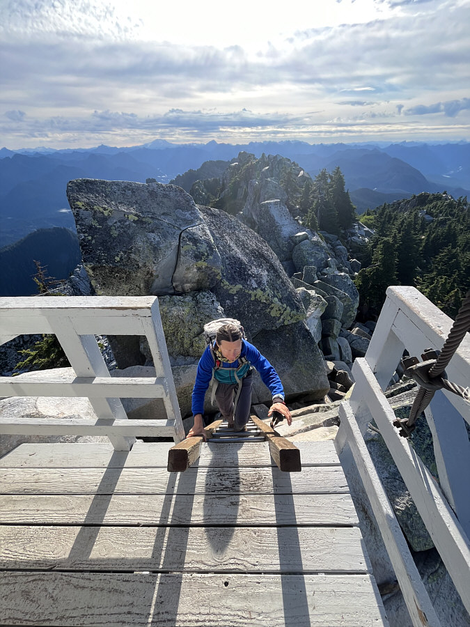
Zosia climbs a ladder to reach the fire lookout's observation deck. |
|
|
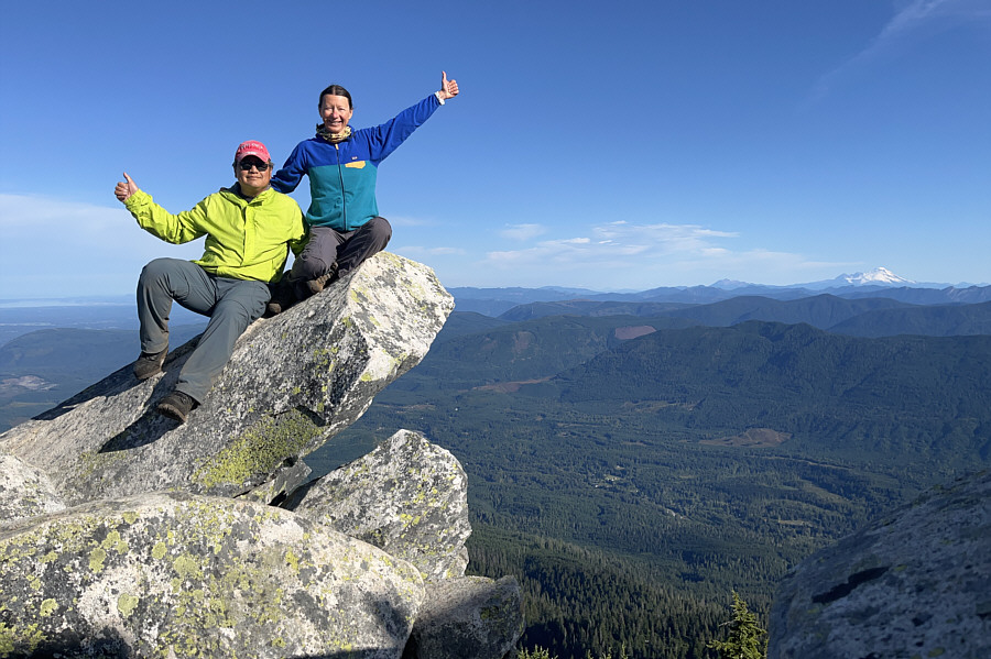
Sonny and Zosia sit on a big flake of rock near the summit of Mount Pilchuck (1623 metres). |
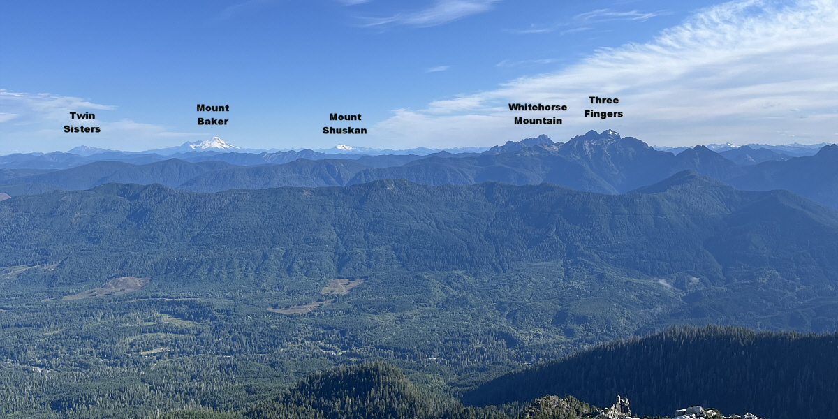
Several notable mountains are visible in this panoramic view to the north.
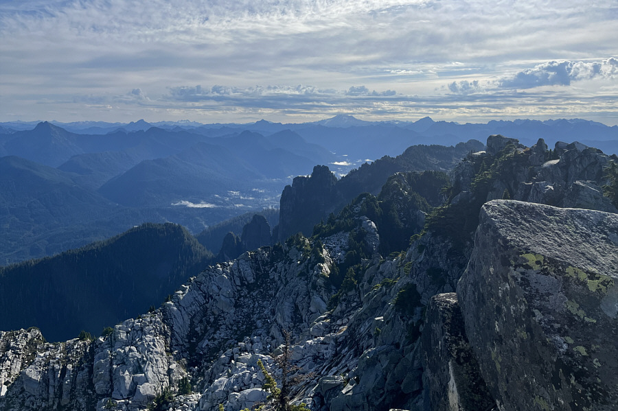 |
Glacier Peak stands out on the centre horizon in this view to the east. |
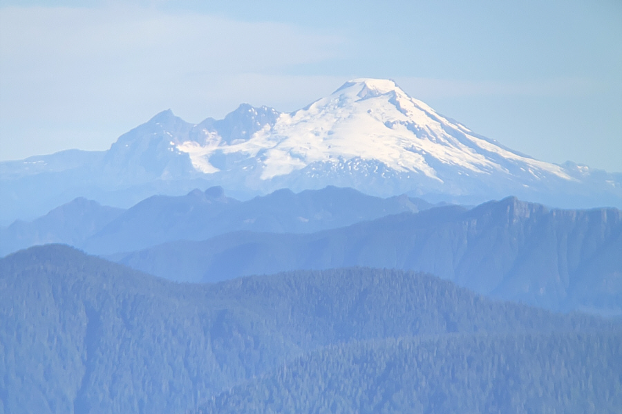 |
Here is a zoomed-in view of Mount Baker which is about 80 kilometres away. |
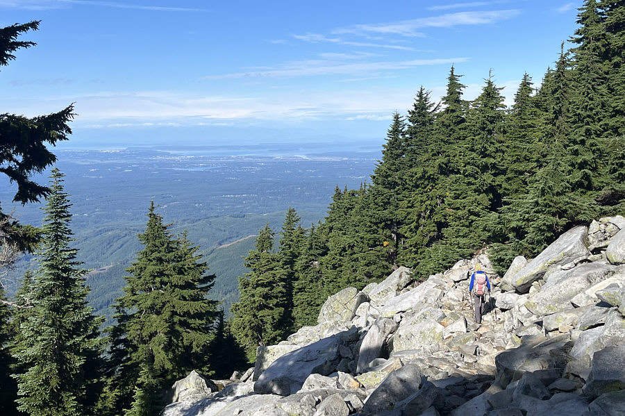 |
The city of Everett and Puget Sound are visible to the west as Zosia descends the upper mountain. |
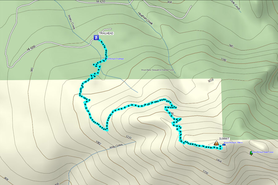 |
Total Distance: 9.0 kilometres Round-Trip Time: 5 hours 32 minutes Cumulative Elevation Gain: 629 metres |