BOU AVENUE
South Sister

South Sister is the highest of the Three Sisters volcanoes in central Oregon and also the third tallest mountain in the state.  With a relatively easy non-technical route all the way to the top, South Sister is understandably a very popular hiking objective.  As such, a daily quota and permit system were introduced in 2021 to limit the number of people who could ascend the mountain during peak season (mid-June to mid-October).  While I understand the need to limit the number of visitors on the mountain, the permit system (administered through recreation.gov) has been an enormous source of frustration for me whenever I have tried to obtain permits for Devils Lake trailhead which is the usual starting point for ascending South Sister.  Despite all my attempts at being proactive and flexible, it seemed like the release of permits for South Sister was perpetually nonexistent or a virtual crapshoot.  At best, I could only ever see availability for a single permit (ie. one hiker only, likely due to a cancellation) but never two or more.  I was beginning to think that the whole permit system was rigged until recently when, by some miracle, I was shocked to see about two dozen available permits.  After a lot of blood, sweat and tears, I finally secured two permits for hiking South Sister on 11 August 2024.

Camping is allowed at Devils Lake trailhead (44.03366, -121.76736), and after arriving the previous evening, Zosia and I got up super early (ie. in the middle of the night) to eat a quick breakfast before setting off with headlamps.  The trail to South Sister used to start beside the vault toilet near the north end of the trailhead parking lot, but it was probably decommissioned to eliminate the risk of dashing across the nearby Cascade Lakes Highway.  Instead, the South Sister trail now shares the same start as the Wickiup Plain trail near the west side of the same parking lot.  Seemingly counter-intuitively, we started hiking southward but only for a short distance before turning west to go through a tunnel under the highway.  After passing the junction where the Wickiup Plain trail splits off to the west, we soon crossed Tyee Creek on a footbridge and settled into a long and steady climb up a drainage between Kaleetan Butte and Devils Hill.  The trail was well-maintained here and not overly steep which made for generally enjoyable hiking.  By the time we reached a treeless plateau near Moraine Lake, it was light enough for us to put away our headlamps, and we got our first good look at our objective.

After crossing the plateau, Zosia and I passed through a short stretch of forest before grinding up a big open slope.  The trail is steeper here and is also heavily braided, but with good visibility, we had no trouble staying on track.  The last part of this slope just below a tarn has perhaps the sketchiest section of trail on the entire mountain.  There was a lot of loose and slippery rubble here, and some care and focus were required to maintain good footing.  The aforementioned tarn was a good place for us to stop and catch our breaths before the final lengthy push up a lateral moraine and then a steep slope of red pumice.  I felt weary and slowed considerably here, but otherwise, we had no other issues reaching the crater rim of South Sister.  The actual summit is on the far side of the crater, and like the majority of other hikers, we circled the rim in a counterclockwise direction on a well-beaten path before finishing the ascent with a short and easy scramble.  With a steady stream of other hikers arriving and congregating at the summit, we decided to move further around the rim to find a quieter spot for an extended break.

Zosia and I spent a good hour relaxing on the crater rim before reluctantly resuming our hike.  We had to do a little bit of scrambling to get down a short dip before climbing back up to complete our circumnavigation of the crater.  Once we returned to the spot where we first gained the rim, we simply retraced our steps down the mountain.  Some of the red pumice high up worked well for a bit of scree surfing, but otherwise, it was mostly a long and relentlessly knee-jarring descent.  We had a bit of a reprieve from the constant downhill pull when we re-crossed the treeless plateau, but the final section down the drainage, while not so steep, felt interminable.  When we reached Tyee Creek, we took another extended break here to refresh ourselves in the icy waters before walking the final short distance back to the trailhead.  Somewhat disappointingly, there were no conservation officers there checking for our hard-won permits.
Apparently, we're on vacation! 
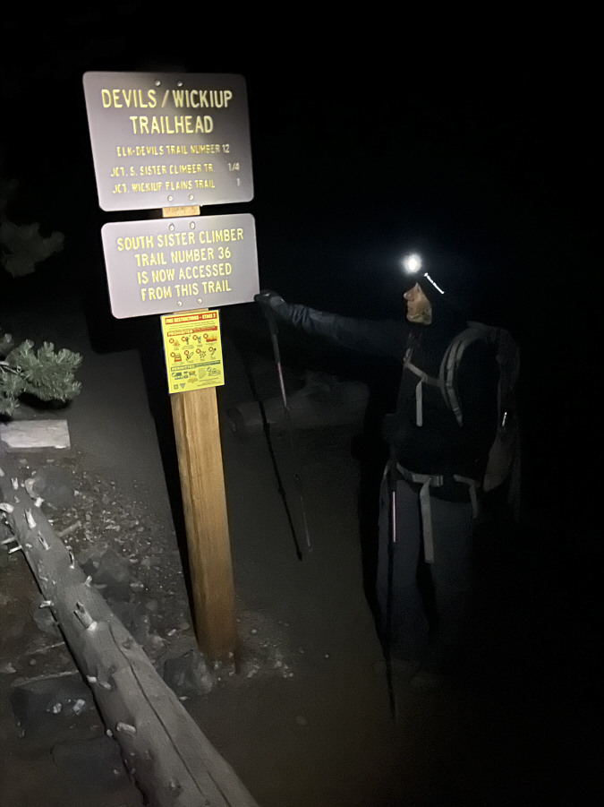
Zosia begins hiking at 3:52 AM PDT.
Not nearly as crowded as Alberta's Moraine Lake! 
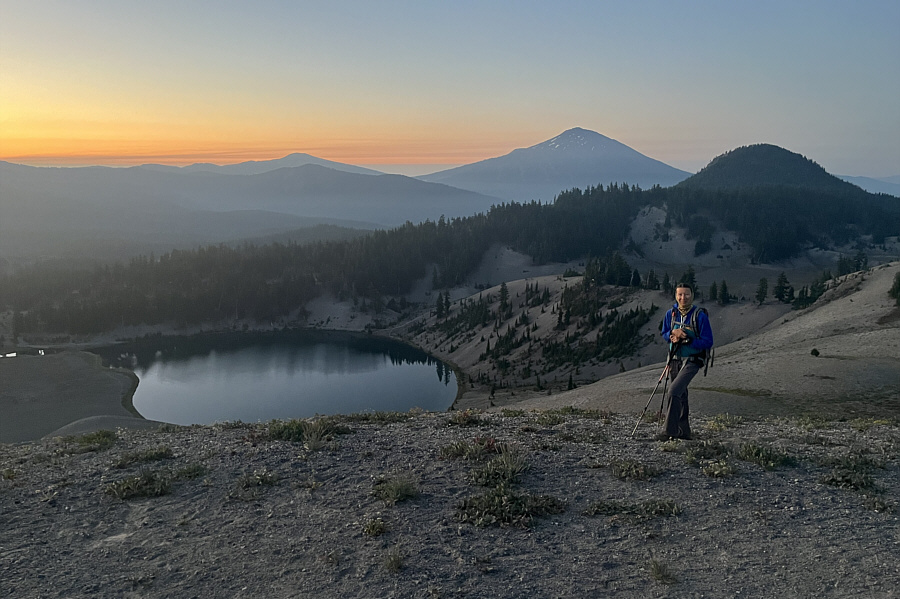
Just before sunrise, Zosia passes Moraine Lake.  Behind her are Devils Hill and Mount Bachelor.
We still have a LONG way to go... 
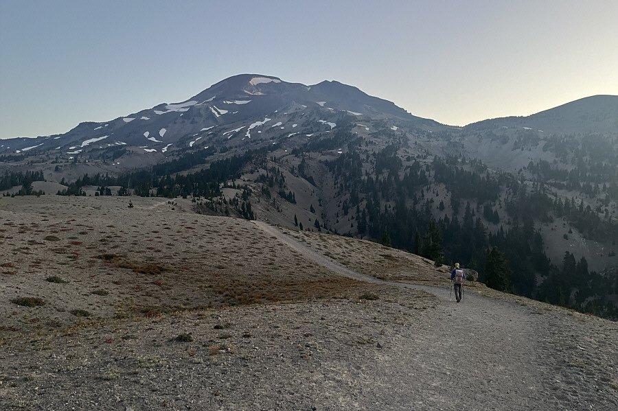
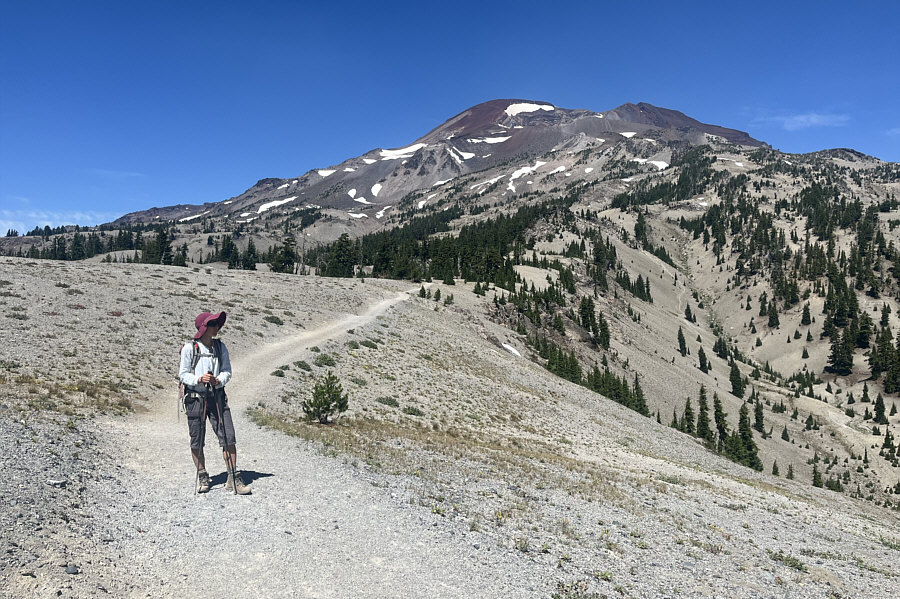
Hiking across this treeless plateau, Zosia gets her first clear look at South Sister.
Definitely should climb this long uphill section in the shade!

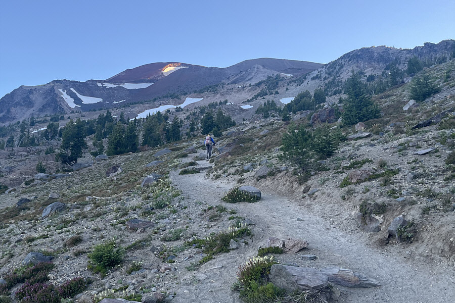
The first rays of sunshine can be seen near the top of the mountain as Zosia steadily grinds uphill.

Still some good skiing to be had here! 
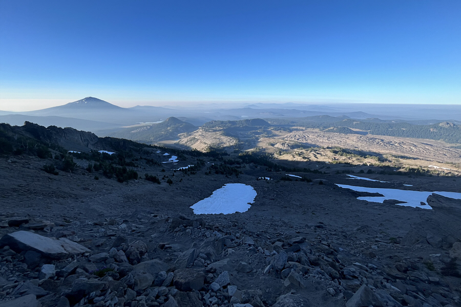
Here is a look back down at the plateau (left of centre) that was crossed earlier with Mount Bachelor on the left horizon.
Possibly the crux? 
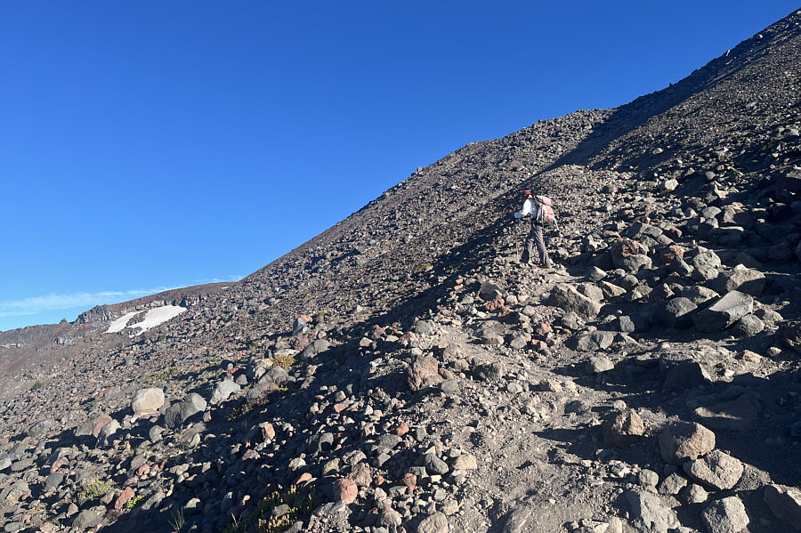
This steep section just ahead of Zosia is perhaps the sketchiest part of the entire trail with lots of loose and slippery rubble.
Good spot for a bivy. 
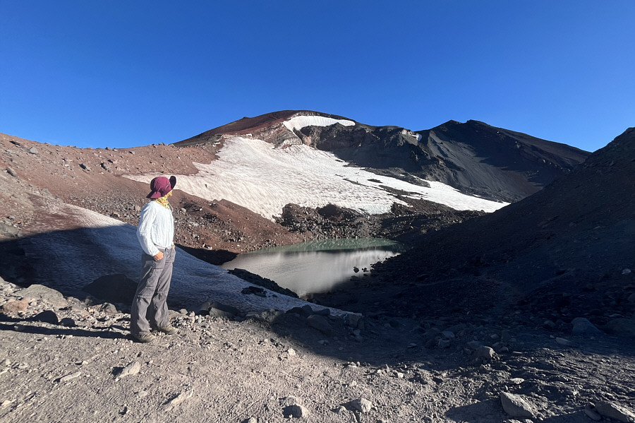
Zosia pauses for a break near an unnamed tarn below Lewis Glacier.
Show me the crumbs! 
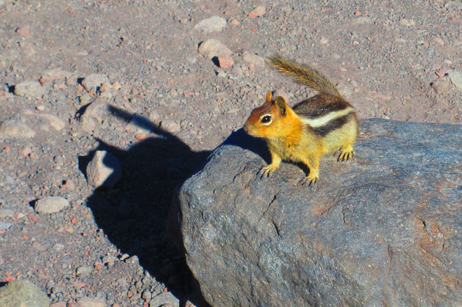
This golden-mantled ground squirrel is probably used to seeing hordes of intruders on a daily basis.

Photo courtesy of Zosia Zgolak

Lotsa people on the trail now! 
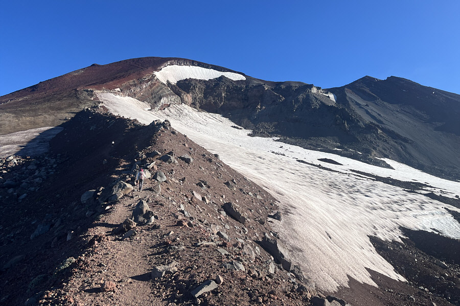
The trail goes up a lateral moraine beside Lewis Glacier.
Much more steeper than it looks! 
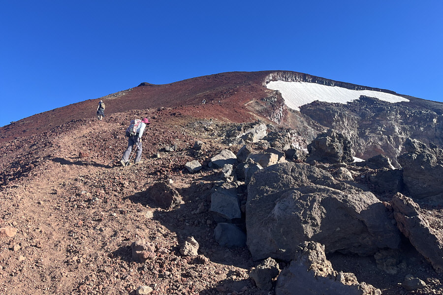
Zosia begins climbing the final steep section of red pumice.  Note the long line of hikers ahead of her.

And this ain't even the best view of the day!

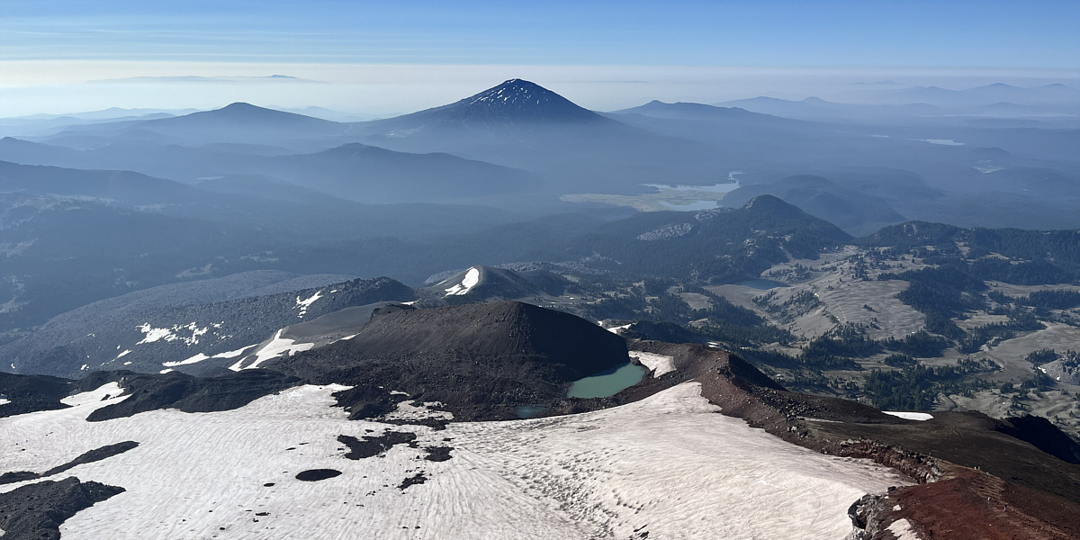
Here is a look back down south from the top of Lewis Glacier.


Almost there! 
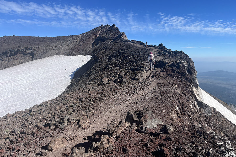
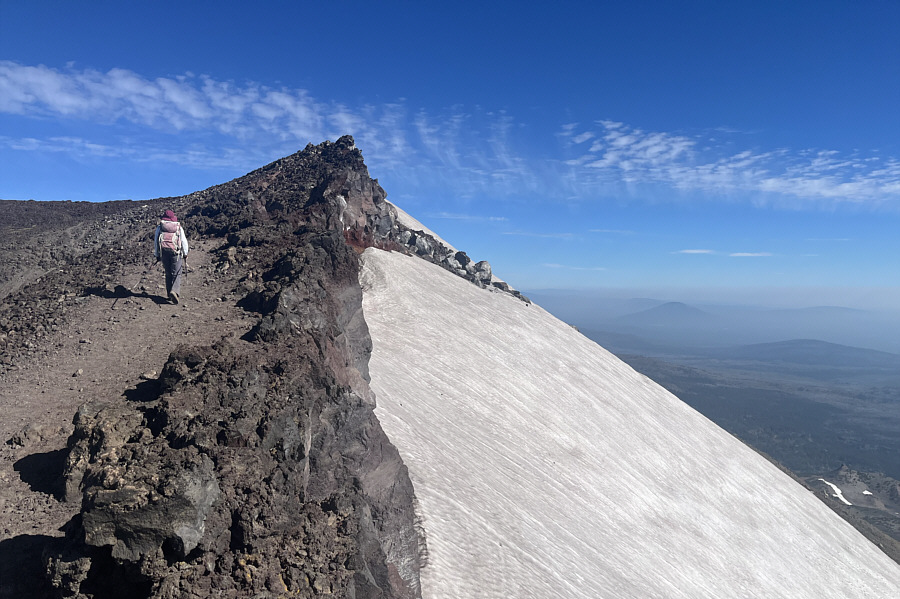
Zosia hikes along the crater rim with the summit just ahead.
Who brought their skis? The northeast side of the mountain is covered by Prouty Glacier.
Two big thumbs up for this mountain! 
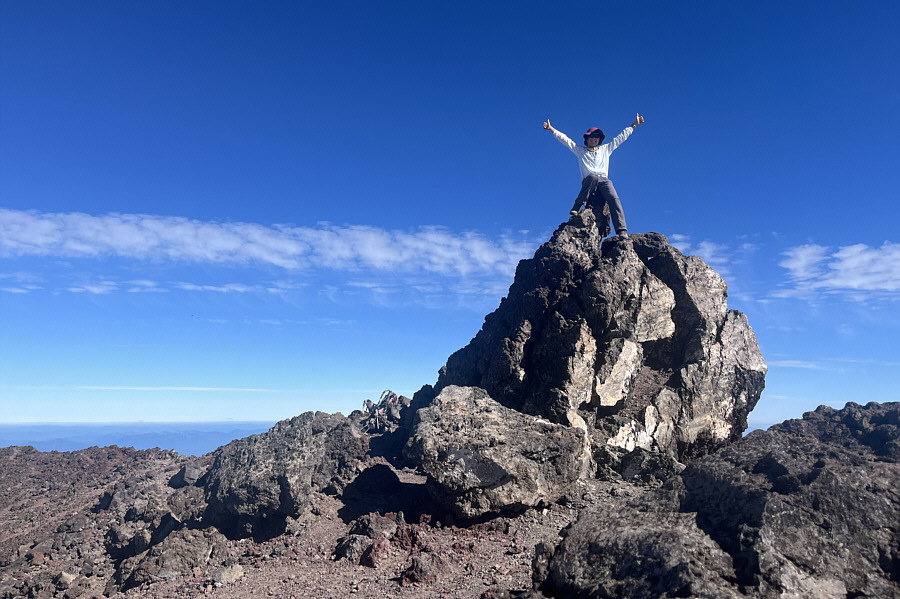
Zosia sits atop the summit of South Sister (3157 metres).

Million-dollar view!

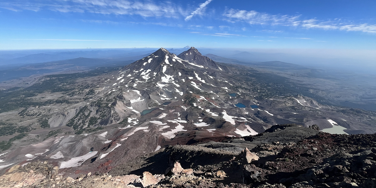
The view to the north is dominated by Middle Sister and North Sister.  Also visible behind North Sister are Mount Jefferson and Mount Hood.


Wanna go for a dip?

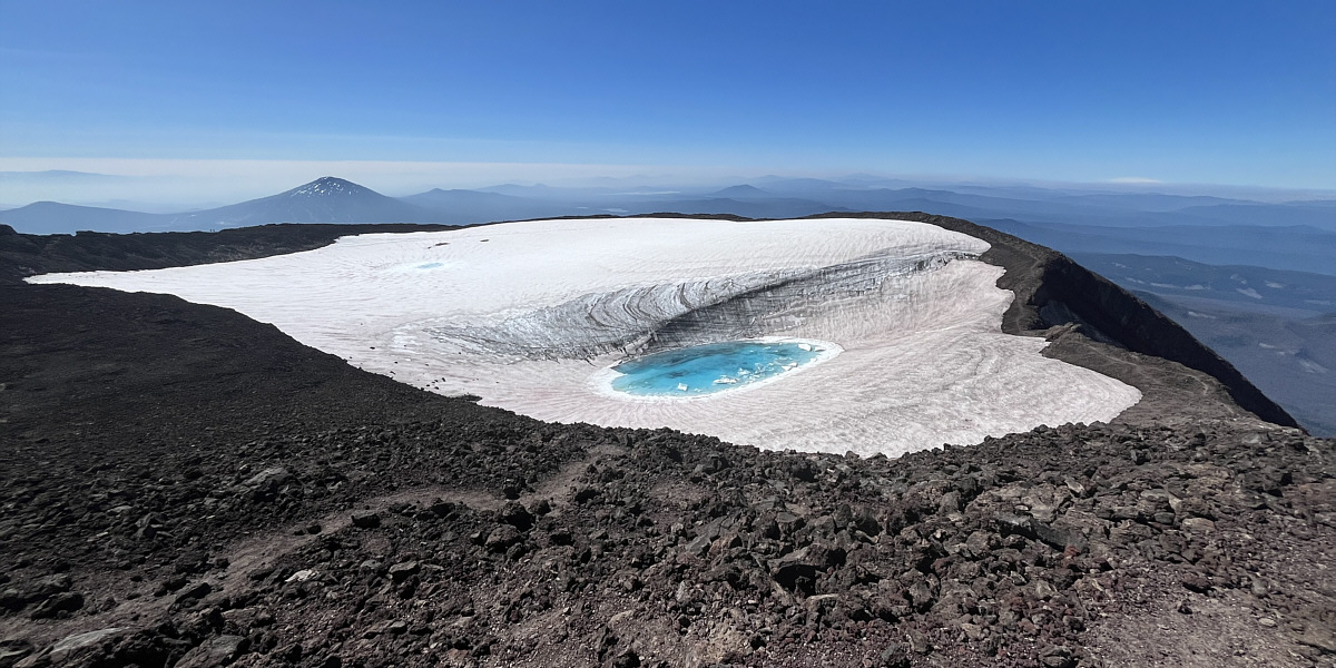
Inside the crater of South Sister is the eye-catching Teardrop Pool.


I heard some ice breaking up in the pool. 
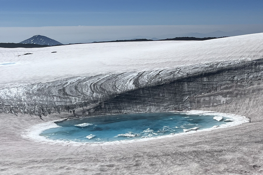
Here is a closer look at Teardrop Pool.
Probably the only real scrambling on the whole mountain! 
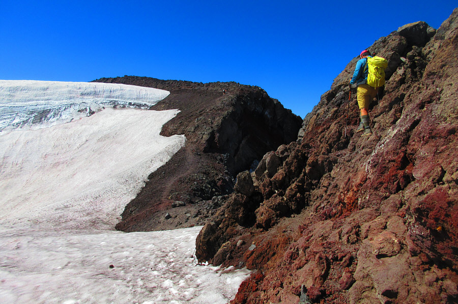
Sonny carefully scrambles down a dip in the crater rim.  Note the hiker climbing up the other side.

Photo courtesy of Zosia Zgolak

Very happy to get away from the crowds at the summit! 
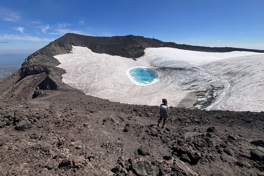
Here is one last look at the summit of South Sister directly above Teardrop Pool.
So many stunning views on this trip! 
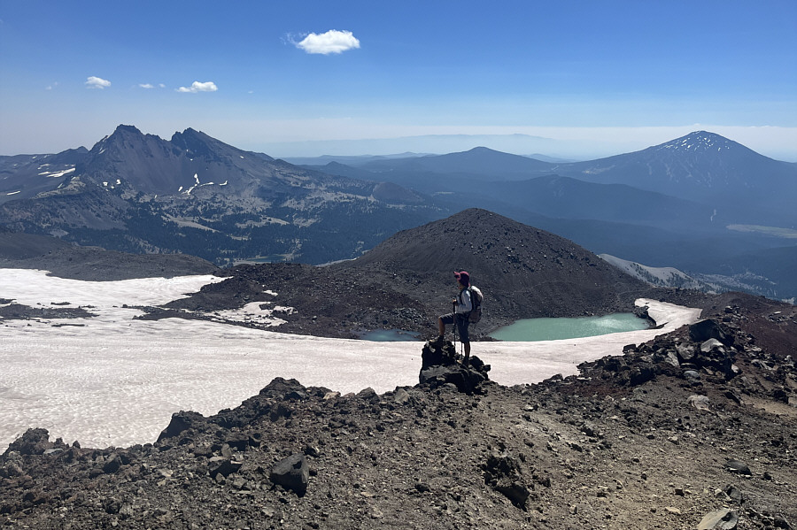
On her way down, Zosia stops to admire the view of Broken Top (far left) and Mount Bachelor (far right).  The smaller bump to the left of Mount Bachelor is Tumalo Mountain, and behind it on the distant horizon is Paulina Peak.
Cute bug!

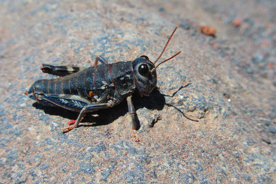
Amazingly, grasshoppers appear to thrive on the upper mountain where there is little vegetation.

Photo courtesy of Zosia Zgolak

It's kinda too bad that we didn't get a chance to ski this volcano. Zosia re-crosses the treeless plateau on descent.
I don't remember any of this! 
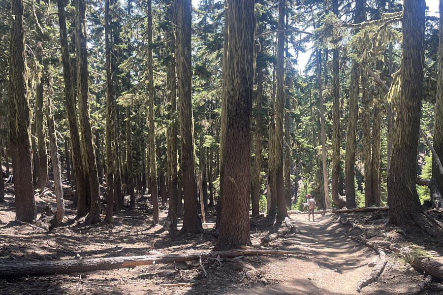
Zosia gets to see the mossy forest which she missed in the dark at the start of the trip.
A good spot for Steve Wallis--guerilla camper extraordinaire--to hunker down! 
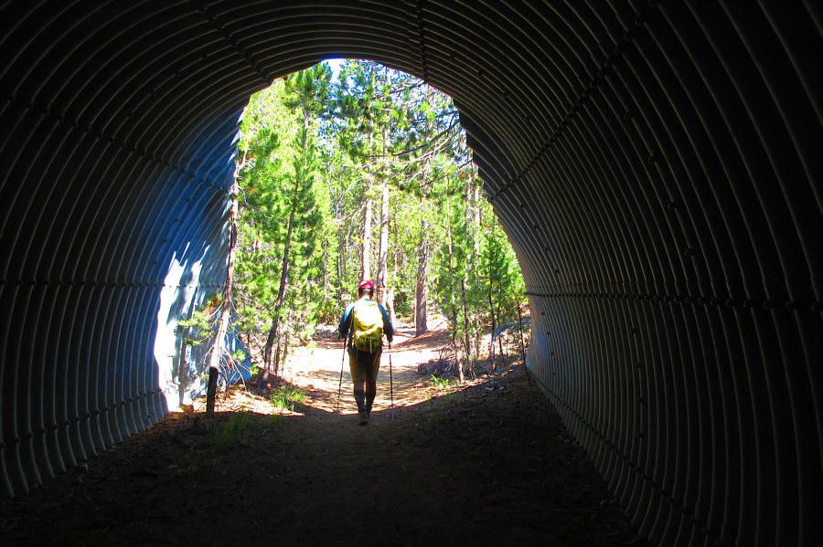
This tunnel allows hikers to avoid crossing the dangerous highway on the way to South Sister.

Photo courtesy of Zosia Zgolak

See ya later, Sistah! 
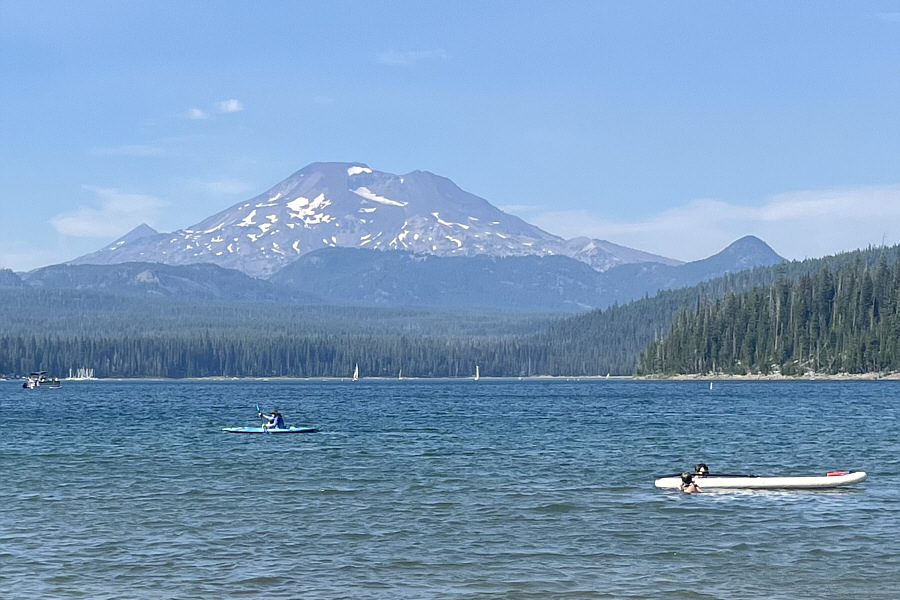
Here is a final look at South Sister from Elk Lake.
The permits are a PITA, but in the end, it was all worth the hassle and then some! 
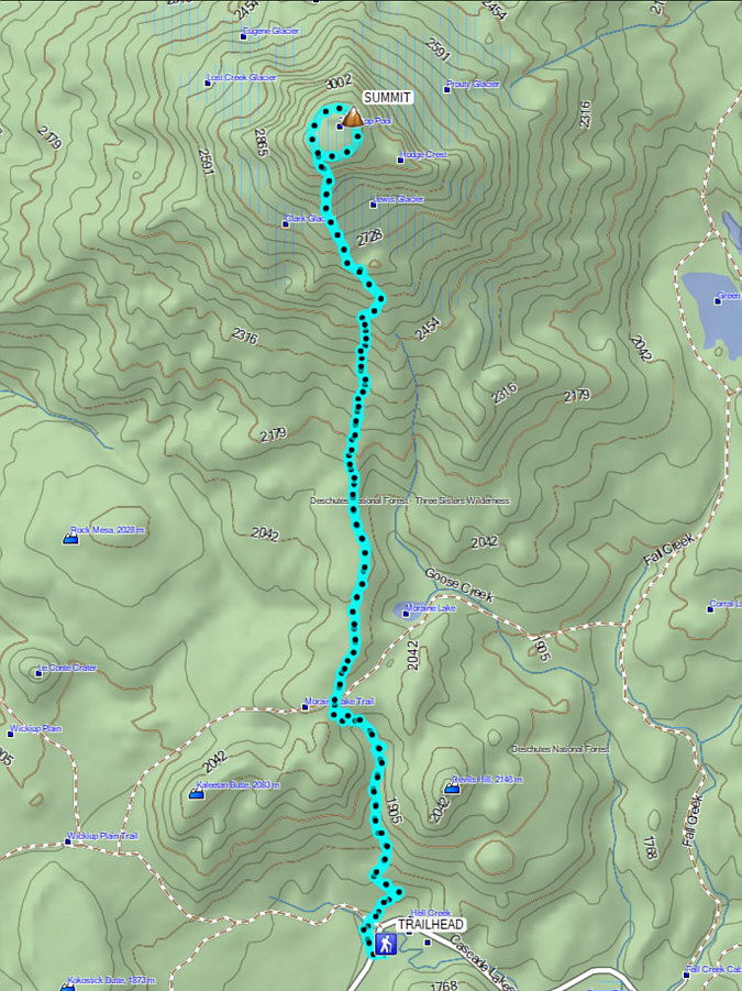
Total Distance:  20.8 kilometres
Round-Trip Time:  11 hours 30 minutes
Cumulative Elevation Gain:  1486 metres

GPX Data