BOU AVENUE
Big Elbow Trail
Zosia Zgolak and I headed out to Alberta's Little
Elbow Provincial Recreation Area on 29 November 2025 to ski Big Elbow
Trail. Given the late arrival of snow this year, we had a lot of
uncertainty about how feasible it would be to ski the trail, but we
wanted to try it anyway before the impending seasonal closure of the
highway. Despite frigid conditions in Calgary that day, the
temperatures in the mountains were actually slightly warmer, and best of all, there
was plenty of sunshine and hardly a breath of wind all day.
Starting from the recreation area's day-use
parking lot (50.79448, -114.85288), Zosia and I skied westward to Harold
Chapman Bridge and crossed over to the south side of Little Elbow River.
A few rock scrapes on the short descent just past the bridge had us
immediately on full alert for subsequent downhill runs, but we would not
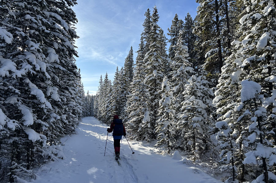
have to worry about any until much later. For the most part, Big
Elbow Trail is generally flat almost to the point of being boring.
The first several kilometres were especially mundane since we were in
forest and had little to see, but once we reached South Glasgow Creek,
the views began to open up making the ski tour much more enjoyable.
About seven or eight kilometres south of the bridge, Big Elbow Trail
makes a couple of undulations high above the river bed--possibly
re-routed sections after the biblical floods of 2013--before arriving at
Big Elbow backcountry campground. This would be our turnaround
point for the day, and we stopped for a break here before commencing
our return journey.
The downhill sections of the aforementioned
undulations proved to be tricky to ski due to the thin snow coverage.
Zosia and I descended very cautiously, and I often used my poles as
brakes to slow myself down. We could relax a bit more once we
returned to the flatter parts of Big Elbow Trail, but perhaps because I
was starting to tire, I had a hard time maintaining any momentum on my
skis. I constantly fell behind Zosia who patiently waited for me to
catch up countless times. Somewhere north of South Glasgow Creek,
we did enjoy at least one good downhill run where the snow had been more
thoroughly packed down because of increased traffic from snowshoers and
possibly other skiers. The sun had already set by the time we
re-crossed the bridge and glided back to the parking lot. While
Zosia was probably still energetic enough to go for a long walk after the
ski, I was pretty spent. Still, this turned out to be a nice way to
kick off the new ski season for us.
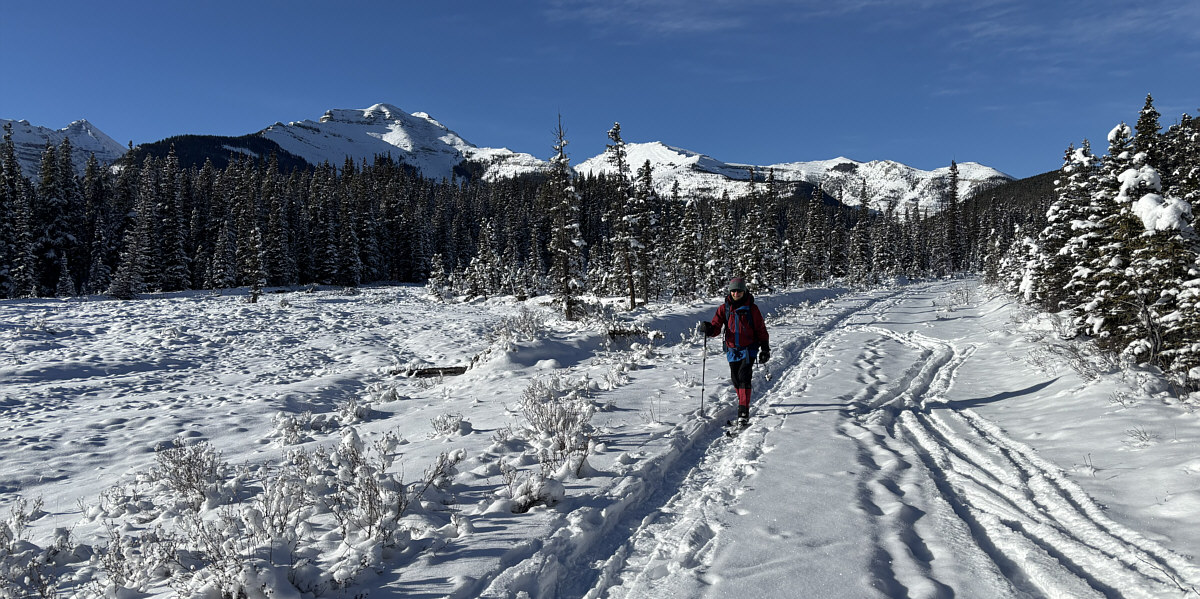
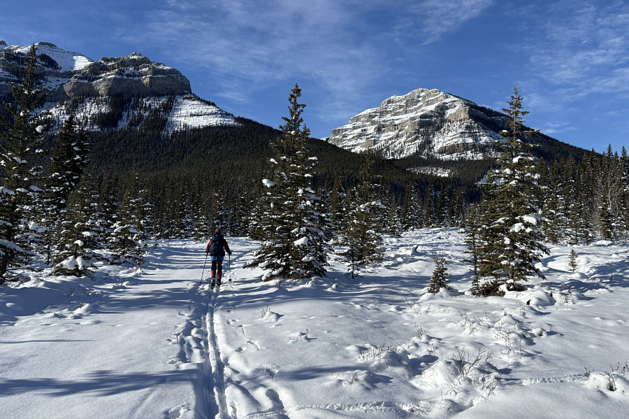
As Zosia skis along South Glasgow Creek, views open up
of Mount
Glasgow (left), "Garriochmill Peak" (right of centre) and "Glasgow
North" (right).
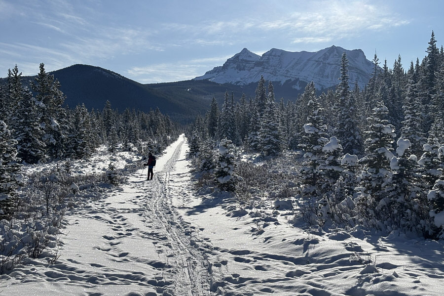 |
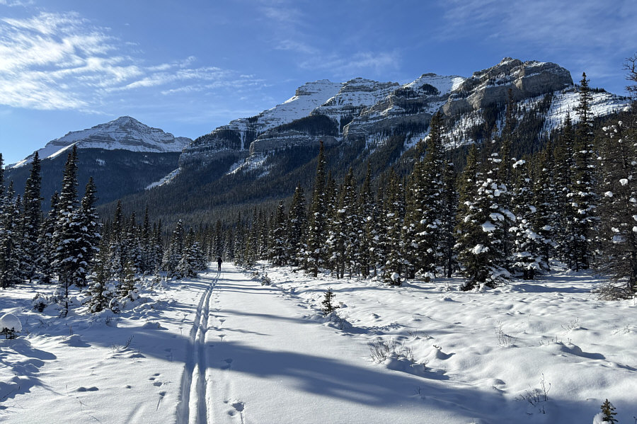
Threepoint Mountain stands out in the
distance as Zosia skis another long and straight section of Big Elbow
Trail. |
 |
At right is the impressive terminus of
Mount Cornwall's east ridge. |
 |
Impressive cliffs guard the northeastern ridge of Banded Peak. |
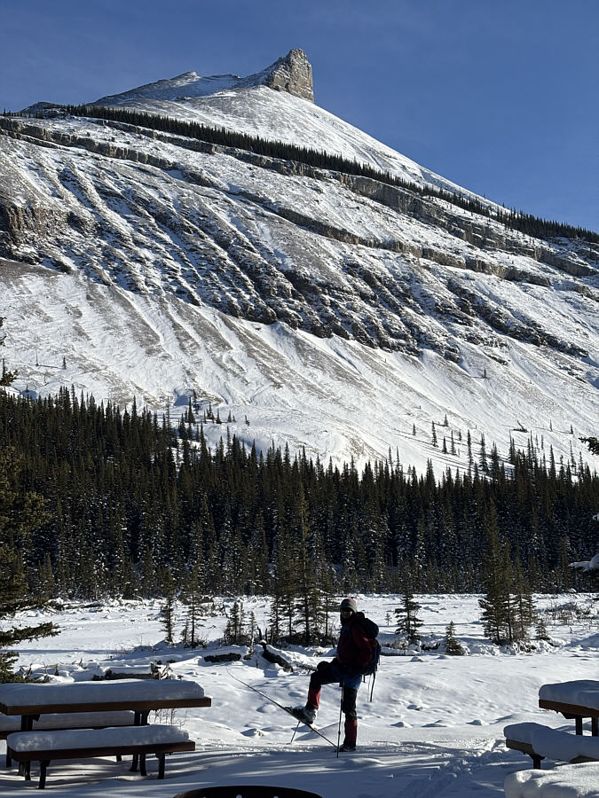 |
Zosia arrives at Big Elbow backcountry
campground. Threepoint Mountain dominates the view across the
valley. |
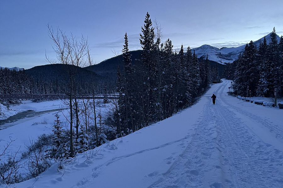 |
Sonny shuffles along the road at Little Elbow campground well after
sunset.
Photo courtesy of Zosia Zgolak |
 |
Total Distance: 19.6 kilometres
Round-Trip Time: 6 hours 26 minutes
Cumulative Elevation Gain: 162 metres
GPX Data |