BOU AVENUE
Camelshoof Mountain

On 6 July 2025, Zosia Zgolak and I hiked up unofficially-named Camelshoof Mountain, the southernmost peak of the Camelsfoot Range located north of Lillooet, British Columbia.  The mountain is easily ascended via a good trail along its south ridge, and there is also an abandoned fire lookout near the summit.  The ascent route is well-documented online, and while many websites--including peakbagger.com--use "Peak" in the name, I am sticking with "Mountain" as it appears in OpenTopoMap and AllTrails.  Interestingly, Bivouac.com has a fascinating account of how the Camelsfoot Range acquired its unusual name.

From the intersection with Main Street in Lillooet, drive northward out of town on Moha Road for 6.1 kilometres and cross Bridge River.  About 300 metres past the crossing, turn right onto West Pavilion Forest Service Road (2WD gravel).  Drive 11.0 kilometres and park in a pullout (50.76972, -121.86648) on the east side of the road opposite a branching spur road.  Determined drivers with a high clearance vehicle could probably drive another 2.8 kilometres up the spur road to just below the first high point along Camelshoof Mountain's south ridge (saves about 300 metres of elevation gain on foot), but there is at least one sizeable water bar along the way that might be problematic to drive over.

Zosia and I started by hiking up the spur road which makes a couple of sweeping switchbacks before ending just below the first high point along Camelshoof Mountain's south ridge.  It took us a little under 1.5 hours to top out on the first high point where we got our first glimpse of the fire lookout near the summit.  From there, we dropped into a slight dip before commencing a steady climb up a well-defined trail along the south ridge.  About two-thirds of the way up the south ridge, the trail bypasses a subsidiary high point and then drops about 45 metres or so into a bigger dip before the final uphill push.  This last uphill section is incredibly steep, and the footing can be a little slippery in a few places.  Thankfully, we made it up without any problems, and we spent a few minutes poking around the fire lookout before going to tag the true summit a short distance further to the north.

Zosia and I spent a good hour on top of Camelshoof Mountain before commencing our descent.  Retracing our steps, we dropped down the steep section below the summit, and I was thankful to have hiking poles here to save some wear and tear on my knees.  When we climbed out of the big dip, we took a spur trail to visit the subsidiary high point that we had skipped on the way up.  We then dropped down the south side of the subsidiary high point and eventually reconnected with the main trail.  The remaining hike down to the first high point and back along the spur road went without a hitch.
I'm just sittin' here watchin' the wheels go round and round... 
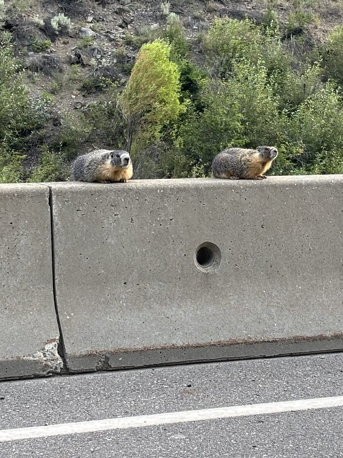
A couple of marmots sit on a roadside barricade watching traffic go by.
I definitely could have driven up the spur road in my CR-V! 
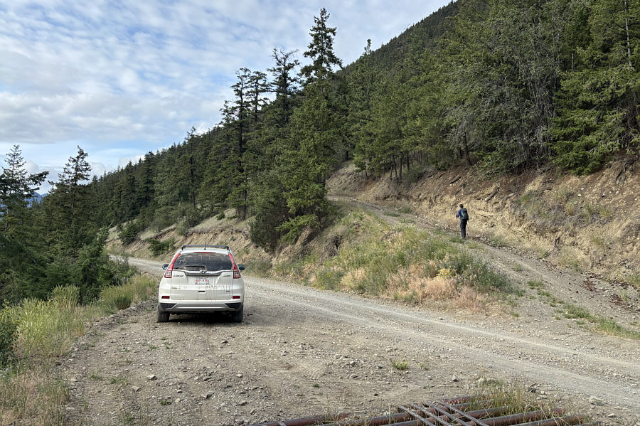
Zosia begins hiking up a spur road which branches off West Pavilion Forest Service Road.
Second breakfast! 
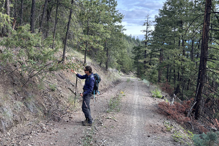
Zosia stops to pick saskatoon berries on the side of the spur road.
The lookout building is farther away than it looks! 
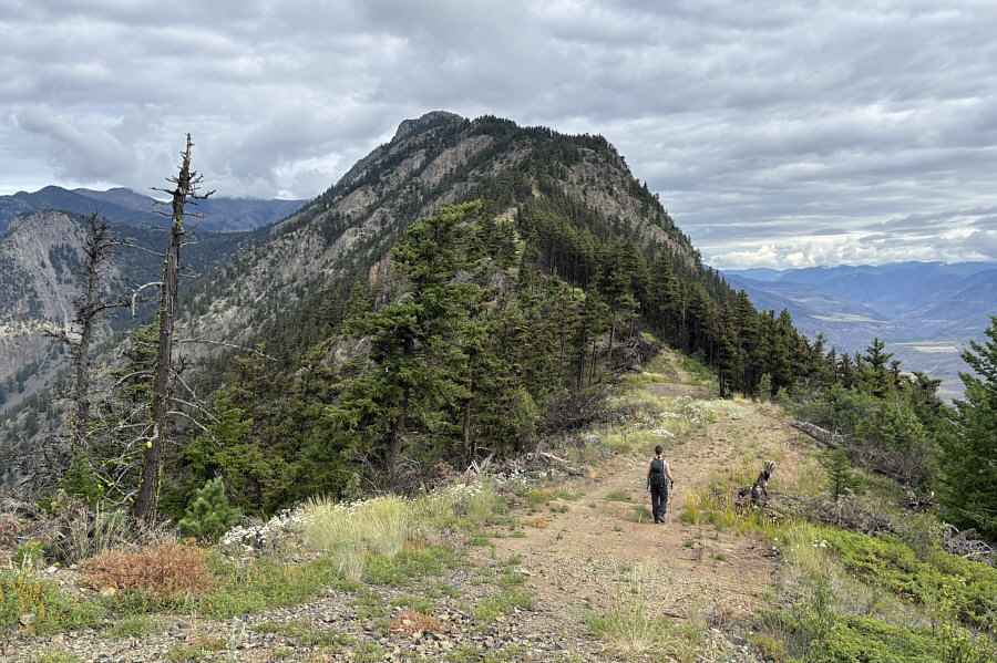
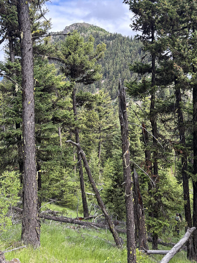
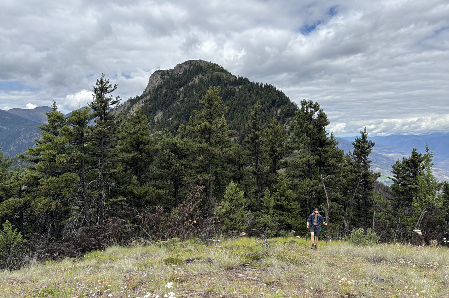
Camelshoof Mountain and most of its south ridge are visible from the first high point near the end of the spur road.
Yay, no bushwhacking! 
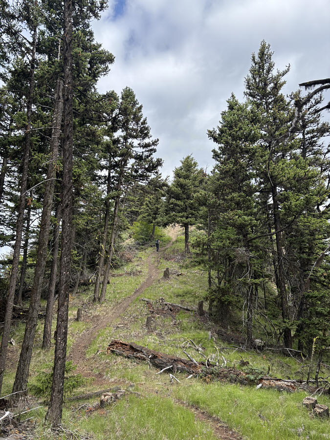
A well-defined trail follows the crest of the south ridge.
Where's Zosia? Here is a glimpse of the fire lookout from the main trail just before it drops into a big dip.
Looks like crappy sandstone though--not good for climbing! 
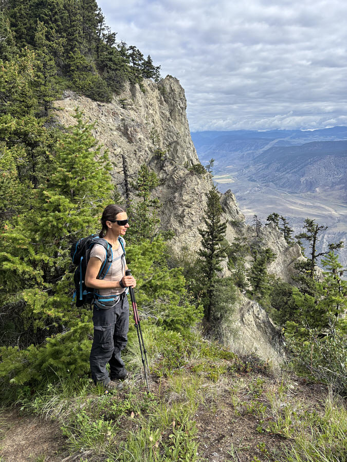
Impressive cliffs flank the east side of the summit block.
No wine left--BYOB! 
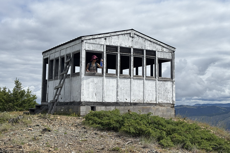
Zosia holds up a discarded wine bottle inside the abandoned fire lookout.
 

Not bad for an abandoned windowless building!

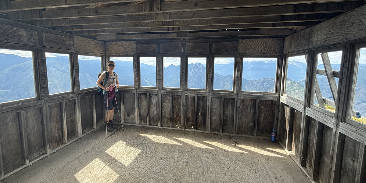
The interior of the fire lookout is empty but relatively clean.


Where's the Camel's Hump? 
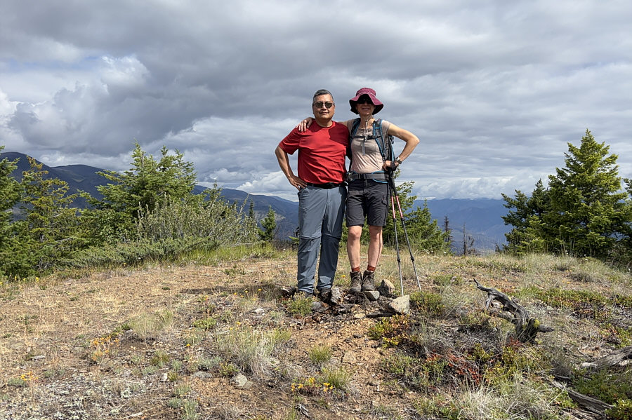
Sonny and Zosia stand on the summit of Camelshoof Mountain (1554 metres).
 

Spectacular photo by Zosia!

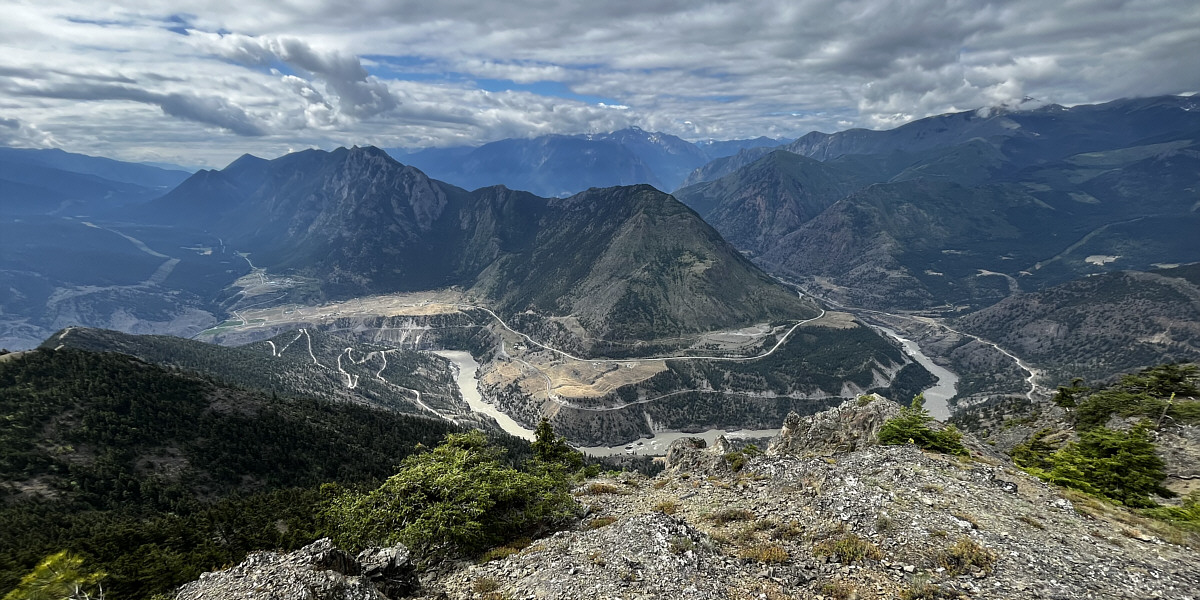
The summit has a commanding view of Fraser River as it winds around the north end of Fountain Ridge.  Visible on the distant centre horizon is Mount Brew.

Photo courtesy of Zosia Zgolak


Hiking poles are a must for the knee-jarring descent! 
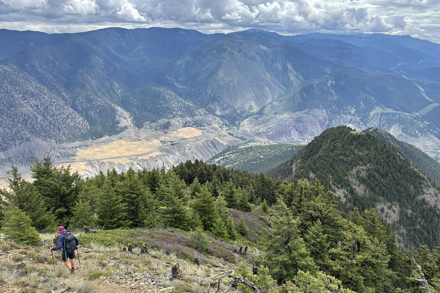
Zosia begins the steep descent.  Note the open tops of the two subsidiary high points further down the south ridge.
Minimal extra effort required to tag this high point! With the fire lookout visible in the distance, Zosia takes the last few steps before the top of a subsidiary high point along the ridge.
LOL! 
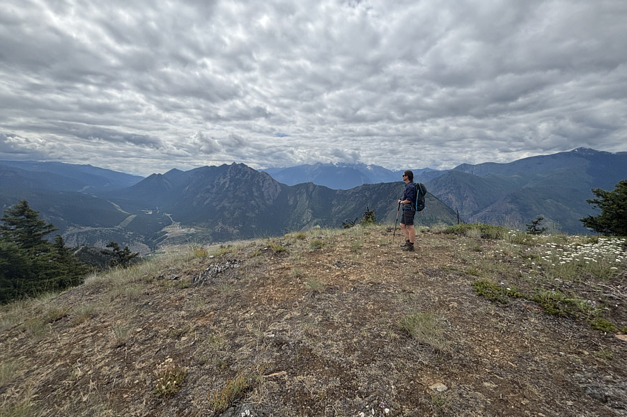
Zosia surveys the panoramic view from the top of the subsidiary high point (1376 metres) which Sonny has whimsically nicknamed "Camel's Toe".
If there was yet another high point, I would have had to name it "Camel's Toenail Lint or Fungus"! 
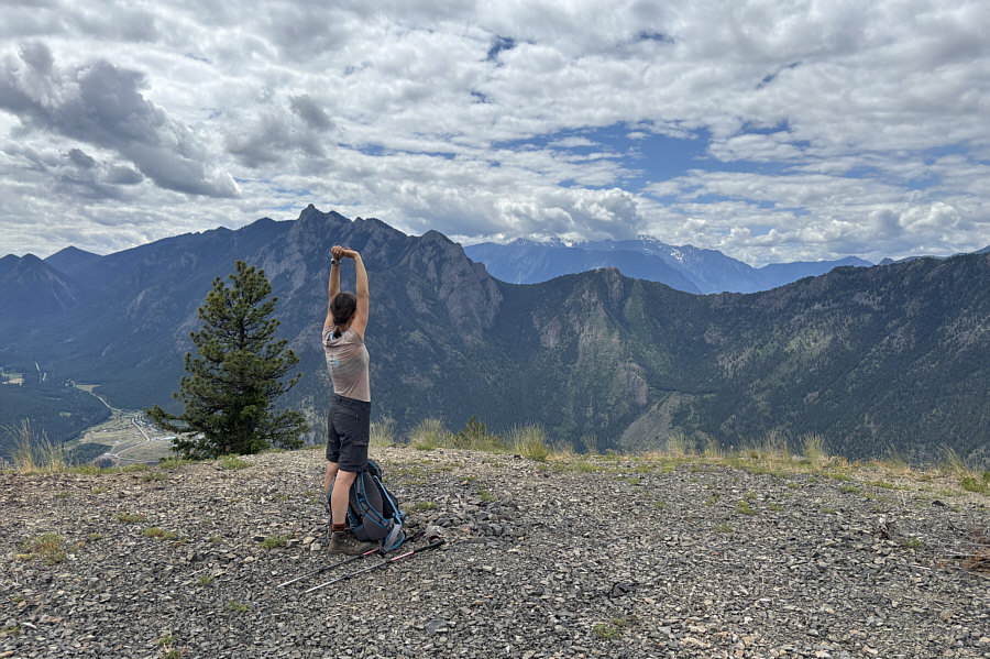
Zosia stretches her back after returning to the very first high point (1127 metres) near the end of the spur road.  Keeping with the theme of the day, Sonny has given this high point the nickname, "Camel's Toenail".
Beautiful. 
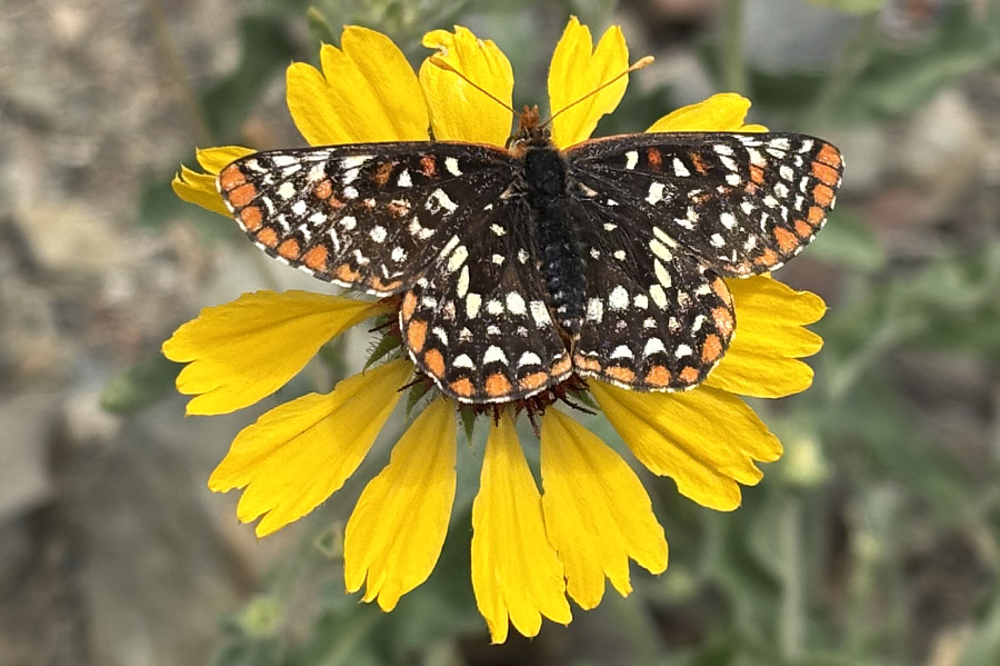
A checkerspot butterfly rests on one of the many common gaillardia growing along the spur road.
A very steep but rewarding hike! 
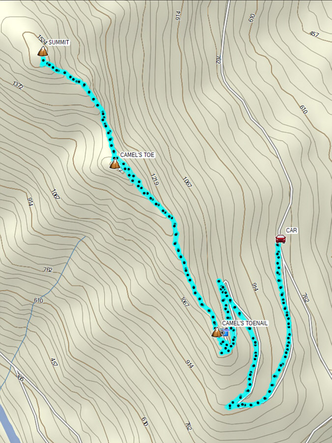
Total Distance:  10.7 kilometres
Round-Trip Time:  6 hours 2 minutes
Cumulative Elevation Gain:  762 metres

GPX Data